The best waterfall hikes and walks in Wurzacher Ried
4.5
(3860)
17,062
hikers
4
hikes
Hiking in Wurzacher Ried offers a unique experience within Central Europe's largest intact raised bog. The landscape is characterized by soft, springy peat paths and extensive boardwalks that traverse dense vegetation and re-naturalized areas. Hikers will encounter a mosaic of water channels, bog pools, and the clear, bluish-green Haidgauer spring lakes, all set within a belt of meadows and natural streams. The terrain provides varied walking conditions, from gentle moorland trails to routes with moderate elevation changes.
Best waterfall hiking…
Last updated: June 25, 2026
3.0
(1)
2
hikers
21.9km
06:04
370m
370m
Hard hike. Very good fitness required. Easily-accessible paths. Suitable for all skill levels.
4.6
(18)
69
hikers
Moderate hike. Good fitness required. Easily-accessible paths. Suitable for all skill levels.

Sign up for free
5.0
(5)
25
hikers
13.8km
03:56
310m
310m
Moderate hike. Good fitness required. Easily-accessible paths. Suitable for all skill levels.
4.3
(3)
6
hikers
Hard hike. Very good fitness required. Easily-accessible paths. Suitable for all skill levels.
5.0
(1)
4
hikers
12.4km
03:20
160m
160m
Moderate hike. Good fitness required. Easily-accessible paths. Suitable for all skill levels.
Our route recommendations are based on thousands of hikes, rides, and runs completed by other people on komoot.
Start today with a free account
Your next adventure awaits.
Login or Signup
Popular around Wurzacher Ried
Other adventures in Wurzacher Ried

Tips from the Community

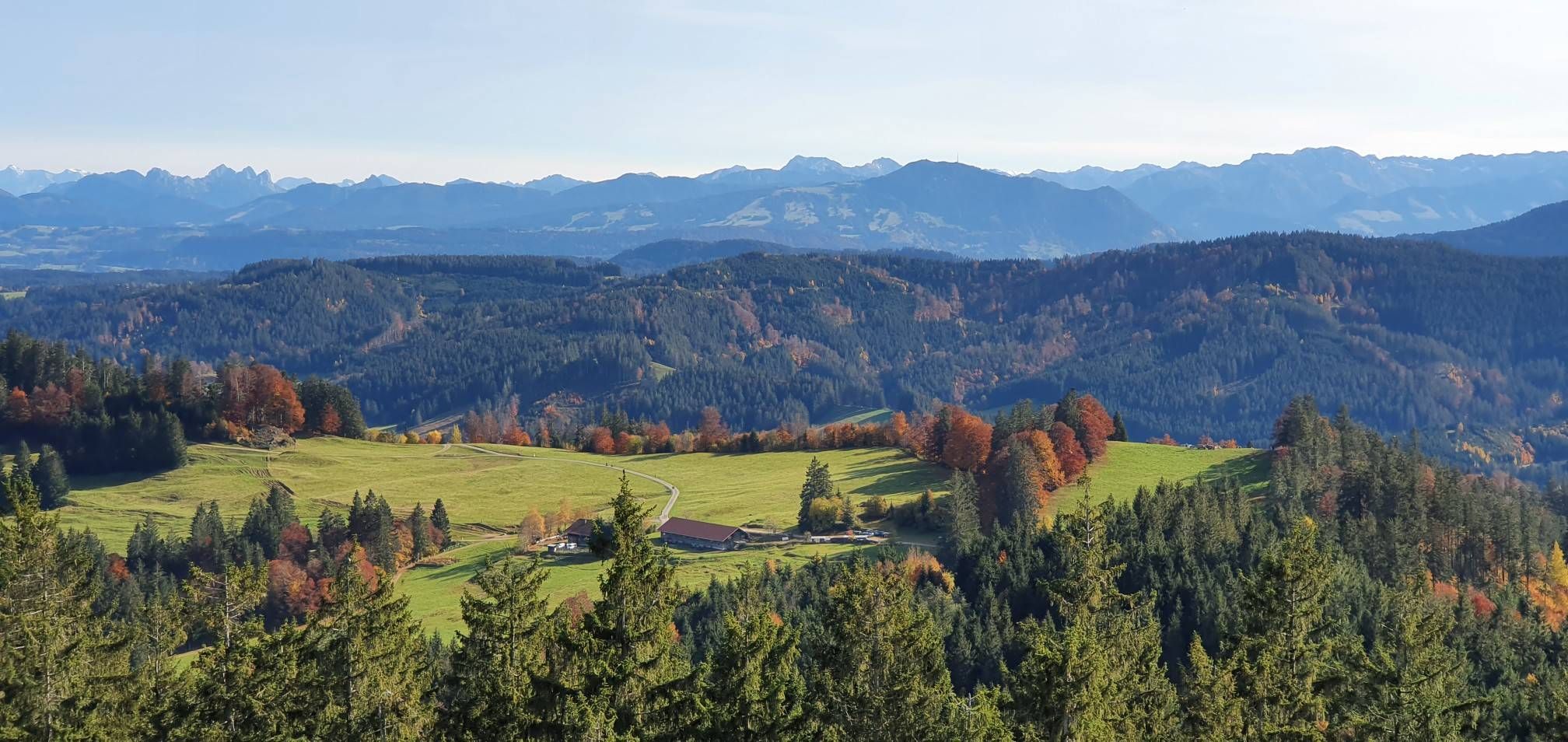
The Wolfegger Süh is also a 725m high viewing point with a cross and seating area that is easily accessible by bike. From here you can see large parts of Upper Swabia. There is also a boulder on the Süh from the Ice Age that was "left behind" by a glacier.
7
0

The path around the pond is quiet and varied. It is particularly beautiful in autumn when the leaves of the deciduous trees change colour.
1
0

The Wolfegger Ach is a 50-kilometer-long left and eastern tributary of the Schussen River in the Upper Swabian district of Ravensburg in Baden-Württemberg, Germany. It is the Schussen's largest tributary by volume and is known in sections as the Immenrieder Ach, then the Kißlegger Ach, and finally, for the longest stretch, as the Wolfegger Ach. Source: Wikipedia
1
0

A nice, secluded walk that you can do in this corner.
1
0

Nice hike, unfortunately poor or no signage, without navigation we would not have found it.
0
0


Definitely keep going, you look forward to it even on cold days 🍻👍🏼, like today on November 1st
2
0
Frequently Asked Questions
How many waterfall hiking trails are there in Wurzacher Ried?
There are several dedicated waterfall hiking trails in Wurzacher Ried. Our guide features 4 distinct routes that allow you to explore the region's unique landscapes and discover its cascades. These range from moderate to difficult, offering options for various fitness levels.
What kind of terrain can I expect on waterfall hikes in Wurzacher Ried?
The terrain in Wurzacher Ried is unique, characterized by soft, springy peat paths and extensive boardwalks that traverse the largest intact raised bog in Central Europe. You'll encounter a mosaic of water channels, bog pools, and clear spring lakes. While some routes feature gentle moorland trails, others, like the Weissenbronnen Waterfalls – Süh Cross Viewpoint loop from Eintürnen, include significant elevation gain, requiring good physical condition and sure-footedness.
Are there family-friendly waterfall hikes in Wurzacher Ried?
Yes, there are options suitable for families. The Small waterfall by the roadside – Weissenbronnen Waterfalls loop from Alttann is a moderate 4.7-mile (7.7 km) path that offers views of smaller cascades and the unique bog environment, making it a good choice for a family outing. Always consider the distance and elevation for younger hikers.
Can I bring my dog on waterfall trails in Wurzacher Ried?
Wurzacher Ried is a nature reserve, and while many trails are generally dog-friendly, it's crucial to keep dogs on a leash to protect the sensitive moorland ecosystem and its diverse wildlife. Always check local signage for specific restrictions, especially in bird breeding areas or near protected habitats.
What are some notable natural features or viewpoints along the waterfall trails?
Beyond the waterfalls, you can explore several unique natural features. The Observation Platform at the Haidgauer Spring Lakes offers magical panoramic views of the Ried landscape. The Riedsee, with its boardwalk and viewing platform, is another picturesque spot. Many routes also pass through the unique bog environment with its distinctive flora and fauna.
Are there circular routes available for waterfall hikes?
Yes, all the waterfall hikes featured in our guide are circular routes, allowing you to start and end at the same point. For example, the Elfenweiher – View of Bergatreute loop from Alttann is an 8.6-mile (13.9 km) trail that takes you through varied landscapes, including the Elfenweiher, before returning to your starting point.
What is the best time of year to visit Wurzacher Ried for waterfall hikes?
Spring and summer are generally the best times to visit Wurzacher Ried for waterfall hikes. During these seasons, the weather is milder, the moorland flora is vibrant, and wildlife, especially birds, is most active. The trails are also less likely to be icy or muddy, making for a more enjoyable hiking experience. However, the unique atmosphere of the moor can be experienced year-round.
What wildlife might I encounter on the trails?
Wurzacher Ried is a European bird protection and FFH area, making it a sanctuary for rare animal and plant species. Birdwatchers might spot species like the European Honey-buzzard, Grey-headed Woodpecker, and Corn Crake. The bog habitats also support unique insects, amphibians, and reptiles. Keep an eye out for diverse flora adapted to the moorland environment.
Are there any difficult waterfall hikes for experienced hikers?
Yes, for experienced hikers seeking a challenge, the Weissenbronnen Waterfalls – Süh Cross Viewpoint loop from Eintürnen is a difficult 13.6-mile (21.9 km) trail with significant elevation gain. Another challenging option is the Small waterfall by the roadside – Weissenbronnen Waterfalls loop from Wolfegg, which covers 12.5 miles (20.1 km) with considerable ascent.
Where can I find parking for waterfall trails in Wurzacher Ried?
Parking is generally available near the starting points of many trails. For instance, routes originating from Alttann or Eintürnen often have designated parking areas. It's advisable to check specific trailheads on komoot for detailed parking information before your visit.
What should I wear for hiking the waterfall trails in Wurzacher Ried?
Given the varied terrain, including soft peat paths and potential for mud, sturdy, waterproof hiking boots are highly recommended. Layered clothing is ideal to adapt to changing weather conditions. Even in summer, a light rain jacket can be useful. Don't forget sun protection and insect repellent, especially in warmer months.
What do other hikers say about the waterfall trails in Wurzacher Ried?
The routes in Wurzacher Ried are highly rated by the komoot community, with an average score of 4.5 stars from over 3500 reviews. Hikers often praise the unique moor landscape, the tranquility of the trails, and the well-maintained boardwalks that offer excellent access to the natural beauty of the region.
Are there options for shorter, moderate waterfall hikes?
Absolutely. If you're looking for a shorter, moderate option, the Small waterfall by the roadside – Weissenbronnen Waterfalls loop from Alttann is a great choice. It's 4.7 miles (7.7 km) long and offers a pleasant walk through the bog environment to see smaller cascades. Another moderate option is the Mahlweiher – Weissenbronnen Waterfalls loop from Bergatreute Furt, which is about 7.7 miles (12.4 km).
Most popular routes in Wurzacher Ried
Most popular attractions in Wurzacher Ried

Get inspired with the komoot mobile app


Explore more
Browse the best Hikes in other regions.
