The best walks and hikes in Geitaknottane Naturreservat
4.6
(16)
80
hikers
8
hikes
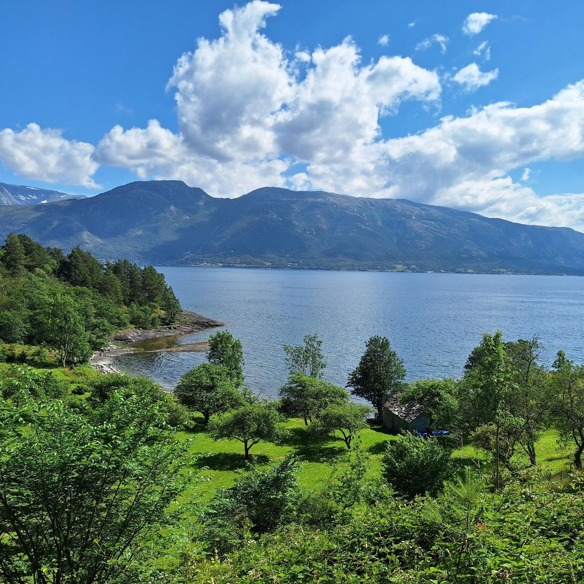
Hiking in Geitaknottane Naturreservat offers diverse landscapes characterized by bedrock and knolls, interspersed with marshes, lakes, and ponds. The reserve features pine forests and varied elevation, ranging from 70 to 300 meters above sea level, with the highest point at Horga reaching 673 meters. This area is known for its unique biological ecosystems and rare natural features, including a significant population of great crested newts.
Best hiking trails in Geitaknottane Naturreservat
- The most popular hiking route is Hiking loop from…
Last updated: August 28, 2026
4.5
(2)
12
hikers
6.19km
01:44
120m
120m
Easy hike. Great for any fitness level. Easily-accessible paths. Suitable for all skill levels.
4.7
(3)
13
hikers
6.16km
02:22
270m
270m
Moderate hike. Good fitness required. Mostly accessible paths. Sure-footedness required.

Sign up for free
1
hikers
11.2km
03:42
350m
350m
Moderate hike. Good fitness required. Mostly accessible paths. Sure-footedness required.
2
hikers
11.9km
03:46
410m
410m
Moderate hike. Good fitness required. Mostly accessible paths. Sure-footedness required.
5.0
(1)
8
hikers
2.19km
00:39
60m
60m
Easy hike. Great for any fitness level. Easily-accessible paths. Suitable for all skill levels.
Get access to more routes and recommendations from other explorers.
Sign up for free
Already have an account?
Our route recommendations are based on thousands of hikes, rides, and runs completed by other people on komoot.
Start today with a free account
Your next adventure awaits.
Login or Signup
Popular around Geitaknottane Naturreservat
Tips from the Community

Moderately difficult hike. The trail is difficult to find in places.
0
0

Two thirds of the way to Svartavatnet you can take a break and enjoy the great view.
0
0

great tour with lots of nature on partly very narrow and steep paths
0
0
Frequently Asked Questions
How many hiking trails are available in Geitaknottane Naturreservat?
Komoot features 5 distinct hiking routes within Geitaknottane Naturreservat, offering a range of experiences from easy strolls to more challenging moderate hikes. These trails allow you to explore the reserve's unique landscapes, from pine forests to marshlands.
What kind of terrain and elevation can I expect on hikes in Geitaknottane Naturreservat?
The terrain in Geitaknottane Naturreservat is characterized by a mosaic of bedrock and knolls, with elevations typically ranging from 70 to 300 meters, reaching up to 673 meters at Horga. Trails often traverse narrow and steep paths, with some routes like the Lily Pads Pond loop from Hatlestrand kyrkje featuring over 400 meters of elevation gain, requiring sturdy shoes and good fitness.
Are there any easy or family-friendly hiking options in Geitaknottane Naturreservat?
Yes, there are options suitable for families and those looking for an easier walk. The Yggdrasil Ancient Tree loop from Varaldsøy is an easy route, just over 2 kilometers long with minimal elevation gain, making it a great choice for a relaxed outing.
What are some notable natural features or viewpoints to look out for?
Geitaknottane Naturreservat is known for its diverse natural features. You'll find pine forests, marshes, lakes, and ponds. A significant ecological attraction is the presence of the great crested newt, which inhabits over 100 ponds. Popular viewpoints include the Fjord from Blanuten Summit, offering rewarding views, and a bench overlooking Svartavatnet, perfect for a break.
What is the best time of year to visit Geitaknottane Naturreservat for hiking?
The best time to visit for hiking is generally from spring through early autumn. The great crested newts are most active in the ponds from April-May for breeding until late July-August. During these months, the weather is typically more favorable, and the diverse flora is in bloom, enhancing the natural beauty of the reserve.
Are there any circular hiking routes in Geitaknottane Naturreservat?
Yes, many of the trails in the reserve are designed as loops. For example, the Tveitaskaret – Sauastigen loop from Hatlestrand kyrkje offers an 11-kilometer circular hike, immersing you in the reserve's abundant nature and providing varied scenery.
What do other hikers enjoy most about Geitaknottane Naturreservat?
The area is highly rated by the komoot community, with an average score of 4.5 stars. Hikers often praise the pristine, unspoiled natural environment, the diverse landscapes ranging from forests to wetlands, and the rewarding views of the fjords from various points along the trails.
Is there parking available for trailheads in Geitaknottane Naturreservat?
While specific parking details for each trailhead are best checked on individual route pages, many trails, such as those starting from Hatlestrand kyrkje, typically have designated parking areas nearby to accommodate hikers accessing the reserve.
Are dogs allowed on the hiking trails in Geitaknottane Naturreservat?
Generally, dogs are permitted on hiking trails in Norwegian nature reserves, but they must be kept on a leash, especially during nesting seasons for birds and when livestock are present. Always ensure your dog is under control and follow local signage regarding pet regulations within the reserve.
What is a moderately challenging hike I can do in the reserve?
For a moderately challenging experience, consider the Tveitaskaret loop from Hatlestrand kyrkje. This route covers over 6 kilometers with around 265 meters of elevation gain, offering a good workout while allowing you to enjoy the reserve's natural beauty.
Are there any longer, more demanding hikes in Geitaknottane Naturreservat?
Yes, for those seeking a longer and more demanding hike, the Gråskolt – Fjellkleiv loop from Varaldsøy is a moderate route spanning nearly 7 kilometers with over 335 meters of elevation. It offers a substantial challenge and a deeper immersion into the reserve's varied terrain.
Most popular routes in Geitaknottane Naturreservat

Get inspired with the komoot mobile app


Explore more
Browse the best Hikes in other regions.
