The best walks and hikes in Galada Tamboore And Marran Baba Parklands
3.8
(11)
144
hikers
11
hikes
Hiking in Galada Tamboore And Marran Baba Parklands features diverse trails through a landscape shaped by volcanic plains and the Merri Creek corridor. The region is characterized by basalt escarpments, expansive grasslands, and riparian zones along the Merri Creek. These parklands provide opportunities to explore geological formations and significant cultural heritage sites. The terrain is generally flat, with options for both sealed and gravel tracks, as well as some dirt paths leading to the creek.
Best hiking trails in Galada…
Last updated: November 17, 2026
11
hikers
2.44km
00:37
10m
0m
Easy hike. Easily walkable paths.
5.0
(2)
14
hikers
8.69km
02:16
60m
50m
Moderate hike. Good fitness required. Easily walkable paths.

15
hikers
3.31km
00:50
10m
10m
Easy hike. Easily walkable paths.
4
hikers
15.7km
04:03
80m
80m
Moderate hike. Good fitness required. Easily walkable paths.
2
hikers
17.4km
04:26
50m
50m
Moderate hike. Good fitness required. Easily walkable paths.
Get access to more routes and recommendations from other explorers.
Already have an account?
Our route recommendations are based on thousands of hikes, rides, and runs completed by other people on komoot.
Start today with a free account
Your next adventure awaits.
Tips from the Community

This sealed walking path winds around Edwardes Lake and through the surrounding park, passing beneath rows of mature cypress, pine, and eucalypt trees. It’s an easy circuit that follows the water through the park’s gardens and open green spaces. The route is flat and accessible, with benches along the way and plenty of opportunities to watch the many birds that call the lake home. You can also extend your walk beyond the lake into the Edgars Creek wetlands, where the path continues through a quieter, more natural section of the creek corridor.
0
0
Edwardes Lake is a 6.3-hectare reservoir formed when Edgars Creek was dammed in the early 20th century, with this original weir and retaining wall still controlling the outflow. The water spills over the wide weir and continues into Edgars Creek, creating this lovely cascade. Gardens and mature trees surround the lake, and its calm waters attract a variety of waterbirds, making the shoreline a great place to stop and watch the activity on the water.
0
0
Edwardes Lake Park spans 28 hectares and has been a local gathering place for more than a century, after 13.8 hectares were donated to the people of Preston in 1914. Today the park draws more than 135,000 visitors a year, with gravel and asphalt paths that circle the lake. There are playgrounds, picnic and barbecue spots, an outdoor gym, a skate park, sports facilities, public toilets, and plenty of birdlife, including three species of heron that you’ll see quietly hunting along the banks of the lake.
0
0

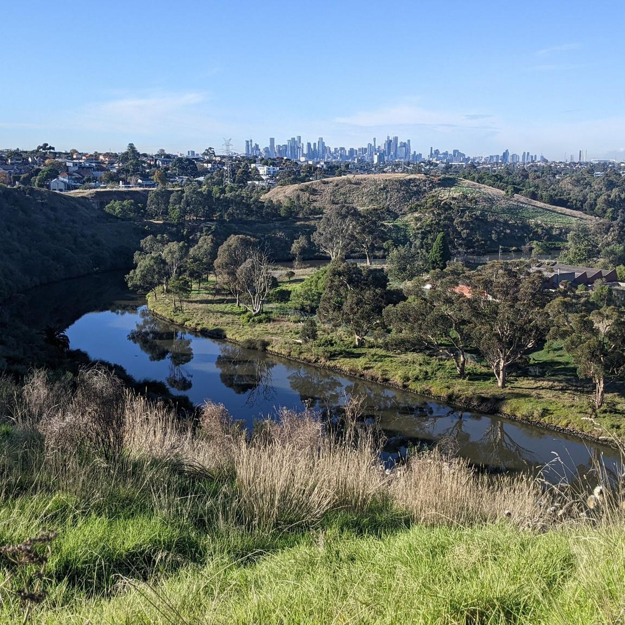
Merri Creek Trail showcases one of Melbourne's best urban nature corridors, following Merri Creek through regenerating bushland, basalt escarpments and open parkland before looping back via shared paths. Despite being surrounded by suburbia, the route feels surprisingly immersed in nature, with native birdlife, mature river red gums and glimpses of the creek accompanying much of the walk.
0
0
Merri Creek winds through one of Melbourne's most important urban nature corridors, where volcanic basalt escarpments, native grasslands and regenerating bushland provide habitat for an impressive variety of wildlife. The creek has been an important place for Aboriginal communities for thousands of years, and decades of restoration have helped transform it into a thriving green space where nature flourishes alongside the city.
0
0
Coburg Lake Reserve is one of the most scenic stops along the Merri Creek Trail, where cascading water spills over the historic weir into the creek below. Shared paths weave between open lawns, mature elm trees and the lakeshore before crossing the rocky basalt-lined creek.
0
0

C.T. Barling Reserve is one of Reservoir's largest community parks and sports facilities, with pitches for cricket and football. The Darebin Creek Trail runs along its eastern side and offers access to a modern pavilion, children's playgrounds, barbecues, electric hotplates, picnic shelters, bubblers, and public toilets. There are dog friendly off-lead open spaces for dogs to run around as well.
0
0
Norris Bank Parklands offers a free Bike Repair Station with tools and an air pump. The station sits right next to a bench and a map of the park's paths.
0
0
Frequently Asked Questions
How many hiking trails are available in Galada Tamboore And Marran Baba Parklands?
There are 7 hiking routes in Galada Tamboore And Marran Baba Parklands listed on komoot. These trails offer diverse experiences through the region's unique landscapes.
What are the typical difficulty levels for hiking trails in the parklands?
The trails in Galada Tamboore And Marran Baba Parklands range from easy to moderate. You'll find 2 easy routes, perfect for a relaxed outing, and 5 moderate routes for those seeking a bit more challenge. There are no difficult trails listed.
Are there any circular walks in Galada Tamboore And Marran Baba Parklands?
Yes, many of the trails in the parklands are circular, allowing you to start and end at the same point. Examples include the Mount Cooper loop from Bundoora, the Peter Hopper Lake loop from Plenty, and The Palisades Wetlands – Quarry Hill loop from South Morang.
Are dogs allowed on the hiking trails in Galada Tamboore And Marran Baba Parklands?
The Marran Baba Merri Creek Regional Parklands aim to protect biodiversity, and regulations regarding dogs can vary. It's best to check specific signage at trailheads or consult the Parks Victoria website for the most current information on dog-friendly areas and leash requirements to ensure compliance and protect local wildlife. You can find more information on the official Parks Victoria website: Parks Victoria.
Are there family-friendly hiking options in the parklands?
Absolutely. The parklands offer several easy trails suitable for families. The Peter Hopper Lake loop from Plenty is an easy 6 km path, ideal for a relaxed family outing. Many trails provide opportunities for exercise, play, and nature appreciation in a bushland setting.
What is the best time of year to go hiking in Galada Tamboore And Marran Baba Parklands?
The parklands can be enjoyed year-round, but spring (September to November) and autumn (March to May) often offer the most pleasant hiking conditions with milder temperatures and vibrant natural scenery. Spring brings blooming wildflowers, while autumn showcases beautiful foliage. Summer can be hot, so early morning or late afternoon hikes are recommended.
What makes the landscape of Galada Tamboore And Marran Baba Parklands unique?
The parklands are characterized by a unique landscape shaped by the erosion of a volcanic plain, featuring striking basalt escarpments and a gorge through which the Merri Creek flows. You'll also find expansive grasslands, remnant native grasslands, and significant riparian zones, all contributing to a diverse and visually interesting environment.
What cultural significance do these parklands hold?
The entire landscape is deeply significant for the Wurundjeri Woi-wurrung people, the Traditional Owners. The basalt plains, gorges, and grasslands represent ancestral and present-day Country, with the Merri Creek holding deep spiritual meaning. Walking through these parklands offers a chance to connect with thousands of years of Indigenous history and cultural practices, often highlighted by signage with Woi-wurrung welcome messages.
What do other hikers enjoy most about Galada Tamboore And Marran Baba Parklands?
The area is highly rated by the komoot community, with an average score of 4.0 stars from over 7 reviews. Hikers often praise the diverse terrain, from volcanic plains and basalt escarpments to grasslands and riparian habitats along the Merri Creek, offering varied views and a sense of natural escape close to the city.
Are there any good viewpoints along the hiking trails?
Yes, the Galada Tamboore Gorge (also known as Barry Road or Merri Gorge) is recognized for its geological significance and offers impressive views of the basalt cliffs and the Merri Creek. Some specific walk options, like a 3km or 5km loop from the Whittlesea Public Gardens, lead to a lookout over the Merri Creek.
Is public transport available to access the hiking trails?
Public transport options to specific entry points like Whittlesea Public Gardens or Horne Street Picnic Area in Campbellfield may be available. It's advisable to check local public transport schedules and routes (e.g., PTV Victoria) for the most up-to-date information on bus services connecting to the parkland areas.
Where can I find parking for the hiking trails?
Parking facilities are generally available at major access points to the parklands, such as Whittlesea Public Gardens. Specific parking areas may also be found near trailheads along the Merri Creek Trail. It's recommended to check maps or local signage for designated parking zones before your visit.
Are permits required for hiking in Galada Tamboore And Marran Baba Parklands?
Generally, permits are not required for casual hiking on established trails within Galada Tamboore And Marran Baba Parklands. However, some sensitive areas, like the bababi marning Grasslands, may have restricted public access to protect endangered species. Always observe local signage and regulations. For any specific inquiries, you can refer to the Parks Victoria website.
Most popular routes in Galada Tamboore And Marran Baba Parklands

Get inspired with the komoot mobile app


Explore more
Browse the best Hikes in other regions.
