The best waterfall hikes and walks in Kürnacher Wald
4.5
(12192)
57,546
hikers
11
hikes
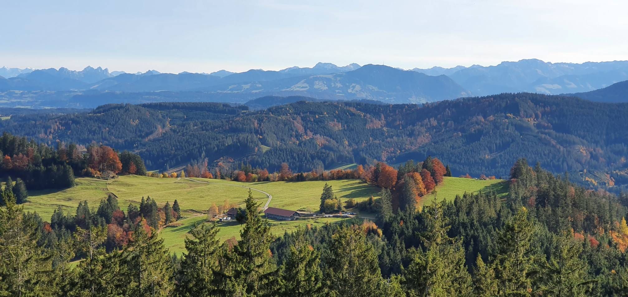
Waterfall hiking trails in Kürnacher Wald are found within a heavily forested section of the Adelegg mountain range in Bavaria, Southern Germany. The region is characterized by dense forests and mountainous terrain, with elevations reaching over 1100 meters. Numerous water bodies contribute to the landscape, forming small tributaries of the Kürnach and Eschach rivers, which create the waterfalls. This diverse topography offers varied conditions for hikers exploring the area's natural features.
Best waterfall hiking trails in Kürnacher Wald
- The most…
Last updated: July 9, 2026
4.4
(30)
86
hikers
6.51km
01:45
80m
80m
Easy hike. Great for any fitness level. Easily-accessible paths. Suitable for all skill levels.
4.6
(7)
37
hikers
5.09km
01:23
80m
80m
Easy hike. Great for any fitness level. Easily-accessible paths. Suitable for all skill levels.

Sign up for free
4.6
(5)
26
hikers
Moderate hike. Good fitness required. Easily-accessible paths. Suitable for all skill levels.
5.0
(2)
24
hikers
4.00km
01:04
50m
50m
Easy hike. Great for any fitness level. Easily-accessible paths. Suitable for all skill levels.
4.8
(224)
907
hikers
14.1km
04:26
480m
480m
Moderate hike. Good fitness required. Mostly accessible paths. Sure-footedness required.
Get access to more routes and recommendations from other explorers.
Sign up for free
Already have an account?
Our route recommendations are based on thousands of hikes, rides, and runs completed by other people on komoot.
Start today with a free account
Your next adventure awaits.
Login or Signup
Popular around Kürnacher Wald
Other adventures in Kürnacher Wald

Tips from the Community

Beautiful view and a restaurant nearby
1
0

When the weather is nice you can see the entire Allgäu Alps.
0
0

The view is one of the most beautiful in the Upper Allgäu and during the week the beer garden at Gasthof Alpenblick is pleasantly quiet. The climb is a bit tough though. The food is homely with room for improvement.
0
0


The Stoffelberg is an easy peak to reach, especially from Riggis. Once at the top there is a nice rest area with a bench, table and chairs😉 You can catch a glimpse of Niso (Niedersonthofer Lake), otherwise the view is rather limited thanks to the treetops.
1
0

When cycling on the Isny-Bähnle-Trasse you should stop here briefly. You have to walk to the waterfall, but cooling off with your feet is just heavenly, especially in summer. There is also a shady seating area with a table and benches.
3
0

Suddenly and unexpectedly, right next to and under the route, a once that invites you to linger. Also nice for children to play there, a nice photo opportunity from the lower part of the waterfall up to the Hoilzbrücke
0
0

Great view from the summit cross
0
0
Frequently Asked Questions
How many waterfall hiking trails are available in Kürnacher Wald?
Kürnacher Wald offers 11 dedicated waterfall hiking trails. These routes traverse a heavily forested and mountainous landscape, featuring numerous small tributaries that create the area's cascades.
Are there easy waterfall hikes suitable for beginners or families?
Yes, Kürnacher Wald has several easy waterfall hikes. A great option is the Speckbach Waterfall loop from Hellengerst, which is 4.0 miles (6.5 km) long and takes about 1 hour 45 minutes. Another shorter, easy trail is the Speckbach Waterfall – Speckbach Waterfall loop from Hellengerst, at 3.3 miles (5.3 km).
What kind of terrain should I expect on the waterfall trails in Kürnacher Wald?
The trails in Kürnacher Wald are characterized by dense woodlands and mountainous terrain, with elevations reaching over 1100 meters. You'll encounter varied topography, including paths alongside numerous small tributaries of the Kürnach and Eschach rivers, which form the waterfalls. Expect natural forest paths, some inclines, and potentially damp areas near the water features.
Are there any circular waterfall routes in the area?
Yes, many of the waterfall trails in Kürnacher Wald are designed as circular routes, allowing you to start and end at the same point. For example, the Speckbach Waterfall – Pathway Under Old Spruce Trees loop from Hellengerst is a popular 4.7-mile (7.6 km) circular trail that takes you through dense forest.
What do other hikers say about the waterfall trails in Kürnacher Wald?
The waterfall trails in Kürnacher Wald are highly rated by the komoot community, with an average score of 4.6 stars from over 1,700 reviews. Hikers often praise the serene forest atmosphere, the refreshing waterfalls, and the well-maintained paths that make for an enjoyable outdoor experience.
Are the waterfall hiking trails in Kürnacher Wald suitable for dogs?
While specific leash rules can vary, Kürnacher Wald is generally a dog-friendly region for hiking. The natural environment with its forests and water features provides a great setting for walks with your canine companion. Always ensure your dog is under control, especially near wildlife or other hikers.
Where can I park when visiting the waterfall trails?
Parking is typically available near the starting points of many trails, especially in villages like Hellengerst, which serves as a common access point for several waterfall routes. Look for designated hiker parking areas, which are usually well-marked.
What are some notable natural landmarks or viewpoints near the waterfall trails?
Beyond the waterfalls themselves, Kürnacher Wald offers several natural landmarks and viewpoints. You can find peaks like Kreuzles Peak and Wolfsberg Summit Cross, which provide expansive views of the surrounding mountainous terrain and dense forests. These can often be incorporated into longer hikes.
Are there any historical sites to explore along the trails?
Yes, Kürnacher Wald has historical points of interest that can be explored during your hikes. The region features "Schwedenschanzen" (Swedish entrenchments), such as the "Große Schwedenschanze" on Ursersberg. These historical structures add a unique dimension to the natural beauty of the trails.
What is the best time of year to visit the waterfalls in Kürnacher Wald?
The waterfalls in Kürnacher Wald are beautiful year-round. Spring offers lush greenery and strong water flow from snowmelt, while summer provides pleasant hiking temperatures. Autumn brings vibrant fall foliage, and even in winter, the frozen cascades can offer a unique, tranquil experience, though some paths might be slippery.
Are there any more challenging waterfall hikes for experienced hikers?
While many waterfall trails are easy to moderate, the mountainous terrain of Kürnacher Wald allows for more demanding routes. For instance, the Stoffelberg Summit – View of Niedersonthofener See loop from Breitenmoos, though not solely focused on waterfalls, offers a moderate challenge with significant elevation gain over 14.1 km (8.8 miles), providing a more strenuous option in the broader region.
Can I reach the waterfall trails using public transport?
Access to Kürnacher Wald by public transport can be limited due to its rural, forested nature. While some larger towns nearby may have bus or train connections, reaching specific trailheads often requires a car. It's advisable to check local bus schedules for connections to villages closest to your desired starting point.
Most popular routes in Kürnacher Wald
Most popular attractions in Kürnacher Wald

Get inspired with the komoot mobile app


Explore more
Browse the best Hikes in other regions.
