The best running trails in Hjerkinn / Kongsvoll / Drivdalen Landskapsvernområde
11
runners
3
runs
Jogging routes in Hjerkinn / Kongsvoll / Drivdalen Landskapsvernområde traverse a landscape characterized by mountain scenery and an alpine ecosystem. The region features tundra, short grasses, moss, and lichen, with sparse trees at higher elevations. Parts of the Dovrefjell mountain range are included, offering varied terrain for running. The Driva River also flows through the area, contributing to the natural environment.
Best jogging routes in Hjerkinn / Kongsvoll / Drivdalen Landskapsvernområde
- The most popular jogging route is Hjerkinn Station –…
Last updated: July 4, 2026
3
runners
19.2km
02:29
500m
500m
Hard run. Very good fitness required. Mostly paved surfaces. Suitable for all skill levels.
8
runners
9.66km
01:12
250m
250m
Moderate run. Good fitness required. Mostly paved surfaces. Suitable for all skill levels.

Sign up for free
21.1km
03:05
1,050m
1,050m
Hard run. Very good fitness required. Mostly paved surfaces. Suitable for all skill levels.
Our route recommendations are based on thousands of hikes, rides, and runs completed by other people on komoot.
Start today with a free account
Your next adventure awaits.
Login or Signup
Popular around Hjerkinn / Kongsvoll / Drivdalen Landskapsvernområde
Tips from the Community

With 80 beds, Snøheim is a large DNT facility, providing a base for those exploring Snøhetta and Dovrefjell–Sunndalsfjella’s other high mountains, with ten peaks over 2,000 metres (6,500 ft) within reasonable hiking distance. A shuttle bus runs from Snøheim to Hjerkinn several times a day during the peak season.
1
0
Of Snøhetta's major summits, Stortoppen is the tallest, towering to 2,286 metres (7,500 ft), making it the highest mountain in Norway outside Jotunheimen. The views from the summit are sensational, with many of the nation’s most celebrated mountain ranges clearly visible on a good day. It's most often ascended from Snøheim or Reinheim and the hike along its east ridge is rocky, tough but not overly technical. It can also be ascended from Åmotdalshytta via its broad, north-west shoulder.
0
0
As the Kongevegen (King's Road) makes its way across Hjerkinnshøe, at the high point here is a stone marker indicating 208 kilometres (129 mi) to Nidaros, Trondheim's medieval name. The high ground here provides exceptional views across the wilds of Dovrefjell-Sunndalsfjella National Park.
0
0

Snøheim is only accessible by shuttle bus. Online booking requires seat reservation. Bookable at: https://reiseplanlegger.nor-way.no/ 120 NOK one way for adults Times must be selected in advance; you can rebook one hour before departure for 39 NOK to take an earlier or later bus. Parking is free here: https://maps.app.goo.gl/Ai3fZCdxwvJgWTWG6?g_st=ic Or here: https://maps.app.goo.gl/xbmadEdvyAdsRYgB8?g_st=ic The shuttle bus departs from here: https://maps.app.goo.gl/ebvYSUkbru8kmmvr5?g_st=ic
1
1


At 2,286 m, Snøhetta, Stortoppen, is the highest peak in Dovrefjell. Magnificent views. Here are a few practical tips: Starting point: The most popular route starts at Snøheim (a DNT hut), accessible by shuttle bus from the parking lot in Hjerkinn (in summer). Duration: Approx. 5–7 hours (round trip), depending on fitness and weather. Distance: Approximately 12–14 km total, with approximately 900 meters of elevation gain. Difficulty: Moderate to difficult. Not a via ferrata, but rocky, steep in places, and slippery when wet.
2
2
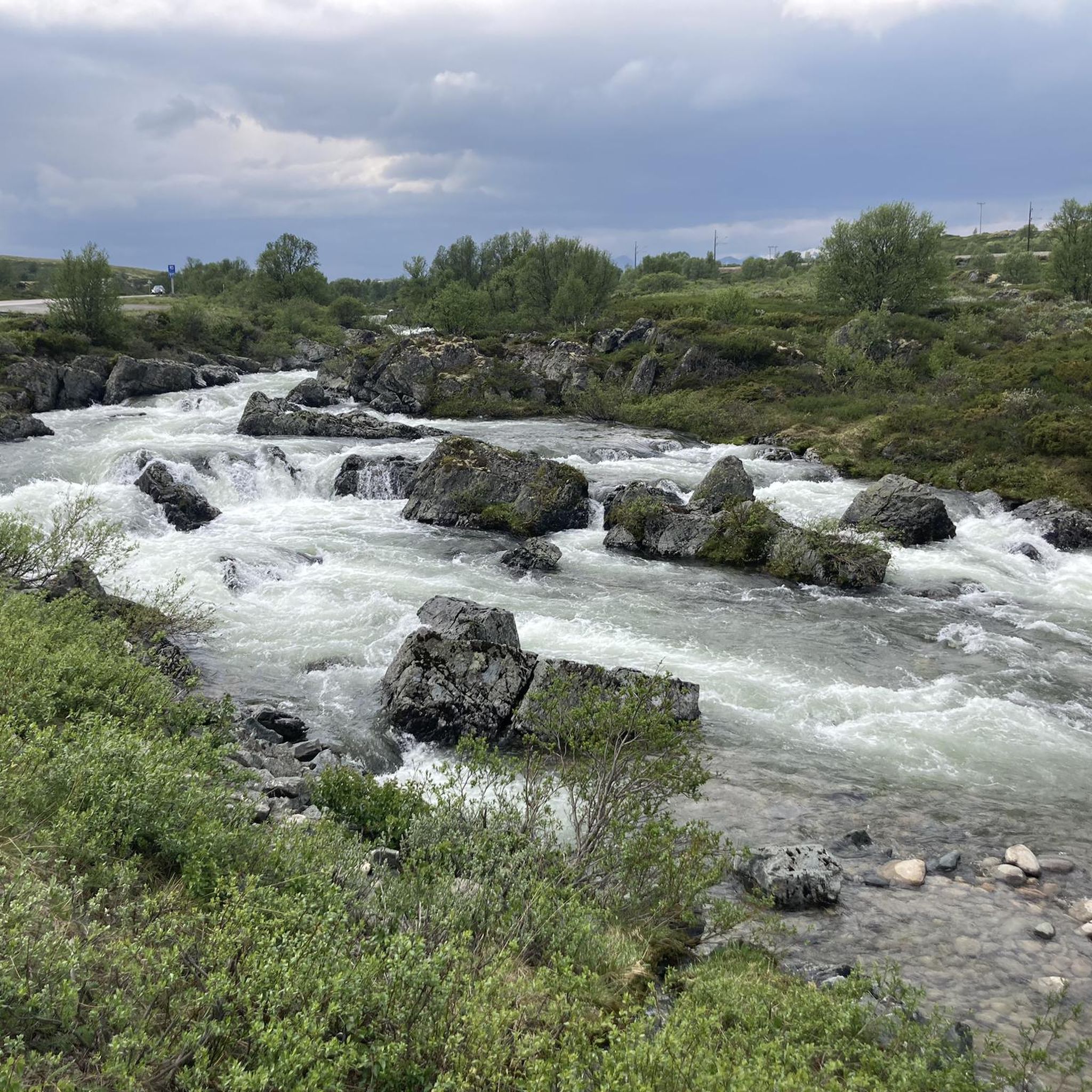
Here, you cross the stream that runs down from the Istjørni lake. On a run to Støhetta, to going gets steeper from here on in. However, it's a good place to refill your water supplies.
0
0
Rising to 7,500 feet (2,286 m), Snøhetta is the highest summit in Norway outside of Jotunheimen. In the summer months, it's a popular objective from the Snøheim DNT cabin.
0
0
Frequently Asked Questions
How many running routes are available in Hjerkinn / Kongsvoll / Drivdalen Landskapsvernområde?
There are several running routes in the Hjerkinn / Kongsvoll / Drivdalen Landskapsvernområde, offering a range of experiences from moderate paths to more challenging mountain trails. The komoot community has mapped 4 distinct routes in the area.
What kind of terrain can I expect on the jogging routes in this region?
The terrain in Hjerkinn / Kongsvoll / Drivdalen Landskapsvernområde is quite varied, characterized by mountain scenery and an alpine ecosystem. You'll encounter tundra, short grasses, moss, and lichen, with sparse birch forests at lower elevations. Some routes traverse exposed mountain plateaus, while others follow river valleys like Drivdalen, which features both narrow gorges and broad plains. The unique calcium-rich bedrock in areas like Knutshø contributes to a rich flora.
Are there running routes suitable for beginners in Hjerkinn / Kongsvoll / Drivdalen Landskapsvernområde?
While many routes in the area are considered difficult, there is at least one moderate option suitable for those looking for a less strenuous run. The Hjerkinn Station – View of Dovrefjell Plateau loop from Hjerkinn is a moderate 9.8 km trail that offers scenic views without extreme elevation changes.
Are there any challenging running trails for experienced runners?
Yes, experienced runners will find several challenging options. The Kongsvold Fjeldstue loop from Jerosbekken is a difficult 12.8 km path navigating through varied mountain landscapes. For an even greater challenge, consider the Snøhetta out and back - Dovrefjell-Sunndalsfjella National Park, a demanding 21.1 km route with significant elevation gain.
Can I find circular jogging routes in the area?
Yes, many of the running routes in Hjerkinn / Kongsvoll / Drivdalen Landskapsvernområde are designed as loops, allowing you to start and finish at the same point. Examples include the Hjerkinn Station – View of Dovrefjell Plateau loop from Hjerkinn and the Kongsvold Fjeldstue loop from Jerosbekken.
What natural features or landmarks can I see while jogging in Hjerkinn / Kongsvoll / Drivdalen Landskapsvernområde?
The region is rich in natural beauty and historical landmarks. You might pass by the historic Kongsvold Fjeldstue, explore the unique flora of the Kongsvoll Alpine Botanical Garden, or even cross parts of the ancient Pilgrims' Route Dovre–Oppdal (Old King's Road). The dramatic Blæsterbekken Canyon is another notable natural feature.
Are there any family-friendly running options in the region?
While specific 'family-friendly' jogging routes aren't explicitly highlighted, the area offers easy walks that can be adapted for shorter, less strenuous runs. The general landscape with its varied terrain and opportunities for wildlife spotting (like musk oxen) can make for an engaging outdoor experience for families. Consider routes that stay closer to the valley floor or well-maintained paths.
Can I bring my dog on the running trails in Hjerkinn / Kongsvoll / Drivdalen Landskapsvernområde?
Generally, dogs are welcome on trails in Norway, but specific rules may apply in protected areas like national parks or landscape conservation areas, especially concerning wildlife (wild reindeer, musk oxen, wolverines, Arctic foxes). It's always best to keep dogs on a leash to protect wildlife and ensure their safety. Check local signage or official park regulations before heading out.
What do other runners enjoy the most about jogging in Hjerkinn / Kongsvoll / Drivdalen Landskapsvernområde?
The area is highly rated by the komoot community, with an average score of 5.0 stars. Runners often praise the stunning mountain scenery, the unique alpine ecosystem, and the sense of wilderness. The diverse terrain, from river valleys to exposed plateaus, offers a rewarding experience for those seeking a connection with nature.
Are there opportunities to see wildlife like musk oxen while running?
Yes, the Dovrefjell area, which includes parts of this region, is famous for its musk oxen, wild reindeer, wolverines, and Arctic foxes. While jogging, you might be lucky enough to spot these animals in their natural habitat. However, it's crucial to maintain a safe distance from wildlife, especially musk oxen, and never approach them. Consider joining a guided musk ox safari for a guaranteed and safe viewing experience.
What is the best season for running in Hjerkinn / Kongsvoll / Drivdalen Landskapsvernområde?
The best season for running is typically late spring, summer, and early autumn (June to September) when the trails are free of snow and the weather is milder. During these months, you'll experience the rich flora, longer daylight hours, and more accessible mountain paths. Be prepared for potentially windy conditions on exposed plateaus, even in summer. Winter jogging is possible but requires specialized gear and knowledge of snow conditions.
Are there any historical routes I can run on?
Absolutely! The region is steeped in history. You can run along sections of the Pilgrims' Route (Pilegrimsleden) or the King's Road (Kongevegen), which was Norway's first public road over a high mountain area. These routes offer a unique blend of natural beauty and cultural heritage.
Most popular routes in Hjerkinn / Kongsvoll / Drivdalen Landskapsvernområde
Most popular attractions in Hjerkinn / Kongsvoll / Drivdalen Landskapsvernområde

Get inspired with the komoot mobile app


Explore more
Browse the best Running Trails & Routes in other regions.
