The best running trails in Øvre Drivdalen
12
runners
3
runs
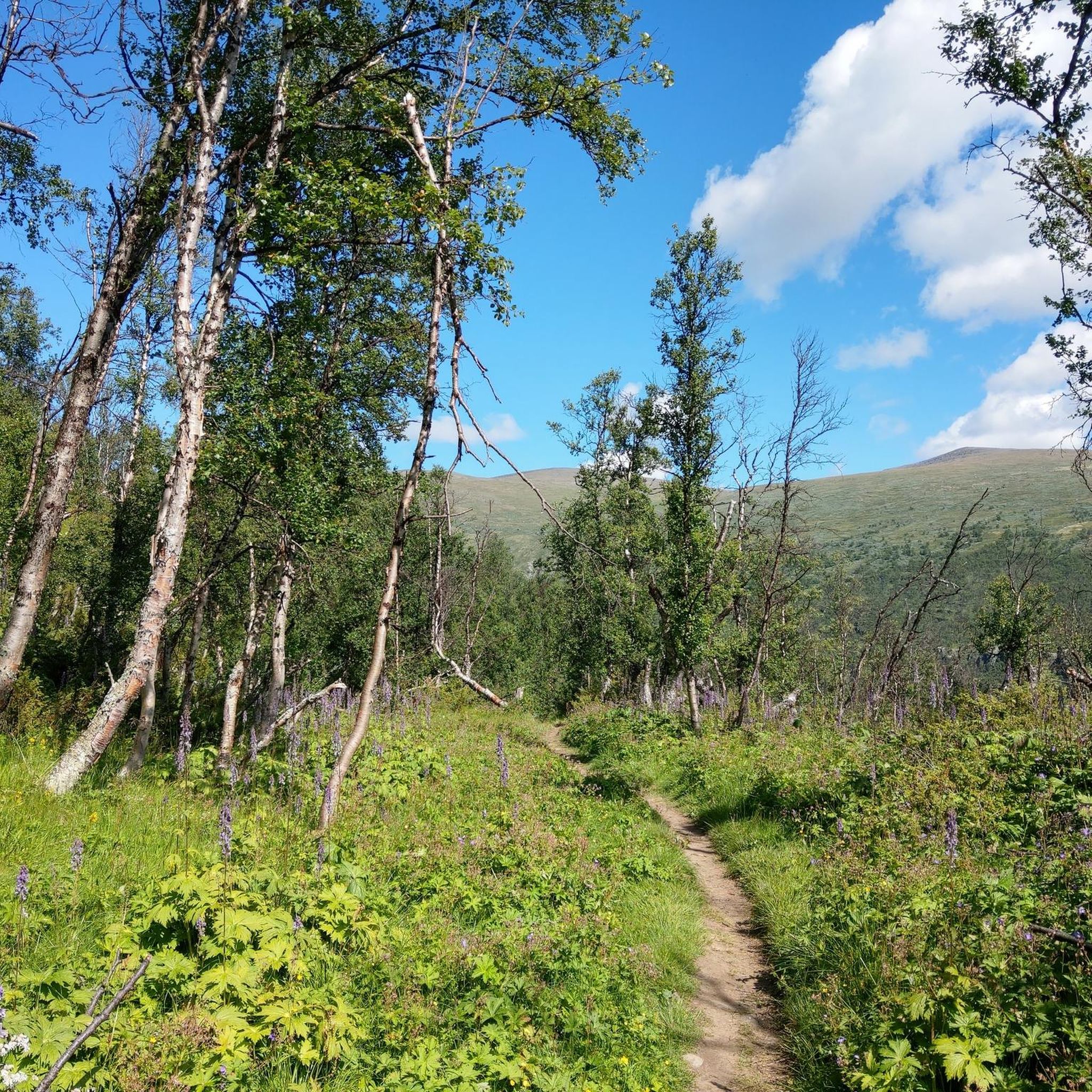
Jogging in Øvre Drivdalen offers diverse landscapes shaped by the Driva river, flowing north from Dovrefjell. The region features lush vegetation and significant botanical importance, with routes often passing through pine forests and along accessible riverside paths. The valley is set against the backdrop of the Dovrefjell–Sunndalsfjella National Park, providing varied terrain from gentle paths to more challenging mountain trails. This combination of river valleys, forests, and mountainous surroundings creates a rich environment for running.
Best jogging routes in Øvre…
Last updated: May 18, 2026
3
runners
19.2km
02:29
500m
500m
Hard run. Very good fitness required. Mostly paved surfaces. Suitable for all skill levels.
9
runners
9.78km
01:13
260m
260m
Moderate run. Good fitness required. Mostly paved surfaces. Suitable for all skill levels.

Sign up for free
21.1km
03:05
1,050m
1,050m
Hard run. Very good fitness required. Mostly paved surfaces. Suitable for all skill levels.
Our route recommendations are based on thousands of hikes, rides, and runs completed by other people on komoot.
Start today with a free account
Your next adventure awaits.
Login or Signup
Popular around Øvre Drivdalen
Tips from the Community

With 80 beds, Snøheim is a large DNT facility, providing a base for those exploring Snøhetta and Dovrefjell–Sunndalsfjella’s other high mountains, with ten peaks over 2,000 metres (6,500 ft) within reasonable hiking distance. A shuttle bus runs from Snøheim to Hjerkinn several times a day during the peak season.
1
0
Of Snøhetta's major summits, Stortoppen is the tallest, towering to 2,286 metres (7,500 ft), making it the highest mountain in Norway outside Jotunheimen. The views from the summit are sensational, with many of the nation’s most celebrated mountain ranges clearly visible on a good day. It's most often ascended from Snøheim or Reinheim and the hike along its east ridge is rocky, tough but not overly technical. It can also be ascended from Åmotdalshytta via its broad, north-west shoulder.
0
0
As the Kongevegen (King's Road) makes its way across Hjerkinnshøe, at the high point here is a stone marker indicating 208 kilometres (129 mi) to Nidaros, Trondheim's medieval name. The high ground here provides exceptional views across the wilds of Dovrefjell-Sunndalsfjella National Park.
0
0

Snøheim is only accessible by shuttle bus. Online booking requires seat reservation. Bookable at: https://reiseplanlegger.nor-way.no/ 120 NOK one way for adults Times must be selected in advance; you can rebook one hour before departure for 39 NOK to take an earlier or later bus. Parking is free here: https://maps.app.goo.gl/Ai3fZCdxwvJgWTWG6?g_st=ic Or here: https://maps.app.goo.gl/xbmadEdvyAdsRYgB8?g_st=ic The shuttle bus departs from here: https://maps.app.goo.gl/ebvYSUkbru8kmmvr5?g_st=ic
1
1


At 2,286 m, Snøhetta, Stortoppen, is the highest peak in Dovrefjell. Magnificent views. Here are a few practical tips: Starting point: The most popular route starts at Snøheim (a DNT hut), accessible by shuttle bus from the parking lot in Hjerkinn (in summer). Duration: Approx. 5–7 hours (round trip), depending on fitness and weather. Distance: Approximately 12–14 km total, with approximately 900 meters of elevation gain. Difficulty: Moderate to difficult. Not a via ferrata, but rocky, steep in places, and slippery when wet.
2
2
Here, you cross the stream that runs down from the Istjørni lake. On a run to Støhetta, to going gets steeper from here on in. However, it's a good place to refill your water supplies.
0
0
Rising to 7,500 feet (2,286 m), Snøhetta is the highest summit in Norway outside of Jotunheimen. In the summer months, it's a popular objective from the Snøheim DNT cabin.
0
0
Frequently Asked Questions
How many running routes are available in Øvre Drivdalen?
There are currently 6 jogging routes available in Øvre Drivdalen on komoot, offering a variety of experiences for runners. These routes range from moderate to difficult, catering to different fitness levels.
What kind of terrain can I expect on the running trails in Øvre Drivdalen?
The running trails in Øvre Drivdalen offer diverse terrain. You can expect routes along the scenic Driva river valley, through lush pine forests, and paths with views of the mountainous Dovrefjell region. Some trails feature mostly paved surfaces or large gravel roads, while others involve more challenging, varied terrain with significant elevation gains.
Are there running routes suitable for beginners or those looking for an easier jog?
While many routes in Øvre Drivdalen are rated as difficult, there are options for easier jogs. The "Lit Trail" of Drivdalen Sports Club, for example, offers a network of paths through pine forests by the Driva river, with various loop lengths from 500 meters to 4 km, often on large gravel roads, making it suitable for a more relaxed run.
What are some of the more challenging running routes in Øvre Drivdalen?
For those seeking a challenge, Øvre Drivdalen offers several difficult routes. One such route is the Snøhetta out and back - Dovrefjell-Sunndalsfjella National Park, a 13.1-mile (21.1 km) trail with over 1000 meters of elevation gain, leading through the national park.
What natural features or landmarks can I see while jogging in Øvre Drivdalen?
Jogging in Øvre Drivdalen allows you to experience a rich natural environment. You might encounter the Kongsvoll Alpine Botanical Garden, known for its diverse plant life, or the dramatic Blæsterbekken Canyon. The historic Olav Pilgrim Trail River Crossing is another notable feature along some routes.
Are there any routes that offer scenic views of the Dovrefjell Plateau?
Yes, for stunning vistas, consider the Hjerkinn Station – View of Dovrefjell Plateau loop from Hjerkinn. This moderate 6.1-mile (9.8 km) path provides excellent views of the majestic Dovrefjell Plateau, characteristic of the region's mountainous terrain.
Can I find running routes that pass through forests?
Absolutely. Øvre Drivdalen is known for its extensive pine forests. The "Lit Trail" of Drivdalen Sports Club is beautifully situated within a pine forest by the Driva river, offering a pleasant and shaded running environment. Many other routes also weave through forested sections.
Are there any circular running routes in the area?
Yes, several routes in Øvre Drivdalen are circular. For instance, the Kongsvold Fjeldstue loop from Jerosbekken is a 7.9-mile (12.8 km) circular trail that explores the area around Kongsvoll and the historic Old Kings' Road.
What is the best time of year to go running in Øvre Drivdalen?
The best time for running in Øvre Drivdalen is generally during the warmer months, from late spring to early autumn, when trails are clear of snow and ice. This period allows for comfortable exploration of the diverse landscapes and ensures better accessibility to all routes.
Are there any historical paths I can run on in Øvre Drivdalen?
Yes, Øvre Drivdalen is rich in history. You can run along sections of the historic Olav Pilgrim Trail (Olavsleden), which passes directly through the area. Another option is the "Old Kings' Road" (Vårstigen), with Kongsvoll as a notable stop, offering a unique blend of heritage and outdoor activity.
What do other runners enjoy the most about jogging in Øvre Drivdalen?
The running routes in Øvre Drivdalen are highly rated by the komoot community, with an average score of 5.0 stars. Runners often praise the diverse landscapes, from the tranquil river valley and pine forests to the dramatic mountainous backdrop of the Dovrefjell region, offering a rich and varied experience.
Are there any places to explore or visit near the running trails?
Yes, there are several interesting places to explore. You can visit Kongsvold Fjeldstue, a historic mountain lodge, or wander through the Kongsvoll Alpine Botanical Garden. The Birch Forest Trail also offers a pleasant walk or cool-down after a run.
Most popular routes in Øvre Drivdalen
Most popular attractions in Øvre Drivdalen

Get inspired with the komoot mobile app


Explore more
Browse the best Running Trails & Routes in other regions.
