The best walks and hikes around Area C (Chilako River/Nechako)
3.0
(2)
142
hikers
21
hikes
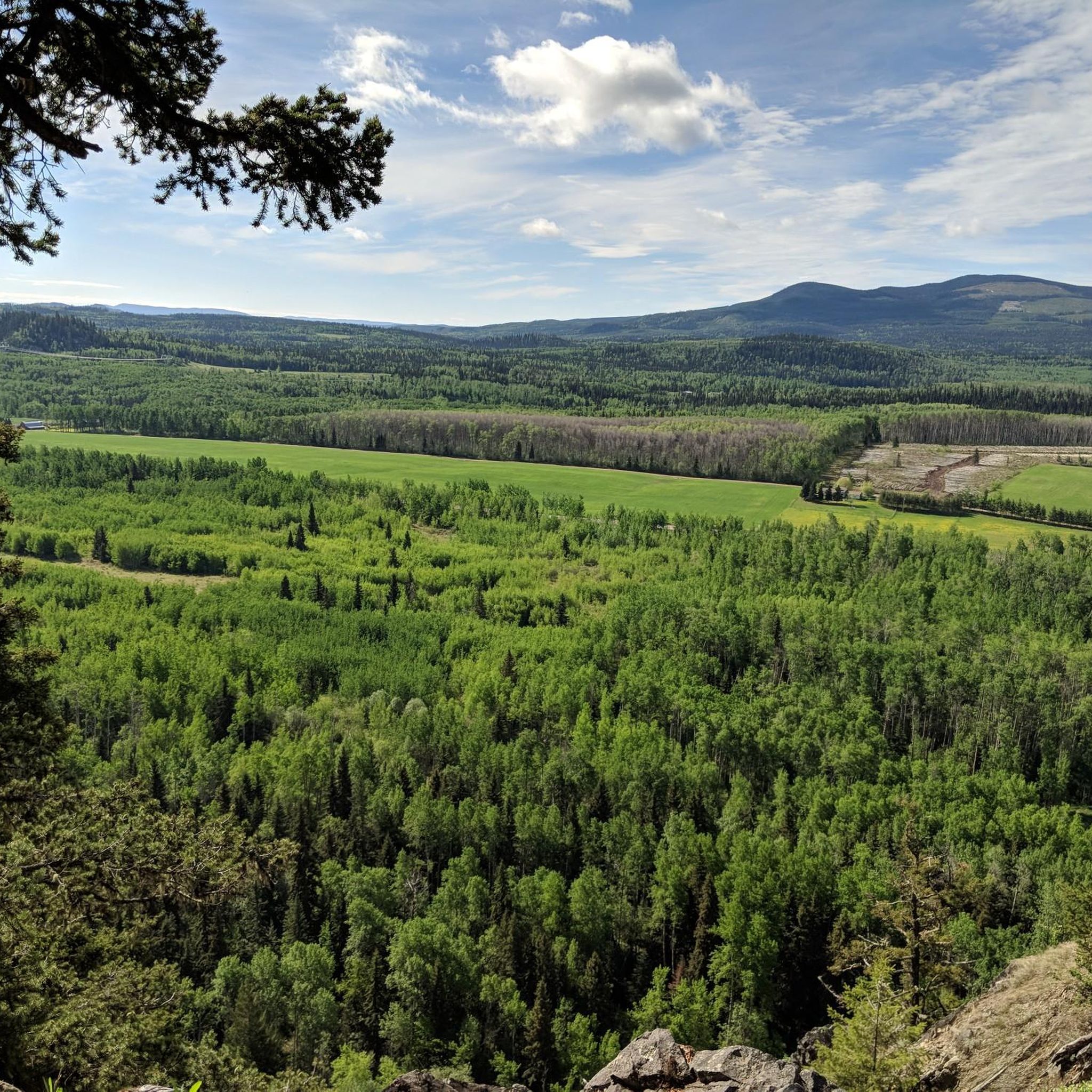
Hiking around Area C (Chilako River/Nechako) offers diverse landscapes across the gently rolling Nechako Plateau. The region is defined by the Nechako and Chilako Rivers, which provide access to various forest communities including tamarack stands, mixed spruce-tamarack, and drier spruce-lodgepole pine forests. Wetlands and sedge meadows contribute to the ecological variety, while the Nechako Canyon presents impressive scenery.
Best hiking trails around Area C (Chilako River/Nechako)
- The most popular hiking route is Fort George Canyon Trail to Fort George Canyon Provincial Park — Fraser-Fort George, a moderate 8.1 miles (13.1 km) trail that takes 3 hours 42 minutes to complete. This route features an elevation gain of 271.5 meters.
- Another top favourite among local hikers is Ferguson Lake Trail Loop, an easy 1.6 miles (2.6 km) path. This trail offers a gentle walk with minimal elevation change around Ferguson Lake.
- Local hikers also love the Nechako River loop from Prince George, a 2.9 miles (4.6 km) trail leading through riverside areas, often completed in about 1 hour 10 minutes.
- Hiking around Area C (Chilako River/Nechako) is defined by river valleys, forest communities, and the Nechako Plateau. The network offers options for different ability levels, from easy riverside strolls to more challenging routes.
- The routes in Area C (Chilako River/Nechako) are highly rated by the komoot community with an average score of 3.0 stars from over 2 reviews. More than 120 hikers have used komoot to explore Area C (Chilako River/Nechako)'s varied terrain.
Last updated: August 13, 2026
15
hikers
6.61km
01:57
180m
180m
Easy hike. Great for any fitness level. Easily-accessible paths. Suitable for all skill levels.
4.0
(1)
14
hikers
Moderate hike. Good fitness required. Easily-accessible paths. Suitable for all skill levels.

Sign up for free
7
hikers
2.58km
00:40
10m
10m
Hike the easy 1.6-mile Ferguson Lake Trail Loop in Prince George, offering family-friendly access, lush forests, and calm lake views.
3
hikers
3.37km
00:53
30m
30m
Easy hike. Great for any fitness level. Easily-accessible paths. Suitable for all skill levels.
6.48km
01:41
50m
40m
Easy hike. Great for any fitness level. Easily-accessible paths. Suitable for all skill levels.
Get access to more routes and recommendations from other explorers.
Sign up for free
Already have an account?
Our route recommendations are based on thousands of hikes, rides, and runs completed by other people on komoot.
Start today with a free account
Your next adventure awaits.
Login or Signup
Popular around Area C (Chilako River/Nechako)
Other adventures around Area C (Chilako River/Nechako)


Tips from the Community

L.C. Gunn Trail is an out and back trail with stunning views of the Fraser River and Prince George behind it. It is a great evening stroll, best to catch the sunset at the end so you don't have to navigate in the dark. There are multiple lookouts of the river along the trail as it weaves in and out of the woods, with interpretive signs detailing the area's history along the way.
0
0
L.C. Gunn Park is home to the western start of L.C. Gunn Trail on the eastern banks of the Fraser River. The park is a thick forest with basic animates like a gravel parking area, interpretive historical signage, and outhouses, but mostly serves as a gateway to the trail.
0
0
From this end point here of the L.C. Gunn Trail in its western section, is a nice overlook of the Simon Fraser Bridge, spanning the Fraser River. It's a double truss bridge with four lanes that was built in 1963.
0
0

The beach at Berman Lake is accessible via a short trail that branches to the west of the parking area. Here you will find an open lawn area and a sandy beach with a designated swimming area.
0
0
Berman Lake Regional Park is a great day-use area with access to a lake shoreline and its natural eskers. There is a dock for canoe access, a sandy beach with a designated swimming area, and about 3 kilometres of hiking trails. Facilities include picnic tables, fire pits, washrooms, and change houses. The park is open seasonally from May to November.
0
0
This canoe launch is located at the end of a small spur trail on the west end of Beaver Trail. Even if you aren't planning on taking a canoe out on the water, this spot is worth the detour for a beautiful view of the lake. You might even see some canoes out and about from here as well!
0
0
This is the first of three bridges that cross over the creek along Beaver Trail. It is steady and well-maintained, and is a very picturesque start to this loop trail.
0
0

The trail ends directly at the Fraser River. Originating at Fraser Pass and stretching 1,375 km to the Strait of Georgia, it is the longest river in British Columbia.
0
0
Frequently Asked Questions
How many hiking trails are available in Area C (Chilako River/Nechako)?
Area C (Chilako River/Nechako) offers a diverse network of trails for hikers. You can find over 18 hiking routes, with options ranging from easy strolls to more moderate treks. The komoot community has explored these trails over 120 times.
What is the best time of year to hike in Area C (Chilako River/Nechako)?
The warmer months are ideal for hiking in Area C, especially for activities like swimming and picnicking along the Chilako River. However, the region's diverse trail system, including areas like Waterlily Lake, also caters to cross-country skiing, suggesting that trails can be enjoyed year-round depending on the activity.
Are there options for winter hiking in the Chilako River/Nechako region?
Yes, while many trails are popular in warmer months, the region offers opportunities for winter activities. For instance, the 24 km network of trails at Waterlily Lake is suitable for cross-country skiing, indicating that some routes are maintained or accessible for winter exploration.
Are there family-friendly hiking trails in the Nechako River area?
Absolutely. Area C has many easy trails perfect for families. For example, the Ferguson Lake Trail Loop is an easy 1.6-mile (2.6 km) path with minimal elevation change, ideal for a gentle family walk. The Nechako Riverside Park also features a wide, peaceful path suitable for leisurely strolls.
Where can beginners find easy hiking routes in Area C?
Beginners have plenty of choices in Area C, with 16 out of 18 routes rated as easy. The Ferguson Lake Trail Loop is a great starting point, offering a gentle walk around the lake. Another accessible option is the Nechako River loop from Prince George, a 2.9-mile (4.6 km) trail through riverside areas.
Are the hiking trails in Area C (Chilako River/Nechako) dog-friendly?
While specific dog regulations can vary by trail, many outdoor areas in the Chilako River/Nechako region are generally welcoming to dogs, especially on leash. Given the natural and diverse landscapes, it's common for hikers to bring their canine companions. Always check local signage for any specific restrictions on individual trails or protected areas.
Are there any loop trails in the Chilako River area?
Yes, the region offers several loop trails. The Ferguson Lake Trail Loop is a popular easy option. Other notable loops mentioned in the region include the Lost Lake Loop Trail, Nechako River Loop via Heritage Nature Trail, and the Tabor Mountain Trail System Loop for more challenging experiences. The Nechako River loop from Prince George is also a great choice.
Are there any waterfalls to see along the hiking trails?
Yes, the region features at least one notable waterfall. You can visit Hixon Falls, which is listed as a nearby attraction. Additionally, Cheslatta Falls is a popular destination with a well-marked circular trail leading to spectacular viewpoints of the falls.
What interesting natural features or landmarks can I explore in Area C (Chilako River/Nechako)?
Area C is rich in natural features. You can explore the unique tamarack stands in the Chilako River Ecological Reserve, which protects the most southerly known stand in British Columbia. The dramatic Nechako Canyon offers impressive scenery, and Cut-Off Butte provides panoramic views of the Nechako Plateau and even the Coast Mountains on clear days. Other points of interest include Connaught Hill Park.
Can I expect to see wildlife while hiking in the Chilako River/Nechako region?
Yes, many trails in Area C offer excellent opportunities for wildlife viewing. Along river systems like the Bulkley River, you might spot birds such as ducks and even river otters. The diverse forest communities and wetlands also provide habitats for various other wildlife, making for an enriching hiking experience.
What do other hikers enjoy most about the trails in Area C (Chilako River/Nechako)?
The trails in Area C (Chilako River/Nechako) are highly rated by the komoot community, with an average score of 3.0 stars. Hikers often praise the diverse landscapes, from river valleys and unique forest communities to the gently rolling Nechako Plateau, offering a variety of experiences for all ability levels.
Are there any unique or 'hidden gem' trails in the Nechako region?
Beyond the well-known routes, the Chilako River Ecological Reserve offers a unique experience with its protected tamarack stands, providing a distinct botanical highlight. For serious wilderness hikers, the restored ancient Carrier trade routes like the Alexander Mackenzie Heritage Trail and Cheslatta Trail present a significant and challenging adventure, often considered hidden gems for their historical and natural significance.
Most popular routes around Area C (Chilako River/Nechako)
Most popular attractions around Area C (Chilako River/Nechako)

Get inspired with the komoot mobile app


Explore more
Browse the best Hikes in other regions.
