Easy hikes and walks around Parco naturale regionale Sirente-Velino
4.5
(1357)
7,822
hikers
284
hikes
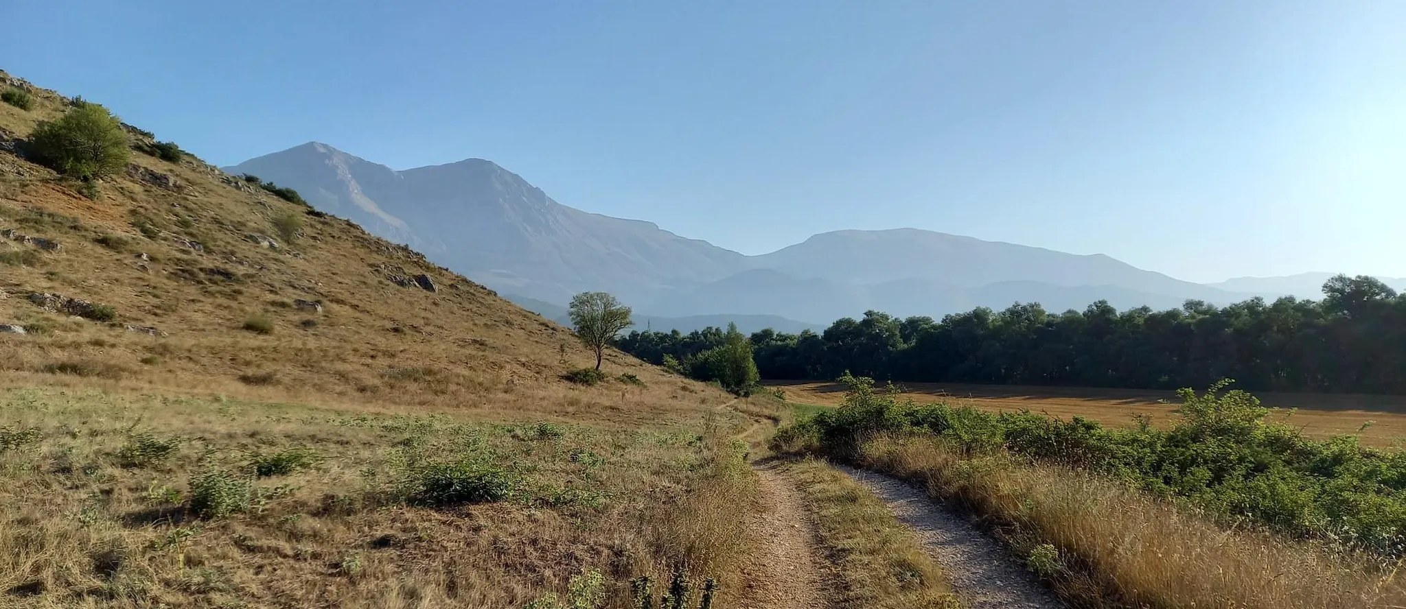
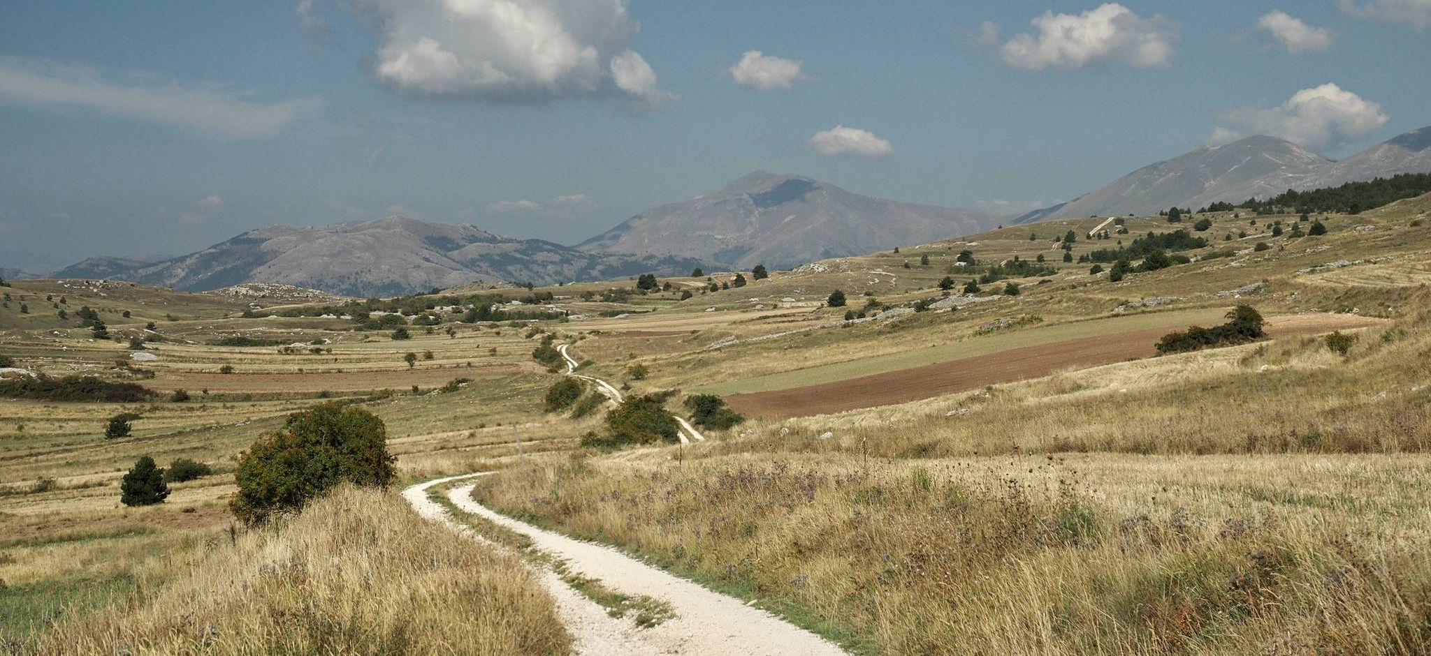
Easy hiking trails around Parco naturale regionale Sirente-Velino traverse a diverse landscape characterized by the imposing Sirente and Velino mountain ranges, deep valleys, and extensive beech forests. The region features pristine lakes, karst plateaus, and dramatic gorges like San Venanzio and Celano. Rivers such as the Aterno wind through the area, which offers a network of well-marked trails suitable for various abilities.
Best easy hiking trails around Parco naturale regionale Sirente-Velino
- The most popular easy hiking route is Fountain with picnic area – Val d'Arano loop from Valle D'Arano, a 3.2 miles (5.2 km) trail that takes about 1 hour 20 minutes to complete. This path offers gentle gradients through scenic landscapes.
- Another top favourite among local hikers is Piano del Ceraso loop from Ovindoli, an easy 3.7 miles (5.9 km) path. This route leads through varied terrain with moderate elevation gain, offering views of the surrounding area.
- Local hikers also love the La Barracca loop from Ovindoli, a 2.8 miles (4.6 km) trail leading through open meadows and forests, often completed in about 1 hour 15 minutes.
- Hiking around Parco naturale regionale Sirente-Velino is defined by mountain ranges, lush forests, and karst plateaus. The extensive network of trails offers options for different ability levels, including many recommended easy routes.
- The routes in Parco naturale regionale Sirente-Velino are highly rated by the komoot community with an average score of 4.6 stars from more than 1,100 reviews. More than 6,000 hikers have used komoot to explore Parco naturale regionale Sirente-Velino's varied terrain.
Last updated: July 7, 2026
4.5
(12)
88
hikers
5.18km
01:22
40m
40m
Easy hike. Great for any fitness level. Easily-accessible paths. Suitable for all skill levels.
3.6
(7)
30
hikers
6.45km
01:47
120m
120m
Easy hike. Great for any fitness level. Easily-accessible paths. Suitable for all skill levels.

Sign up for free
4.5
(10)
42
hikers
6.56km
01:46
90m
90m
Easy hike. Great for any fitness level. Easily-accessible paths. Suitable for all skill levels.
4.3
(6)
38
hikers
5.88km
01:42
150m
150m
Easy hike. Great for any fitness level. Easily-accessible paths. Suitable for all skill levels.
3.0
(3)
6
hikers
4.56km
01:16
80m
80m
Easy hike. Great for any fitness level. Easily-accessible paths. Suitable for all skill levels.
Get access to more routes and recommendations from other explorers.
Sign up for free
Already have an account?
Our route recommendations are based on thousands of hikes, rides, and runs completed by other people on komoot.
Start today with a free account
Your next adventure awaits.
Login or Signup
Popular around Parco naturale regionale Sirente-Velino
Other adventures around Parco naturale regionale Sirente-Velino


Tips from the Community

Breathtaking view of Mount Magnola
0
0

Is it also possible with gravel? Can October be considered as a period to do it?
0
0

view on the right going towards the plank spring
0
0

Done many times, as well as with cross-country skis, also with Mtb. Enchanting scenery both in summer and in winter as someone has already commented. Did it again just yesterday in Mtb, and we'll do it again, and again 🚴🏻♀️😎✌🏾
1
1

Val d'Arano is the result of the erosion of an ancient lake formed by the river La Foce, which has also carved out the suggestive Celano-Aielli Gorges. It is crossed by a 5 km loop trail that offers breathtaking views of the canyon and the mountain.
0
0

Val d'Arano is a small mountain valley formed during the glaciation, in barren stretches woods of beech and hazelnut groves alternate.
1
0
Frequently Asked Questions
How many easy hiking trails are there in Parco naturale regionale Sirente-Velino?
The Parco naturale regionale Sirente-Velino offers over 40 easy hiking trails. These routes are designed to be accessible, allowing you to explore the diverse landscapes of the Sirente and Velino mountain ranges, deep valleys, and extensive beech forests without significant challenge.
What is the best time of year for easy walks in Parco naturale regionale Sirente-Velino?
Spring and autumn are ideal for easy walks in Parco naturale regionale Sirente-Velino. In spring, the meadows, especially on the Rocche Plateau, burst with daffodil blooms, and the weather is generally mild. Autumn offers pleasant temperatures and vibrant foliage. Summer can also be enjoyable, particularly at higher elevations, while winter provides opportunities for snowshoeing on some routes.
Are there family-friendly easy walks in Parco naturale regionale Sirente-Velino?
Yes, many easy trails in the park are suitable for families. Routes often feature gentle gradients and scenic points of interest. For example, the Fountain with picnic area – Val d'Arano loop from Valle D'Arano is a popular choice, offering a pleasant walk through a scenic area with a picnic spot.
Can I bring my dog on easy hikes in Parco naturale regionale Sirente-Velino?
Generally, dogs are permitted on trails in Parco naturale regionale Sirente-Velino, but it's crucial to keep them on a leash to protect the park's diverse wildlife, which includes species like the Apennine wolf and Marsican brown bear. Always check specific trail regulations before heading out.
Are there easy loop trails in Parco naturale regionale Sirente-Velino?
Yes, the park features several easy loop trails perfect for a relaxed outing. The Piano del Ceraso loop from Ovindoli is a great example, offering varied terrain and views. Another option is the Wolf Mountain Hut – Piani di Pezza loop from Vado di Pezza, which takes you through open meadows.
What natural attractions can I see on easy hiking trails?
Easy hiking trails in the park can lead you to stunning natural features. You might encounter dramatic gorges like the Gorges of Celano, expansive plains such as Piani di Pezza, or even beautiful waterfalls like the Fonte degli Innamorati Waterfall. The park's diverse landscape ensures a variety of natural sights.
Are there opportunities for wildlife spotting on easy hikes?
Parco naturale regionale Sirente-Velino is rich in biodiversity, offering chances to spot wildlife even on easy trails. Keep an eye out for deer, wild boar, and various bird species like golden eagles and griffon vultures. While rarer, the park is also home to the Apennine wolf and Marsican brown bear, though sightings are less common.
What historical or cultural sites can be explored on easy hikes?
Beyond its natural beauty, the park is dotted with historical and cultural gems. Some easy routes may pass near charming medieval villages, ancient hermitages, or even Roman ruins like those of Alba Fucens, offering a glimpse into the region's rich past.
Is public transport available to reach easy trails in Parco naturale regionale Sirente-Velino?
Public transport options to reach specific trailheads within the vast Parco naturale regionale Sirente-Velino can be limited. It is often recommended to use a car for greater flexibility in accessing various starting points for easy hikes. Check local bus schedules for connections to larger towns within or near the park.
Where can I find parking for easy hiking trails?
Parking is generally available at or near the starting points of many popular easy hiking trails. Look for designated parking areas in villages like Ovindoli or Valle D'Arano, which serve as common access points for routes such as the La Barracca loop from Ovindoli.
What should I pack for easy trails in Parco naturale regionale Sirente-Velino?
Even for easy trails, it's wise to pack essentials. Bring comfortable walking shoes, water, snacks, sun protection (hat, sunscreen), and a light jacket, as mountain weather can change quickly. A basic first-aid kit and a fully charged phone are also recommended.
What do other hikers enjoy the most about hiking in Parco naturale regionale Sirente-Velino?
The area is highly rated by the komoot community, with an average score of 4.6 stars from over 1,100 reviews. Reviewers often praise the well-marked paths, the stunning natural beauty of the Sirente and Velino mountain ranges, and the peaceful atmosphere found within the park's diverse landscapes.
Most popular routes around Parco naturale regionale Sirente-Velino
Most popular attractions around Parco naturale regionale Sirente-Velino

Get inspired with the komoot mobile app


Explore more
Browse the best Hikes in other regions.
