Easy hikes and walks around Lac de la Haute-Sûre
4.4
(4884)
20,583
hikers
378
hikes
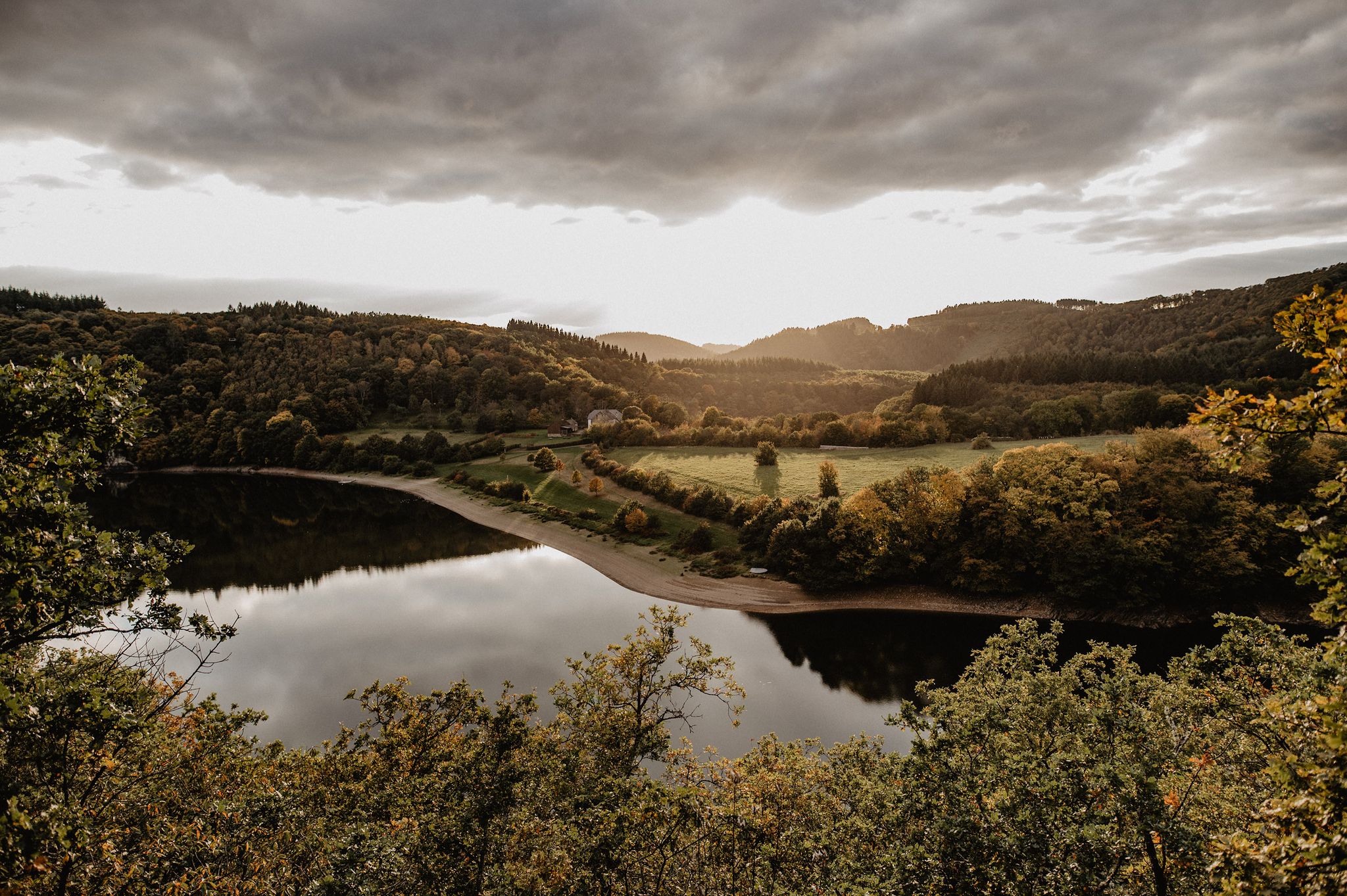
Easy hiking trails around Lac de la Haute-Sûre traverse a landscape defined by a large artificial lake, surrounded by lush greenery, rolling hills, and wooded slopes. The region features narrow valleys and clear streams, all within the Upper Sûre Natural Park. This area offers diverse natural features, making it suitable for accessible walks.
Best easy hiking trails around Lac de la Haute-Sûre
- The most popular easy hiking route is ES 1: Burfeld – hiking in the north of Luxembourg, a 3.0 miles (4.8 km) trail that takes 1 hour 28 minutes to complete. This route offers accessible paths through the northern part of Luxembourg.
- Another top favourite among local hikers is View of Lac de la Haute-Sûre – Liefrange Campsite loop from Mecher, an easy 1.8 miles (2.9 km) path. This trail provides continuous scenic views of Lac de la Haute-Sûre.
- Local hikers also love the Esch-sur-Sûre village – Esch-sur-Sûre Castle loop from Esch-sur-Sûre, a 2.4 miles (3.9 km) trail leading through historical village settings and past the ruins of Esch-sur-Sûre Castle, often completed in about 1 hour 4 minutes.
- Hiking around Lac de la Haute-Sûre is defined by serene lake views, dense forests, and rolling hills. The extensive network offers options for various ability levels, with many routes suitable for easy outings.
- The routes in Lac de la Haute-Sûre are highly rated by the komoot community with an average score of 4.4 stars from over 4400 reviews. More than 20000 hikers have used komoot to explore Lac de la Haute-Sûre's varied terrain.
Last updated: July 4, 2026
4.7
(70)
309
hikers
4.83km
01:28
160m
160m
Easy hike. Great for any fitness level. Easily-accessible paths. Suitable for all skill levels.
4.7
(26)
70
hikers
Easy hike. Great for any fitness level. Easily-accessible paths. Suitable for all skill levels.

Sign up for free
4.7
(3)
35
hikers
Easy hike. Great for any fitness level. Easily-accessible paths. Suitable for all skill levels.
4.4
(5)
16
hikers
3.39km
00:59
90m
90m
Easy hike. Great for any fitness level. Easily-accessible paths. Suitable for all skill levels.
5.0
(3)
15
hikers
Easy hike. Great for any fitness level. Easily-accessible paths. Suitable for all skill levels.
Get access to more routes and recommendations from other explorers.
Sign up for free
Already have an account?
Our route recommendations are based on thousands of hikes, rides, and runs completed by other people on komoot.
Start today with a free account
Your next adventure awaits.
Login or Signup
Popular around Lac de la Haute-Sûre
Other adventures around Lac de la Haute-Sûre

Tips from the Community

I was hiking in the area on a hot summer day. As I entered this trail in the forest, the shade and cool flowing water made it so cool and refreshing that it felt truly soothing.
0
0

Esch-sur-Sûre (Luxembourgish, German: Esch-Sauer) is a municipality in the canton of Wiltz, Luxembourg. The municipality has a total area of 51.25 km² and had 2,982 inhabitants on January 1, 2021. Esch-sur-Sûre is located on the River Sûre. A large reservoir has been constructed near the town. Tourism is an important source of income for the municipality. A 10th-century castle ruin stands on a hilltop, offering panoramic views of Esch-sur-Sûre and the river. Two campsites are located near the town on the Sûre. The water is known for its low temperatures, even in summer: it is the underwater part of the reservoir located higher up. Swimming in the reservoir is recommended, as it is a designated recreational area.
0
0
Before the arrival of tourism, the village relied primarily on cloth production. In the former factory by the water, you can visit a museum that provides a glimpse into that era: "Duch vum Séi." On display are large looms, presses, and bobbins of yarn. The building (Haute-Sûre Nature Park) is located on the road to the reservoir and is easily accessible on foot from Esch-sur-Sûre.
0
0
The historic center is charming and small. The climb to the castle is over stones polished by thousands of footsteps. Once at the top, you'll find yourself standing in a 19th-century landscape painting, with a ruin at its center, as it should be: worn down enough to be exciting, but with enough walls and towers to spark the imagination. The discovered foundations, dating back to 927, are said to be the oldest castle in the Grand Duchy of Luxembourg. The ruins are the ideal setting for the annual Night of Legends, a festival featuring fire-eaters, actors, storytellers, jugglers, acrobats, and musicians. Esch-sur-Sûre is part of the Éislek tourist region. Its central location in the Luxembourg Ardennes makes it the perfect base for exploring the surrounding area. Thanks to the village, its location, the reservoir, and the Sûre, the town is also popular with campers and outdoor enthusiasts.
1
0

Esch-sur-Sûre has a beautiful castle ruin.
1
0

A Romanesque tower fortress was built as early as 927 by Maingaud (Meginaud) on the initiative of the Stavelot Abbey. In the 13th century, the last Counts of Esch expanded the castle in the Gothic style, including additional buildings. Around 1400, the village was fortified with a city wall approximately 450 meters long and 1.5 meters thick – with the round pierced tower as part of the fortifications. Decay began in the mid-16th century. In 1685, troops of Louis XIV had parts of the castle demolished – but the outer wall remained standing because many houses used it as a back wall. Villagers lived in parts of the ruins until well into the 19th century – Victor Hugo reported on families living there in 1871. In 1902, Martin-Rianod'Hutzt bought the site; with the assistance of architect Charles Arendt, restoration followed from 1903 to 1906, particularly of the chapel and keep.
1
0
Nestled in a narrow loop of the Sauer River, the village center feels like a window into the Middle Ages – with narrow alleys and houses that nestle harmoniously into the hill surrounding the castle.
2
0
Frequently Asked Questions
What is the typical terrain like on easy hiking trails around Lac de la Haute-Sûre?
Easy trails in the Lac de la Haute-Sûre region generally feature accessible paths through lush greenery, rolling hills, and wooded slopes. You'll often find yourself walking alongside the tranquil lake, through narrow valleys, and near crystal-clear streams. The paths are well-marked and suitable for all fitness levels.
What are the typical distances and durations for easy hikes in this area?
Easy hikes around Lac de la Haute-Sûre typically range from 1.8 to 3 miles (2.9 to 4.8 km) in distance. Most can be completed within 1 to 1.5 hours, making them ideal for short outings or family walks. For example, the View of Lac de la Haute-Sûre – Liefrange Campsite loop is 1.8 miles long, while ES 1: Burfeld covers 3 miles.
Are there any family-friendly easy hikes around Lac de la Haute-Sûre?
Yes, many easy trails are suitable for families. The region's diverse landscapes and well-maintained paths make it ideal for all ages. Consider routes that pass by attractions like the Lultzhausen Floating Footbridge, which offers unique views directly over the water and is popular with children. The Esch-sur-Sûre village – Esch-sur-Sûre Castle loop is another great option, combining easy walking with historical exploration.
What natural features or viewpoints can I expect to see on easy trails?
The region is rich in natural beauty. You can expect continuous scenic views of Lac de la Haute-Sûre, dense forests, and rolling hills. Panoramic viewpoints like Belvédère Burfelt offer breathtaking vistas. Many trails also follow the Sûre River, providing varied and interesting paths through the natural environment.
Are there any interesting landmarks or attractions along easy hiking trails?
Yes, several easy trails incorporate historical and architectural attractions. You can explore the ruins of Esch-sur-Sûre Castle, or visit significant landmarks like the Esch-sur-Sûre Dam. The Lultzhausen Floating Footbridge is a unique structure offering direct lake views. Some paths also pass by the Natur Pur Trail – Misärsbrëck, known for its varied scenery.
How many easy hiking trails are available in Lac de la Haute-Sûre?
There are over 140 easy hiking trails available around Lac de la Haute-Sûre, offering a wide variety of options for different preferences and fitness levels. In total, the region boasts nearly 400 hiking routes across all difficulty grades.
What do other hikers enjoy most about hiking in Lac de la Haute-Sûre?
The area is highly rated by the komoot community, with an average score of 4.4 stars from over 4400 reviews. Hikers often praise the serene lake views, dense forests, and the extensive network of well-marked paths that cater to various ability levels, especially the accessible easy routes.
Are there any easy circular walks around Lac de la Haute-Sûre?
Yes, many easy trails in the region are circular, allowing you to start and end at the same point. Examples include the View of Lac de la Haute-Sûre – Liefrange Campsite loop and the Esch-sur-Sûre village – Esch-sur-Sûre Castle loop, both offering convenient round trips.
Can I bring my dog on the easy hiking trails?
The Upper Sûre Natural Park, which encompasses Lac de la Haute-Sûre, is generally dog-friendly. Many trails are suitable for walks with leashed dogs, allowing them to enjoy the natural environment alongside you. Always ensure your dog is under control and respect local regulations regarding pets in natural areas.
What is the best time of year for easy hikes around Lac de la Haute-Sûre?
The region is beautiful year-round, but spring and autumn offer particularly pleasant conditions for easy hikes. In spring, the landscape bursts with new growth, while autumn brings vibrant foliage. Summer is also popular, though trails can be busier. Winter offers a tranquil experience, but some paths might be slippery or require appropriate footwear.
Where can I find a map of the easy hiking trails in the region?
For a comprehensive overview of the hiking network, you can consult detailed maps of the Upper Sûre Lake area. An official map is available for download from the regional tourism board: Upper-Sure Lake map.
Are there any easy trails that offer views of the Upper Sûre Lake near Bavigne?
Yes, the War Memorial (1940–1945) – View of Lake Bavigne loop is an easy route that provides excellent views of the Upper Sûre Lake near Bavigne. This trail is approximately 3 miles (4.8 km) long and offers scenic vistas of this part of the lake.
Most popular routes around Lac de la Haute-Sûre
Most popular attractions around Lac de la Haute-Sûre

Get inspired with the komoot mobile app


