Easy hikes and walks around São Teotónio
4.3
(4374)
20,108
hikers
64
hikes
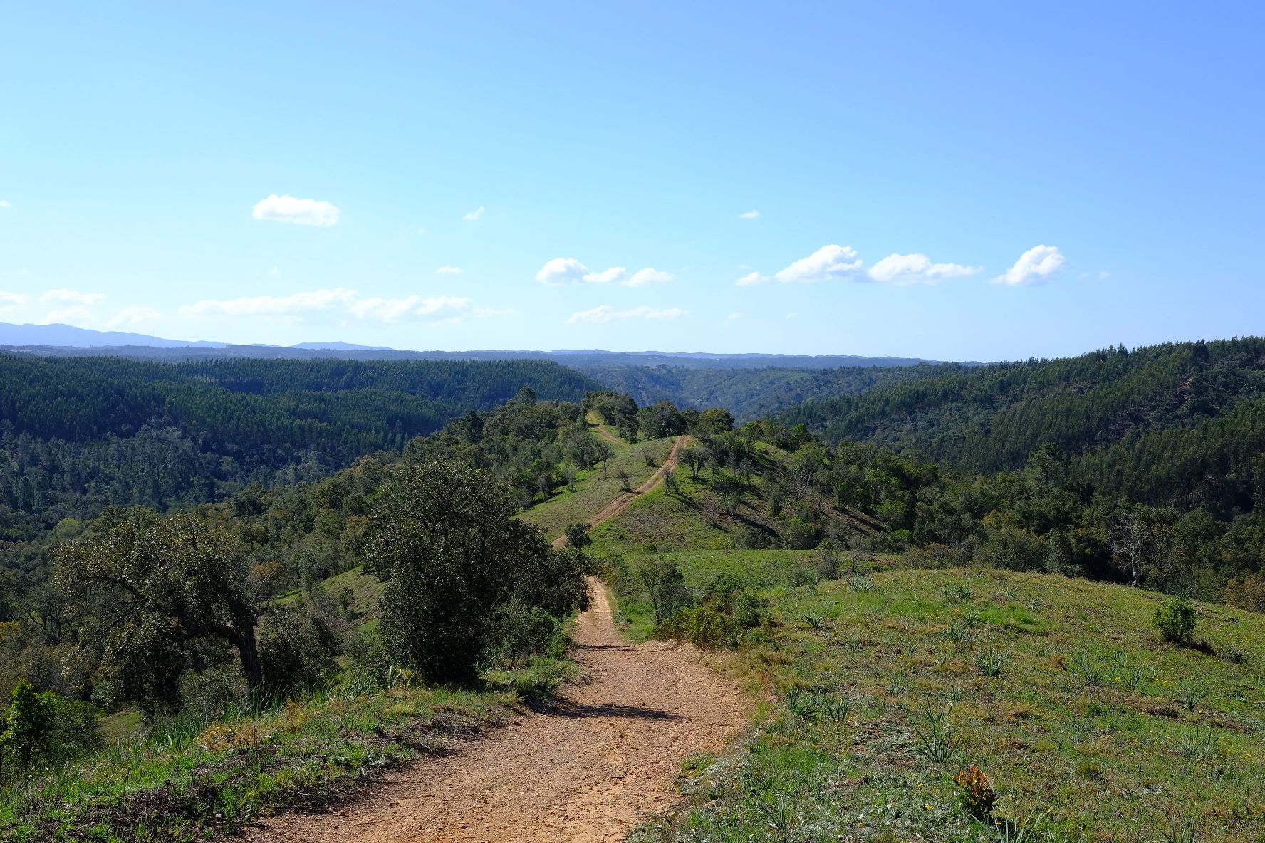
Easy hiking trails around São Teotónio offer access to diverse landscapes within the Southwest Alentejo and Vicentine Coast Natural Park. The region features a blend of coastal scenery with dramatic rock formations and beaches, alongside verdant inland vistas with agricultural fields. São Teotónio is also an integral part of the Rota Vicentina, providing well-established routes for exploration. The terrain generally includes gentle coastal paths and rolling countryside.
Best easy hiking trails around São Teotónio
- The most popular easy hiking route…
Last updated: August 24, 2026
4.8
(13)
71
hikers
Easy hike. Great for any fitness level. Easily-accessible paths. Suitable for all skill levels.
4.5
(2)
4
hikers
Easy hike. Great for any fitness level. Easily-accessible paths. Suitable for all skill levels.

Sign up for free
4.3
(3)
12
hikers
6.54km
01:47
90m
90m
Easy hike. Great for any fitness level. Easily-accessible paths. Suitable for all skill levels.
4.0
(2)
8
hikers
Easy hike. Great for any fitness level. Easily-accessible paths. Suitable for all skill levels.
8
hikers
3.17km
00:53
60m
60m
Easy hike. Great for any fitness level. Easily-accessible paths. Suitable for all skill levels.
Get access to more routes and recommendations from other explorers.
Sign up for free
Already have an account?
Our route recommendations are based on thousands of hikes, rides, and runs completed by other people on komoot.
Start today with a free account
Your next adventure awaits.
Login or Signup
Popular around São Teotónio
Other adventures around São Teotónio

Tips from the Community

Attention! Crossing at high tide is almost impossible.
0
0

After Capo Sardaõ with its lighthouse, one of the most beautiful coasts ever appears: an ochre landscape, speckled with green, with white, orange, yellow, red, brown earth tones and baked in enchanting shapes .... so beautiful that you can't get enough of it! These ochre rocks lie on the slate slabs, sometimes broken by limestone and calcareous sandstone, and resemble in their structure the ochre rocks of Roussillon (are only much harder).
0
0

Seating area in the shade, one of the last towards Almograve
0
0

São Teotónio is a parish (and town) in the municipality of Odemira, in the district of Beja, Alentejo, Portugal, known for its rich landscape, popular festivities, and for being part of the Southwest Alentejo and Vicentine Coast Natural Park, encompassing coastal towns such as Zambujeira do Mar. Location and Context: Municipality: Odemira (the largest municipality in Portugal). District: Beja. Region: Alentejo. Main Characteristics: Landscape: Varies from fields and mountains to stunning beaches, with cliffs and sandy areas. Events: Famous for its popular saints' festivals and FACECO (Fair of Cultural and Economic Activities of the Municipality of Odemira). Included Localities: Covers several localities such as Zambujeira do Mar, Azenha do Mar, Brejão, Cavaleiro, among others. Economy: Strong links to agriculture, fishing, tourism and handicrafts.
0
0
Spectacular trails, almost always with views of the sea.🥾🌊
0
0


Cavaleiro Beach is one of those well-kept secrets of the Costa Vicentina: wild, secluded, almost invisible from the trail. But all you have to do is follow the sound of the sea. Here, the view of Cabo Sardão provides breathtaking views from the top of the cliff. Nature speaks volumes and the horizon seems endless. In addition to the views, the terrain is very interesting for running, with some technical elements, but nothing too difficult.
1
0

Here, the sand shines brilliantly white in places. Very beautiful!
2
1
Frequently Asked Questions
How many easy hiking trails can I find around São Teotónio?
São Teotónio offers a good selection of easy hiking trails, with 16 routes specifically categorized as easy. In total, there are over 60 hiking routes available in the region, catering to various difficulty levels.
What kind of terrain can I expect on easy hikes in São Teotónio?
Easy hikes in São Teotónio feature a diverse landscape. You can expect gentle coastal paths with dramatic rock formations and beaches, as well as verdant inland vistas that traverse agricultural fields and traditional Portuguese countryside. The region is part of the Rota Vicentina, so many paths are well-established.
Are there any easy circular routes in São Teotónio?
Yes, São Teotónio has several easy circular routes. For example, the View of Odeceixe Beach – View of Odeceixe Beach loop is a 4.1 km trail offering coastal views. Another option is the São Teotónio loop from São Teotónio, which is 6.7 km and takes you through the local countryside.
Can I bring my dog on easy hikes in São Teotónio?
Many trails in the São Teotónio region, especially those in natural parks, generally welcome dogs, often requiring them to be on a leash to protect local wildlife and maintain the natural environment. It's always a good idea to check specific trail regulations or local signage before heading out.
Are the easy trails around São Teotónio suitable for families with children?
Yes, the easy trails around São Teotónio are generally suitable for families. Routes like the View of Odeceixe Beach loop (4.1 km) or the Cabo Sardão Lighthouse loop (2.2 km) are shorter and have minimal elevation gain, making them enjoyable for children.
What natural features or landmarks can I see on easy hikes in the area?
Easy hikes in São Teotónio offer access to stunning natural features. You can see dramatic coastal views, beautiful beaches like Brejo Largo Beach, and the View of Praia de Odeceixe and Seixe River Mouth. Keep an eye out for stork nests on coastal cliffs, a unique sight in the region.
Where can I park when accessing easy hiking trails in São Teotónio?
Parking is generally available near popular trailheads and villages in the São Teotónio area. For coastal routes, you can often find parking close to beaches like Odeceixe or near landmarks such as the Cabo Sardão lighthouse. For inland routes, parking is typically available in or near São Teotónio village.
Is it possible to reach easy hiking trails in São Teotónio using public transport?
São Teotónio is connected by regional bus services, which can provide access to the village itself and some nearby areas. However, reaching specific trailheads, especially those along the more remote coastal sections or within the natural park, might require a car or local taxi services for convenience.
What is the best time of year for easy hiking in São Teotónio?
The best time for easy hiking in São Teotónio is typically during the spring (March to May) and autumn (September to November). During these seasons, the weather is mild and pleasant, avoiding the intense heat of summer and the heavier rains of winter. The landscapes are also particularly vibrant in spring.
Do I need any permits to hike in the Southwest Alentejo and Vicentine Coast Natural Park?
Generally, you do not need specific permits for day hiking on established trails within the Southwest Alentejo and Vicentine Coast Natural Park. However, always respect local regulations, especially concerning camping, fires, and protected areas. If you plan any specific activities beyond standard hiking, it's advisable to check with the park authorities.
What do other hikers say about the easy trails in São Teotónio?
The easy trails in São Teotónio are highly rated by the komoot community, with an average score of 4.4 stars from over 900 reviews. Hikers often praise the stunning coastal views, the tranquility of the countryside, and the well-maintained paths that make for an enjoyable and accessible outdoor experience.
Are there any cafes or restaurants near the easy hiking trails in São Teotónio?
Yes, you can find cafes and restaurants in São Teotónio village itself, as well as in nearby coastal towns like Odeceixe and Zambujeira do Mar. These spots are perfect for a refreshment or a meal before or after your hike, offering local Portuguese cuisine.
Can I combine an easy hike with a visit to a beach in São Teotónio?
Absolutely! Many easy trails in São Teotónio are coastal or lead directly to beautiful beaches. For instance, the Carvalhal Beach – Alvorião Beach loop is a 3.2 km route that allows you to explore two distinct beaches, perfect for a refreshing stop or a swim.
Most popular routes around São Teotónio
Most popular attractions around São Teotónio

Get inspired with the komoot mobile app


Explore more
Browse the best Hikes in other regions.
