Easy hikes and walks around Lifford-Stranorlar Municipal District
4.2
(42)
250
hikers
23
hikes
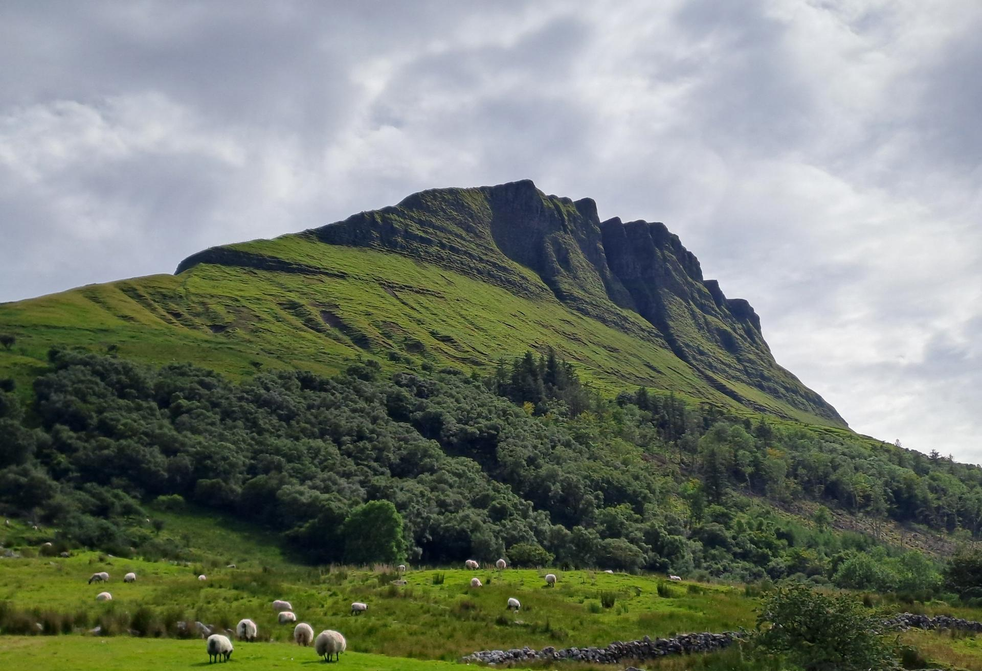
Easy hiking trails around Lifford-Stranorlar Municipal District traverse diverse landscapes, characterized by wild and dramatic scenery. The region features well-maintained forestry paths, peaceful woodlands, and open countryside. Hikers can explore areas with streams and waterfalls, as well as broader County Donegal landscapes with mountains and bogland. These natural features provide varied terrain suitable for accessible walks.
Best easy hiking trails around Lifford-Stranorlar Municipal District
- The most popular easy hiking route is Leghowney Loop, a 4.3 miles (7.0 km) trail that takes 1 hour 58 minutes to complete. This route offers a gentle exploration of the local countryside.
- Another top favourite among local hikers is Drumboe Woods loop from MacCumhaill Park, an easy 3.8 miles (6.1 km) path. This trail winds through peaceful trees and offers easily accessible paths.
- Local hikers also love the Bernard McGlinchey Town Park loop, a 0.5 miles (0.8 km) trail leading through a town park, often completed in about 12 minutes.
- Hiking around Lifford-Stranorlar Municipal District is defined by diverse landscapes, forestry paths, and peaceful woodlands. The network offers options for different ability levels, with 14 easy hiking trails available.
- The routes in Lifford-Stranorlar Municipal District are highly rated by the komoot community with an average score of 4.0 stars from over 30 reviews. More than 200 hikers have used komoot to explore Lifford-Stranorlar Municipal District's varied terrain.
Last updated: August 19, 2026
5.0
(1)
11
hikers
3.18km
00:49
10m
10m
Easy hike. Great for any fitness level. Easily-accessible paths. Suitable for all skill levels.
3.11km
00:55
100m
100m
Easy hike. Great for any fitness level. Easily-accessible paths. Suitable for all skill levels.

Sign up for free
21
hikers
4.21km
01:09
60m
60m
Easy hike. Great for any fitness level. Easily-accessible paths. Suitable for all skill levels.
5
hikers
Easy hike. Great for any fitness level. Easily-accessible paths. Suitable for all skill levels.
4
hikers
6.06km
01:36
50m
50m
Easy hike. Great for any fitness level. Easily-accessible paths. Suitable for all skill levels.
4
hikers
Easy hike. Great for any fitness level. Easily-accessible paths. Suitable for all skill levels.
6
hikers
4.06km
01:03
20m
20m
Easy hike. Great for any fitness level. Easily-accessible paths. Suitable for all skill levels.
6
hikers
Easy hike. Great for any fitness level. Easily-accessible paths. Suitable for all skill levels.
2.0
(1)
2
hikers
Easy hike. Great for any fitness level. Easily-accessible paths. Suitable for all skill levels.
Get access to more routes and recommendations from other explorers.
Sign up for free
Already have an account?
Our route recommendations are based on thousands of hikes, rides, and runs completed by other people on komoot.
Start today with a free account
Your next adventure awaits.
Login or Signup
Popular around Lifford-Stranorlar Municipal District
Other adventures around Lifford-Stranorlar Municipal District

Tips from the Community

The rough gravel trail takes you from the road head east of the larger Lough Eske out to Lough Fad and the five other small lakes in this area. You'll cross boggy moorland where there are some interesting plants.
0
0

The Hiring Fair – bronze sculpture group by Maurice Harron (1994) on Market Square. Four children represent the former Hiring Fairs, where young workers were hired for seasonal work. A historic and emotional anchor point in the center of Letterkenny.
4
0
With 20,000 inhabitants, Letterkenny is the most populous town in Donegal. While not exactly a charming town, it offers a convenient base for exploring the region and is certainly worth a visit for its lively atmosphere, particularly the pubs. The town also has an informative museum about the region's history, the Donegal County Museum.
4
0
Drumboe Woods is managed mixed leaf woodland on the north side of the River Finn. There are several waymarked walking trails here, with details of the routes on the noticeboard at the start.
0
0
A useful footbridge over the Riber Finn, linking Ballybofey with the riverside trails and Drumboe woodland trails.
0
0

Be sure to use the Riverside Walk on both sides, definitely the most beautiful part of the loop!
0
0

Letterkenny, rather than Donegal, is the largest town in County Donegal. It is a lively town. Stomping round the streets of the town makes for an interesting and varied run. There is plenty of culture as well as historic buildings to entertain you.
2
0
Frequently Asked Questions
How many easy hiking trails are available in the Lifford-Stranorlar Municipal District?
There are 14 easy hiking trails available in the Lifford-Stranorlar Municipal District, offering diverse landscapes suitable for various fitness levels.
Are there any easy circular walks in the Lifford-Stranorlar Municipal District?
Yes, the district offers several easy circular walks. Popular options include the Leghowney Loop, which is 4.3 miles (7.0 km) long, and the Drumboe Woods loop from MacCumhaill Park, an easy 3.8 miles (6.1 km) path. For a shorter option, consider the Bernard McGlinchey Town Park loop.
What kind of natural features can I expect to see on easy hikes in this region?
Easy hikes in the Lifford-Stranorlar Municipal District traverse diverse landscapes, including peaceful woodlands, well-maintained forestry paths, and open countryside. You might encounter streams and even a waterfall in areas like Corravaddy Wood, and experience the broader County Donegal scenery with its mountains and bogland.
Are there any trails with waterfalls in the Lifford-Stranorlar Municipal District?
Yes, Corravaddy Wood is known for its peaceful trails that lead past streams and to a waterfall. The Corravaddy Wood Gravel Path – Scenic Forest Trails loop is an easy option to explore this area.
What historical sites or landmarks can I visit near the easy hiking trails?
You can explore the ancient Beltany Stone Circle, a historical site dating from 2100-700 BC, which is accessible via an uphill path near Raphoe. The Lifford Slí, a 3km 'path to health' route, also connects to the town of Lifford, offering a cultural element to your walk. For more information on the Lifford Slí, you can visit govisitdonegal.com.
Are there any easy trails suitable for families with children?
Many of the easy trails are suitable for families. The Bernard McGlinchey Town Park loop is a very short and accessible option. The Drumboe Woods loop from MacCumhaill Park also offers peaceful, easily accessible paths through woodlands, which can be enjoyable for families.
What do other hikers say about the easy trails in Lifford-Stranorlar Municipal District?
The easy trails in Lifford-Stranorlar Municipal District are highly rated by the komoot community, with an average score of 4.0 stars from over 30 reviews. Hikers often praise the peaceful woodlands, well-maintained paths, and the sense of natural beauty and wilderness.
Are there any viewpoints on the easy walks in the Lifford-Stranorlar Municipal District?
Yes, some trails offer scenic views. For example, the Road With Views of Carricklee Hill and the general area around Barnesmore Gap provide stunning vistas. You can also find a highlight named Beautiful views which indicates a scenic spot.
How long do easy hikes in Lifford-Stranorlar Municipal District typically take?
The duration of easy hikes varies. Shorter loops like the Bernard McGlinchey Town Park loop can be completed in about 12 minutes. Longer easy trails, such as the Leghowney Loop (7.0 km), typically take around 2 hours.
Is there parking available near the easy hiking trails?
Yes, many trailheads for easy hikes in the Lifford-Stranorlar Municipal District, such as those leading to Corravaddy Wood or Drumboe Woods, typically have designated parking areas. The Barnesmore Gap also has a car park and picnic site for accessing views of Barnes Lough.
Can I find trails that are accessible via public transport?
While many trails are best accessed by car, routes like the Lifford Slí are integrated into the town of Lifford, making them more accessible. For specific public transport options to trailheads, it's advisable to check local transport schedules.
What is the best time of year to enjoy easy hikes in this region?
The Lifford-Stranorlar Municipal District offers beautiful scenery year-round. Spring and summer provide lush greenery and milder weather, while autumn brings vibrant colors to the woodlands. Even in winter, many easy trails remain accessible, offering a different, often more serene, experience of the dramatic landscapes.
Most popular routes around Lifford-Stranorlar Municipal District
Most popular attractions around Lifford-Stranorlar Municipal District

Get inspired with the komoot mobile app


Explore more
Browse the best Hikes in other regions.
