Easy hikes and walks around Aguilar
4.4
(380)
1,871
hikers
57
hikes
Easy hiking trails around Aguilar are set within the Natural Space of Las Tuerces and the Parque Natural Montaña Palentina. The region features diverse landscapes, including unique geological formations like Peña Mesa and the Horadada Tunnel. Hikers can explore varied terrain, from river valleys to areas offering scenic views over the Embalse de Aguilar. The area provides a range of easy paths suitable for different activity levels.
Best easy hiking trails around Aguilar
- The most popular easy hiking route is…
Last updated: July 7, 2026
5.0
(4)
46
hikers
5.04km
01:32
180m
180m
Explore the unique 'lunar landscape' of Las Tuerces on this easy 3.1-mile circular hike, featuring panoramic views from Peña Mesa.
1
hikers
3.25km
00:52
40m
40m
Easy hike. Great for any fitness level. Easily-accessible paths. Suitable for all skill levels.

Sign up for free
Easy hike. Great for any fitness level. Easily-accessible paths. Suitable for all skill levels.
4.4
(5)
10
hikers
6.46km
01:46
100m
100m
Easy hike. Great for any fitness level. Easily-accessible paths. Suitable for all skill levels.
4.0
(2)
10
hikers
6.95km
01:52
90m
90m
Easy hike. Great for any fitness level. Easily-accessible paths. Suitable for all skill levels.
4.6
(5)
9
hikers
3.21km
01:08
180m
180m
Easy hike. Great for any fitness level. Easily-accessible paths. Suitable for all skill levels.
5
hikers
Easy hike. Great for any fitness level. Easily-accessible paths. Suitable for all skill levels.
4.0
(1)
8
hikers
Easy hike. Great for any fitness level. Easily-accessible paths. Suitable for all skill levels.
5.0
(1)
3
hikers
3.91km
01:01
20m
20m
Easy hike. Great for any fitness level. Easily-accessible paths. Suitable for all skill levels.
2
hikers
Easy hike. Great for any fitness level. Easily-accessible paths. Suitable for all skill levels.
Get access to more routes and recommendations from other explorers.
Sign up for free
Already have an account?
Our route recommendations are based on thousands of hikes, rides, and runs completed by other people on komoot.
Start today with a free account
Your next adventure awaits.
Login or Signup



Other adventures around Aguilar

Tips from the Community

The Valcabado Viewpoint is located in the Covalagua Natural Area, in Revilla de Pomar (Pomar de Valdivia), within the Las Loras Unesco World Geopark. This viewpoint is a natural balcony located at an altitude of 1,224 metres, offering spectacular views of the Valderredible Valley. It is an ideal place to enjoy nature, go hiking and observe stars due to the low light pollution. In addition, near the viewpoint is the Cueva de los Franceses, about 1,500 metres away.
5
0
The Pozo de los Lobos in Pomar de Valdivia is a small stone construction that was once used to capture wolves. It is located near the Mirador de Valcabado, approximately 1.5 km away. This type of trap was covered with branches and leaves, and the wolves fell into the well when they were guided towards it. In addition, the area offers incredible hiking trails and spectacular views of the Valderredible Valley from the Mirador de Valcabado. It is a perfect place to enjoy nature and local history.
4
0

One of the entrance gates to the old town of Aguilar de Campoo, specifically the one that gives access to the Jewish quarter.
0
1
In the Plaza de España, the nerve centre of the town.
1
0

It is a beautiful and quiet place where you can rest if you have done a route in the area or directly enjoy a day with your family at one of the tables that surround the shelter.
0
0

a cool place.
0
0

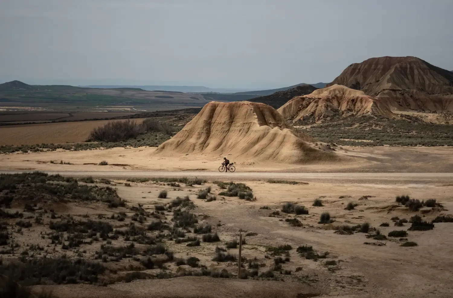
The stone labyrinth of Las Tuerces has several paths and the Natural monument can be explored according to one's taste, letting oneself be guided by intuition and the indications of the itineraries. The track is a general proposal with a loop that approaches the viewpoints of the Pisuerga River to learn about the natural, geological and environmental values of the natural area. The Las Tuerces labyrinth occupies a plain of limestone rocks sculpted by water erosion on a syncline hanging in the canyon of the Pisuerga River, a territory of geological interest because it marks the meeting between the Cantabrian mountains and the lands of the moor. In the shadowy stone alleys, relict beech trees, hazelnut trees, gall oaks, rocky vegetation and thorny plants from humid environments typical of other latitudes appear, coexisting amazingly with holm oaks, junipers and shrubs from a Mediterranean environment, a forest wonder. An admirable whim of nature that is a lesson in geology and the history of the Earth in the last hundred million years in the open air.
2
0

Temple built at the end of the 12th century and beginning of the 13th, it is located on a beautiful hillock, on the outskirts of Barrio de Santa María, near the Aguilar de Campoo reservoir.
2
0
Frequently Asked Questions
How many easy hiking trails are there around Aguilar?
There are over 20 easy hiking trails around Aguilar, offering a variety of landscapes and experiences suitable for different activity levels. In total, the region features 68 hiking routes, with the majority being easy or moderate.
What kind of landscapes can I expect on easy hikes near Aguilar?
Easy hikes around Aguilar de Campoo, Spain, traverse diverse landscapes within the Natural Space of Las Tuerces and the Parque Natural Montaña Palentina. You'll encounter unique geological formations like Peña Mesa and the Horadada Tunnel, river valleys, and scenic viewpoints overlooking the Embalse de Aguilar.
Are there any circular easy hikes in the Aguilar area?
Yes, many easy routes around Aguilar are circular. For example, the Peña Mesa — circular by the Natural Space of las Tuerces is a popular 3.1-mile loop, and the Ermita de Santa Eulalia y Barrio de San Pedro desde Barrio de Santa María — circular por el Camino Natural del Románico Palentino offers a 3.4-mile circular path.
Are the easy trails around Aguilar suitable for families?
Yes, the easy trails are generally suitable for families. Many routes are relatively short with minimal elevation gain, making them accessible for children and those looking for a relaxed outing. The varied landscapes and interesting geological features can also be engaging for younger hikers.
What are some notable natural features or landmarks to see on easy hikes?
You can explore several interesting natural features and landmarks. Highlights include the distinctive rock formations of Peña Mesa, the unique Horadada Tunnel, and the scenic views over the Embalse de Aguilar. You might also encounter historical sites like the Santa María la Real Monastery or the Salinas de Pisuerga Bridge.
Are there any easy hikes that feature waterfalls?
Yes, you can find easy hikes that lead to waterfalls. The Covalagua Pool – Covalagua Waterfall loop from Monumento Natural de la Cascada de Covalagua is an easy 3.2-mile route that takes you to the Covalagua Waterfall.
What is the typical length and duration of easy hikes around Aguilar?
Easy hikes around Aguilar typically range from 2 to 4 miles (3 to 6.5 km) in length. Most can be completed within 1 to 2 hours, depending on your pace and how often you stop to enjoy the scenery. For instance, the Peña Mesa circular route is 3.1 miles and takes about 1 hour 32 minutes.
What do other hikers say about the easy trails in Aguilar?
The easy trails in Aguilar are highly rated by the komoot community, with an average score of 4.5 stars from over 200 reviews. Hikers often praise the well-maintained paths, the unique geological formations, and the peaceful natural surroundings.
Are there any historical sites or cultural points of interest along easy routes?
Absolutely. The region is rich in history. The Camino Natural del Románico Palentino, for example, offers views of historical sites and natural landscapes. You can also find highlights like the Santa María la Real Monastery and the Hermitage of Santa Cecilia near some routes.
Is parking available at the trailheads for easy hikes?
Parking is generally available near the starting points of many popular easy hikes around Aguilar, especially in or near villages and natural park access points. It's advisable to check specific route details for precise parking information.
What is the best time of year to go hiking on easy trails in Aguilar?
The best time for easy hiking in Aguilar is typically during spring and autumn when the weather is mild and pleasant. Summer can also be enjoyable, especially in the mornings or late afternoons, but it can get warm. Winter offers a different experience, though some trails might be affected by colder temperatures or occasional snow.
Are there any easy routes that offer scenic views of the reservoir?
Yes, several easy routes provide scenic views of the Embalse de Aguilar. The Mirador del Embalse de Aguilar offers panoramic vistas, and some trails are specifically designed to showcase the reservoir's beauty.
Can I find easy hikes that pass through interesting tunnels or caves?
Yes, the region is known for its unique geological features. The Horadada Tunnel loop from Mave is a popular easy hike that takes you directly through the notable Horadada Tunnel. Other caves like Chozo Tonino Cave are also nearby.
Most popular routes around Aguilar
Most popular attractions around Aguilar

Get inspired with the komoot mobile app


Didn’t find what you were looking for?
Check out more Hikes throughout Aguilar below and find the perfect route in your destination.
Explore more
Browse the best Hikes in other regions.
