The best gravel rides in Réserve Biologique Dirigée De Saint-Guillhem-Le-Désert
4.0
(1)
22
riders
4
rides
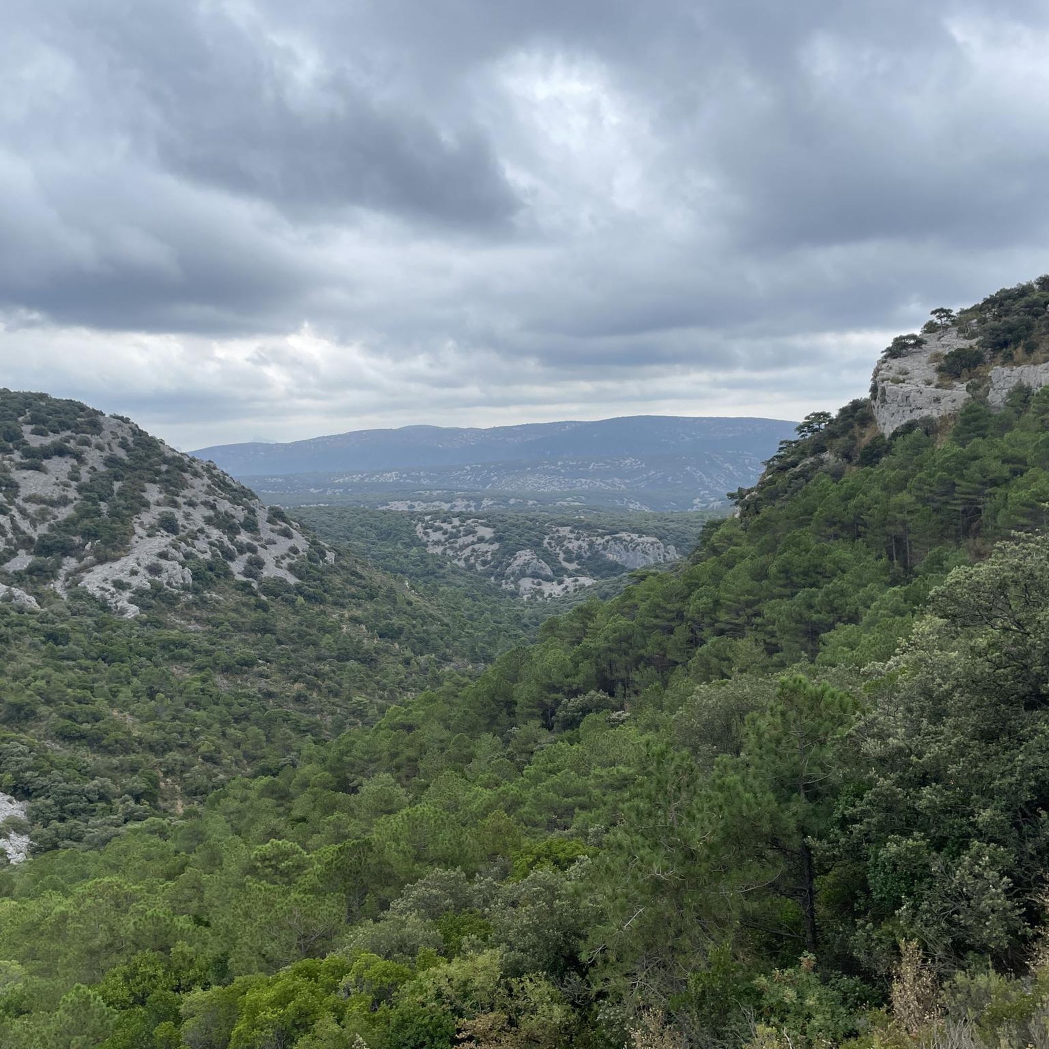
Gravel biking in Réserve Biologique Dirigée De Saint-Guillhem-Le-Désert offers routes through a varied natural landscape. The region features significant elevation changes, with trails ascending to summits and cols, indicating a hilly to mountainous terrain. These routes often traverse natural environments, providing diverse surfaces for gravel biking. The area is characterized by its biological reserve status, suggesting a focus on preserved natural habitats.
Best gravel bike trails in Réserve Biologique Dirigée De Saint-Guillhem-Le-Désert
- The most popular gravel bike trail is Devil's…
Last updated: July 6, 2026
5
riders
51.1km
04:00
1,090m
1,090m
Hard gravel ride. Very good fitness required. Mostly paved surfaces. Suitable for all skill levels.
4.0
(1)
14
riders
Hard gravel ride. Very good fitness required. You may need to push your bike for some segments of this route.

Sign up for free
2
riders
18.2km
01:21
320m
320m
Moderate gravel ride. Good fitness required. Mostly paved surfaces. Suitable for all skill levels.
2
riders
43.3km
03:55
1,020m
1,020m
Hard gravel ride. Very good fitness required. Mostly paved surfaces. Suitable for all skill levels.
Our route recommendations are based on thousands of hikes, rides, and runs completed by other people on komoot.
Start today with a free account
Your next adventure awaits.
Login or Signup
Popular around Réserve Biologique Dirigée De Saint-Guillhem-Le-Désert
MTB Trails in Réserve Biologique Dirigée De Saint-Guillhem-Le-Désert
Cycling in Réserve Biologique Dirigée De Saint-Guillhem-Le-Désert
Running Trails in Réserve Biologique Dirigée De Saint-Guillhem-Le-Désert
Road Cycling Routes in Réserve Biologique Dirigée De Saint-Guillhem-Le-Désert
Hiking in Réserve Biologique Dirigée De Saint-Guillhem-Le-Désert
Tips from the Community

A great village, with winding alleyways where it's pleasant to get lost.
0
0

Very beautiful place
0
0

From Mont Saint-Baudille, the view is breathtaking! Enjoy the panorama of the Hérault plain, the Mediterranean, Pic Saint Loup, and Canigou!
0
0

The mountain bike climb up the north face is very steep and stony, and we did most of it on foot. The descent to the northeast to Mas d'Aubert is easy.
0
0
a fairly challenging single track, especially in its northern section. I recommend doing it in a south-to-north direction (easier in my opinion).
0
0

magnificent waterfalls, a must-see
1
0

Everything is fine until the Buèges floods 😅
0
0
One of the few ways in the area to cross the Buèges when it is in flood 😅
0
0
Frequently Asked Questions
How many gravel bike trails are available in the Réserve Biologique Dirigée De Saint-Guillhem-Le-Désert?
There are 7 gravel bike trails available in the Réserve Biologique Dirigée De Saint-Guillhem-Le-Désert, offering a range of experiences through its varied natural landscape.
Are there any easy gravel bike trails for beginners in this reserve?
The Réserve Biologique Dirigée De Saint-Guillhem-Le-Désert primarily features routes with significant elevation changes, making most trails moderate to difficult. There are no routes classified as easy. However, the Saint-Jean-de-Buèges – Saint-Jean-de-Buèges loop from Saint-Jean-de-Buèges is rated as moderate and is the least challenging option, covering 11.1 miles (17.9 km) with 314 meters of ascent.
What are the more challenging gravel bike routes in the Réserve Biologique Dirigée De Saint-Guillhem-Le-Désert?
Many of the gravel routes in this region are quite challenging due to significant elevation gains. For instance, the Devil's Bridge – View of the Devil's Bridge loop from Lodève is a difficult 38.6 miles (62.1 km) trail with over 1279 meters of climbing. Another demanding option is the Mont Saint-Baudille Summit – Col du Vent (703 m) loop from Saint-Jean-de-Fos, which is 26.7 miles (43.0 km) long and includes nearly 1000 meters of ascent to a summit.
Are there circular gravel bike routes available?
Yes, all the featured gravel bike routes in the Réserve Biologique Dirigée De Saint-Guillhem-Le-Désert are designed as circular loops. This allows you to start and finish at the same point, making logistics simpler. Examples include the The monks' descent – The Castellas of Montpeyroux loop from Montpeyroux and the The monks' descent – Col de Lavagne loop from Montpeyroux.
What is the best season for gravel biking in the Réserve Biologique Dirigée De Saint-Guillhem-Le-Désert?
Given the region's Mediterranean climate, spring and autumn are generally the most pleasant seasons for gravel biking. Temperatures are milder, and the natural landscape is vibrant. Summers can be very hot, especially in the middle of the day, while winters might bring cooler, wetter conditions, though snow is rare at lower elevations.
Where can I find parking for gravel biking in the area?
Many of the circular routes start from villages or towns that typically offer public parking. For example, routes like the Devil's Bridge – View of the Devil's Bridge loop start from Lodève, and the Saint-Jean-de-Buèges – Saint-Jean-de-Buèges loop begins in Saint-Jean-de-Buèges. It's advisable to check local parking availability in these starting locations before your trip.
What kind of scenic viewpoints can I expect on these trails?
The trails in the Réserve Biologique Dirigée De Saint-Guillhem-Le-Désert offer diverse natural scenery, including views of the biological reserve's preserved habitats and significant elevation changes that provide panoramic vistas. Routes often traverse hilly to mountainous terrain, leading to scenic overlooks. For example, the Mont Saint-Baudille Summit – Col du Vent (703 m) loop includes a summit ascent, promising expansive views.
Are there any less crowded gravel trails in the Réserve Biologique Dirigée De Saint-Guillhem-Le-Désert?
While the region is a biological reserve, its trails are generally less frequented than more urban areas. To find potentially less crowded options, consider routes that are slightly longer or have higher difficulty ratings, as these naturally attract fewer riders. The The monks' descent – Col de Lavagne loop from Montpeyroux, for instance, is a challenging 43.1 km route that offers a more immersive experience in nature.
What should I bring for a gravel biking trip in this region?
Given the significant elevation changes and varied terrain, it's essential to bring appropriate gear. This includes a well-maintained gravel bike, a helmet, sufficient water and snacks, a repair kit (spare tube, pump, multi-tool), and navigation tools. Layered clothing is recommended to adapt to changing temperatures, especially when ascending to higher points.
Are there cafes or places to refuel near the gravel bike trails?
Many of the gravel bike routes start or pass through small villages and towns like Lodève, Saint-Jean-de-Fos, Saint-Jean-de-Buèges, or Montpeyroux. These locations often have local cafes, bakeries, or small shops where you can refuel and rest. It's a good idea to check opening hours in advance, especially in smaller communities.
What do other gravel bikers say about the trails in Réserve Biologique Dirigée De Saint-Guillhem-Le-Désert?
The gravel biking routes in Réserve Biologique Dirigée De Saint-Guillhem-Le-Désert are highly rated by the komoot community, with an average score of 4.3 stars from over 3 reviews. Riders often praise the diverse natural landscapes, the challenge of the elevation changes, and the varied trail surfaces that make for an engaging gravel biking experience.
Most popular routes in Réserve Biologique Dirigée De Saint-Guillhem-Le-Désert

Get inspired with the komoot mobile app


Explore more
Browse the best Gravel rides in other regions.
