The best gravel rides around Fleurigné
4.3
(53)
276
riders
32
rides
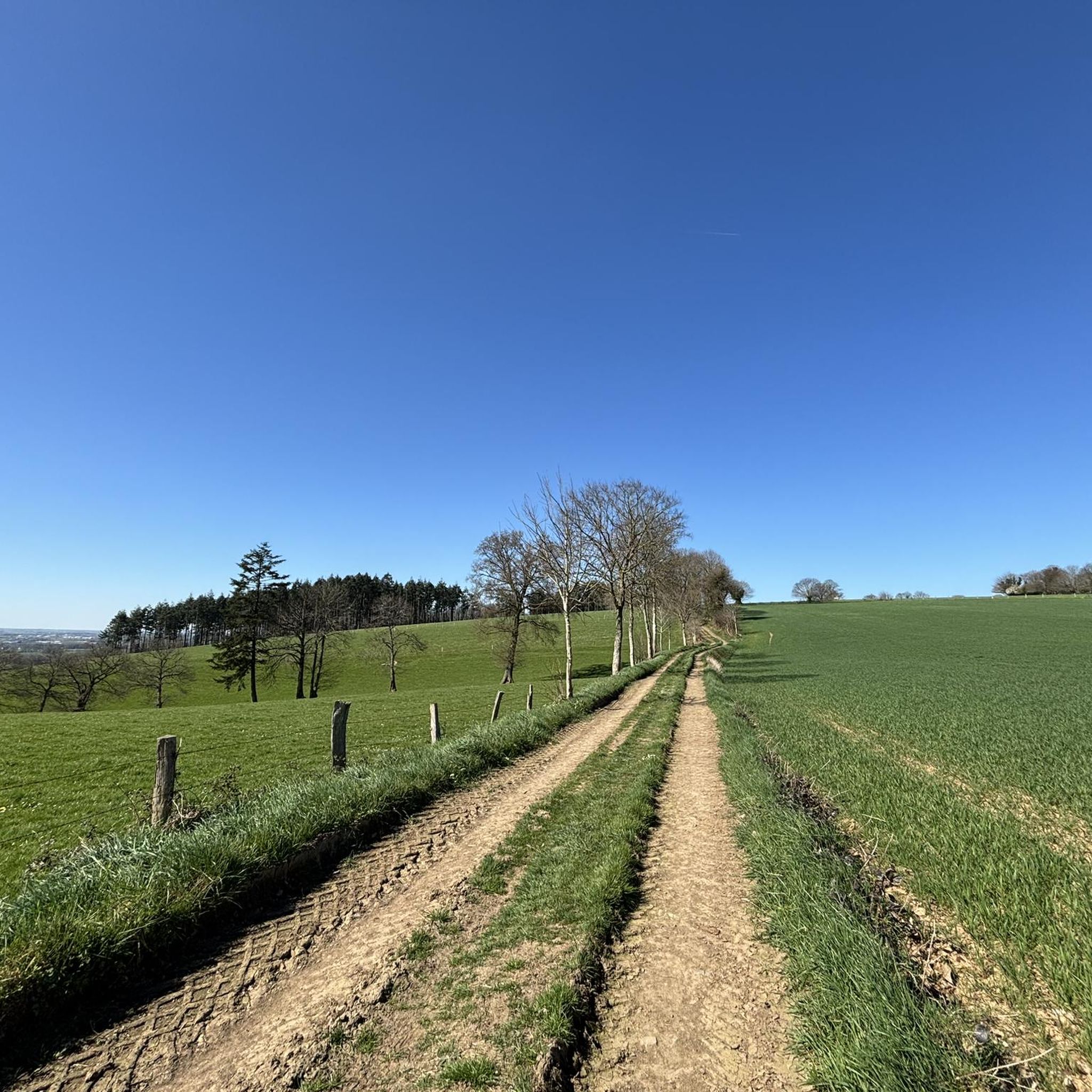
Gravel biking around Fleurigné offers diverse terrain across the Ille-et-Vilaine department of Brittany. The region features a mix of countryside roads, wooded trails, and river valleys, providing varied surfaces for gravel cyclists. Riders can expect to traverse rolling hills, agricultural lands, and dense woodlands, often utilizing "voies vertes" (greenways) which are suitable for gravel bikes. This landscape provides a blend of established routes and more rustic paths, characteristic of the area's natural features.
Best gravel bike trails around Fleurigné
- The most popular gravel bike trail is Fougères–Vitré Greenway – Saint Léonard Church loop from Fougères, a 40.2 miles (64.7 km) trail that takes 4 hours 19 minutes to complete. This route incorporates sections of the Fougères–Vitré Greenway, offering a mix of surfaces.
- Another top favourite among local gravel bikers is Railroad line to Pontorson – Avenue near Pontorson loop from Lécousse, a difficult 55.4 miles (89.1 km) path. This trail follows a former railroad line, providing a unique perspective on the regional landscape.
- Local gravel bikers also love the View of Mont Saint-Michel – The Couesnon at Beauvoir loop from Fougères, a 77.1 miles (124.1 km) trail leading through the Couesnon Valley, often completed in about 8 hours 7 minutes.
- Gravel biking around Fleurigné is defined by varied countryside roads, wooded trails, and river valleys. The network offers options for different ability levels, from moderate rides to more challenging long-distance routes.
- The routes in Fleurigné are highly rated by the komoot community with an average score of 4.4 stars from over 50 reviews. More than 250 gravel bikers have used komoot to explore Fleurigné's varied terrain.
Last updated: July 1, 2026
4.5
(24)
52
riders
63.7km
03:17
280m
280m
Moderate gravel ride. Good fitness required. Mostly paved surfaces. Suitable for all skill levels.
4.4
(10)
45
riders
89.4km
04:44
460m
460m
Hard gravel ride. Very good fitness required. Mostly paved surfaces. Suitable for all skill levels.

Sign up for free
3.0
(1)
20
riders
Hard gravel ride. Very good fitness required. Mostly paved surfaces. Suitable for all skill levels.
5.0
(3)
16
riders
42.7km
02:14
230m
220m
Moderate gravel ride. Good fitness required. Mostly paved surfaces. Suitable for all skill levels.
5.0
(1)
12
riders
20.2km
01:03
120m
120m
Easy gravel ride. Great for any fitness level. Mostly paved surfaces. Suitable for all skill levels.
Get access to more routes and recommendations from other explorers.
Sign up for free
Already have an account?
Our route recommendations are based on thousands of hikes, rides, and runs completed by other people on komoot.
Start today with a free account
Your next adventure awaits.
Login or Signup
Tips from the Community

From there it looks the strongest !!!
0
0

Lovely route, first along the coast on good cycle paths, then after the large car park via all sorts of narrow roads and villages back to the campsite in Ceaux.
0
0

Parts of the route along the sea do not exist or are forbidden for bicycles
0
0

If there's a remarkable site that's worth a detour, it's Mont St Michel!
0
0

This greenway between Mont Saint-Michel and Pontorson alternates between magnificent stretches with unobstructed views and shaded sections with bucolic charm. Away from road traffic, this section reveals the unique calm of nature.
0
0


Go at low or high tide
1
0

beautiful old town church
1
0
Frequently Asked Questions
What kind of terrain can I expect on gravel bike trails near Fleurigné?
The region around Fleurigné offers a diverse mix of terrain, ideal for gravel biking. You'll find countryside roads, wooded trails, and river valleys. Many routes utilize "voies vertes" (greenways), which are typically former railway lines or canal paths, providing relatively flat and traffic-free surfaces. Expect to traverse rolling hills, agricultural lands, and dense woodlands, characteristic of Brittany's varied landscape.
Are there any easy gravel bike trails suitable for beginners around Fleurigné?
Yes, there are options for beginners. For example, the Étang de Dompierre du Chemin – Fougères–Vitré Greenway loop from Fougères is an easy 25.6 km route that takes about 1 hour 40 minutes to complete. This trail incorporates sections of the Fougères–Vitré Greenway, offering a gentle introduction to gravel biking in the area.
What are some challenging gravel routes for experienced riders near Fleurigné?
For more experienced gravel bikers seeking a challenge, the region offers several difficult routes. The Railroad line to Pontorson – Avenue near Pontorson loop from Lécousse is a difficult 89.1 km path, following a former railroad line. Another demanding option is the View of Mont Saint-Michel – The Couesnon at Beauvoir loop from Fougères, a 124.1 km trail leading through the Couesnon Valley, often completed in about 8 hours.
What natural landscapes or viewpoints can I discover on gravel rides around Fleurigné?
Gravel routes around Fleurigné often lead through diverse natural settings. You can expect to see varied countryside, including rolling hills and agricultural lands, as well as dense woodlands like those found in nearby forests. The View of Mont Saint-Michel – The Couesnon at Beauvoir loop from Fougères, for instance, offers views of the distinctive Couesnon Valley, shaped by the river and characterized by granite formations and rich flora.
Are there any historical sites or landmarks accessible by gravel bike near Fleurigné?
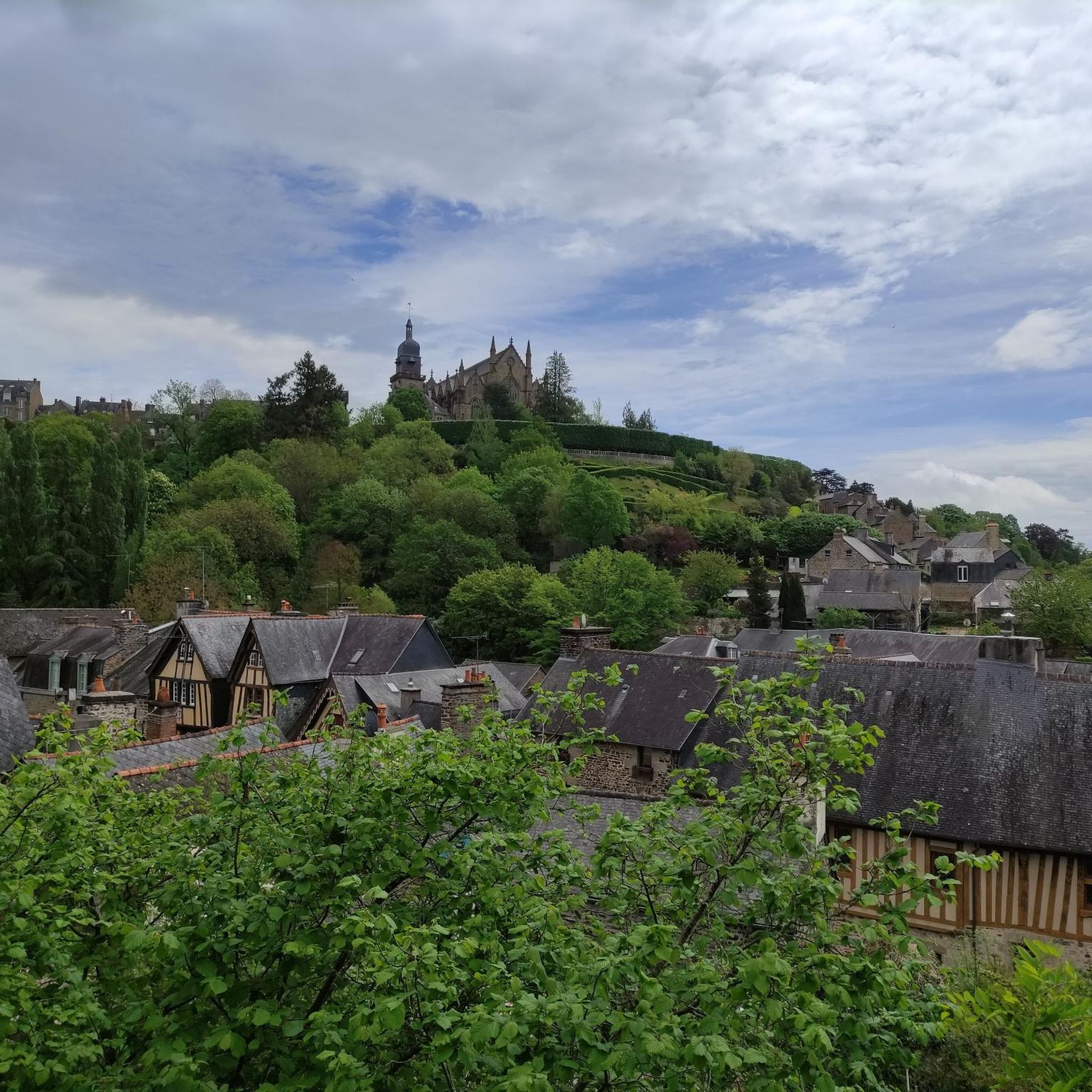
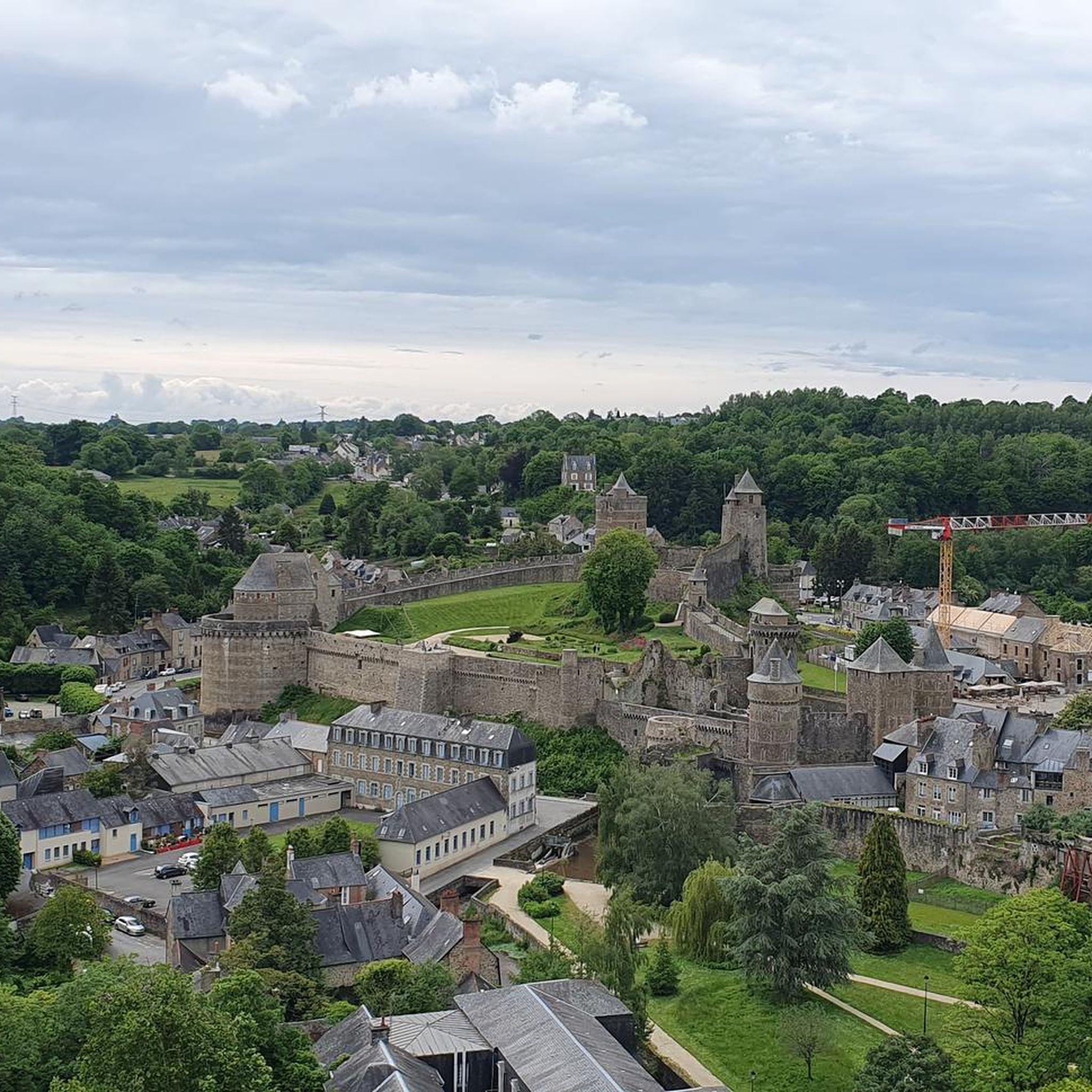
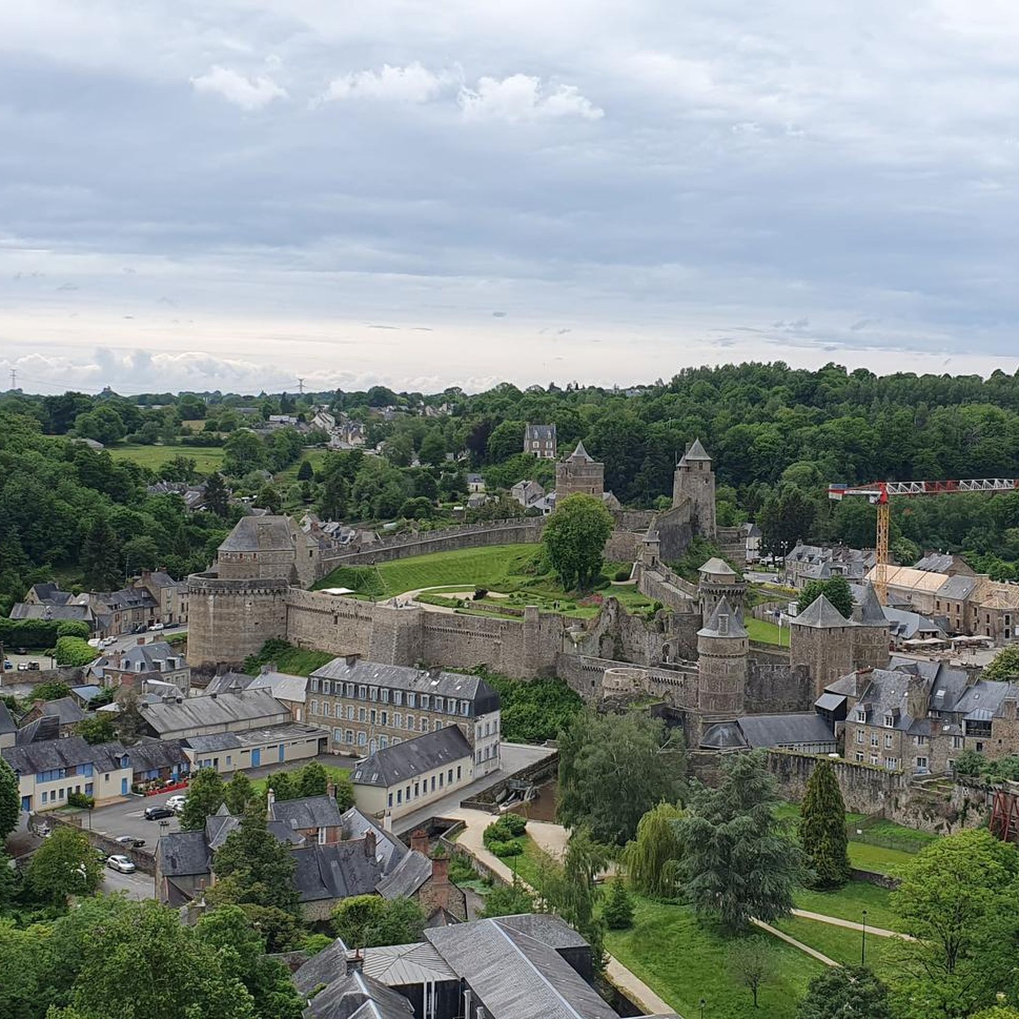
Yes, many routes in the region weave through historic areas. The impressive Fougères Castle, one of Europe's largest medieval fortresses, is just 8.1 km from Fleurigné and can be incorporated into rides. You might also pass through charming villages with half-timbered houses, such as those found near Place du Marchix in Fougères, or see the Belfry of Fougères.
What is the best time of year for gravel biking in Fleurigné?
The region's diverse landscapes are enjoyable throughout much of the year. Spring and autumn generally offer pleasant temperatures and beautiful scenery, with changing foliage in the woodlands. Summer can also be good, especially for shaded routes through forests. While specific winter conditions vary, some routes may be suitable depending on weather, but it's always best to check local forecasts.
Are there any family-friendly gravel biking options around Fleurigné?
While specific family-designated routes aren't highlighted, the "voies vertes" (greenways) often incorporated into routes are generally flat and traffic-free, making them suitable for families. Easy-rated tours, such as the Étang de Dompierre du Chemin – Fougères–Vitré Greenway loop from Fougères, could be good starting points for families, offering a less strenuous experience.
Are there any loop gravel routes available near Fleurigné?
Yes, many of the gravel routes around Fleurigné are designed as loops, allowing you to start and end at the same point. Examples include the popular Fougères–Vitré Greenway – Saint Léonard Church loop from Fougères, the challenging Railroad line to Pontorson – Avenue near Pontorson loop from Lécousse, and the scenic Fougères Castle – Cordon des druides loop from Fougères.
What do other gravel bikers say about the trails around Fleurigné?
The gravel biking experience around Fleurigné is highly rated by the komoot community, with an average score of 4.4 stars from over 50 reviews. More than 250 gravel bikers have used komoot to explore the varied terrain, often praising the diverse mix of countryside roads, wooded trails, and river valleys that define the region's routes.
Where can I find parking for gravel bike trails near Fleurigné?
While specific parking locations for each trail are not detailed here, many routes start from towns like Fougères or Lécousse. These towns typically offer public parking facilities. It's advisable to check the starting point of your chosen route on komoot for more precise parking information, as many tours begin from accessible points within or near these communities.
Are there any dog-friendly gravel trails around Fleurigné?
Many outdoor trails in France, especially those in natural areas or on greenways, are generally dog-friendly, provided dogs are kept on a leash and owners clean up after them. While specific dog-friendly designations for each gravel route are not available, the varied countryside and wooded trails offer good opportunities for riding with a well-behaved dog. Always be mindful of local regulations and private land.
Most popular attractions around Fleurigné

Get inspired with the komoot mobile app


Explore more
Browse the best Gravel rides in other regions.
