The best gravel rides around Tenay
5.0
(4)
41
riders
11
rides
Gravel biking around Tenay offers diverse landscapes across the Ain department, characterized by a network of trails between ridges, lakes, and forests. The region's topography, including parts of the Jura massif and Bugey, provides varied gradients suitable for cycling. Limestone soils in many areas contribute to consistent grip and smooth riding conditions. This environment features coniferous forests, river valleys, and panoramic views.
Best gravel bike trails around Tenay
- The most popular gravel bike trail is View of the Saut du…
Last updated: November 1, 2026
5.0
(1)
6
riders
39.5km
02:51
820m
820m
Hard gravel ride. Very good fitness required. Mostly paved surfaces.
5
riders
59.4km
04:13
1,010m
1,010m
Hard gravel ride. Very good fitness required. Mostly paved surfaces.

4
riders
27.1km
01:56
510m
510m
Hard gravel ride. Very good fitness required. Mostly paved surfaces.
4
riders
103km
06:30
1,290m
1,290m
Hard gravel ride. Very good fitness required. Mostly paved surfaces.
5.0
(1)
5
riders
Hard gravel ride. Very good fitness required. Mostly paved surfaces.
Get access to more routes and recommendations from other explorers.
Already have an account?
Our route recommendations are based on thousands of hikes, rides, and runs completed by other people on komoot.
Start today with a free account
Your next adventure awaits.


Tips from the Community

The commune of Vertrieu, located in the department of Isère within the Balcons du Dauphiné, has the unique particularity of housing two major historical buildings: the Château Vieux (or Maison-Forte) and the Château Neuf (or Château Moderne).
0
0
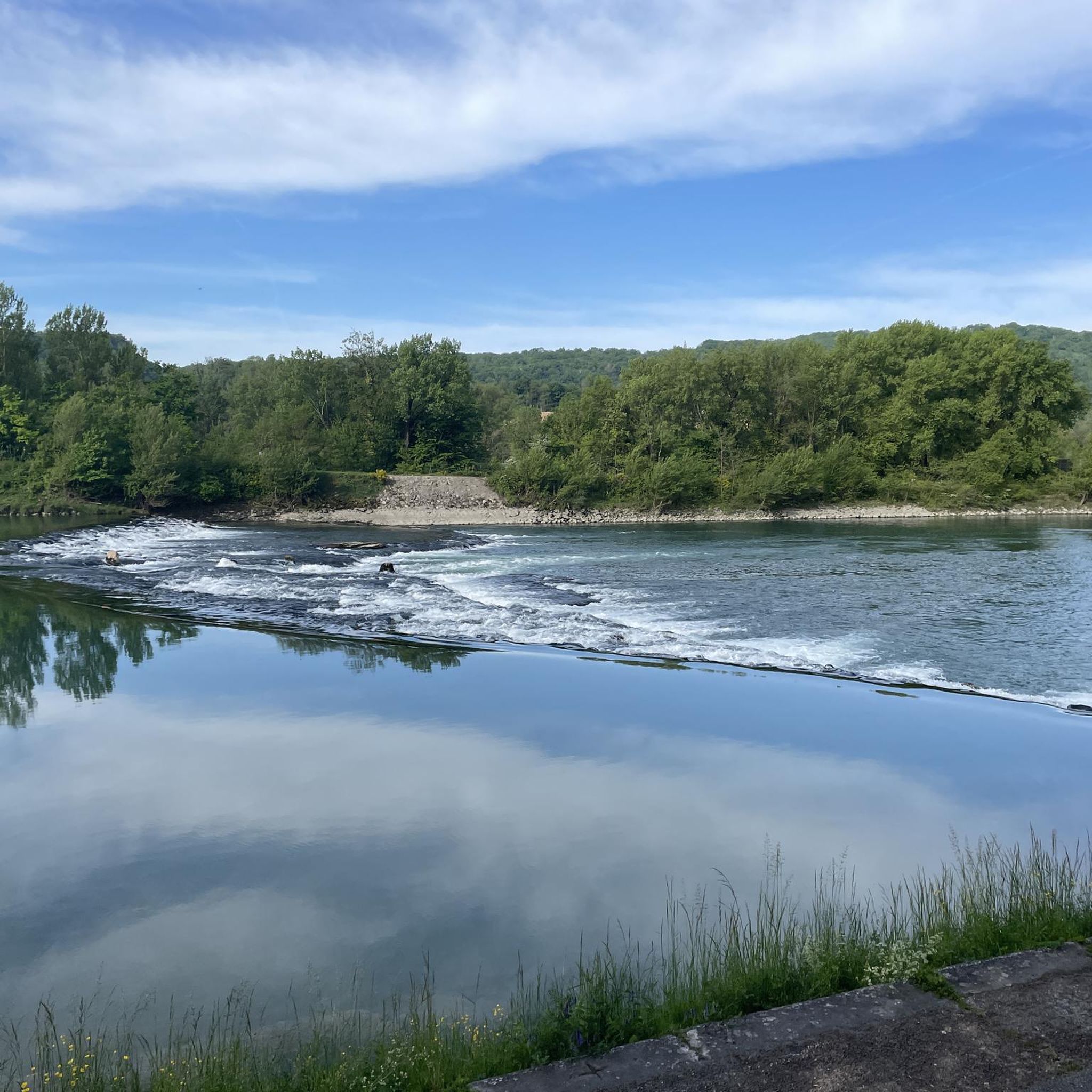
The Sault-Brénaz dam (also called Villebois dam or Sault-Brénaz facility) is an important hydroelectric infrastructure located on the Rhône River. It is situated on the border between the departments of Ain and Isère, mainly near the communes of Sault-Brénaz and Villebois. Commissioned in 1986, this structure was the last major facility built by the Compagnie Nationale du Rhône (CNR) on the upper Rhône.
0
0
The Sault-Brénaz dam (also called Villebois dam or Sault-Brénaz facility) is an important hydroelectric infrastructure located on the Rhône River. It lies on the border between the departments of Ain and Isère, mainly near the communes of Sault-Brénaz and Villebois. Commissioned in 1986, this structure was the last major development built by the Compagnie Nationale du Rhône (CNR) on the upper Rhône.
0
0
The area is located on the border between the departments of Isère and Ain, right next to the Pont d’Évieu. A specific ViaRhôna link allows you to reach the center of the commune of Les Avenières directly from this point via small country roads.
0
0

Very beautiful campsite, quiet, well-maintained, clean sanitary facilities, swimming pool. Open from mid-April to the end of September.
0
0

Very straight cycle path with a very beautiful view in the middle of nature
0
0

The Cormaranche Bike Park is made up of seven downhill trails, five enduro trails, and a Ludi Park for the youngest. Enough to have fun whatever your level. Picnic tables, a barbecue area, and a bivouac area are also available on site.
0
0
Frequently Asked Questions
What kind of gravel biking trails can I expect around Tenay?
The Tenay area, situated in the Ain department, offers a diverse network of gravel trails winding through ridges, lakes, and forests. You'll find varied gradients, from river valleys to parts of the Jura massif, providing a mix of challenges and scenic beauty. The limestone soils in areas like Bugey ensure good grip and smooth riding conditions, as they are rarely muddy.
How many gravel bike routes are available in the Tenay region?
There are over a dozen gravel bike routes available around Tenay, catering to various skill levels. The region is part of the Ain department, which boasts approximately 2,000 km of marked and certified trails by the FFC and FFCT, ensuring quality and proper signposting for cyclists.
Are there any easy or beginner-friendly gravel bike trails near Tenay?
Yes, while many routes are challenging, there are options suitable for beginners. For instance, the View of the Saut du Rhône – View of Vertrieu castle loop from Porcieu - Pont de Sault-Brénaz is a moderate 68 km route that follows the Rhône river, offering beautiful views without extreme difficulty. Another moderate option is the Fresne Washhouse – Haut Bugey country of calm loop from Hauteville-Lompnes, which is shorter at 12.8 km.
What are some challenging gravel bike routes for experienced riders?
For experienced gravel bikers seeking a challenge, routes like the Evosges Pass – Lesines Pond loop from Évosges offer significant elevation gain over 59.4 km. Another demanding option is the Groslée Bridge – Virignin footbridge loop from La Rivolière, which spans over 100 km with substantial climbing.
Are there any circular gravel bike routes around Tenay?
Yes, many of the gravel bike routes around Tenay are designed as loops, allowing you to start and finish at the same point. Examples include the View of the Saut du Rhône – View of Vertrieu castle loop from Porcieu - Pont de Sault-Brénaz and The Albarine – Tour Saint-Denis loop from Torcieu, providing convenient options for your ride.
What kind of scenic views or natural features can I expect on the trails?
The region around Tenay is rich in natural beauty. You can expect to cycle through coniferous forests, along sparkling lakes and wild rivers, and enjoy exceptional panoramic views that sometimes extend to the Alps and Mont Blanc. Waterfalls are a notable attraction, and many areas are designated as 'Espaces Naturels Sensibles,' highlighting their ecological significance.
Are there any waterfalls or other natural attractions along the gravel routes?
Absolutely! The area around Tenay is known for its beautiful water features. You might encounter highlights such as the Claire Fontaine Waterfall, Melogne Waterfalls, Charabotte Waterfall, or the Luizet Waterfall. Some routes also pass by the serene Lac Bleu on the Gardon.
What historical landmarks or points of interest can I explore near the gravel trails?
Beyond natural beauty, the region offers historical sites. You could visit Allymes Castle or Château Saint-Germain. The View of the Saut du Rhône – View of Vertrieu castle loop from Porcieu - Pont de Sault-Brénaz specifically offers views of Vertrieu castle.
What do other gravel bikers say about the trails in Tenay?
The gravel biking routes around Tenay are highly rated by the komoot community, with an average score of 4.75 stars from over 4 reviews. More than 73 gravel bikers have used komoot to explore the varied terrain, often praising the diverse landscapes and the quality of the trails.
When is the best time of year to go gravel biking in Tenay?
The Ain department, where Tenay is located, offers good conditions for cycling due to its limestone soils, which are rarely muddy. This suggests that many months of the year are suitable. Spring and autumn generally provide pleasant temperatures and vibrant scenery, while summer can be great for longer days, though it's always wise to check local weather forecasts.
Are the gravel biking trails in Tenay well-marked?
Yes, the trails in the Ain department are certified by the FFC (Fédération Française de Cyclisme) and FFCT (Fédération Française de Cyclotourisme), which ensures proper signposting and quality. This makes navigation easier and enhances the overall riding experience.
Most popular attractions around Tenay

Get inspired with the komoot mobile app


Explore more
Browse the best Gravel rides in other regions.
