The best gravel rides around Margès
4.1
(13)
54
riders
10
rides
Gravel biking around Margès offers access to the diverse landscapes of the Drôme department in southeastern France. The terrain is characterized by rolling hills, riverside paths along the Rhône, and varied natural sites. Elevations in the immediate Margès area range from 216m to 344m, providing a mix of gentle gradients and more challenging climbs. This region provides a suitable environment for gravel biking, connecting natural and cultural points of interest.
Best gravel bike trails around Margès
- The most popular gravel…
Last updated: June 30, 2026
4.1
(7)
11
riders
31.5km
02:11
470m
470m
Hard gravel ride. Very good fitness required. Mostly paved surfaces. Suitable for all skill levels.
8
riders
39.3km
03:03
660m
660m
Hard gravel ride. Very good fitness required. Mostly paved surfaces. Suitable for all skill levels.

Sign up for free
5
riders
30.3km
02:17
400m
390m
Hard gravel ride. Good fitness required. You may need to push your bike for some segments of this route.
8
riders
43.9km
03:19
860m
860m
Hard gravel ride. Very good fitness required. Mostly paved surfaces. Suitable for all skill levels.
5.0
(1)
4
riders
34.8km
02:27
640m
640m
Hard gravel ride. Very good fitness required. You may need to push your bike for some segments of this route.
Get access to more routes and recommendations from other explorers.
Sign up for free
Already have an account?
Our route recommendations are based on thousands of hikes, rides, and runs completed by other people on komoot.
Start today with a free account
Your next adventure awaits.
Login or Signup


Tips from the Community

The FRANCE VOYAGE website reports on the origin of the current place name with Saint DONATUS: "With the advent of Christianity, Saint-Donat bore the name Jovincieu or Jovenzieux. In 732, during the invasion of the Saracens, Corbus, the bishop of Grenoble, fled to Jovenzieux and brought with him the relics of Saint Donatus, who died in the 6th century, on his way to Sisteron – hence the name Saint-Donat." However, the collegiate church located in the town has a different patron saint than the place name; here, the choice was made for the two prince of the apostles, SAINTS PIERRE et PAUL, whose common feast day is celebrated on June 29th in the calendar.
0
0

You will discover the washhouse, below the perched village of Veaunes, by following the « La Veaune » walking circuit! The construction of the washhouse dates back to 1896, it is located on the edge of the stream that bears its name: La Veaune. For its centenary in 1996, the washhouse was renovated and given a new roof structure, thanks to the work of the association “Jeunesse et reconstruction”. Nowadays, the restored washhouse is a testament to the history of the washerwomen of yesteryear. https://www.mercurol-veaunes.fr/decouvrir-mercurol-veaunes/le-patrimoine-de-mercurol-veaunes/
0
0

Very beautiful cloister with sculptures of musicians
0
0

Fishing pond that is ideal for a relaxing stroll. Signs show the layperson the types of fish. There is a large car park with a toilet nearby.
0
0

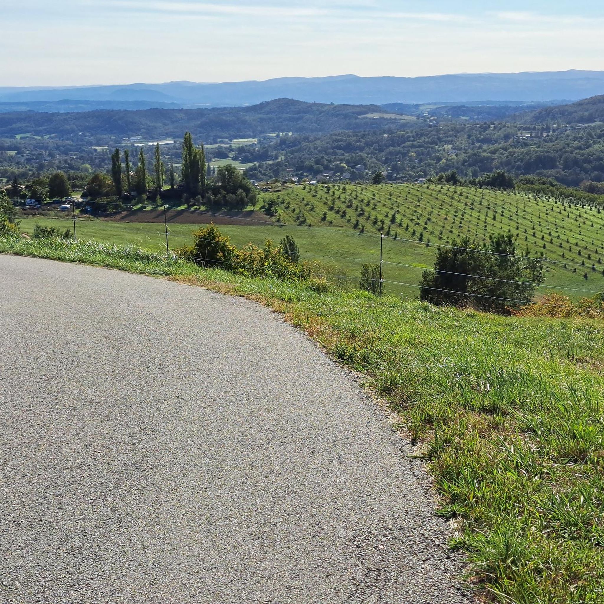
Secondary road with very little traffic and mediocre asphalt. Partly it runs along the hill with magnificent views of the Vercors and the Royans, partly in narrow sunken lanes. Fast descents are less possible due to the narrow road width and a number of adjacent houses and farms.
0
0

These are two water reservoirs which allow fishing as well as a walking and nature discovery trail. There is also an observatory and identification panels for the species that can be observed there.
0
0

No technical path apart from the hills of Mours
1
0

Great view with benches for a well deserved break
0
0
Frequently Asked Questions
How many gravel bike trails are available around Margès?
There are over a dozen gravel bike trails around Margès. The region offers a diverse network of routes, with 2 easy, 5 moderate, and 6 difficult trails to explore.
What is the general difficulty level of gravel biking in Margès?
Gravel biking around Margès offers a range of difficulties. You'll find routes from moderate to difficult, characterized by rolling hills, riverside paths, and varied natural sites. The immediate Margès area has elevations ranging from 216m to 344m, providing a mix of gentle gradients and more challenging climbs.
What do other gravel bikers enjoy most about gravel biking in Margès?
The gravel biking routes in Margès are highly rated by the komoot community, with an average score of 4.3 stars from over a dozen reviews. More than 50 gravel bikers have used komoot to explore the area, often praising the diverse landscapes, rolling hills, and picturesque views of the surrounding countryside.
Are there any moderate gravel bike trails suitable for less experienced riders?
Yes, for those looking for a moderate challenge, the Vanelle dam – Natural Quarry loop from Romans - Bourg-de-Péage is a great option. This 22.8-mile (36.8 km) trail leads through picturesque landscapes with views of the Vanelle dam and is typically completed in about 2 hours 40 minutes.
What kind of terrain can I expect on gravel bike routes around Margès?
The terrain around Margès is diverse, featuring rolling hills typical of the Drôme des Collines, riverside paths along the Rhône, and varied natural sites. You can expect a mix of forest sections, open fields, and paths that connect to nearby towns and natural attractions. Elevations in the immediate Margès area range from 216m to 344m.
Are there any gravel routes that offer significant elevation gain for a challenge?
Absolutely. For a challenging ride with significant elevation, consider the View on arthemonay – Montmiral church loop from Romans - Bourg-de-Péage. This 30.1-mile (48.5 km) trail features over 650 meters of elevation gain and offers panoramic views of the surrounding countryside.
What are some interesting landmarks or places to explore along gravel bike routes near Margès?
Many routes offer opportunities to see local landmarks. For example, the Vanelle dam – Natural Quarry loop provides views of the Vanelle dam. You can also find routes that pass near the Historic centre of Romans-sur-Isère or the Collegiate Church of Saint Peter and Saint Paul, offering cultural stops during your ride.
Are there any gravel routes that pass by water features or lakes?
Yes, the Drôme department is known for its waterways. While specific routes are not detailed, the region offers numerous bathing spots, including 9 lakes and 25 rivers. The Bellevue Ponds near Bourg-lès-Valence are an example of a scenic water feature that could be incorporated into a ride, offering walking trails and nature observation points.
What is the best time of year for gravel biking around Margès?
The Drôme region generally offers pleasant conditions for outdoor activities. Spring and autumn are often ideal, with milder temperatures and beautiful scenery. Summer can also be enjoyable, especially along riverside paths, but it's advisable to start early to avoid the midday heat. Winter rides are possible, but trail conditions may vary.
Are there any family-friendly gravel cycling options near Margès?
While specific 'easy' family routes are not highlighted, the region's diverse network includes paths suitable for various abilities. The general terrain of rolling hills and riverside paths can be adapted for family outings. Look for shorter, less elevated sections or consider the Isère Valley Greenway Cycle Route for a more relaxed experience.
Where can I find parking for gravel bike trails near Margès?
Many gravel bike routes around Margès start from nearby towns like Romans-sur-Isère or Saint-Donat-sur-l'Herbasse, where public parking is generally available. For example, routes like the View over Mours-Saint-Eusèbe – Romans-sur-Isère station loop often begin from accessible points within these larger communities.
Can I access gravel bike trails near Margès using public transport?
Access to gravel bike trails via public transport will largely depend on the starting point of your chosen route. Larger towns like Romans-sur-Isère, which serve as starting points for several routes, typically have better public transport connections. It's recommended to check local bus or train schedules to these towns and then plan your ride accordingly.
Are there any gravel routes that offer a good mix of forest and open fields?
Yes, the Étang du Mouchet loop from Saint-Donat-sur-l'Herbasse is a difficult 18.9-mile (30.4 km) path that winds through varied terrain, including both forest sections and open fields. This route provides a dynamic riding experience with changing scenery.
Most popular attractions around Margès

Get inspired with the komoot mobile app


Explore more
Browse the best Gravel rides in other regions.
