The best walks and hikes in Withlacoochee State Forest
4.9
(11)
92
hikers
28
hikes
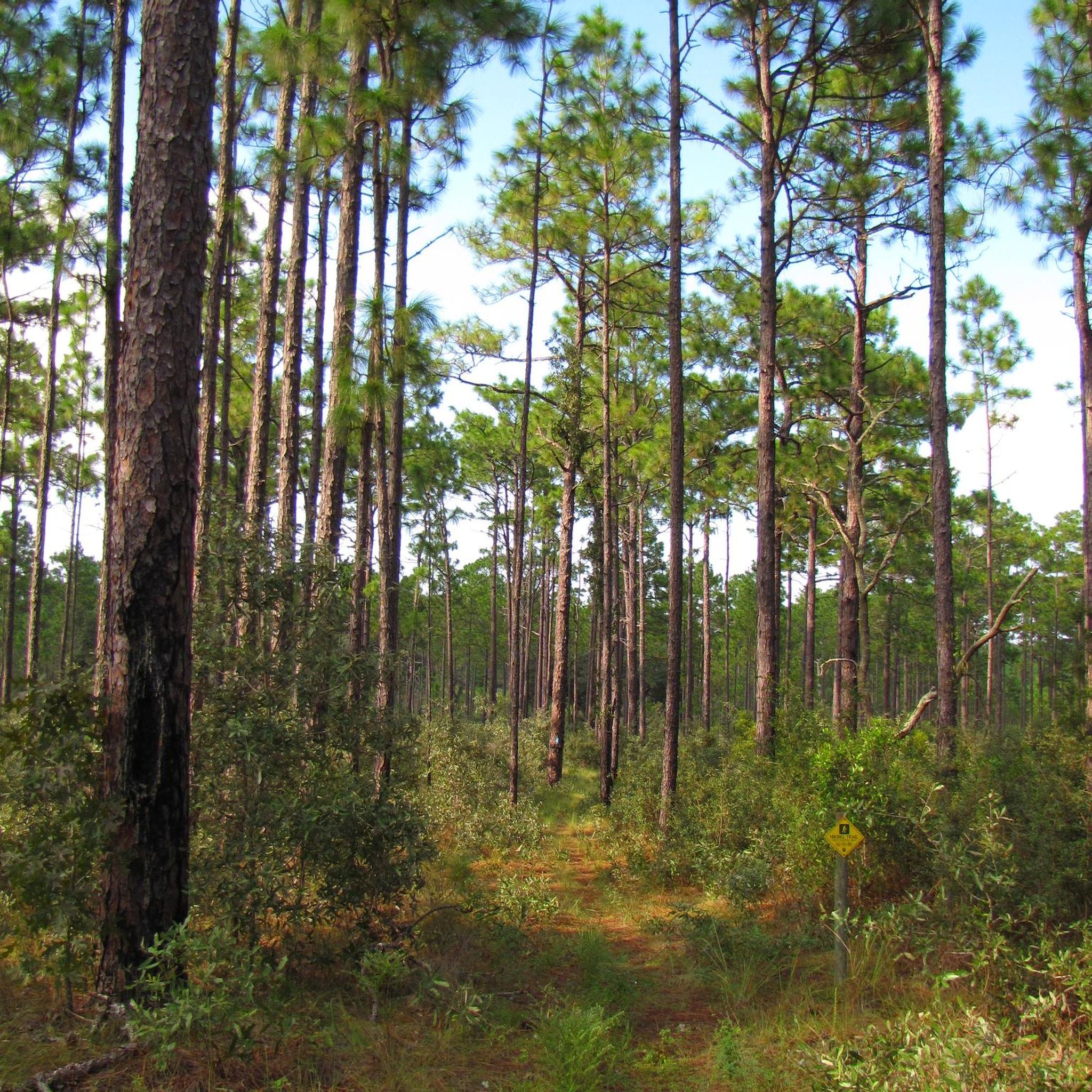
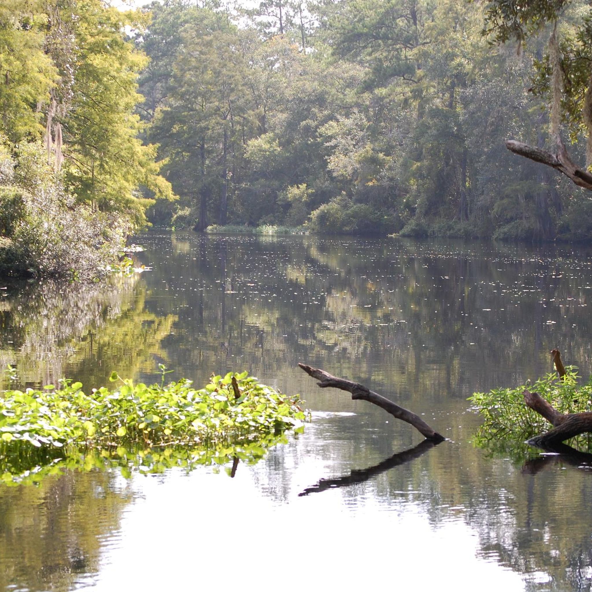
Hikes in Withlacoochee State Forest explore a varied Central Florida landscape characterized by rolling hills, dense oak hammocks, and longleaf pine forests. The region's trail network follows the banks of the Withlacoochee River and passes through distinct ecosystems, including cypress wetlands and areas with limestone outcroppings. The terrain offers a mix of flat, easy paths and more undulating routes with noticeable elevation changes.
Best hiking trails in Withlacoochee State Forest
- The most popular hiking route is Hog Island via Croom Trail — Withlacoochee State Forest, a 8.2 mile (13.3 km) trail that takes around 3 hours 20 minutes to complete. This moderate hike follows paths along the Withlacoochee River in the Croom Tract.
- Another top favourite among local hiking enthusiasts is Withlacoochee State Forest loop — Citrus County, a moderate 6.9 mile (11.1 km) path. The route explores the forest of the Citrus Tract, known for its rolling terrain.
- Local hiking enthusiasts also love the Florida Trail & South Trail 9 loop — Withlacoochee State Forest, a 4.8 mile (7.7 km) trail leading through pine and oak forest, often completed in about 2 hours.
- Hiking in Withlacoochee State Forest is defined by its mix of riverside paths, sandhill ecosystems, and dense hardwood forests. The trail network provides options for different ability levels, from short, easy loops to longer, more challenging hikes.
- The routes in Withlacoochee State Forest are highly rated by the komoot community with an average score of 5.0 stars from a number of reviews. More than 60 hikers have used komoot to explore Withlacoochee State Forest's varied terrain.
Last updated: October 11, 2026
5.0
(1)
5
hikers
4.39km
01:06
0m
0m
The Rooks Trail West offers a delightful and easy journey through the Homosassa Tract of Withlacoochee State Forest, showcasing Florida's varied ecosystems. As you hike, you'll experience a blend of improved pasture, tranquil hardwood swamp, and classic sandhill forest, with several ponds dotting the landscape. The route is well-maintained and provides a pleasant, flat walk, making it an ideal choice for a casual outing.
This 2.7-mile (4.4 km) loop is rated easy, with a negligible 13 feet (4 metres) of elevation gain, and typically takes just over an hour, around 1 hour and 6 minutes, to complete. The Homosassa Tract is a day-use area, open from sunrise to sunset, and dogs are welcome on the trail. For optimal conditions and wildlife sightings, consider visiting during the spring or fall.
One of the standout features of the Rooks Trail West is its abundant wildlife, particularly for birdwatching. You might spot Wild Turkeys, Eastern Meadowlarks, and Northern Bobwhites, along with Gopher Tortoises. During migration seasons, look for Blue-headed Vireos and Blue Grosbeaks, and keep an eye to the sky for Great Horned Owls and Red-tailed Hawks, adding to the trail's natural appeal.
6.94km
01:49
60m
60m
Embark on an easy hike through the Dames Cave and Stage Pond trail, a 4.3-mile (6.9 km) route that offers a gentle exploration of Florida's unique landscapes. You will encounter pine forests, oak scrub, and sandy sections as you make your way through the Citrus Wildlife Management Area. With a modest elevation gain of 188 feet (57 metres) and an estimated duration of 1 hours and 49 minutes, this trail provides a relaxing outdoor experience for all skill levels. Keep an eye out for the historic Stage Pond, a notable feature along your journey.
When planning your visit, you will find the trails are generally well-marked, making navigation straightforward and enjoyable. While the Dames Cave area is family-friendly, it is always wise to wear sturdy hiking boots for comfort and stability on varied terrain. Before heading out, remember to check local conditions to ensure a smooth and pleasant trip. This trail is accessible and welcoming, making it a great choice for a spontaneous outing.
This route stands out for its blend of natural beauty and geological interest, showcasing Florida's distinctive karst landforms. The trail leads you towards Dames Cave, a fascinating natural formation where a partially collapsed ceiling allows sunlight to filter in, creating a unique atmosphere. This area provides a glimpse into the region's natural history and ecological diversity, offering more than just a walk in the woods. It is a perfect opportunity to connect with the environment and discover some of the hidden gems within the Withlacoochee State Forest.

11.2km
02:54
70m
50m
Embark on the Citrus A Loop for a moderate hike that reveals Florida's unexpected geological diversity. This 7.0-mile (11.2 km) route takes you through rolling sandhills dotted with longleaf pine, transitioning into cooler, shaded hardwood forests. You will gain 214 feet (65 metres) in elevation, encountering distinctive sand live oaks and even rocky sections with limestone karst formations. Plan for about 2 hours and 53 minutes to complete this loop, which offers a unique look at the state's varied landscapes.
Before you set out on the Citrus A Loop, remember that this is a dry trail with no natural water sources along its 7.0 miles (11.2 km). You should carry all the water you need for the entire duration of your hike. The route is well-maintained and clearly marked with orange blazes, making navigation straightforward for all hikers. Check local weather conditions before your visit, especially during warmer months.
This trail stands out in Florida for its surprisingly rugged terrain, which is atypical for the region. The presence of limestone karst formations provides a unique geological experience, showcasing a different side of the state's natural environment. You will find a diverse ecosystem here, from the open sandhills to the denser hardwood sections, offering varied scenery throughout your journey.
1.18km
00:18
0m
10m
Embark on an easy 0.7-mile (1.2 km) hike along the Chinsegut Pines to Prairie Loop Trailhead, a gentle route that takes only about 17 minutes to complete. You will experience a subtle elevation gain of just 3 feet (1 metres) as you wander through diverse landscapes. Imagine strolling past towering old-growth longleaf pines, some of the oldest in Central Florida, with the distinct scent of pine in the air. The path leads you through sandhills and into open prairies, offering a peaceful and accessible outdoor experience.
This short and easy trail is ideal for a quick escape into nature, perfect for beginner hikers or anyone seeking a leisurely stroll. You will find well-defined paths, with some portions following old roadways, making for very easy walking. The route is part of the Chinsegut Wildlife and Environmental Area, providing straightforward access for your visit. Consider coming during cooler parts of the day for the most comfortable experience.
The Chinsegut Pines to Prairie Loop Trailhead is notable for its ecological diversity, showcasing a blend of sandhills, longleaf pine forests, and prairies. Keep an eye out for May's Prairie, a significant wetland area where sandhill cranes often gather, especially during the winter months. This offers excellent opportunities for wildlife viewing from designated boardwalks. The trail provides a unique glimpse into Central Florida's natural heritage and its ancient pine ecosystems.
14.8km
03:50
70m
90m
Embark on the Croom Trail North Loop for a moderate hiking experience through the diverse landscapes of Withlacoochee State Forest. This 9.2-mile (14.8 km) route guides you through rolling sandhill landscapes and expansive longleaf pine forests, offering a true taste of Florida's natural beauty. You will gain 239 feet (73 metres) in elevation over an estimated 3 hours and 49 minutes, encountering varied terrain that includes oak hammocks and brushy areas. Keep an eye out for the unique, more rugged sections around the Sugar Mountain Loop, which add to the adventure.
When planning your visit, you will find parking generally available near the Tucker Hill Day Use Area, which serves as a convenient starting point for your hike. While specific permits are not typically required for day hiking, it is always a good idea to check with the Withlacoochee State Forest directly for any current regulations or fees before you head out. This ensures you have the most up-to-date information for a smooth and enjoyable trip.
This trail offers a unique opportunity to immerse yourself in Florida's distinct ecosystem, where you might spot wildlife such as red-headed woodpeckers and deer amidst the varied flora. The Croom Trail North Loop also provides a connection to the much larger Florida National Scenic Trail, giving you options for extending your adventure if you are looking for a longer journey through the state's natural wonders. It is a great way to experience the region's natural heritage.
Get access to more routes and recommendations from other explorers.
Already have an account?
Our route recommendations are based on thousands of hikes, rides, and runs completed by other people on komoot.
Start today with a free account
Your next adventure awaits.


Tips from the Community

This area serves as the starting point for an extensive trail system with miles of trails, offering several scenic options and routes for your run. With restrooms, grills, and picnic areas available, it's easy to spend the entire day enjoying the surroundings.
0
0

Citrus Wildlife Management Area is a 50,000 acre nature preserve. There are many miles of trail and dirt roads that cut through the preserve, so there are many routes to choose from.
0
0
The Withlacoochee State Forest is a 157,479 acre nature preserve along the Chassahowitzka River and coastal swamps. The forest is a mix of woodland and swampland. There are several miles of trails throughout the forest.
0
0
The Withlacoochee State Forest is a 157,479 acre nature preserve along the Chassahowitzka River and coastal swamps. The forest is a mix of woodland and swampland. There are several miles of trails throughout the forest.
0
0
Citrus Wildlife Management Area is a 50,000 acre nature preserve. There are many miles of trail and dirt roads that cut through the preserve, so there are many routes to choose from.
0
0
Stage Pond is a nice small pond along in the Citrus Wildlife Management Area. There is a dirt path that circles the pond, so you can get a good look at the water.
0
0

Tucker Hill, situated within the Withlacoochee State Forest, is an excellent spot to begin or conclude your hike. The area features multiple trailheads, along with amenities such as picnic areas, BBQ grills, and restrooms. The trailheads provide easy access to a variety of hiking paths, making it a convenient and well-equipped location for outdoor enthusiasts looking to explore the forest.
0
0

Tucker Hill lies within the Withlacoochee State Forest and is a good place to start and/or end your ride. There area number of trailheads in the parking area as well as picnic areas, BBQs, and restrooms.
0
0
Frequently Asked Questions
Are dogs allowed on the trails in Withlacoochee State Forest?
Yes, dogs are generally welcome in Withlacoochee State Forest but must be kept on a leash. The trails offer plenty of space for you and your canine companion to explore. For example, the Withlacoochee State Forest loop via Withlacoochee State Trail is a long, shaded route that's great for a walk with your dog.
What are the main differences between the Croom and Citrus Tracts for hiking?
The Croom Tract is known for its trails along the bluffs of the Withlacoochee River, offering scenic water views and relatively gentle terrain. The Citrus Tract, in contrast, provides a more rugged experience with rolling hills, limestone outcroppings, and a more challenging network of trails through sandhill and pine ecosystems.
Are there any easy, family-friendly hikes in the forest?
Yes, the forest has several options suitable for families. The Florida Trail & South Trail 9 loop is a great choice. It's a relatively short loop of under 5 miles (8 km) through pleasant pine and oak forest, making it manageable for hikers of various ages.
What kind of wildlife might I see while hiking?
The diverse habitats of the forest support a rich variety of wildlife. It's common to spot white-tailed deer, wild turkey, gopher tortoises, and fox squirrels. Birdwatchers can look for bald eagles, various songbirds, and waterfowl, especially near the river and wetland areas. Keep an eye out for bobcats and Sherman's fox squirrels as well.
Are there any caves I can see while hiking?
Yes, the Citrus Tract is famous for its karst topography, which includes sinkholes and small caves. Trails in this area, such as the ones near Dames Cave and Peace Cave, allow you to explore these unique limestone formations. These are not deep, extensive cave systems but rather interesting rock shelters and openings.
What is the best time of year to hike in Withlacoochee State Forest?
The most pleasant seasons for hiking are fall, winter, and spring (October through April), when temperatures are cooler and humidity is lower. Summer hiking is possible, but be prepared for heat, high humidity, and insects. If hiking in summer, start early in the morning and carry plenty of water.
Are there any fees or permits required for hiking?
For day-use hiking, there is generally no entrance fee required at most trailheads. However, fees may apply for specific recreation areas, camping, or other activities. It's also important to be aware of hunting seasons, as some areas may be closed or have restricted access. Check the Florida Fish and Wildlife Conservation Commission for current hunt dates.
Where can I find a challenging backpacking loop?
For a strenuous backpacking trip, the Citrus Hiking Trail offers a rugged loop of nearly 40 miles. If you're looking for a shorter but still challenging hike, the Stage Pond via Trail 22 route covers over 11 miles (17.7 km) of the area's characteristic rolling terrain and elevation changes.
What do other hikers enjoy about Withlacoochee State Forest?
The area is highly rated by the komoot community, with an average score of 5.0 stars. Reviewers often praise the well-marked and easy-to-follow trails, which allow for a relaxing experience. The shady tree canopy and the variety of scenery, from riverside paths to rolling sandhills, are also frequently mentioned as highlights.
Are there any waterfalls in the forest?
No, due to Central Florida's flat topography, there are no natural waterfalls within Withlacoochee State Forest. The main water features you'll encounter are the scenic Withlacoochee River, various creeks, and cypress swamps.
What are the parking situations at the trailheads?
Parking availability varies by trailhead. Major trailheads, like the Ridge Manor Trailhead for the Withlacoochee State Trail, have paved lots and facilities. Smaller trailheads, such as the Oxbow Trailhead, often have unpaved parking areas with fewer amenities. Most day-use parking is free.
Most popular routes in Withlacoochee State Forest
Most popular attractions in Withlacoochee State Forest

Get inspired with the komoot mobile app


Explore more
Browse the best Hikes in other regions.
