The best MTB trails around Duarte
4.5
(2)
76
riders
7
rides
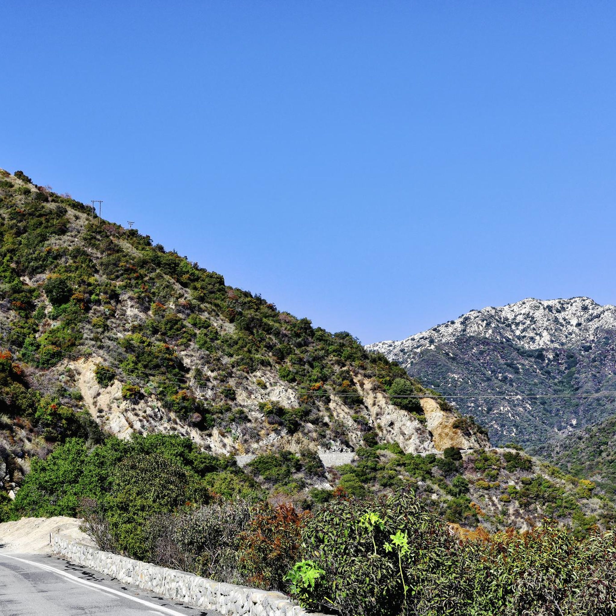
Mountain biking around Duarte offers access to diverse trail systems and natural landscapes, situated at the base of the San Gabriel Mountains. The area features a mix of multi-use paths and challenging mountain biking trails with significant elevation changes. Riders can explore paved bike paths alongside dirt sections, as well as rugged routes within the Angeles National Forest. The terrain often includes rocky and rutted sections, providing varied experiences for mountain bikers.
Best mountain bike trails around Duarte
- The most…
Last updated: May 22, 2026
4.5
(2)
19
riders
38.9km
03:36
1,190m
1,550m
Tackle the difficult 24.2-mile Glendora Mountain Road and Lower Monroe Truck Trail mountain bike route, featuring challenging climbs and exp
30
riders
22.3km
02:38
820m
820m
Experience a moderate 13.9-mile mountain bike ride on the Lower Monroe Truck Trail, known for its sustained climb and long descent.

Sign up for free
56.2km
07:11
2,170m
2,170m
The Mt. Wilson Enduro Loop is a difficult 34.9-mile mountain biking trail in Angeles National Forest with 7127 feet of elevation gain.
8.76km
01:07
420m
430m
The Upper and Lower Winter Creek Trail Loop offers a challenging 5.4-mile mountain bike ride with 1388 feet of gain through Angeles National
1
riders
10.2km
01:11
340m
340m
Explore the moderate Lower Clamshell Truck Trail in Monrovia Hillside Wilderness Preserve, a 6.4-mile mountain biking route with scenic view
Get access to more routes and recommendations from other explorers.
Sign up for free
Already have an account?
Our route recommendations are based on thousands of hikes, rides, and runs completed by other people on komoot.
Start today with a free account
Your next adventure awaits.
Login or Signup
Tips from the Community

Mostly smooth fire road through Monrovia Hillside Wilderness, but with some steep and technical sections that might challenge beginners. Ride counterclockwise from Canyon Park and follow the signs—many side trails cross private land. The descent includes tight switchbacks and a short singletrack section. You can stick to the main road or take the “advanced” trail, Cactus Road, for more climbs, exposure, and a fun technical finish.
0
0

Chantrey Flats is the natural end for those riding the Sturtevant Trail. If you shuttled to Mt. Wilson with a friend then this is likely the end of the line for you. Others might need to ride back down to Altadena if they took the shuttle offered by SCOAoutdoors.net. And still others might be climbing their way back up to the top via the myriad of roads and trails that depart from this picnic area.
0
0

The Lower Monroe Truck Trail has a mix of terrain, starting with a flat, rocky doubletrack section that transitions into a gradual, twisty eight-mile climb up to Glendora Mountain Road. It starts with a 1.7-mile rock garden creek section; the trail features intermittent tree cover and narrows to singletrack in spots. After a sharp right turn, the trail climbs steadily for 6.2 miles, mostly exposed, with great views of the San Gabriel Valley at the 3.3-mile plateau, a popular rest point. At the top, a gate marks the turnaround for the fast-paced, twisting descent. Riders navigate rocky and rutted sections with trail-hugging vegetation, so gloves and water are essential. Be ready for the occasional pedestrian encounters, a cowbell comes in handy.
0
0
At the junction of Lower Monroe Trail, Mystic Canyon Trail, and Lower Monroe Truck Trail is a great view over Glendora down in the south below.
0
0

Little Dalton Debris Basin is a small, man-made collecting pond in Big Dalton Canyon Wilderness Park. It is just off Big Dalton Canyon Road and Glendora Mountain road, which are both popular, challenging roads for biking.
0
0

Newman Point is an awesome overlook area with a large parking lot off the side of Glendora Mountain Road. The overlook peers down at Morris Reservoir and West Covina off in the distance.
0
0
Newman Point is an awesome overlook area with a large parking lot off the side of Glendora Mountain Road. The overlook peers down at Morris Reservoir and West Covina off in the distance.
0
0
Newman Point is an awesome overlook area with a large parking lot off the side of Glendora Mountain Road. The overlook peers down at Morris Reservoir and West Covina off in the distance.
0
0
Frequently Asked Questions
How many mountain bike trails are available around Duarte?
There are 7 mountain bike trails around Duarte listed on komoot, offering a range of experiences from moderate to difficult. These routes are highly rated by the komoot community, with an average score of 4.5 stars.
Are there mountain bike trails suitable for beginners in Duarte?
While many trails in the surrounding mountains offer significant challenges, the Duarte Bike Trail provides a more accessible option. This Class 1 bike path runs for about 1.6 miles and includes a paved section alongside a dirt area, suitable for those looking for a less strenuous ride. It also connects to the San Gabriel River Bicycle Path for extended, flatter routes.
What are some challenging mountain bike trails near Duarte for experienced riders?
For experienced riders seeking a challenge, the Mt. Wilson Enduro Loop is a difficult 34.9-mile trail in the Angeles National Forest with substantial elevation gain. Another option is the Glendora Mountain Road and Lower Monroe Truck Trail, a 24.2-mile difficult route known for its sustained climb and long descent.
Are there any loop mountain bike trails in the Duarte area?
Yes, the Upper and Lower Winter Creek Trail Loop is a moderate 5.4-mile (8.8 km) route that offers a loop experience. This trail provides a good option for those looking to start and end their ride in the same location.
What natural features or landmarks can I see while mountain biking near Duarte?
Mountain biking in Duarte offers views of the San Gabriel Mountains. You can also explore the Duarte Bike Trail, which is built on a historic railway line and features an arched old bridge. The Santa Fe Flood Control Basin, part of the Santa Fe Dam Recreation Area, provides scenic views and natural trails accessible from the San Gabriel River Greenway.
Is parking available at the trailheads in Duarte?
Yes, Royal Oaks Park, which serves as a trailhead for the Duarte Bike Path, offers parking facilities. Many other trailheads in the Angeles National Forest also provide designated parking areas, though it's always advisable to check specific trail information for details.
Are permits required for mountain biking in the Angeles National Forest near Duarte?
Some areas within the Angeles National Forest may require an Adventure Pass for parking at certain trailheads. It's recommended to check the official Angeles National Forest website or local ranger stations for the most current permit requirements before heading out.
What is the best time of year to go mountain biking in Duarte?
Spring and fall generally offer the most pleasant conditions for mountain biking in Duarte, with milder temperatures. Summer can be very hot, especially on exposed trails, so early morning rides are recommended. Winter can bring cooler temperatures and occasional rain, which might make some trails muddy or slippery.
Are there any family-friendly mountain bike trails in Duarte?
The Duarte Bike Trail is an excellent family-friendly option. It's a relatively flat, multi-use path with both paved and dirt sections, suitable for riders of various ages and skill levels. It also connects to the San Gabriel River Bicycle Path, offering longer, gentle rides.
Can I bring my dog on the mountain bike trails in Duarte?
Many multi-use trails in the Duarte area, including sections of the Duarte Bike Trail and the San Gabriel River Bicycle Path, are dog-friendly. However, regulations can vary, especially within the Angeles National Forest. Always ensure your dog is on a leash and check specific trail rules before you go.
What do other mountain bikers enjoy the most about mountain biking in Duarte?
The mountain bike trails around Duarte are highly rated by the komoot community, with an average score of 4.5 stars from 2 reviews. Riders often praise the diverse terrain, from multi-use paths to challenging routes in the San Gabriel Mountains, and the stunning natural landscapes.
Are there cafes or places to eat near the mountain bike trails in Duarte?
Duarte offers various dining options within the city, many of which are a short drive from the main trailheads like Royal Oaks Park. While there might not be cafes directly on the trails, you'll find places to refuel in town after your ride.
Most popular attractions around Duarte

Get inspired with the komoot mobile app


Explore more
Browse the best MTB trails in other regions.
