The best walks and hikes in McDonald County
4.8
(43)
348
hikers
53
hikes
Hiking in McDonald County explores the southwestern corner of Missouri, an area defined by the rugged terrain of the Ozark Mountains. The landscape features rolling, forested hills, clear-flowing creeks, and dramatic river bluffs carved by the Elk River and its tributaries. Routes navigate through dense oak-hickory woodlands and across small bedrock streams, offering varied hiking experiences.
Best hiking trails in McDonald County
- The most popular hiking route is Tanyard Creek Falls loop from Bella Vista, a 1.6 miles (2.5…
Last updated: July 8, 2026
4.8
(5)
56
hikers
3.12km
00:51
50m
40m
The Tanyard Perimeter Loop offers an easy hiking experience through lush wooded areas, perfect for a quick outdoor escape. You will follow a crystal-clear creek, passing rock bluffs and crossing…
1
hikers
4.88km
01:21
90m
70m
The Bamboozled Trail offers an easy hiking experience, covering 3.0 miles (4.9 km) with a gentle elevation gain of 287 feet (88 metres). You can expect to complete this route…

Sign up for free
4.96km
01:24
100m
120m
Hike the easy 3.1-mile Huckleberry Ridge Conservation Area Trail through beautiful oak and hickory forests with rolling hills in southern Mi
1.77km
00:29
30m
20m
Embark on the easy Bear Hollow Cave Trail, a short 1.1-mile (1.8 km) hike that takes about 28 minutes to complete. You will gain a gentle 88 feet (27 metres)…
1.82km
00:30
40m
0m
Hike the easy 1.1-mile Pinyon Creek to Brittany Dam Trail in Bella Vista, featuring a waterfall, creek, and the Lake Brittany Dam.
4
hikers
4.50km
01:12
40m
40m
The Pinyon Creek Trail is an easy 2.8-mile hike in Bella Vista, Arkansas, offering wooded scenery, wildflowers, and views of Lake Ann and La
2
hikers
15.2km
04:08
210m
210m
Hike the moderate 9.5-mile Tunnel Vision and Bamboozled Loop, featuring unique art, a waterfall, and Lake Avalon views, perfect for dog-frie
1
hikers
13.7km
03:40
160m
160m
Hike the moderate 8.5-mile Sugar Bridge Trail in Bella Vista, Arkansas, featuring Tanyard Creek Falls, Sugar Bridge, and Lake Ann.
10.5km
02:51
150m
150m
Hike the moderate 6.5-mile SBAT Trail in Bella Vista, featuring varied terrain, wooded views, and a scenic detour to Lake Brittany Dam.
36
hikers
2.55km
00:42
40m
40m
Easy hike. Great for any fitness level. Easily-accessible paths. Suitable for all skill levels.
Get access to more routes and recommendations from other explorers.
Sign up for free
Already have an account?
Our route recommendations are based on thousands of hikes, rides, and runs completed by other people on komoot.
Start today with a free account
Your next adventure awaits.
Login or Signup




Tips from the Community

Tunnel Vision passes over Browning Creek with a little bridge as it weaves around Cullen Hills Drive.
0
0
Tunnel Vision has quite a bit of switchbacks followed by descents. It is a shared trail with mountain bikers, and it is very well marked. The entirety of the trail circles the east side of Bella Vista and spans over 25 miles.
0
0
Lake Avalon spans 67 acres and has waterfront Lake Avalon Park. Residents and visitors can enjoy fishing, swimming, kayaking, and paddle boarding. The lake is stocked with fish, including bass, bluegill, and catfish, making it a great spot for fishing.
0
0
Lake Ann Park has a picnic shelter, a grill, and often a port-o-potty. The woods that surround Lake Ann are frequently mirrored on the water here, as this area usually has calm waters. It also features a dock and a lawn that gradually goes into the water, making it a popular boat launch.
0
0
Pinion Creek Trail is a dirt path for hikers and mountain bikers connecting Lake Brittany and Lake Ann and continuing east till it reaches Back 40. The trail is not too rocky and takes hikers into a nice natural area without being too far from a road or exit point.
0
0
Lake Brittany Dam sits on a small, north-flowing tributary to Pinion Hollow and is upstream of Lake Ann. Walk a short way up the Pinion Creek trail to Lake Brittany Dam for great views of the lake and the hills of Bella Vista.
0
0

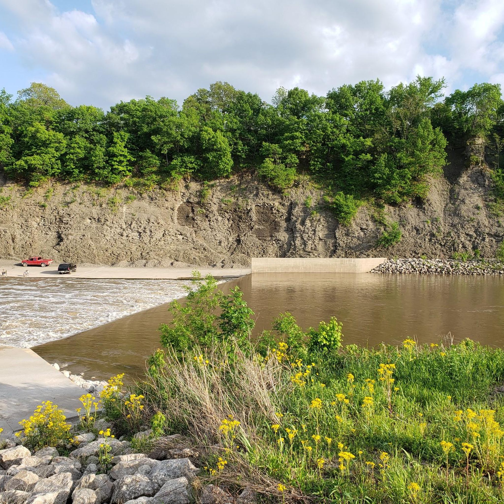
The falls are just below where the trail crosses the creek as it flows out of the Lake Windsor Dam and over the drop to form the falls. Be aware that the trails just off Lago Vista East around the falls are off limits to bikes.
0
0
Frequently Asked Questions
Are there any dog-friendly hiking trails in McDonald County?
Yes, most trails in conservation areas and state parks in Missouri are dog-friendly, but your dog must be kept on a leash. Areas like Huckleberry Ridge Conservation Area and Big Sugar Creek State Park offer extensive trails where you can hike with your leashed pet. Always check specific park regulations before you go and be sure to pack out any waste.
What are the best places to go hiking in McDonald County?
McDonald County offers several excellent hiking destinations. Huckleberry Ridge Conservation Area is a local favorite, known for its large, forested landscape and multi-use trails. For a more rugged experience, many hikers visit Big Sugar Creek State Park, which features the scenic Chinquapin Trail with its unique flora and stream crossings. For a highly-rated trail system with waterfalls, the Tanyard Creek Nature Trail just across the border in Bella Vista is also extremely popular with visitors to the region.
Can I find any easy, family-friendly hikes in the area?
Absolutely. The region has numerous options suitable for families and beginners. For a very gentle walk, consider the The Gear Garden – Wooden berm loop from Pea Ridge, which is a short 2.4-mile (3.9 km) trail. It's a great way to introduce kids to hiking in the Ozarks.
Are there any hiking trails with waterfalls in McDonald County?
While many creeks in the Ozarks create small cascades, the most prominent waterfall feature in the immediate vicinity is at the Tanyard Creek Nature Trail. The Tanyard Creek Falls loop from Bella Vista is a very popular and easy hike specifically designed to showcase the falls.
What do other hikers say about the trails in McDonald County?
The trails in and around McDonald County are highly regarded by the komoot community, holding an average rating of 4.8 out of 5 stars. Hikers frequently praise the beautiful Ozark scenery, the clear-flowing creeks, and the tranquility of the dense oak-hickory forests. The well-maintained paths in areas like Bella Vista are also a common highlight.
How many hiking trails are available in McDonald County?
You can explore over 25 hiking routes in McDonald County on komoot. These range from short, easy walks perfect for an afternoon stroll to more demanding long-distance treks, ensuring there's a trail for every fitness level and interest.
Are there any good circular hikes or loop trails?
Yes, loop trails are very common in the area, allowing you to enjoy a varied hike without backtracking. A great example of a moderate loop is the Blowing Springs Loop Upper North and Upper South — Bella Vista. This 3.8-mile (6.1 km) route offers a pleasant walk through the woods with manageable elevation changes.
What should I pack for a day hike in the Ozarks?
For a day hike in McDonald County, it's essential to wear sturdy hiking shoes, as trails can be rocky and uneven. Bring plenty of water, especially in warmer months. It's also wise to pack snacks, a basic first-aid kit, insect repellent, and sunscreen. Since many trails involve water crossings, waterproof footwear or a change of socks can be very useful. Always download your route map for offline use, as cell service can be unreliable in remote areas.
Can I go backcountry camping in McDonald County?
Yes, primitive backcountry camping is permitted in designated areas within the Huckleberry Ridge Conservation Area. This offers a fantastic opportunity to immerse yourself in the wilderness. There are no facilities, so you must be self-sufficient and practice Leave No Trace principles. Always check the latest regulations with the Missouri Department of Conservation before your trip.
Are there any challenging, long-distance hikes available?
For experienced hikers looking for a full-day challenge, the Back 40 and Summit School loop — Bella Vista is the most difficult trail in this collection. At nearly 19 miles (30.4 km), it's a strenuous trek through extensive woodlands that requires good fitness and preparation.
What is hiking like in Big Sugar Creek State Park?
Hiking in Big Sugar Creek State Park is known for being a rugged and authentic Ozark experience. The main route, the Chinquapin Trail, takes you through steep, forested hills and glades. Be prepared for several unbridged water crossings along a bedrock stream, which can be a fun challenge, especially after rain. The park is a designated Natural Area, preserving a wilder landscape.
Are there any lakeside hiking trails?
Yes, the trail systems around Bella Vista offer several routes that pass by scenic lakes. For a pleasant walk between two lakes, you could try the Lake Ann to Brittany Dam via Pinion Creek Trail — Bella Vista. It's an easy 2.8-mile (4.5 km) hike that provides lovely water views along the way.
Most popular routes in McDonald County

Get inspired with the komoot mobile app


Didn’t find what you were looking for?
Check out more Hikes throughout Mcdonald County below and find the perfect route in your destination.
Explore more
Browse the best Hikes in other regions.
