The best MTB trails around Vorspeicher Galgenbichl
4.7
(14)
129
riders
3
rides
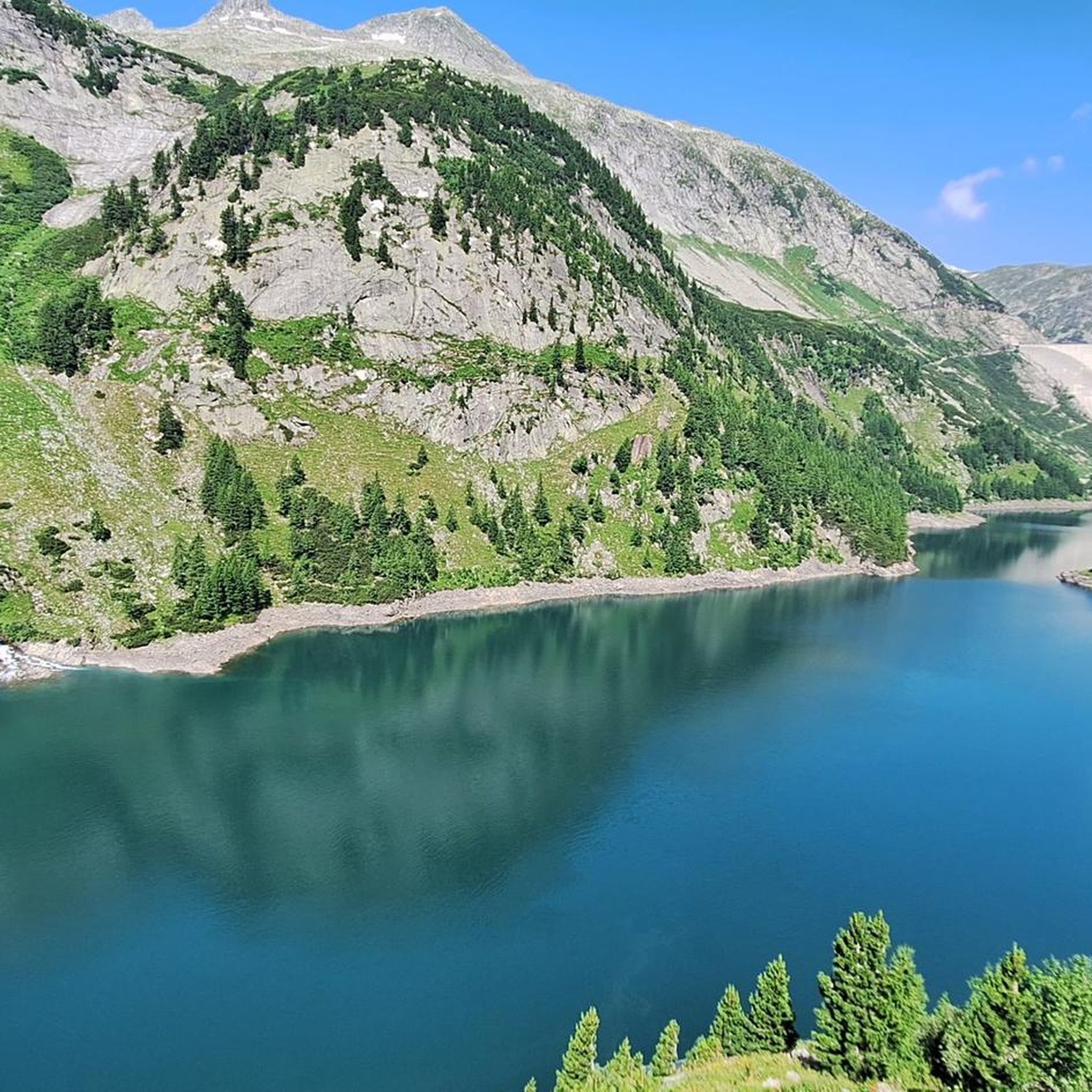
Mountain biking around Vorspeicher Galgenbichl features routes set amidst alpine reservoirs and mountain valleys. The terrain is characterized by the presence of large dams and their associated reservoirs, such as the Kölnbrein Reservoir, offering a mix of paved and unpaved paths. Riders can expect varied elevation changes as trails navigate through the Grossarl Valley and surrounding alpine landscapes.
Best mountain bike trails around Vorspeicher Galgenbichl
- The most popular mountain bike trail is Kölnbreinsperre Dam – Kölnbrein Reservoir loop from Speichersee…
Last updated: July 2, 2026
4.9
(11)
80
riders
17.0km
01:45
420m
410m
Moderate mountain bike ride. Good fitness required. Suitable for all skill levels.
9
riders
10.9km
01:08
260m
260m
Easy mountain bike ride. Great for any fitness level. Suitable for all skill levels.

Sign up for free
4.0
(1)
15
riders
7.55km
01:45
450m
450m
Moderate mountain bike ride. Good fitness required. Suitable for all skill levels.
5.0
(1)
9
riders
14.7km
01:31
440m
440m
Moderate mountain bike ride. Good fitness required. Suitable for all skill levels.
5.0
(1)
16
riders
27.8km
02:35
1,020m
1,020m
Hard mountain bike ride. Very good fitness required. Suitable for all skill levels.
Our route recommendations are based on thousands of hikes, rides, and runs completed by other people on komoot.
Start today with a free account
Your next adventure awaits.
Login or Signup
Popular around Vorspeicher Galgenbichl

Tips from the Community

The Kölnbreinsperre is a profoundly impressive highlight high above the Maltatal and the undisputed heart of Austria's highest dam. Via the hairpin bends of the Malta-Hochalmstraße, you reach the huge Kölnbrein reservoir. Directly on the dam crest, the Berghotel Malta with its viewing restaurant and the informative experience exhibition “Verbund-Energiewelt” invite you to take a break. A real thrill is the “Airwalk”. A glass viewing platform that juts out freely over the vertical dam into the depths.
1
0

If there's a waterfall nearby, it attracts us, and this time it was a highlight too, absolutely beautiful.
2
0

If there are more people, you have to wait a long time for the food.
0
0
7.24 km and 410 m elevation gain from here to the Sticklerhütte. Half on asphalt, half on gravel. You have to be careful going down, because you can easily accelerate over 60km/h and the road is narrow and cars can come at you.
0
0

Free of charge. There are two parking spaces directly at the dam. Restrooms are available. Perfect starting point for a walk over the dam and the Airwalk or to the adventure trail.
2
0
A fantastic day at the Kölnbrein Dam! Super modern fitness trail for kids with a premium view. Almost entirely suitable for children under 3 years old with good motor skills. The kids can test their skills on the balance beam, balance beam, stone jumper, Tibetan bridge, spider web, and mini via ferrata, among other things. Can be reached from the parking lot in under 5 minutes. At the end of the summit trail, a fantastic view of the Kölnbrein Dam awaits you.
1
0

Adventure trail in alpine terrain with motor skills stations, a via ferrata station on natural rock, and alpine hiking trail sections. Target group: Families with children ages 6 and up Duration of the hike: approximately 1 hour
0
0

The rustic Stickler Hut is located on the border of the Hohe Tauern National Park and is the starting point for various hikes, including the source of the Mur River, the Rotgüldensee Hut, the Tappenkarsee Hut, and the Franz Fischer Hut. There's a playground and a few animals for children. The hut can be reached on foot, by bike, or by shuttle bus (for a fee). Multi-bed rooms and dormitories are available for overnight stays. You can find all the information at https://www.sticklerhuette.at/.
3
0
Frequently Asked Questions
What types of mountain bike trails can I expect around Vorspeicher Galgenbichl?
The trails around Vorspeicher Galgenbichl are characterized by alpine reservoirs, large dam structures, and mountain valley paths. You'll find a mix of paved and unpaved sections, with varied elevation changes as routes navigate through areas like the Grossarl Valley.
Are there any easy mountain bike trails suitable for beginners?
Yes, there is at least one easy trail. The Kölnbreinsperre Dam – Kölnbrein Reservoir loop from Speichersee Kölnbrein is an easy 6.7-mile (10.9 km) route that offers scenic views around the reservoir and is suitable for those new to mountain biking in the area.
Are there any family-friendly mountain bike routes in the area?
For families looking for a less strenuous ride, the easy Kölnbreinsperre Dam – Kölnbrein Reservoir loop from Speichersee Kölnbrein is a good option. Its relatively flat profile around the reservoir makes it suitable for a family outing.
Can I bring my dog on the mountain bike trails around Vorspeicher Galgenbichl?
Many trails in alpine regions are dog-friendly, but it's always best to keep your dog on a leash, especially near livestock or wildlife. Ensure your dog is fit enough for the chosen route and carry enough water for both of you. Specific regulations may apply in certain areas, so check local signage.
What is the best time of year for mountain biking near Vorspeicher Galgenbichl?
The best time for mountain biking around Vorspeicher Galgenbichl is typically from late spring to early autumn (May to October). During these months, the weather is generally more stable, and trails are free of snow. Always check local weather forecasts and trail conditions before heading out, as alpine weather can change rapidly.
Are there any mountain bike trails that feature waterfalls or significant viewpoints?
Yes, the region offers trails with impressive natural features. The Kölnbrein Dam – Waterfall loop from Mautstation is a challenging route that specifically highlights a waterfall. Many routes around the reservoirs and dams also provide expansive views of the alpine landscape.
Are there any loop trails for mountain biking in Vorspeicher Galgenbichl?
Yes, several routes are designed as loops. For example, the Kölnbrein Reservoir – Osnabrücker Hut loop from Kölnbrein Dam offers a moderate 10.5-mile (16.8 km) circular path with notable elevation gain. The Kölnbreinsperre Dam – Kölnbrein Reservoir loop from Speichersee Kölnbrein is an easier loop option.
Where can I find parking for mountain biking near Vorspeicher Galgenbichl?
Parking is generally available near major access points to the reservoirs and dam areas, such as at the Kölnbrein Dam or Speichersee Kölnbrein. For routes like the Stickler Hut – Plölitzen Reservoir loop from P Arsenhaus, designated parking areas are often indicated at the starting points, like 'P Arsenhaus'.
Are there cafes or refreshment stops along the mountain bike trails?
In an alpine region like Vorspeicher Galgenbichl, you can often find mountain huts (Hütten) or small cafes, especially along popular routes or near trailheads. For instance, the Kölnbrein Reservoir – Osnabrücker Hut loop leads towards the Osnabrücker Hut, which typically offers refreshments during the season. It's advisable to check opening times before your ride.
What do other mountain bikers say about the trails in Vorspeicher Galgenbichl?
The mountain bike trails around Vorspeicher Galgenbichl are highly rated by the komoot community, with an average score of 4.7 stars from over 10 reviews. Riders often praise the stunning alpine scenery, the well-maintained paths, and the unique experience of cycling around the impressive dam structures and reservoirs.
What is the longest mountain bike trail available in this guide?
The longest mountain bike trail featured in this guide is the Kölnbrein Dam – Waterfall loop from Mautstation, which spans approximately 17.4 miles (27.9 km) and includes significant elevation gain, making it a challenging ride.
Are there any challenging mountain bike trails for experienced riders?
Yes, experienced riders can find challenging routes. The Kölnbrein Dam – Waterfall loop from Mautstation is classified as difficult, covering nearly 17.4 miles (27.9 km) with over 1000 meters of elevation gain, offering a substantial workout and technical sections.
Most popular routes around Vorspeicher Galgenbichl

Get inspired with the komoot mobile app


Explore more
Browse the best MTB trails in other regions.
