The best mountain hikes around Vorspeicher Galgenbichl
4.9
(14)
144
hikers
8
hikes
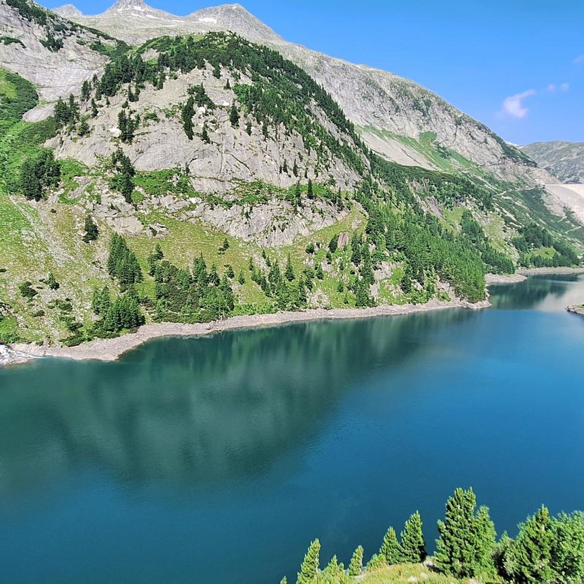
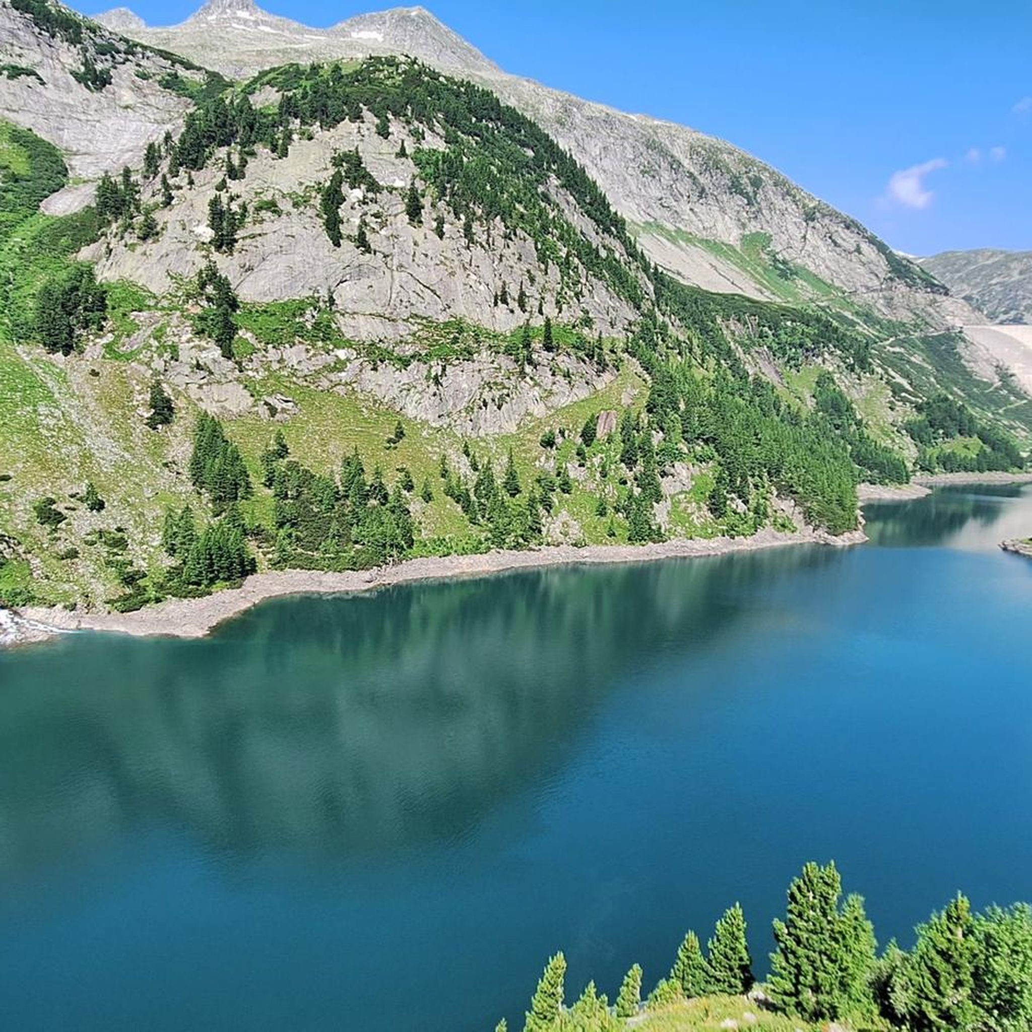
Mountaineering routes around Vorspeicher Galgenbichl are situated within Austria's Maltatal valley, part of the Hohe Tauern mountain range. The terrain features majestic mountains, prominent granite rock formations, and the impressive Kölnbrein Dam, with Vorspeicher Galgenbichl being a smaller dam below it. This alpine environment offers diverse landscapes for challenging expeditions.
Best mountaineering routes around Vorspeicher Galgenbichl
- The most popular mountaineering route is Kattowitzer Hut – Großer Hafner Summit Ridge loop from Kölnbrein Dam, a 9.7 miles (15.6 km) trail…
Last updated: June 25, 2026
5.0
(2)
43
hikers
15.7km
07:48
1,130m
1,120m
Hard mountaineering route. Very good fitness required. Sure-footedness, sturdy shoes and alpine experience required.
4.5
(2)
15
hikers
16.9km
04:51
420m
410m
Moderate mountaineering route. Good fitness required. Mostly accessible paths. Sure-footedness required.

Sign up for free
5.0
(1)
10
hikers
9.11km
03:53
500m
490m
Hard mountaineering route. Good fitness required. Sure-footedness, sturdy shoes and alpine experience required.
5.0
(2)
5
hikers
16.2km
07:42
950m
940m
Hard mountaineering route. Very good fitness required. Sure-footedness, sturdy shoes and alpine experience required.
5.0
(5)
38
hikers
17.1km
08:29
1,480m
1,480m
Hard mountaineering route. Very good fitness required. Sure-footedness, sturdy shoes and alpine experience required.
Get access to more routes and recommendations from other explorers.
Sign up for free
Already have an account?
Our route recommendations are based on thousands of hikes, rides, and runs completed by other people on komoot.
Start today with a free account
Your next adventure awaits.
Login or Signup
Popular around Vorspeicher Galgenbichl

Tips from the Community

The Kölnbreinsperre is a profoundly impressive highlight high above the Maltatal and the undisputed heart of Austria's highest dam. Via the hairpin bends of the Malta-Hochalmstraße, you reach the huge Kölnbrein reservoir. Directly on the dam crest, the Berghotel Malta with its viewing restaurant and the informative experience exhibition “Verbund-Energiewelt” invite you to take a break. A real thrill is the “Airwalk”. A glass viewing platform that juts out freely over the vertical dam into the depths.
1
0

Free of charge. There are two parking spaces directly at the dam. Restrooms are available. Perfect starting point for a walk over the dam and the Airwalk or to the adventure trail.
2
0
A fantastic day at the Kölnbrein Dam! Super modern fitness trail for kids with a premium view. Almost entirely suitable for children under 3 years old with good motor skills. The kids can test their skills on the balance beam, balance beam, stone jumper, Tibetan bridge, spider web, and mini via ferrata, among other things. Can be reached from the parking lot in under 5 minutes. At the end of the summit trail, a fantastic view of the Kölnbrein Dam awaits you.
1
0

Adventure trail in alpine terrain with motor skills stations, a via ferrata station on natural rock, and alpine hiking trail sections. Target group: Families with children ages 6 and up Duration of the hike: approximately 1 hour
0
0

…an impressive and worth seeing building 👀
1
0
…the view from the terrace is a dream 👀
1
0
…an impressive and worth seeing building 👀
3
1
…a nice hut with good food 🥾
1
0
Frequently Asked Questions
What kind of terrain can I expect on mountaineering routes around Vorspeicher Galgenbichl?
The region is characterized by the majestic Hohe Tauern mountains and significant granite rock formations, offering a striking alpine environment. You'll encounter diverse landscapes, from challenging high-alpine terrain to more moderate paths, often with views of the impressive Kölnbrein Dam and the smaller Vorspeicher Galgenbichl.
Are there any challenging mountaineering routes for experienced climbers?
Yes, the area offers several demanding routes. For instance, the Kattowitzer Hut – Großer Hafner Summit Ridge loop from Kölnbrein Dam is a difficult 15.6 km trail with over 1100 meters of elevation gain, typically taking nearly 8 hours. Another challenging option is the Großer Hafner Summit Ridge – Großer Hafner loop from Ankogel Group, which features over 1400 meters of ascent.
Are there any moderate mountaineering options available?
Absolutely. For those seeking a less strenuous but still rewarding experience, the Kölnbrein Dam – Osnabrücker Hut loop from Kölnbrein Dam is a moderate 16.9 km path. This route offers beautiful views of the dam and surrounding alpine landscapes with a more manageable elevation gain of around 400 meters.
What are some notable natural features or landmarks to look out for?
Beyond the stunning mountain scenery, you'll encounter the impressive Kölnbrein Dam, Austria's highest dam wall, and the smaller Vorspeicher Galgenbichl. Keep an eye out for unique flora like Sempervivum stiriacum (a type of succulent) and Swiss pine trees on the slopes above the lake, particularly at altitudes around 1690 meters.
What do other mountaineers say about the routes in Vorspeicher Galgenbichl?
The mountaineering routes in Vorspeicher Galgenbichl are highly regarded by the komoot community, with an average rating of 4.9 stars from over 18 reviews. Many users praise the diverse terrain and the striking views of the dams and the Hohe Tauern mountains.
Is Vorspeicher Galgenbichl suitable for family-friendly mountaineering?
While many routes are challenging, the region does offer easier paths suitable for families. These typically involve shorter durations (under two hours) and smaller elevation gains (around 300 meters). It's best to check individual route details for suitability for younger hikers or those with less experience.
Can I bring my dog on the mountaineering trails?
Generally, dogs are welcome on many trails in the Austrian Alps, but specific rules can vary, especially within national park areas like Hohe Tauern. It's always advisable to keep dogs on a leash to protect wildlife and ensure their safety on alpine terrain. Check local signage for any specific restrictions.
What is the best time of year for mountaineering in this region?
The prime season for mountaineering in the Hohe Tauern mountains typically runs from late spring to early autumn (June to September), when trails are generally free of snow and weather conditions are more stable. However, the Maltatal valley is also known as an 'Ice Climbing Mecca' in winter, suggesting opportunities for winter sports like snowshoe hiking for those with appropriate experience and gear.
Are there any circular routes available?
Yes, many routes are designed as loops, allowing you to start and end at the same point. Examples include the Arlhöhe Summit and Sundial – Kölnbrein Dam loop from Kölnbrein Dam, a difficult 8.8 km trail, and the View of Kölnbrein Dam – Kölnbrein Dam loop from Kölnbrein Dam, another challenging 15.8 km option.
Where can I find parking for the mountaineering routes?
Many of the mountaineering routes, particularly those starting near the Kölnbrein Dam, offer parking facilities. The Kölnbrein Dam itself is a common starting point, and access is typically via the Malta High Alpine Road. Specific parking information for each trailhead should be checked before your visit.
Are there any cafes or accommodation options nearby?
The area around Vorspeicher Galgenbichl and the Kölnbrein Dam, being a popular tourist destination, offers amenities such as cafes and accommodation. You can often find options near the dam or in the wider Maltatal valley, providing places to refuel and rest after your mountaineering adventures.
Most popular routes around Vorspeicher Galgenbichl

Get inspired with the komoot mobile app


Explore more
Browse the best Mountain Hikes & Routes in other regions.
