The best waterfall hikes and walks in Northeastern Connecticut Planning Region
4.4
(29)
375
hikers
9
hikes
If you've ever tried to plan a waterfall hike in Northeastern Connecticut Planning Region, you know how quickly the options can feel overwhelming. With so many trails winding through the "Quiet Corner," it's tough to tell which routes are genuinely worth your time and which might leave you feeling a little underwhelmed. That's where we come in: our komoot community has explored, mapped, and reviewed these trails, so we've curated a shortlist of the best waterfall hikes to save you the guesswork.
Hiking in Northeastern Connecticut Planning Region means immersing yourself in a landscape of rolling hills, dense woodlands, and peaceful rivers. It's a place where trails often follow waterways, leading to charming cascades and falls, offering everything from easy riverside strolls to more moderate forest explorations. While the region doesn't boast dramatic mountain vistas, its preserved natural areas provide a serene backdrop for a refreshing day out.
If you only have time for one, we'd start with the Bailey's Ravine at Ayer Gap route. It's an easy 1.4 miles (2.3 km) that packs a lovely waterfall experience into a short, accessible walk, perfect for a quick escape. For something a bit longer and more varied, the Fairy, Dam, Waterfalls, River Ridge, and Beaver Trail Loop is a moderate 4.7 miles (7.6 km) path that truly showcases the region's aquatic features. With more than 300 hikers having already explored these trails using komoot, you can trust you're in for a treat.
Last updated: May 11, 2026
3
hikers
2.31km
00:42
70m
80m
Bailey's Ravine at Ayer Gap offers a surprisingly rugged and rewarding hike packed into a short distance. You'll navigate rocky inclines and unpaved sections, descending into a deep, hemlock-shrouded ravine where Bailey Brook creates a series of small waterfalls and cascades. Keep an eye out for the unique Scotland Schist rock formations and sweeping views of the Franklin countryside from the ridgeline trail. It's a fantastic way to experience diverse natural features in a compact 1.4-mile (2.3 km) loop.
This easy route, with 245 feet (75 metres) of elevation gain, can be completed in about 41 minutes, making it ideal for a quick nature escape. While generally manageable, some sections are steep and challenging, so be prepared for a bit of a workout. The preserve is open year-round, and visiting in winter can transform the cascades into a beautiful frozen spectacle. Parking information isn't detailed, but arriving early is always a good strategy for popular trailheads.
Owned by The Nature Conservancy, this 80-acre preserve is a haven for unique flora, including a delicate fern species found in only a few other Connecticut locations. The area also boasts historical significance, named after early settler John Ayer Trapper. It's a great option for families who enjoy a bit of a challenge or anyone looking for a memorable hike with waterfalls and scenic overlooks without committing to a long day on the trail.
2
hikers
7.65km
02:02
80m
90m
The Fairy, Dam, Waterfalls, River Ridge, and Beaver Trail Loop offers a charming exploration of Connecticut's natural beauty, blending diverse scenery with a comfortable hiking experience. You'll traverse through verdant forests, where the sounds of a babbling brook accompany your steps, and after rainfall, you might even catch glimpses of small waterfalls. Keep an eye out for evidence of beaver activity near the water, adding a touch of wildlife intrigue to this picturesque route.
This moderate 4.8-mile (7.6 km) hike, with a gentle 252 feet (77 metres) of elevation gain, is a fantastic option for a leisurely outing, typically taking around 2 hours and 2 minutes to complete. While specific parking information for this unique combination of features isn't detailed, many local trailheads offer convenient access. It's best enjoyed in the spring or autumn for pleasant weather and stunning foliage, but it remains a rewarding hike throughout the year.
This trail provides a taste of the varied landscapes found across Connecticut, from the mixed-use paths of Franklin to the lush woodlands and potential beaver habitats of other preserves. It's a great choice if you're looking for a hike that combines natural beauty with a manageable challenge, offering a peaceful escape into the region's diverse ecosystems without the strenuous climbs of more demanding routes.

Sign up for free
5
hikers
5.70km
01:27
20m
20m
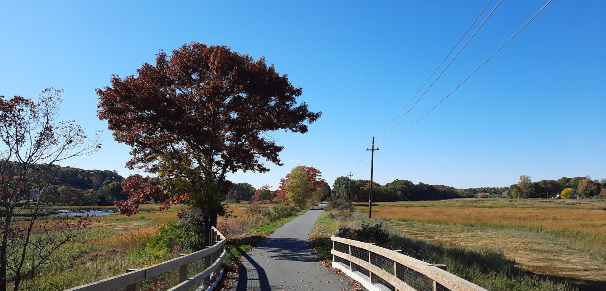
The Putnam River Trail offers a delightful journey along the Quinebaug River, where you'll discover a blend of natural beauty and local history. The path is predominantly paved and flat, winding through peaceful woodlands and past revitalized mills. You'll enjoy stunning vistas of the water, including the impressive Cargill Falls, and cross a charming 200-foot pedestrian bridge. This easy 3.5-mile (5.7 km) hike, with only 60 feet (18 metres) of elevation gain, takes about 1 hour and 27 minutes, making it ideal for a relaxed outing.
Planning your visit to the Putnam River Trail is straightforward, as it's well-integrated with the town of Putnam. You'll find ample parking and amenities like picnic tables and a dog park right along the route. The trail's accessibility and proximity to downtown shops and restaurants mean you can easily combine your walk with other activities. It's a great option for families and beginners, offering a gentle experience without the need for special permits or challenging terrain.
Beyond its scenic appeal, the Putnam River Trail is rich in historical significance, with interpretive signs detailing Putnam's railroad history, textile mills, and the Great Flood of 1955. It's also part of the extensive East Coast Greenway, highlighting its importance as a regional connector. The trail's unique blend of natural features, historical context, and artistic installations makes it a standout choice for a leisurely stroll in Connecticut.
1
hikers
4.47km
01:13
60m
60m
The Ben Utter and River Trail Loop offers a delightful journey through classic New England woodland, following the picturesque Falls River. You'll wander among towering White Pines and Red Maples, with the path occasionally rocky but generally easy underfoot. The star attraction is Stepstone Falls, a captivating series of cascades over rocky steps, creating beautiful pools that sparkle in the sunlight.
This easy 2.8-mile (4.5 km) loop, with a gentle 207 feet (63 metres) of elevation gain, is perfect for a quick escape, taking about 1 hour and 12 minutes to complete. It's a popular choice for families and those with leashed dogs, offering an accessible way to enjoy nature. Parking is available at the trailhead within the Arcadia Management Area, making it a convenient destination for a scenic hike.
Beyond the natural beauty, the trail also offers glimpses into the area's past, with remnants of old mill foundations and a restored Civilian Conservation Corps Picnic Pavilion. Keep an eye out for diverse plant life, especially wildflowers in the spring, and opportunities for birdwatching. This trail provides a rewarding experience for anyone seeking a tranquil and historically rich outdoor adventure in Rhode Island.
7.20km
01:57
100m
100m
The Barden Reservoir Loop in Rhode Island is a charming and accessible hike, perfect for a leisurely outing. You'll wander along quiet country roads, both dirt and paved, passing through woodlands and alongside historic stone walls. The highlight is undoubtedly the Barden Reservoir itself, offering serene views, and a picturesque man-made waterfall cascading over boulders.
This easy 4.5-mile (7.2 km) loop involves a gentle 322 feet (98 metres) of elevation gain and takes about 1 hour and 57 minutes. It's a great option for families and beginners, with parking available at the trailhead. Since it's part of a public water supply, direct reservoir access is restricted, but the perimeter roads provide lovely views.
Beyond the scenic reservoir, the route also passes several historic cemeteries, including one with Civil War Veterans, adding a layer of historical interest to your walk. The trail's road-based nature makes it a very accessible option for a casual stroll, offering a peaceful escape into nature without strenuous effort.
Get access to more routes and recommendations from other explorers.
Sign up for free
Already have an account?
Our route recommendations are based on thousands of hikes, rides, and runs completed by other people on komoot.
Start today with a free account
Your next adventure awaits.
Login or Signup
Popular around Northeastern Connecticut Planning Region

Other adventures in Northeastern Connecticut Planning Region

Tips from the Community

The Putnam River Trail is a 1.8 mile long paved trail. It is part of the East Coast Greenway Trail. As the name suggests, it follows along the Putnam River and gives you great views of the water.
0
0

The Kate Randall Road is a quiet gravel and dirt road that runs north-south from the Central Pike, just west of the Barden Reservoir. This is a great place for a quiet stroll around the lake.
0
0
From this spot on the Central Pike (be aware of cars!) you get great views on both sides of the Barden Reservoir. Just west of the bridge on a small peninsula historic cemetery where Civil War Veterans are buried. Interestingly, there are a few more historic cemeteries near by along Ponagansett Road, which part of a pleasant walking loop on a mix of gravel and dirt, and paved roads around the reservoir.
0
0

At Cargill Falls, you'll find a dam and cascades right in the heart of the city. From the Pomfret Bridge on US-44, you can see the wide dam and several flowing channels clearly. An island splits the Quinebaug River and the dam, creating a beautiful display of cascades below as the river rushes to reconnect.
0
0

Stepstone Falls is a collection of cascades formed by slabs that create "steps" in the riverbed. The falls are located on the Wood River, which runs seasonally drier in the peak of the summer. The most popular path accessing the falls is the Ben Utter Trail, but there are a few different paths that lead to the viewing area.
0
0
Stepstone Falls is a collection of cascades formed by slabs that create "steps" in the riverbed. The falls are located on the Wood River, which runs seasonally drier in the peak of the summer. The most popular path accessing the falls is the Ben Utter Trail, but there are a few different paths that lead to the viewing area.
0
0
Frequently Asked Questions
How many waterfall hiking trails are available in Northeastern Connecticut Planning Region?
The Northeastern Connecticut Planning Region offers a selection of 7 dedicated waterfall hiking trails. These routes traverse a diverse landscape of rolling hills and woodlands, providing various opportunities to experience the region's natural beauty.
What is the best time of year to visit the waterfalls in Northeastern Connecticut?
The waterfalls in Northeastern Connecticut are often at their most impressive during spring, following snowmelt and heavy rains, or after significant rainfall in other seasons. Autumn also offers beautiful scenery with fall foliage, though water flow might be reduced. Winter can provide a unique, frozen landscape, but trails may be icy.
Are there easy waterfall hikes suitable for families or beginners?
Yes, there are several easy waterfall hikes perfect for families and beginners. For instance, the Bailey's Ravine at Ayer Gap is an easy 1.4-mile trail that explores a natural ravine with accessible waterfall views. Another gentle option is the Putnam River Trail, an easy 3.5-mile route alongside the river, offering potential waterfall sightings.
Can I bring my dog on the waterfall trails in Northeastern Connecticut?
Many trails in Northeastern Connecticut's state forests and parks are dog-friendly, but it's always best to check specific park regulations before heading out. Generally, dogs are welcome on leash, allowing you and your canine companion to enjoy the scenic waterfall hikes together.
Are there any circular waterfall hikes in the region?
Yes, you can find circular routes that feature waterfalls. A notable option is the Fairy, Dam, Waterfalls, River Ridge, and Beaver Trail Loop, a moderate 4.7-mile path that explicitly highlights waterfalls and follows a scenic river ridge.
What kind of terrain should I expect on waterfall hikes in Northeastern Connecticut?
The terrain in Northeastern Connecticut is varied, characterized by rolling hills, dense woodlands, and extensive state forests. You can expect a mix of gentle paths, including riverside strolls, as well as more rugged forest hikes. Trails often follow rivers and meander around picturesque lakes, leading to various waterfalls and cascades.
What other natural features or landmarks can I see near the waterfall trails?
Beyond the waterfalls, the region offers diverse natural features and landmarks. You might encounter extensive state forests like James L. Goodwin State Forest, scenic rivers such as the Natchaug River, and picturesque lakes like Pine Acres Lake. Other points of interest include the West Thompson Dam and the Acme Pond Waterfall.
Which state parks are known for waterfall hikes in Northeastern Connecticut?
Several state parks and forests in the region offer excellent opportunities for waterfall hikes. Mashamoquet Brook State Park is known for its varied terrain and features, while James L. Goodwin State Forest and Natchaug State Forest also contain extensive trail systems that may lead to cascades and waterfalls within their woodlands.
How do other hikers rate the waterfall trails in Northeastern Connecticut?
The waterfall trails in Northeastern Connecticut are highly regarded by the komoot community, boasting an average rating of 4.4 stars from over 20 reviews. More than 300 hikers have explored these varied routes, often praising the scenic beauty and diverse natural features.
Is public transport available to reach waterfall hiking areas, or is parking generally available?
While public transport options to specific trailheads in the more rural Northeastern Connecticut Planning Region may be limited, parking is generally available at state parks and designated trail access points. It's advisable to check specific trail information for parking details before your visit.
Are there any longer or more challenging waterfall hikes for experienced hikers?
For those seeking a more extended experience, the Fairy, Dam, Waterfalls, River Ridge, and Beaver Trail Loop is a moderate 4.7-mile trail that offers a good challenge with explicit waterfall features and scenic river views. While there are no 'difficult' rated trails in this specific guide, the moderate options provide a satisfying longer hike.
Are there any trails that combine waterfalls with lake views?
Yes, the region's landscape often combines waterways and lakes. While not explicitly listed as a waterfall trail in the guide, the James L. Goodwin State Forest, which features Pine Acres Lake, is known for trails that offer beautiful lake views and varied forest terrain, where you might discover smaller cascades or seasonal waterfalls.
Most popular routes in Northeastern Connecticut Planning Region
Most popular attractions in Northeastern Connecticut Planning Region

Get inspired with the komoot mobile app


Didn’t find what you were looking for?
Check out more Hikes throughout Northeastern Connecticut Planning Region below and find the perfect route in your destination.
Explore more
Browse the best Hikes in other regions.
