The best waterfall hikes and walks around Bütgenbacher Lake
4.5
(13037)
53,388
hikers
22
hikes
Waterfall hiking trails around Bütgenbacher Lake traverse a landscape characterized by dense forests, flowing rivers, and the prominent Bütgenbacher Lake itself. The region features varied terrain, including gentle riverside paths and more challenging ascents, often leading to scenic viewpoints and natural water features. This area is known for its natural beauty, with numerous streams and cascades contributing to its appeal for outdoor activities.
Best waterfall hiking trails around Bütgenbacher Lake
- The most popular waterfall hiking route is Lake Robertville –…
Last updated: September 29, 2026
5.0
(1)
9
hikers
26.6km
07:20
430m
430m
Hard hike. Very good fitness required. Sure-footedness, sturdy shoes and alpine experience required.
5.0
(3)
16
hikers
16.5km
04:29
230m
230m
Hard hike. Good fitness required. Sure-footedness, sturdy shoes and alpine experience required.

4.7
(48)
150
hikers
16.5km
04:42
370m
370m
Moderate hike. Good fitness required. Mostly accessible paths. Sure-footedness required.
4.8
(15)
71
hikers
11.7km
03:11
160m
160m
Moderate hike. Good fitness required. Mostly accessible paths. Sure-footedness required.
5.0
(4)
17
hikers
28.3km
07:41
400m
400m
Hard hike. Very good fitness required. Easily-accessible paths. Suitable for all skill levels.
Get access to more routes and recommendations from other explorers.
Already have an account?
Our route recommendations are based on thousands of hikes, rides, and runs completed by other people on komoot.
Start today with a free account
Your next adventure awaits.
Popular around Bütgenbacher Lake
Other adventures around Bütgenbacher Lake

Tips from the Community

Steiler, naturbelassener Abstieg am Wasserfall über einen schmalen, steinigen und bei Nässe rutschigen Pfad. Etwas Trittsicherheit ist hier erforderlich.
13
0

The path is already worth it because of the great view of the castle.
0
0

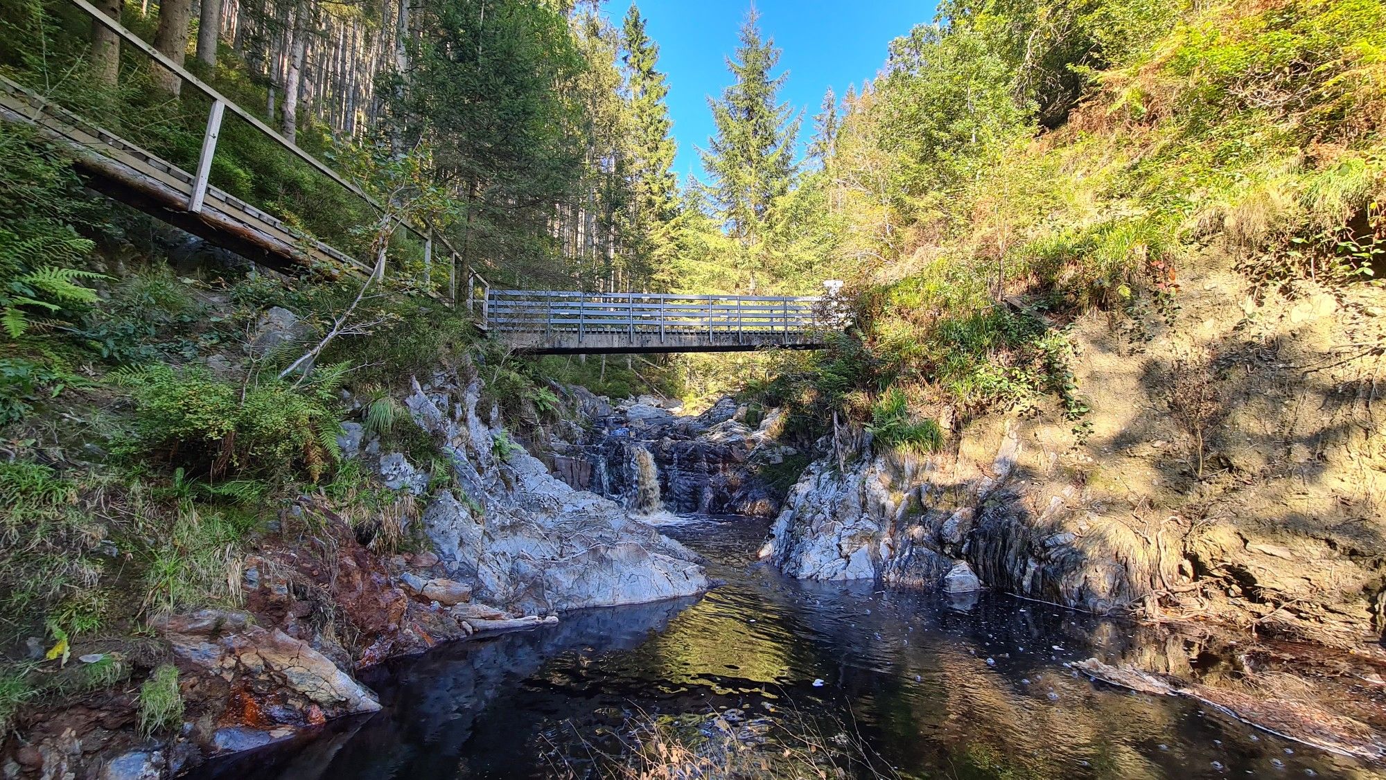
Between roots and rocky blocks, the ocher-colored Trôs Marets stream.
0
0

1 challenging path in the forest area
1
0

The Trôs Marets is a tributary of the Warche River, approximately 5 kilometers long. It's a popular destination for hikers. This route takes you 14 km through the High Fens and the Trôs Marets Valley. You'll walk through a beautiful nature reserve, surrounded by rugged cliffs, dense forests, and a babbling mountain stream with beautiful waterfalls. A hike through the Trôs Marets Canyon is highly recommended. You can, of course, start anywhere using the Komoot route planner. Most hikers start the route at Auberge du Moulin or the Ferme Libert hotel/restaurant. After the hike, there's an opportunity to enjoy a snack and a drink. The Auberge du Moulin is particularly charming and open every day except Christmas Day. Important: Sturdy hiking boots and gloves are essential for holding onto the steel cables, which are not always well-maintained.
3
0

About the beautiful Bayehon
0
0

The Trôs-Maret, a true mountain stream, springs from these heaths and moorlands. It will be your constant companion for the next few kilometers.
4
0
Frequently Asked Questions
How many waterfall hiking trails are there around Bütgenbacher Lake?
There are over 20 waterfall hiking trails around Bütgenbacher Lake, offering a variety of options for different skill levels and preferences. The region is known for its dense forests, flowing rivers, and the prominent Bütgenbacher Lake, all contributing to scenic routes.
Are there easy waterfall hikes suitable for beginners or families?
Yes, the Bütgenbacher Lake area offers several easy waterfall hikes. There are 4 routes specifically rated as easy, perfect for beginners or families looking for a more relaxed experience. These trails often feature gentle paths along rivers and through woodlands.
What kind of terrain can I expect on waterfall hikes in this region?
The terrain around Bütgenbacher Lake is varied, ranging from gentle riverside paths to more challenging ascents. You'll encounter dense woodlands, open landscapes, and paths that lead to scenic viewpoints and natural water features, including the waterfalls themselves. Some trails might be muddy, especially after rain.
What are some notable natural attractions or landmarks along these trails?
Many waterfall hikes in the region offer views of significant natural and historical landmarks. You might encounter the impressive Bütgenbach Reservoir, the scenic Warche River, or even catch glimpses of Reinhardstein Castle on some routes. The Wooden Boardwalk Through the Bütgenbach Moor is another unique highlight.
Are there any circular waterfall walks around Bütgenbacher Lake?
Yes, many of the waterfall hikes in the Bütgenbacher Lake area are designed as circular routes, allowing you to start and end at the same point. For example, the View of Reinhardstein Castle – Warche Rapids loop from Robertville is a moderate 16.7 km circular trail that takes you past scenic points and the Warche Rapids.
When is the best time of year to go waterfall hiking in Bütgenbacher Lake?
Waterfall hikes around Bütgenbacher Lake are enjoyable year-round, but each season offers a different experience. Spring (after snowmelt) and autumn (with vibrant foliage) are particularly popular for their scenic beauty and often higher water levels in the waterfalls. Summer provides pleasant temperatures for hiking, while winter can transform the landscape into a serene, frosted wonderland, though some paths might be slippery.
What do other hikers enjoy most about the waterfall trails in Bütgenbacher Lake?
The area is highly rated by the komoot community, with an average score of 4.6 stars from over 4,500 reviews. Reviewers often praise the quiet woodlands, the well-marked paths, and the diverse natural beauty, especially the views of the lakes and the sound of the flowing water at the waterfalls.
Are dogs allowed on the waterfall hiking trails?
Generally, dogs are welcome on most hiking trails around Bütgenbacher Lake, provided they are kept on a leash. It's always a good idea to check specific trail regulations or local signage, especially in nature reserves, to ensure a pleasant experience for everyone.
Are there any waterfall hikes that are particularly challenging?
Yes, for experienced hikers seeking a challenge, there are 10 routes rated as difficult. These trails often feature longer distances and more significant elevation changes. An example is the Lake Robertville – View of Reinhardstein Castle loop from Waimes, a 16.5 km route with notable ascents.
Are there places to eat or cafes near the waterfall hiking routes?
The villages and towns surrounding Bütgenbacher Lake, such as Waimes and Robertville, offer various dining options, including cafes and restaurants. Many routes start or pass near these settlements, making it convenient to find refreshments before or after your hike.
What should I wear or bring for a waterfall hike in this region?
Given the varied terrain and potential for changing weather, it's advisable to wear sturdy, waterproof hiking boots. Layered clothing is recommended, as conditions can change quickly. Bringing water, snacks, and a map or GPS device is also essential. Depending on the season, rain gear or sun protection might be necessary.
Can I reach the trailheads for waterfall hikes by public transport?
While some trailheads might be accessible via local bus services, public transport options in the more rural areas around Bütgenbacher Lake can be limited. It's often more convenient to reach many starting points by car. We recommend checking local bus schedules in advance if you plan to rely on public transport.
Most popular routes around Bütgenbacher Lake
Most popular attractions around Bütgenbacher Lake

Get inspired with the komoot mobile app


Explore more
Browse the best Hikes in other regions.
