The best waterfall hikes and walks in Vall Del Madriu-Perafita-Claror
4.5
(2039)
17,379
hikers
28
hikes
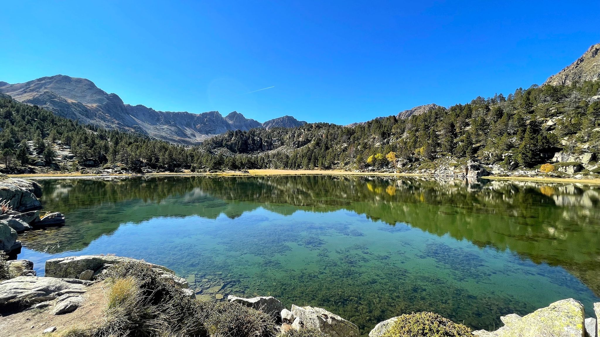
Waterfall hiking trails in Vall Del Madriu-Perafita-Claror traverse a UNESCO World Heritage site characterized by glacial valleys, high-altitude lakes, and dense forests. The landscape features rugged peaks and a network of streams and rivers that feed numerous waterfalls. This area offers a diverse range of terrain, from gentle paths along valley floors to more challenging ascents through rocky sections.
Best waterfall hiking trails in Vall Del Madriu-Perafita-Claror
- The most popular waterfall hiking route is Lakes of Pera and Peaks of Sirvent, Perafita and Monturull, a 6.4 miles (10.4 km) trail that takes 3 hours 57 minutes to complete. This moderate route offers views of alpine lakes and mountain peaks.
- Another top favourite among local hikers is Estany Gran de la Pera – Estany de la Pera loop from Caseta forestal de la Font de les Pollineres, a moderate 3.1 miles (5.0 km) path. This loop provides access to two significant high-altitude lakes.
- Local hikers also love the Collet de Sant Vicenç – Estany Gran de la Pera loop from les Pollineres, a 5.8 miles (9.4 km) trail leading through mountain passes and past glacial lakes, often completed in about 3 hours 38 minutes.
- Hiking in Vall Del Madriu-Perafita-Claror is defined by glacial valleys, high mountain lakes, and forested slopes. The network offers options for easy waterfall hikes for beginners as well as more difficult trails for experienced hikers.
- The routes in Vall Del Madriu-Perafita-Claror are highly rated by the komoot community with an average score of 4.5 stars from more than 1,600 reviews. More than 14,500 hikers have used komoot to explore Vall Del Madriu-Perafita-Claror's varied terrain.
Last updated: July 7, 2026
5.0
(4)
31
hikers
10.4km
03:57
680m
680m
Moderate hike. Good fitness required. Mostly accessible paths. Sure-footedness required.
8
hikers
Moderate hike. Great for any fitness level. Mostly accessible paths. Sure-footedness required.

Sign up for free
20
hikers
9.42km
03:39
580m
580m
Moderate hike. Good fitness required. Mostly accessible paths. Sure-footedness required.
18
hikers
7.85km
02:55
430m
430m
Moderate hike. Good fitness required. Mostly accessible paths. Sure-footedness required.
5
hikers
17.6km
06:50
890m
890m
Hard hike. Very good fitness required. Mostly accessible paths. Sure-footedness required.
Get access to more routes and recommendations from other explorers.
Sign up for free
Already have an account?
Our route recommendations are based on thousands of hikes, rides, and runs completed by other people on komoot.
Start today with a free account
Your next adventure awaits.
Login or Signup
Popular around Vall Del Madriu-Perafita-Claror

Other adventures in Vall Del Madriu-Perafita-Claror


Tips from the Community

Access by private vehicle to Les Pollineres is restricted all year round via both the Lles and Aransa tracks. In Summer (August to early September): A shuttle bus operates from Fornell and the Cap del Rec refuge. Rest of the year: Motorized access is limited to authorized residents. You will have to leave your car at the Nordic ski stations (Lles or Aransa) and walk, which increases the duration and elevation gain of the route. The ideal way is to go up by mountain bike or gravel bike from Martinet.
0
0
La Font de les Pollineres is a recreational area and mountain refuge located at an altitude of 2,100 meters in Lles de Cerdanya (Lleida). It is the main and most accessible starting point for the popular family excursion to Estanys de la Pera, a route of about 4 km (round trip) and 211 m of elevation gain.
0
0

One of the most magical places in the eastern Pyrenees, surrounded by alpine meadows, fir trees, and the two lakes that give it its name. At almost 2,350 meters above sea level, the refuge offers food, accommodation, and postcard-perfect views. It's a gateway to the Perafita pass and the cross-border routes with Andorra. By mountain bike, the climb from Cap del Rec is demanding but spectacular: a wide track, rocky sections, and sustained gradients. The best approach is to take it easy, maintain a steady cadence, and savor the final reward: the reflection of the mountains in the lakes, with the sound of the wind and cows as your only companions.
0
0

The views of the northern slope of the Cadí mountain range, although distant, are impressive.
0
0

Rising at an altitude of 2,357 m, the Estanys de la Pera shelter is located on the southern slope of the port of Perafita, next to the Estanys de la Pera. The facility, inaugurated in 1957, is a crossing point for the GR 11.10, one of the variants of the trans-Pyrenean trail par excellence, which connects Cerdanya with the Principality of Andorra. The building follows the same architectural pattern as the Sant Jordi and Serra d'Ensija refuges, with an entrance door for the three facilities. It is an ideal place for hiking in the summer and downhill skiing and snowshoeing in the winter, with mountain profiles that are mostly quite rounded, ideal for practicing 'this mountain discipline. Summer is an ideal time to go there with children, as access is quite quick and easy. SERVICES AT THE SHELTER: - Shower with hot water - Biomass stove - Internet (with usage restrictions) - Blankets - Food and drinks - toilet MATERIAL IN THE ABSENCE OF THE GUARD: 4 seats, 2 mattresses, 1 table, 1 bench, 1 wood stove and firewood. light
0
0
The Tossal Bovinar is one of the peaks we find on the ridge section that, presided over by the Tossa Plana de Lles, separates Cerdanya from the Riu Madriu valley, in Andorra. Without being the highest or the most prominent in the area, due to its central location it is an outstanding peak with beautiful perspectives. It is a mountain with two very different sides. To the north, a large vertical wall, striated by dihedrals and ridges, drops straight down to the bare quarries that flank the wooded bottom of the Madriu valley. On the other hand, to the south, the slope undulates in wide ridges and open ravines, and slides gently towards Cerdanya on slopes of grass and stony, first, and then pine forests, until the villages and fields that occupy the lap of the mountain Above all, the culmination is a flat extension from which two peaks protrude: the NW elevation (2835 m) is slightly lower than the SE summit (2842 m). Prominence: 156m This peak is included in the list of the 100 peaks of the FEEC
0
0
Cross-border mountain pass that connects Cerdanya with Andorra. From this pass we can follow the ridge of the Pic de Perafita and Monturull towards the SW, the ridge of the Serra de Sirvent to the Tossa Plana de Lles towards the E. or, go down towards the Vall de Madriu - Perafita - Claror, already on the Andorran side, towards the NW.
0
0
At an altitude of 2,357 m, the Estanys de la Pera refuge is located on the southern slope of the Perafita pass, next to the Pera lakes. The facility, inaugurated in 1957, is a crossing point for the GR 11.10, one of the variants of the great trans-Pyrenean trail par excellence, which connects Cerdanya with the Principality of Andorra. The building follows the same architectural pattern as the Sant Jordi and Serra d’Ensija refuges, with one entrance for all three facilities. It is an ideal place for hiking in the summer and ski mountaineering and snowshoeing in the winter, with mostly quite rounded mountain profiles, ideal for practicing this mountain discipline. Summer is an ideal time to go there with children, as access is quite quick and easy. SERVICES AT THE SHELTER: - Shower with hot water - Biomass stove - Internet (with restrictions on use) - Blankets - Food and drinks - Toilet EQUIPMENT IN THE ABSENCE OF THE GUARD: 4 seats, 2 mattresses, 1 table, 1 bench, 1 wood stove and wood for a fire. Light.
1
0
Frequently Asked Questions
How many waterfall hiking trails are available in Vall Del Madriu-Perafita-Claror?
There are nearly 30 waterfall hiking trails in Vall Del Madriu-Perafita-Claror. These routes range in difficulty from easy to difficult, offering options for various skill levels.
Are there easy waterfall hikes suitable for beginners in Vall Del Madriu-Perafita-Claror?
Yes, Vall Del Madriu-Perafita-Claror offers 6 easy waterfall hikes perfect for beginners or those looking for a more relaxed experience. These trails typically feature gentler terrain and shorter distances, allowing you to enjoy the scenery without strenuous effort.
What is the best time of year to go waterfall hiking in Vall Del Madriu-Perafita-Claror?
The best time for waterfall hiking in Vall Del Madriu-Perafita-Claror is generally from late spring to early autumn (May to October). During this period, the snow has melted, ensuring trails are accessible and the waterfalls are at their most impressive due to snowmelt and seasonal rainfall. Summer offers pleasant temperatures for exploring the high-altitude landscapes.
Are there any family-friendly waterfall trails in Vall Del Madriu-Perafita-Claror?
Yes, several trails are suitable for families, especially the easier routes. While specific family-designated trails aren't listed, routes with shorter distances and less elevation gain are ideal. Always check the route details for elevation and terrain to ensure it's appropriate for all family members.
Can I bring my dog on waterfall hikes in Vall Del Madriu-Perafita-Claror?
Vall Del Madriu-Perafita-Claror is generally dog-friendly, but it's always best to check specific trail regulations. As a UNESCO World Heritage site, some areas might have restrictions to protect wildlife. Always keep your dog on a leash, especially in sensitive areas, and ensure they are well-behaved around other hikers and livestock.
Are there circular waterfall walks in Vall Del Madriu-Perafita-Claror?
Yes, there are several circular routes that allow you to experience the waterfalls and return to your starting point without retracing your steps. An example is the Estany de la Pera – Estany Gran de la Pera loop from les Pollineres, which offers a scenic journey through the landscape.
What kind of natural attractions can I see along the waterfall hiking trails?
Beyond the waterfalls themselves, the trails in Vall Del Madriu-Perafita-Claror lead through a stunning UNESCO World Heritage landscape. You can expect to see glacial valleys, high-altitude lakes like Estany de la Nou and Estany de l'Illa, dense forests, and rugged mountain peaks such as Pic dels Pessons.
What should I wear for waterfall hiking in Vall Del Madriu-Perafita-Claror?
Given the varied terrain and mountain environment, it's advisable to wear sturdy hiking boots with good grip, as trails can be rocky or wet near waterfalls. Layered clothing is recommended to adapt to changing weather conditions, and a waterproof jacket is essential. Don't forget sun protection, a hat, and plenty of water.
Are there any less crowded waterfall hikes for a more peaceful experience?
While popular routes can see more visitors, exploring some of the more challenging or longer trails, such as the Estany de Setut – Refugi del Pradell (2,100 m) loop from Solà dels Espinacals, can offer a more secluded experience. Early mornings or weekdays are also good times to avoid peak crowds on any trail.
What do other hikers enjoy most about hiking in Vall Del Madriu-Perafita-Claror?
The area is highly rated by the komoot community, with an average score of 4.5 stars from over 1,600 reviews. Hikers often praise the breathtaking natural beauty, the well-maintained trails, and the sense of immersion in a pristine mountain environment, especially the stunning glacial valleys and high-altitude lakes.
Are there opportunities for wild swimming near the waterfalls?
While the region features numerous lakes and streams, wild swimming near waterfalls can be dangerous due to strong currents and slippery rocks. However, some of the high-altitude lakes, like those found along routes such as the Estany de la Pera – Estany Gran de la Pera loop, may offer opportunities for a refreshing dip in designated or safe areas. Always exercise caution and assess conditions before entering the water.
Are there places to eat or get refreshments near the waterfall trails?
While the Vall Del Madriu-Perafita-Claror is a protected natural area, you might find mountain huts (refugis) along some longer routes, such as the Refugi de l'Illa, which often offer basic refreshments or meals. For more extensive options, you'll typically need to head to the nearby villages or towns outside the valley.
Most popular routes in Vall Del Madriu-Perafita-Claror
Most popular attractions in Vall Del Madriu-Perafita-Claror

Get inspired with the komoot mobile app


