The best waterfall hikes and walks around The Municipal District of Baltinglass
4.6
(3476)
20,965
hikers
29
hikes
Waterfall hiking trails around The Municipal District of Baltinglass are primarily found within the diverse landscapes of County Wicklow, including parts of the Wicklow Mountains National Park. The region features varied terrain, from river valleys carved by the River Slaney to woodlands like Tomnafinnoge Woods and the foothills of mountains such as Baltinglass Hill. This area provides a range of elevations and natural features, making it suitable for different hiking abilities.
Best waterfall hiking trails around The Municipal District of Baltinglass
- The most popular waterfall hiking route is Spinc and the White Route from Glendalough — Wicklow Mountains National Park, an 8.4 miles (13.6 km) moderate trail that takes about 4 hours 26 minutes to complete. This route offers views of the Glendalough valley and its cascades.
- Another top favourite among local hikers is Mullacor, Lugduff and the Spinc Route — Wicklow Mountains National Park, a difficult 9.5 miles (15.3 km) path. This trail traverses mountain ridges and offers expansive views of the surrounding Wicklow Mountains.
- Local hikers also love the Poulanass Waterfall – Lower Lake, Glendalough loop from Glendalough Round Tower, a 4.6 miles (7.4 km) trail leading through Glendalough's historic sites and natural features, often completed in about 2 hours 21 minutes.
- Hiking around The Municipal District of Baltinglass is defined by its woodlands, river valleys, and mountain foothills. The network of trails offers options for easy walks, moderate excursions, and more challenging mountain ascents.
- The routes in The Municipal District of Baltinglass are highly rated by the komoot community with an average score of 4.5 stars from more than 1,900 reviews. More than 11,500 hikers have used komoot to explore The Municipal District of Baltinglass's varied terrain.
Last updated: May 15, 2026
4.9
(755)
4,346
hikers
Moderate hike. Good fitness required. Mostly accessible paths. Sure-footedness required.
4.8
(43)
197
hikers
15.3km
05:42
630m
630m
Hard hike. Very good fitness required. Mostly accessible paths. Sure-footedness required.

Sign up for free
4.5
(32)
144
hikers
Moderate hike. Good fitness required. Mostly accessible paths. Sure-footedness required.
4.9
(13)
110
hikers
Moderate hike. Good fitness required. Mostly accessible paths. Sure-footedness required.
4.5
(20)
158
hikers
Easy hike. Great for any fitness level. Easily-accessible paths. Suitable for all skill levels.
Get access to more routes and recommendations from other explorers.
Sign up for free
Already have an account?
Our route recommendations are based on thousands of hikes, rides, and runs completed by other people on komoot.
Start today with a free account
Your next adventure awaits.
Login or Signup
Popular around The Municipal District of Baltinglass

Other adventures around The Municipal District of Baltinglass


Tips from the Community

For the loop, you need about half an hour.
0
0

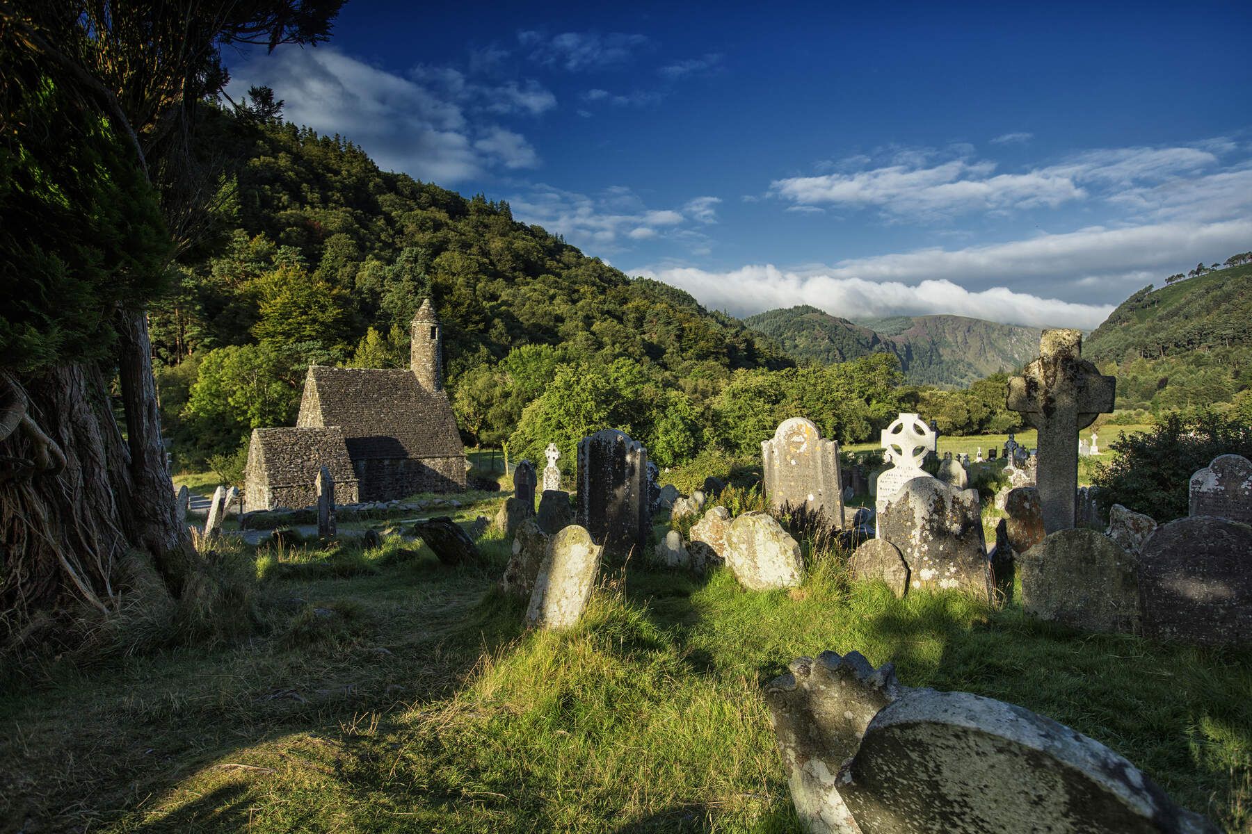
Very special place with old graves standing askew. The whole area breathes a distant mystical history.
0
0

A beautiful monastery complex that also includes an information center; the outdoor area is dreamy and mystical.
3
0

Beautiful panoramic view of the Upper Lake
0
0

great spot to have a break, recharge energy with a coffee and keep going.
0
0

The Irish saint St. Kevin (c. 498–618 AD), from a noble family in Leinster, was trained as a monk and then sought solitude – here in Glendalough as a hermit. Around 540, he withdrew to this remote valley to live in seclusion, asceticism, and prayer. Legends tell that he had deer, otters, and birds as friends. But as it sometimes happens: disciples soon followed him, and a monastic community was established (545 AD), which developed into one of the most important monasteries in Ireland (heyday: 10th–12th centuries). A 30-meter-high round tower (10th–11th centuries), the ruins of the cathedral (1214), a stone church (St. Kevin's Kitchen), and a house still remain. – Very pretty and mystical, the whole thing in the middle of the cemetery.
1
0

A beautiful cascade, Poulanass takes its name from the Irish Poll an Eas: hole of the waterfall. Runners on the Wicklow Way and the Spinc Trail will find it hard not to stop and admire the falls. However, in ascent, you might be glad of the chance to rest for a moment.
0
0

Easy walk along the miners' path, splendid view of the lake, little difference in altitude.
0
0
Frequently Asked Questions
How many waterfall hiking trails are there in The Municipal District of Baltinglass?
The Municipal District of Baltinglass and its surrounding areas offer a diverse range of hiking opportunities, with over 25 waterfall-focused trails available. These routes vary in difficulty, from easy strolls to more challenging mountain ascents, ensuring options for all experience levels.
Are there any easy waterfall hikes suitable for beginners or families?
Yes, there are several easy options perfect for beginners or families. The Glendalough Miners' Village – Poulanass Waterfall loop from Glendalough Round Tower is an easy 7 km (4.3 miles) trail that takes you past the beautiful Poulanass Waterfall and through historic sites without significant elevation gain.
Which waterfall trails offer a more challenging hiking experience?
For a more challenging adventure, consider the Mullacor, Lugduff and the Spinc Route — Wicklow Mountains National Park. This difficult 15.3 km (9.5 miles) path traverses mountain ridges, offering expansive views of the Wicklow Mountains and a demanding workout.
Are dogs allowed on the waterfall hiking trails?
Many trails in the Wicklow Mountains National Park area, including those near waterfalls, are dog-friendly, though regulations can vary. It's generally recommended to keep dogs on a leash to protect local wildlife and ensure the safety of other hikers. Always check specific trail guidelines before you go.
What is the best time of year to visit the waterfalls?
The waterfalls are particularly impressive after periods of heavy rainfall, typically during autumn and winter, when water flow is at its strongest. However, spring and summer offer milder weather, making for more comfortable hiking conditions, though the waterfalls might be less voluminous. Always be prepared for changeable weather in the Wicklow Mountains.
Are there any circular waterfall walks in the area?
Yes, many of the waterfall trails are designed as circular routes. A popular moderate option is the Poulanass Waterfall – Lower Lake, Glendalough loop from Glendalough Round Tower, which is about 7.4 km (4.6 miles) and takes you through Glendalough's historic sites and natural features, including the waterfall.
What other natural attractions can I see near the waterfall trails?
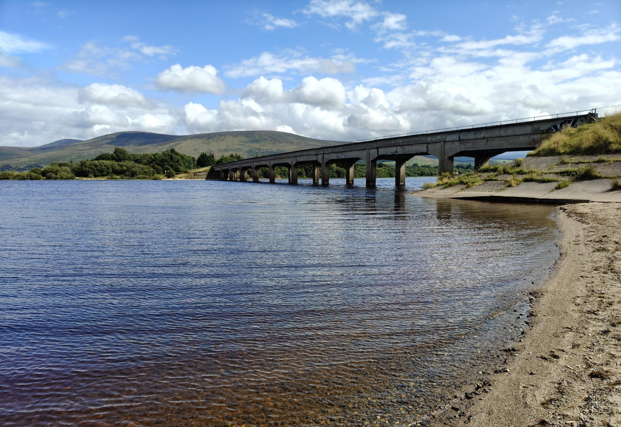
Beyond the waterfalls, the region is rich in natural beauty. You can explore areas like Blessington Lake or enjoy panoramic views from Wicklow Mountains viewpoint. The diverse landscapes include woodlands, river valleys, and mountain foothills, offering varied scenery along your hike.
Is there parking available for waterfall hikes?
Parking is generally available at popular trailheads, especially in areas like Glendalough, which serves as a starting point for several waterfall routes. However, these can fill up quickly during peak season or on weekends, so arriving early is advisable. Some car parks may have a fee.
Can I reach the waterfall trails using public transport?
While some areas, particularly Glendalough, are accessible by bus services from Dublin, public transport options can be limited for more remote trailheads. It's recommended to check local bus schedules and plan your journey in advance if relying on public transport.
What do other hikers enjoy most about the waterfall trails in this region?
The waterfall trails in The Municipal District of Baltinglass are highly rated by the komoot community, with an average score of 4.5 stars from over 1,900 reviews. Hikers frequently praise the stunning natural beauty, the well-maintained paths, and the rewarding views of the cascades and surrounding Wicklow Mountains.
Are there any specific trails that offer views of the Glenealo Valley?
Yes, the Poulanass Waterfall – View of Glenealo Valley loop from Glendalough Round Tower is a moderate 5.9 km (3.7 miles) trail that not only features the Poulanass Waterfall but also provides excellent views of the scenic Glenealo Valley.
Are there any historical sites near the waterfall trails?
Many trails, especially those around Glendalough, pass by significant historical sites. The area is home to ancient monastic ruins dating back to around 700 A.D. and a Stone Age passage grave on Baltinglass Hill. The Seefin Passage Tomb is another notable historical site accessible via hiking routes.
Most popular routes around The Municipal District of Baltinglass
Most popular attractions around The Municipal District of Baltinglass

Get inspired with the komoot mobile app


Explore more
Browse the best Hikes in other regions.
