The best MTB trails around Saint-Bonnet-De-Salers
3.9
(12)
223
riders
12
rides
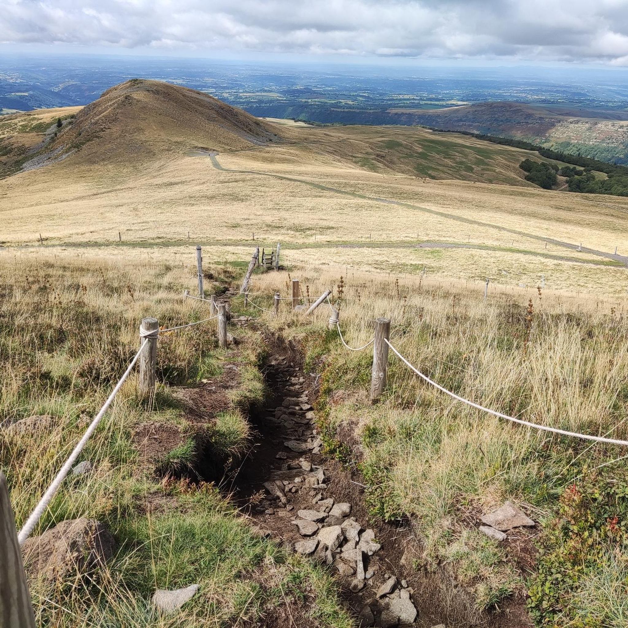
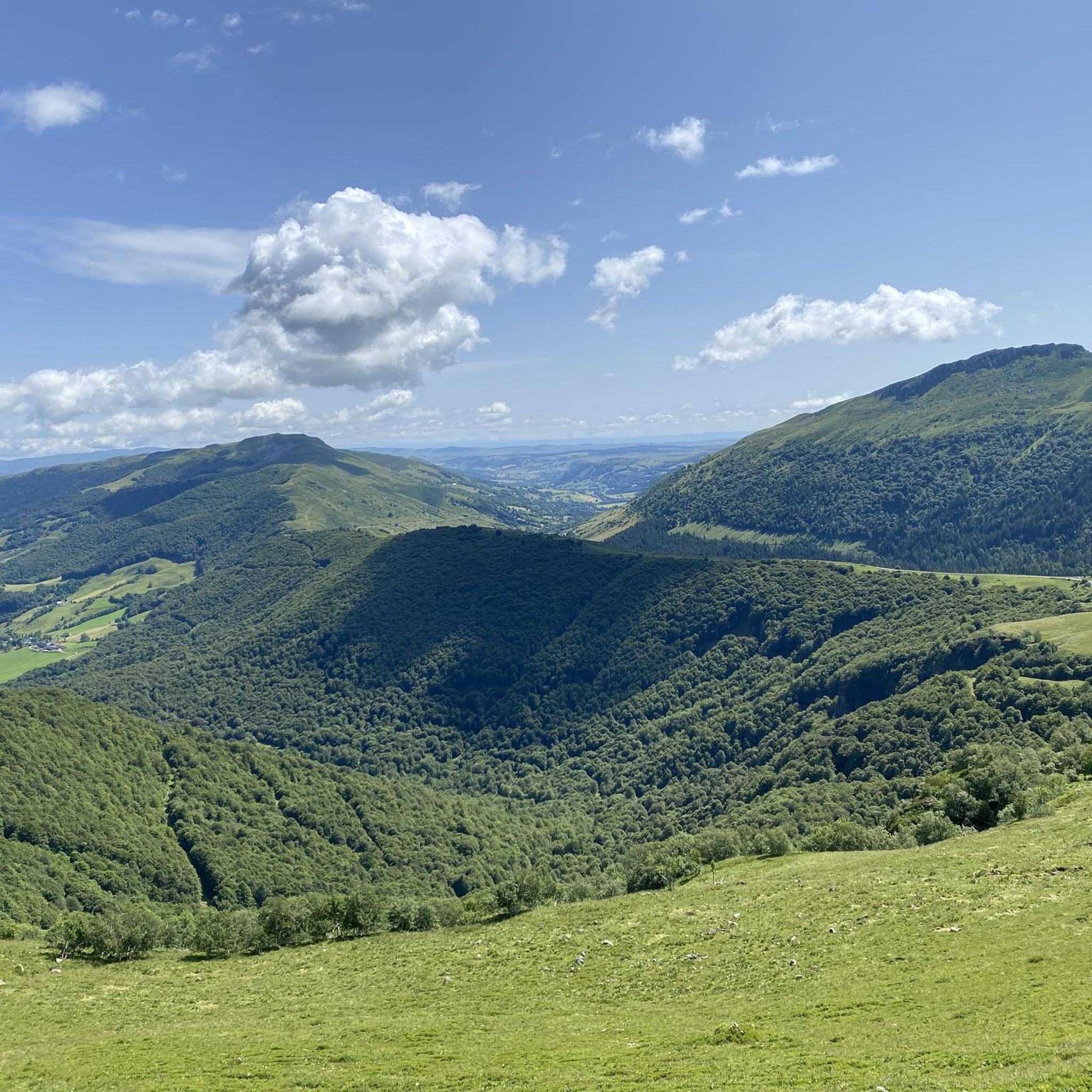
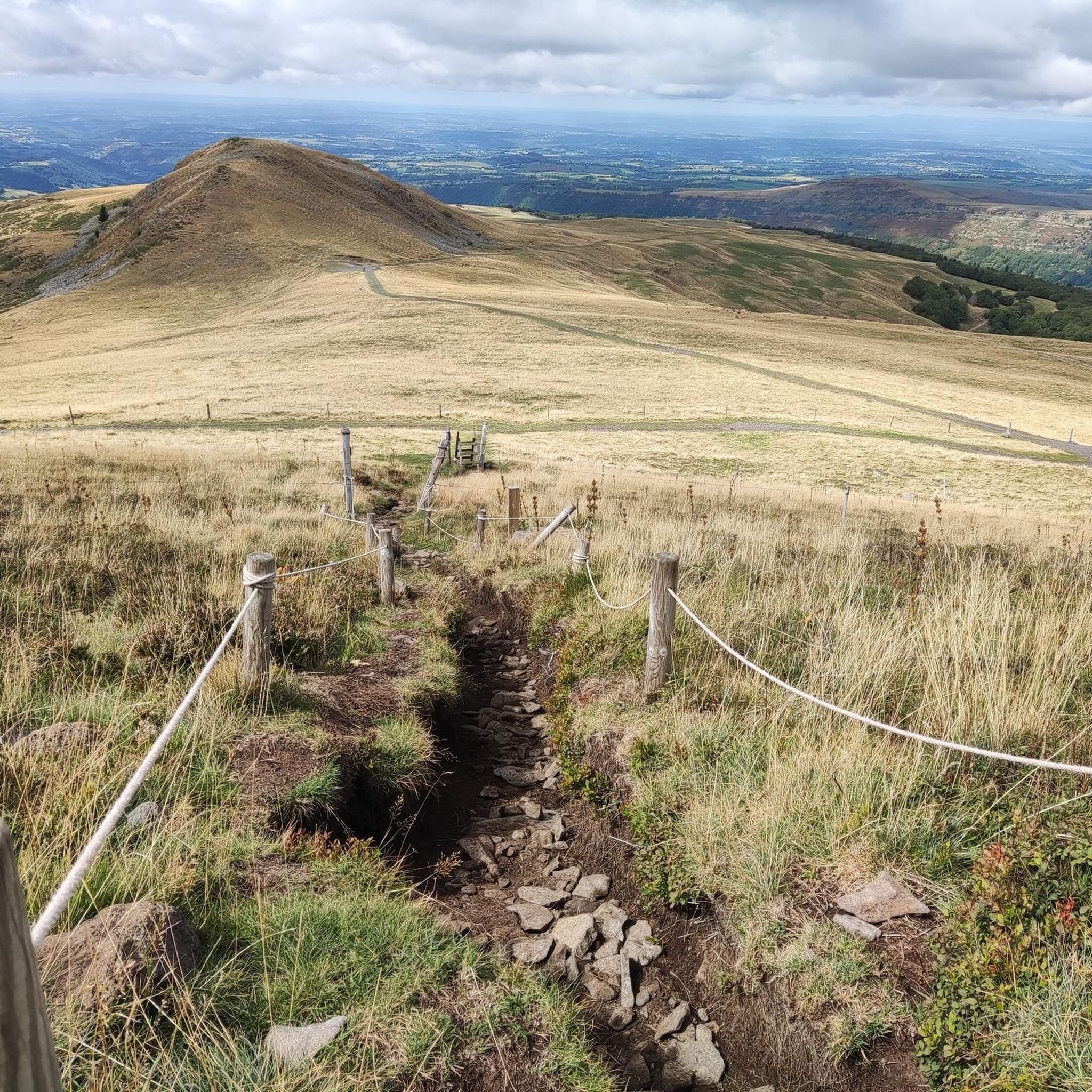
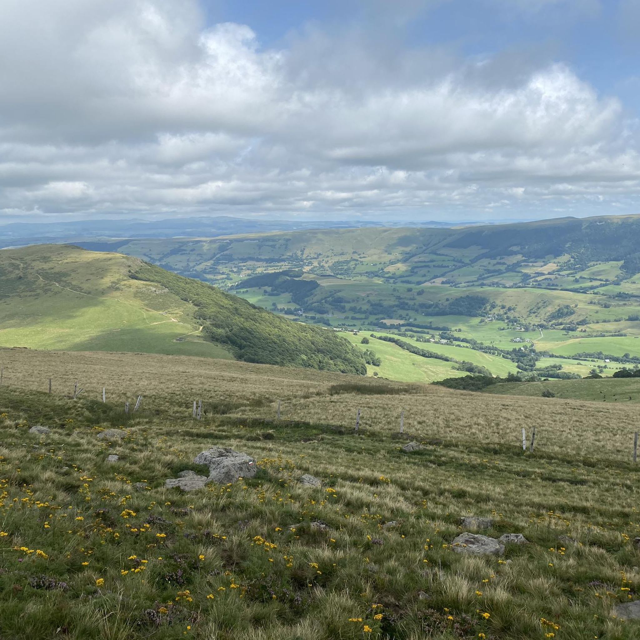
Mountain biking around Saint-Bonnet-De-Salers offers diverse terrain shaped by its volcanic origins in the Cantal department of France. The region features a landscape of mountains, plateaus, and valleys, providing varied routes for mountain bikers. Riders can explore lush pastures, wooded volcanic areas, and forests, with trails ranging from gentle paths to challenging ascents. This topography includes significant elevation changes and panoramic views of the Monts du Cantal.
Best mountain bike trails around Saint-Bonnet-De-Salers
- The most popular mountain bike trail is…
Last updated: June 24, 2026
4.5
(4)
124
riders
61.3km
06:14
1,830m
1,830m
Hard mountain bike ride. Very good fitness required. Advanced riding skills necessary.
35
riders
47.6km
04:02
1,060m
1,060m
Hard mountain bike ride. Very good fitness required. Suitable for all skill levels.

Sign up for free
10
riders
40.6km
03:29
930m
930m
Hard mountain bike ride. Very good fitness required. Suitable for all skill levels.
4.0
(2)
11
riders
23.6km
01:48
560m
560m
Moderate mountain bike ride. Good fitness required. Suitable for all skill levels.
3.0
(2)
12
riders
53.4km
04:00
1,250m
1,250m
Hard mountain bike ride. Very good fitness required. Suitable for all skill levels.
Get access to more routes and recommendations from other explorers.
Sign up for free
Already have an account?
Our route recommendations are based on thousands of hikes, rides, and runs completed by other people on komoot.
Start today with a free account
Your next adventure awaits.
Login or Signup
Tips from the Community

Either stressful or relaxed from Puy Mary.
0
0
Great scenery, beautiful road, beautiful views. Perfect for a downhill ride.
0
0

Quickly move through the landscape on the balcony.
1
0

It's steep but you absolutely have to do this pass because the landscape is magnificent.
1
0

Salers is a municipality in the Cantal department in the Auvergne-Rhône-Alpes region. The town is a completely preserved small town from the Renaissance period, with private and public buildings, city walls, defensive towers and a church. It was included in the association of the most beautiful villages in France. Despite its small population of around 300 inhabitants, the town is a historical, cultural and agricultural center in the sparsely populated mountain region of the Monts du Cantal. Source: https://de.wikipedia.org/wiki/Salers
3
0

From Salers, a pass with low percentages but with a magnificent view of the Santoire valley.
0
0

At an altitude of 1,588 meters, the Pas de Peyrol is located between the Puy Mary and the Puy de la Tourte. It is known to be the highest road pass in the Massif Central and is worth it, because the last few kilometers have high percentages. There you can admire Puy Mary which peaks at an altitude of 1,783 metres. It is one of the peaks of the Cantal mountains. It is easily recognizable with its pyramidal silhouette.
1
0
Frequently Asked Questions
What kind of terrain and difficulty can I expect on mountain bike trails around Saint-Bonnet-De-Salers?
The region's volcanic origins create a diverse landscape, offering trails that range from moderate to difficult. You'll encounter lush pastures, wooded volcanic areas, and forests, with significant elevation changes and panoramic views of the Monts du Cantal. Most of the trails are considered difficult, with 10 out of 13 routes falling into this category, while 3 are moderate.
Are there any easy mountain bike trails suitable for beginners in Saint-Bonnet-De-Salers?
While the area is known for its challenging routes, there are a few moderate options available. For example, the Route du Puy Mary – Neronne Pass loop from Salers is a moderate 31.8-mile (51.1 km) trail that offers a good balance of challenge and accessibility for those with some experience.
What natural features or landmarks can I see while mountain biking around Saint-Bonnet-De-Salers?
The trails offer breathtaking views of the Monts du Cantal and traverse varied volcanic landscapes. You can encounter iconic mountain passes like the Pas de Peyrol Pass (1,589 m) and the Neronne Pass. The routes also often pass by the charming settlement of Salers and offer glimpses of summits such as Puy Mary Summit and Puy Chavaroche.
When is the best time of year to go mountain biking in Saint-Bonnet-De-Salers?
The best time for mountain biking in Saint-Bonnet-De-Salers is generally from spring through autumn. During these seasons, the weather is more favorable, and the trails are typically in good condition. The region's high plateaus and mountains can experience harsh winter conditions, making some trails inaccessible or more challenging.
Are there any circular mountain bike routes in the area?
Yes, many of the mountain bike routes around Saint-Bonnet-De-Salers are designed as loops. For instance, the challenging Pastourelle loop from Navaste and the Neronne Pass – Néronne Pass loop from Anglards-de-Salers are popular circular options, allowing you to start and finish at the same point.
What do other mountain bikers enjoy the most about mountain biking in Saint-Bonnet-De-Salers?
The area is highly rated by the komoot community, with an average score of 4.0 stars from over 10 reviews. Reviewers often praise the diverse volcanic landscapes, the challenging ascents, and the rewarding panoramic views of the Monts du Cantal.
Are there any mountain bike trails that pass by waterfalls?
While specific routes in our data don't explicitly mention waterfalls, the region of Saint-Bonnet-De-Salers is known for picturesque waterfalls such as the Cascade de Liadouze, Cascade de Salins, and the Biaguin Waterfall. It's worth checking local maps or tourist information for trails that might incorporate these natural features.
Is parking available for mountain bikers in Saint-Bonnet-De-Salers?
Yes, parking is generally available in and around Saint-Bonnet-De-Salers and at common starting points for trails. Many routes, like the Salers / Puy Mary loop from Saint-Paul-de-Salers, start from villages or designated parking areas, making access convenient.
Can I bring my dog on the mountain bike trails?
Regulations regarding dogs on trails can vary. While many natural areas in France are dog-friendly, it's always best to check local signage or with the regional tourist office (e.g., Salers Tourisme) for specific rules, especially concerning nature reserves or areas with livestock like the famous Salers cattle.
Are there any family-friendly mountain bike trails in the Saint-Bonnet-De-Salers area?
The majority of trails listed are rated as difficult, indicating they are more suited for experienced riders. However, the region does offer a network of trails for various skill levels. For family-friendly options, look for shorter, less steep paths, or consider exploring the more gentle sections of the moderate routes. Always check the route details for elevation and technical difficulty before heading out with children.
Do I need a permit to mountain bike in the Cantal department?
Generally, you do not need a specific permit for mountain biking on public trails in the Cantal department. However, it's always important to respect private property, follow local regulations, and stay on marked trails to protect the environment and livestock. For specific details, you can consult local tourism resources like Hautes Terres Tourisme.
How long are the mountain bike trails near Saint-Bonnet-De-Salers?
The mountain bike trails in this area vary significantly in length. For example, the Pastourelle loop from Navaste is a substantial 35.4 miles (57.0 km) route, while others like the Pastourelle – Salers / Puy Mary loop from Fontanges cover 26.1 miles (41.9 km). You'll find options ranging from around 25 miles up to over 35 miles, typically requiring several hours to complete.
Most popular routes around Saint-Bonnet-De-Salers
Most popular attractions around Saint-Bonnet-De-Salers

Get inspired with the komoot mobile app


Explore more
Browse the best MTB trails in other regions.
