The best mountain hikes around Saint-Jean-De-Belleville
4.7
(9)
40
hikers
4
hikes
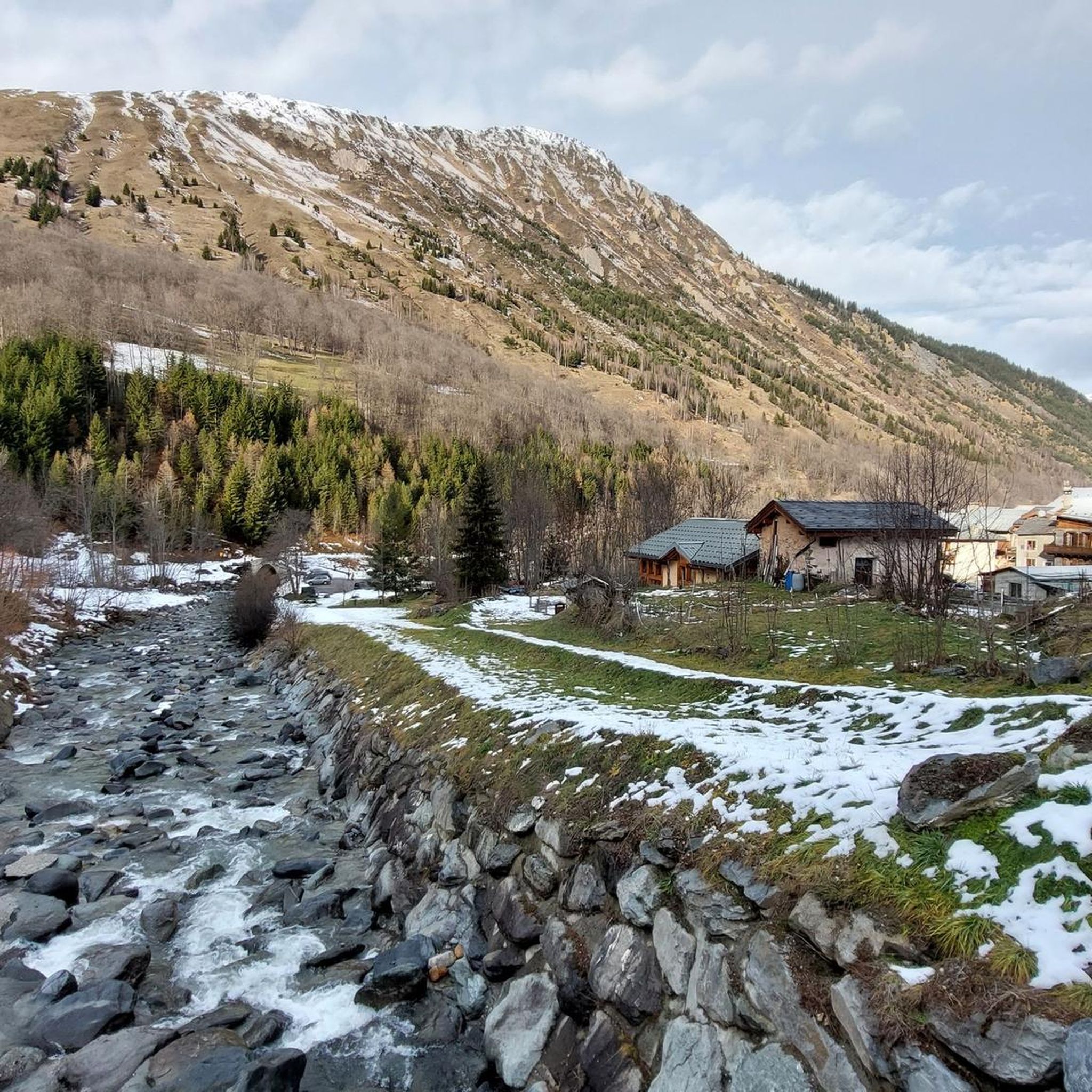
Mountaineering routes around Saint-Jean-De-Belleville traverse the authentic and wild alpine environment of the Belleville Valley in Savoie, France. The region features diverse landscapes, including dense forests, expansive alpine pastures, and dramatic rocky slopes. Prominent summits like Le Cheval Noir (2,832m) and Crève-Tête offer challenging ascents and panoramic views. Untouched valleys such as Nant Brun, Varlossière, and Encombres provide a natural setting for exploration.
Best mountaineering routes around Saint-Jean-De-Belleville
- The most popular mountaineering route is Lake Tuéda – Refuge du Saut loop from Châtelet, a 8.6 miles (13.8 km) trail that takes 4 hours 58 minutes to complete. This moderate route offers views of alpine lakes and mountain refuges.
- Another top favourite among local mountaineers is Mont Jovet – Col du Jovet loop from Notre-Dame-du-Pré, a difficult 14.3 miles (23.0 km) path. This route features significant elevation gain and expansive mountain vistas.
- Local mountaineers also love the White Lake – Blue Lake loop from Saint-François-Longchamp 1650, a 8.7 miles (14.1 km) trail leading through high-altitude terrain, often completed in about 6 hours 17 minutes.
- Mountaineering around Saint-Jean-De-Belleville is defined by prominent summits, wild valleys, and high-altitude passes. The network offers options for various ability levels, from moderate ascents to difficult, challenging climbs.
- The routes in Saint-Jean-De-Belleville are highly rated by the komoot community with an average score of 4.8 stars from 7 reviews. More than 30 mountaineers have used komoot to explore Saint-Jean-De-Belleville's varied terrain.
Last updated: July 6, 2026
5.0
(2)
13
hikers
13.8km
04:59
450m
450m
Moderate mountaineering route. Good fitness required. Mostly accessible paths. Sure-footedness required.
5.0
(1)
10
hikers
23.1km
09:08
1,440m
1,440m
Hard mountaineering route. Very good fitness required. Mostly accessible paths. Sure-footedness required.

Sign up for free
5.0
(1)
7
hikers
14.4km
06:23
1,180m
1,180m
Hard mountaineering route. Very good fitness required. Mostly accessible paths. Sure-footedness required.
4.3
(3)
4
hikers
10.8km
03:58
620m
620m
Moderate mountaineering route. Good fitness required. Mostly accessible paths. Sure-footedness required.
4.0
(1)
3
hikers
9.78km
03:33
530m
530m
Moderate mountaineering route. Good fitness required. Mostly accessible paths. Sure-footedness required.
Our route recommendations are based on thousands of hikes, rides, and runs completed by other people on komoot.
Start today with a free account
Your next adventure awaits.
Login or Signup
Popular around Saint-Jean-De-Belleville

Tips from the Community


The Saut refuge, located in the Vanoise park, offers dormitories for 8 and 6 people as well as rooms with 2 to 4 beds. The refuge also has a room with disabled access. You can also enjoy a continuous catering service. Reservations and information on opening times are available on the refuge website: https://www.refuges-vanoise.com/fiche-hebergement-le-saut----bql5a3s5xavw.html
0
0

The landscapes in the heart of the Tuéda Nature Reserve are magnificent. A walk around the lake allows you to discover the rich Alpine ecosystem, and admire the surrounding mountains.
0
0

Very charming lake that you will like no matter the weather 👀👍🏾
0
0

Incredible views of the mountains and the lake from the ridge just below the top of the Cheval Noir.
0
0
At 2,832 meters, this summit, still little known, offers a 360° panorama at the top. Incredible views.
0
0
Frequently Asked Questions
How many mountaineering routes are available around Saint-Jean-De-Belleville?
There are 5 mountaineering routes available around Saint-Jean-De-Belleville, offering a range of experiences from moderate ascents to challenging climbs.
What kind of terrain can I expect on mountaineering routes in Saint-Jean-De-Belleville?
The routes traverse a diverse alpine environment, featuring dense forests, expansive alpine pastures, and dramatic rocky slopes. You'll encounter prominent summits like Le Cheval Noir and Crève-Tête, as well as wild, untouched valleys such as Nant Brun, Varlossière, and Encombres.
What makes Saint-Jean-De-Belleville a unique destination for mountaineering?
Saint-Jean-De-Belleville offers an authentic, wild, and quiet alpine environment within the Belleville Valley. Its diverse landscapes, from forests to high-altitude passes and dramatic peaks, provide a true escape into nature, catering to various skill levels.
What is the best time of year for mountaineering in Saint-Jean-De-Belleville?
The region is excellent for mountaineering during the warmer months when trails are clear. However, it also transforms into a haven for winter activities like ski-touring and ice climbing, with professional guides available for safety.
What do other mountaineers say about the routes in Saint-Jean-De-Belleville?
The routes in Saint-Jean-De-Belleville are highly rated by the komoot community, with an average score of 4.8 stars from 7 reviews. Mountaineers often praise the varied terrain and the rewarding panoramic views from the summits.
Are there mountaineering routes suitable for beginners in Saint-Jean-De-Belleville?
Yes, there are moderate routes suitable for those with some experience. For example, the Lake Tuéda – Refuge du Saut loop from Châtelet is a moderate 8.6-mile (13.8 km) trail that offers beautiful views of alpine lakes and mountain refuges.
Are there challenging mountaineering routes for experienced climbers?
Absolutely. For experienced mountaineers, routes like the Mont Jovet – Col du Jovet loop from Notre-Dame-du-Pré offer significant elevation gain and expansive mountain vistas over 14.3 miles (23.0 km). The ascents to prominent summits such as Le Cheval Noir and Crève-Tête also provide challenging experiences.
Are there any circular mountaineering routes in the area?
Yes, several routes are circular, allowing you to return to your starting point. Examples include the Lake Tuéda – Refuge du Saut loop from Châtelet, the Mont Jovet – Col du Jovet loop from Notre-Dame-du-Pré, and the White Lake – Blue Lake loop from Saint-François-Longchamp 1650.
What natural landmarks can I see along the mountaineering routes?
You can discover several natural landmarks. Highlights include the stunning View of the Cascade du Morel, the serene Lac Blanc, and various summits offering panoramic views such as Longecha Summit and Roc de Fer Summit (Méribel).
Are there any viewpoints offering panoramic vistas?
Yes, the region is rich with viewpoints. The Croix de Feissons Viewpoint offers expansive views, and many of the higher routes, such as the Col du Galot – View of the Valley loop from Parking Cheval Blanc, provide incredible panoramas of the Belleville Valley and surrounding peaks.
Are there any specific peaks or passes worth noting for mountaineering?
Beyond the challenging summits of Le Cheval Noir and Crève-Tête, you can explore high-altitude passes like Col du Bonnet du Prêtre and Col du Châtelard. The Col de la Loze Summit (2304 m) is also a notable point of interest.
Are there any family-friendly mountaineering options?
While many mountaineering routes are challenging, some moderate trails can be enjoyed by families with older children who have some hiking experience. The region's diverse landscapes also offer easier hikes through forests and alpine pastures, which can be a good starting point.
Is public transport available to reach the trailheads?
Saint-Jean-de-Belleville is part of the Belleville Valley, which has connections to larger towns. While specific public transport details for individual trailheads might vary, it's advisable to check local bus schedules or consider carpooling for direct access to more remote starting points. For general information about the area, you can visit coeurdetarentaise-tourisme.com.
Most popular routes around Saint-Jean-De-Belleville
Most popular attractions around Saint-Jean-De-Belleville

Get inspired with the komoot mobile app


Explore more
Browse the best Mountain Hikes & Routes in other regions.
