The best gravel rides around Saint-Jean-De-Belleville
4.6
(8)
167
riders
12
rides
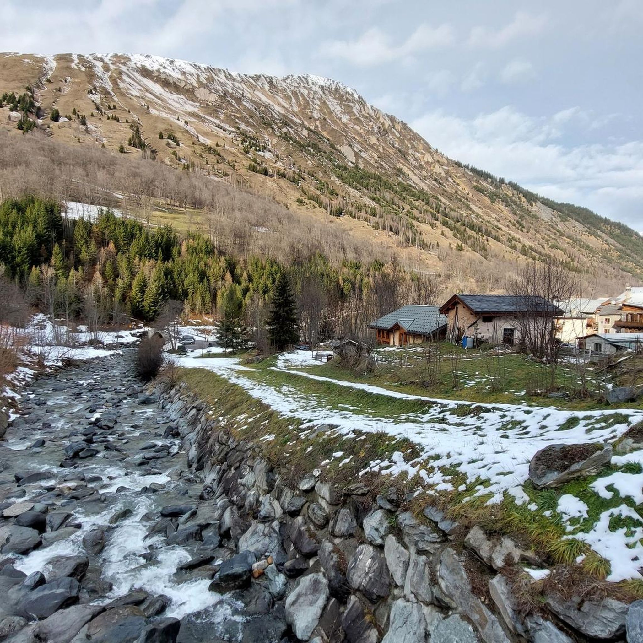
Gravel biking around Saint-Jean-De-Belleville features routes through the mountainous terrain of the French Alps. The region is characterized by significant elevation changes, high mountain passes, and alpine valleys. Gravel bike trails here often involve sustained climbs and descents, providing challenging experiences for riders. The landscape includes a mix of open mountain roads, forest trails, and more technical sections.
Best gravel bike trails around Saint-Jean-De-Belleville
- The most popular gravel bike trail is Col de la Loze Summit (2304 m) – Route du Col de la Loze loop from La Perrière, a 23.5 miles (37.7 km) trail that takes 3 hours 50 minutes to complete. This route leads to a high-altitude summit, offering a significant climbing challenge.
- Another top favourite among local gravel bikers is Col de Chaussy – Col du Chaussy loop from Saint-Jean-de-Maurienne - Vallée de l'Arvan, a difficult 39.4 miles (63.5 km) path. This route features extensive mountain views and demanding ascents.
- Local gravel bikers also love the Saint-Martin-de-Belleville – Tougnette pass loop from Les Ménuires, a 27.3 miles (43.9 km) trail leading through alpine landscapes with significant elevation gain, often completed in about 5 hours 26 minutes.
- Gravel biking around Saint-Jean-De-Belleville is defined by high mountain passes, challenging summits, and alpine valley roads. The network primarily offers routes for experienced riders seeking demanding climbs and descents.
- The routes in Saint-Jean-De-Belleville are highly rated by the komoot community with an average score of 5.0 stars from over 8 reviews. More than 150 gravel bikers have used komoot to explore Saint-Jean-De-Belleville's varied terrain.
Last updated: July 2, 2026
5.0
(1)
29
riders
37.8km
03:04
1,200m
1,200m
Hard gravel ride. Very good fitness required. Mostly paved surfaces. Suitable for all skill levels.
5.0
(2)
14
riders
32.0km
02:52
1,040m
1,040m
Hard gravel ride. Very good fitness required. Mostly paved surfaces. Suitable for all skill levels.

Sign up for free
18
riders
40.7km
03:36
1,620m
1,620m
Hard gravel ride. Very good fitness required. Mostly paved surfaces. Suitable for all skill levels.
4
riders
24.5km
02:46
1,040m
1,040m
Hard gravel ride. Very good fitness required. Mostly paved surfaces. Suitable for all skill levels.
12
riders
Hard gravel ride. Very good fitness required. Mostly paved surfaces. Suitable for all skill levels.
Get access to more routes and recommendations from other explorers.
Sign up for free
Already have an account?
Our route recommendations are based on thousands of hikes, rides, and runs completed by other people on komoot.
Start today with a free account
Your next adventure awaits.
Login or Signup
Popular around Saint-Jean-De-Belleville
Tips from the Community

Part of the cycle path with uneven climbs, beautiful views.
2
0
Beautiful cycle path, uneven climbs.
0
0
Great views, nice bike path, but uneven in the climbs.
2
0
Path with cycle path and great views. Ascent partly uneven. More info: https://de.wikipedia.org/wiki/Col_de_la_Loze?wprov=sfla1
2
0
Great views and great cycle path. More info: https://de.wikipedia.org/wiki/Col_de_la_Loze?wprov=sfla1
2
0
Difficult for me to assess the place the first time, more of a winter area, luckily no huge hotel castles.
3
0
From here it becomes really beautiful, a cycle path to the pass. I only discovered it through the Tour de France. Today just the beginning, tomorrow the real thing.
3
0

One of the most mythical Tour de France climbs.
0
0
Frequently Asked Questions
What is the overall difficulty of gravel biking trails around Saint-Jean-De-Belleville?
Gravel biking in Saint-Jean-De-Belleville is primarily suited for experienced riders. The region's mountainous terrain, characterized by significant elevation changes and high mountain passes, means most routes involve demanding climbs and descents. All 12 routes listed in this guide are rated as difficult.
Are there any easy or beginner-friendly gravel bike routes in Saint-Jean-De-Belleville?
Due to the challenging mountainous landscape of the French Alps in this region, Saint-Jean-De-Belleville does not offer easy or beginner-friendly gravel bike routes. The trails are designed for experienced riders seeking demanding ascents and descents.
What is the typical length and duration of gravel bike trails in this area?
The gravel bike trails around Saint-Jean-De-Belleville vary in length and duration, reflecting the challenging terrain. For example, the Madeleine Pass – Magnifique vue loop from Pontamafrey-Montpascal is 43.0 miles (69.2 km) and takes around 6 hours 9 minutes, while the Val Thorens – Les Bruyères Pond loop from Preyerand is 14.3 miles (23.1 km) and typically takes about 2 hours 13 minutes.
What are the best seasons for gravel biking in Saint-Jean-De-Belleville?
The best seasons for gravel biking in Saint-Jean-De-Belleville are generally late spring, summer, and early autumn (June to September). During these months, mountain passes are typically clear of snow, and weather conditions are more stable. Winter brings significant snowfall, making most high-altitude routes impassable.
Are there any scenic viewpoints or natural attractions along the gravel bike routes?
Yes, the region offers numerous scenic viewpoints and natural attractions. Many routes feature extensive mountain views, such as the Madeleine Pass – Magnifique vue loop. You can also find highlights like the Col de la Loze Summit (2304 m), View of the Cascade du Morel, and Lac Blanc, which offer stunning vistas and natural beauty.
Are there any loop gravel bike trails available?
Yes, many of the gravel bike trails in Saint-Jean-De-Belleville are designed as loops, allowing you to start and finish at the same point. Examples include the Col de la Loze Summit (2304 m) – Route du Col de la Loze loop from La Perrière and the Col de la Loze – Col de la Loze Summit (2304 m) loop from Altiport de Méribel.
What kind of wildlife might I spot while gravel biking in the French Alps?
While gravel biking in the French Alps, you might encounter various alpine wildlife. Keep an eye out for marmots, chamois, and ibex in higher elevations. Birdwatchers may spot eagles or other raptors. Always observe wildlife from a distance and avoid disturbing their natural habitats.
What do other gravel bikers say about the trails in Saint-Jean-De-Belleville?
The gravel biking routes in Saint-Jean-De-Belleville are highly rated by the komoot community, with an average score of 4.8 stars from over 10 reviews. Riders often praise the challenging climbs, the extensive mountain views, and the unique experience of riding through high alpine landscapes.
Are there cafes or places to refuel near the gravel bike trails?
Given the mountainous and often remote nature of some routes, it's advisable to carry sufficient water and snacks. However, many routes pass through or near alpine villages and ski resorts (like Val Thorens or Méribel) where you can find cafes, restaurants, and shops to refuel. Plan your route to include these stops if needed.
What should I wear for gravel biking in Saint-Jean-De-Belleville?
Due to the significant elevation changes and alpine environment, weather can change rapidly. It's recommended to wear layers, including a windproof and waterproof jacket, even in summer. Padded shorts, gloves, and a helmet are essential. Always check the local mountain weather forecast before heading out.
How many gravel bike routes are available in Saint-Jean-De-Belleville?
There are 12 gravel bike routes available around Saint-Jean-De-Belleville, all of which are rated as difficult due to the challenging mountainous terrain.
Is it possible to access these trails using public transport?
Access to trailheads in mountainous regions like Saint-Jean-De-Belleville can be challenging via public transport, especially for carrying bikes. While some larger towns may have bus services, reaching specific starting points often requires a car. It's best to research local bus schedules and bike transport policies for your chosen trailhead.
Where can I park my car when starting a gravel bike tour?
Parking is generally available in the villages and towns that serve as starting points for these routes, such as Pontamafrey-Montpascal, La Perrière, Preyerand, Montvernier, or Altiport de Méribel. Look for designated public parking areas, especially near tourist information centers or village squares. Always check local signage for any parking restrictions or fees.
Most popular routes around Saint-Jean-De-Belleville
Most popular attractions around Saint-Jean-De-Belleville

Get inspired with the komoot mobile app


Explore more
Browse the best Gravel rides in other regions.
