The 6 Most Amazing Peaks around Langenenslingen
Best mountain peaks around Langenenslingen are characterized by a hilly landscape on the northern edge of Upper Swabia and the Swabian Alb. The municipality features elevated areas and natural landmarks suitable for outdoor activities. These prominent hills and gentle slopes offer scenic hiking trails and expansive views of the surrounding region. Langenenslingen provides a network of paths for exploring its natural beauty and historical sites.
Best mountain peaks around Langenenslingen
- The most popular mountain peaks is St. John the Baptist…
Last updated: August 31, 2026
St. John the Baptist on the Bussen
Highlight • Religious Site
Translated by Google •
Tip by

Pilgrimage church on the Bussen
Highlight • Religious Site
Translated by Google •
Tip by

Sign up now to discover places like this
Get recommendations on the best single tracks, peaks, & plenty of other exciting outdoor places.
Sign up for free
Augstberg Tower
Highlight • Viewpoint
Translated by Google •
Tip by

View of the Lämmerstein
Highlight • Viewpoint
Translated by Google •
Tip by

Reunification Oak at Bussen Church
Highlight • Natural Monument
Translated by Google •
Tip by

Sign up for free to discover even more peaks around Langenenslingen.
Sign up for free
Already have an account?
Start today with a free account
Your next adventure awaits.
Login or Signup
Tips from the Community

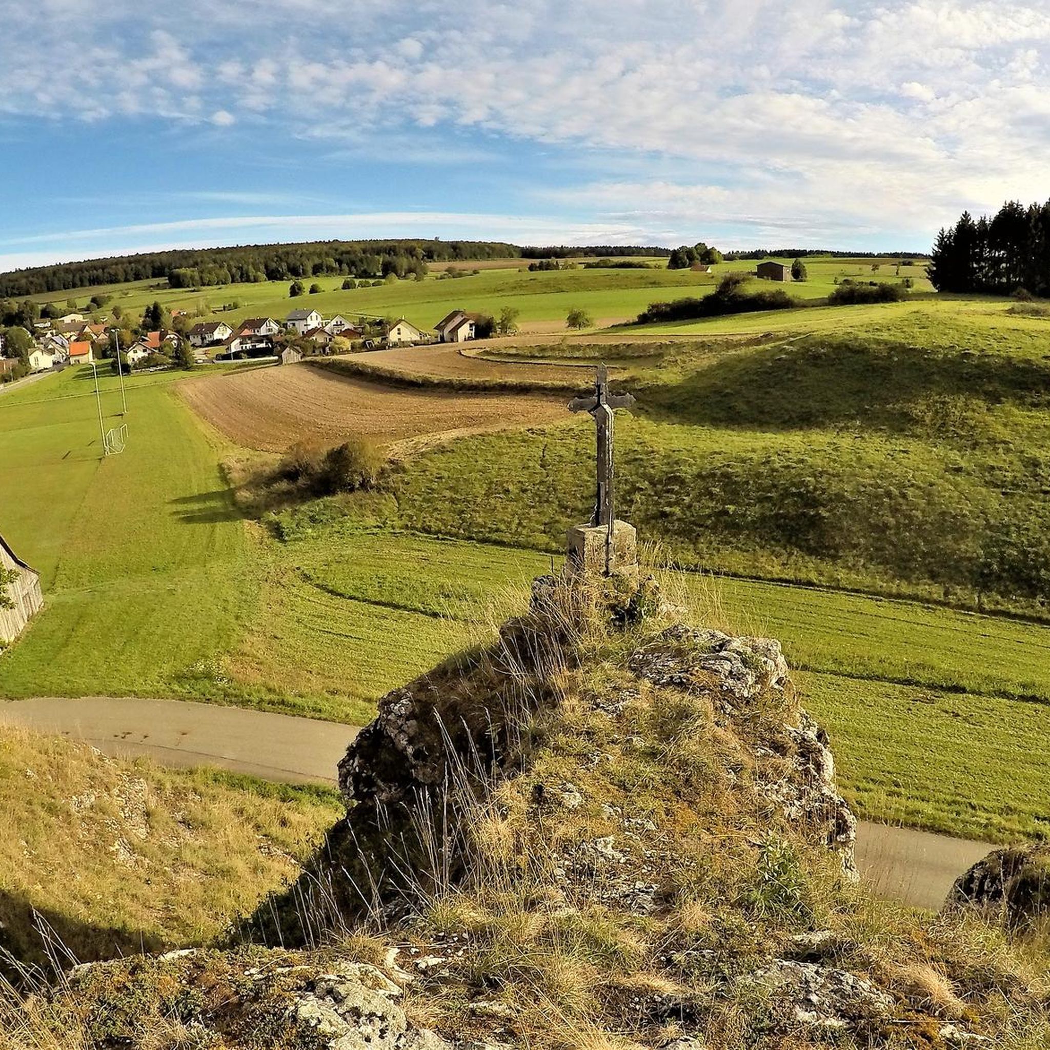
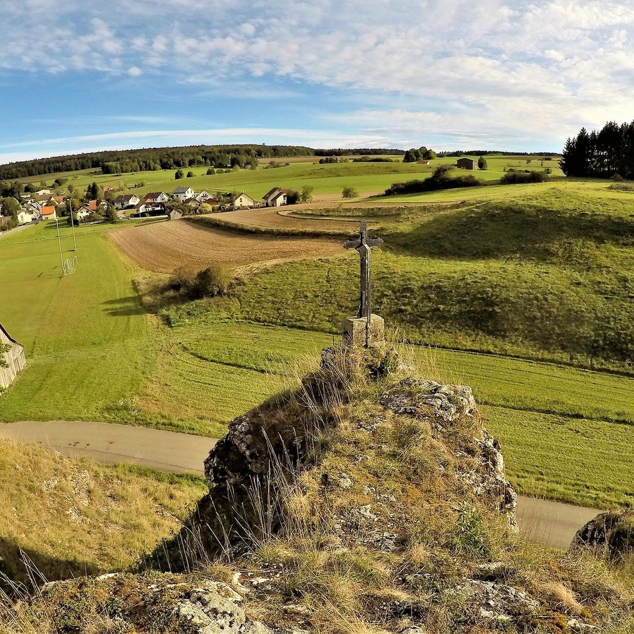
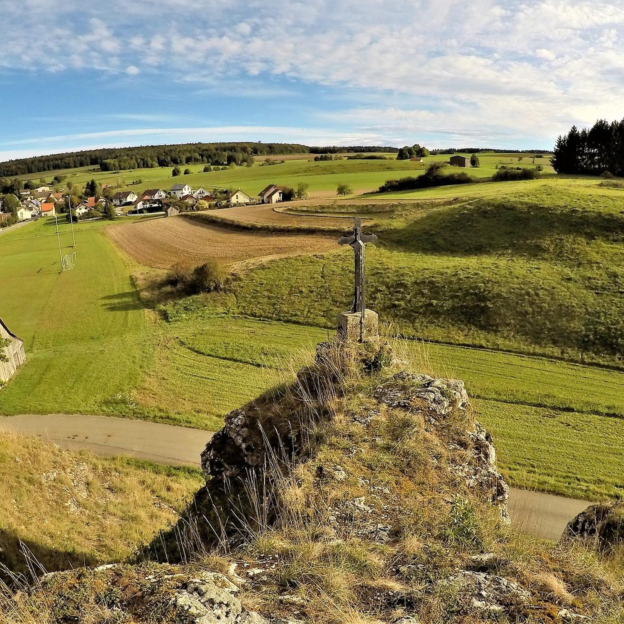
And if you look closely you will also discover the summit cross
9
0

Beautiful view of the huge and wide rock face. There is even a summit cross on it.
4
0

All in all, an unspectacular church, but one with significance for Upper Swabia and a wonderful panoramic view of the Oberland. Definitely worth a detour.
1
0

At 767 metres, the Bussen is the highest elevation in Upper Swabia. It is located in the Biberach district and is notable for the fact that there is a church and a castle ruin on the mountain saddle.
2
0
At the highest point in Upper Swabia there is no summit cross but a church. Open daily, it offers visitors a quiet place for reflection and contemplation. Invited to pray and in becoming aware of the Creator, many visitors are sure to come to their senses here.
2
0
Up here on the Bussen, this church is a wonderful and special place for contemplation, silence and prayer.
3
0
Here, directly next to the church on Bussen, the oak tree was planted on October 3, 1990 on the occasion of German reunification
2
0

In the middle of the valley suddenly a summit cross between the trees
8
0
Frequently Asked Questions
How would you describe the 'mountain peaks' around Langenenslingen?
The region around Langenenslingen is characterized by a hilly landscape with rolling hills and gentle slopes, rather than traditional towering mountain peaks. These elevated areas offer scenic views and are ideal for outdoor activities like hiking and cycling. The highest point in the Biberach district, reaching 800.8 meters, is located near Ittenhausen within the municipality.
What are some of the most popular elevated spots or viewpoints to visit near Langenenslingen?
Among the most popular elevated spots are St. John the Baptist on the Bussen, known as the 'Holy Mountain of Upper Swabia' and the highest elevation in Upper Swabia. Another favorite is the Augstberg Tower, which provides excellent views over the Trochtelfinger Alb. The View of the Lämmerstein, with its distinctive summit cross, is also highly regarded.
Are there any historical sites among the elevated areas around Langenenslingen?
Yes, several elevated areas have historical significance. The Bussen is home to the pilgrimage church of St. John the Baptist, with documented pilgrimages since 1521 and indications of even older Celtic and Germanic worship sites. Additionally, the Alte Burg near Emerfeld is an excavation site of a Celtic hill settlement, offering insights into ancient history.
Where can I find the best panoramic views in the Langenenslingen area?
For expansive views, the Augstberg Tower offers a very nice panorama over the Trochtelfinger Alb. The Bussen is also an excellent panoramic mountain, with views that can extend to the Alps on clear days. The Warmtal Valley near Emerfeld provides gently hilly terrain with broad views of the Upper Swabian landscape, and the Schatzberg Ruins are associated with scenic vistas.
Are there family-friendly elevated areas or trails suitable for children?
Many of the elevated areas and trails around Langenenslingen are suitable for families due to the region's generally gentle slopes and well-developed path network. Highlights like St. John the Baptist on the Bussen and the Augstberg Tower are categorized as family-friendly. The Augstberg Tower even has a children's playground nearby.
What outdoor activities can I do near these elevated areas?
The hilly landscape around Langenenslingen is perfect for hiking and cycling. You can explore extensive forests and a network of well-marked paths. For specific hiking routes, check out the Easy hikes around Langenenslingen guide. For cycling, there are options for gravel biking and MTB trails, including routes that pass by the Bussen.
Are there easy hiking trails around Langenenslingen's elevated areas?
Yes, there are numerous easy hiking trails. The Warmtal Valley is particularly recommended for walking due to its gentle terrain. You can find several well-marked circular hiking trails ranging from 4.5 km to 11.2 km, catering to various fitness levels. For more options, refer to the Easy hikes around Langenenslingen guide, which includes routes like the 'Andelfinger Berg Trail loop' and the 'Alte Burg excavation site loop'.
What is the best time to visit the elevated areas for hiking?
The region is suitable for outdoor activities throughout much of the year. Spring and autumn offer pleasant temperatures and beautiful scenery, with spring bringing rare flower species to areas like the Lohrmannsbuckel. Summer is also popular, while winter conditions can vary, so it's advisable to check local conditions if planning a winter hike.
Are there any unique natural features to look out for?
Beyond the general hilly landscape, the Warmtal Valley is part of the 'Riedlinger Alb' landscape protection area and is known for its natural beauty. The Lohrmannsbuckel, located in the vicinity of Warmtal, is notable for its rare flower species. The region also boasts extensive forests, providing a tranquil natural environment.
What do visitors enjoy most about the elevated areas around Langenenslingen?
Visitors frequently appreciate the expansive views, especially from spots like the Augstberg Tower and the Bussen. The tranquility and natural beauty of the region, combined with the well-developed network of paths for unburdened hiking and cycling, are also highly valued. The historical significance of sites like the Bussen pilgrimage church adds another layer of interest.
Can I find circular walks around the elevated areas?
Yes, the municipality offers several well-marked circular hiking trails that allow you to explore the elevated areas and surrounding landscapes. These trails vary in length and difficulty, making it easy to find a loop that suits your preferences. For example, the 'Andelfinger Berg Trail loop' is an easy option for a circular walk.
Are there any challenging hikes in the Langenenslingen area?
While the region is generally known for its gentle slopes, some longer routes or combinations of trails can offer a more challenging experience. For instance, some of the gravel biking and MTB routes listed in the Gravel biking around Langenenslingen guide and MTB Trails around Langenenslingen guide are rated as 'difficult' due to their distance and terrain, which could be adapted for longer, more strenuous hikes.
Most popular routes around Langenenslingen
Most popular attractions around Langenenslingen

Get inspired with the komoot mobile app


Explore more
See even more amazing summits around Langenenslingen with these guides:
