The best gravel rides around Saint-Rome-De-Cernon
4.4
(68)
773
riders
33
rides
Gravel biking around Saint-Rome-De-Cernon offers diverse terrain within the Cernon valley, situated between the Larzac plateau and the Lévézou heights. The region features a varied landscape of garrigues, plateaus, and river valleys, providing a mix of surfaces for gravel cyclists. Routes often follow the Cernon river or ascend onto the expansive limestone plateaus, offering varied elevation profiles. This area, part of the Grands Causses Regional Natural Park, provides a robust network of paths suitable for gravel bikes.
Best gravel bike…
Last updated: November 2, 2026
3.0
(4)
41
riders
28.3km
01:47
240m
240m
Moderate gravel ride. Good fitness required. Mostly paved surfaces.
13
riders
89.1km
06:18
1,220m
1,220m
Hard gravel ride. Very good fitness required. You may need to push your bike for some segments of this route.

4.0
(1)
12
riders
41.7km
02:46
490m
490m
Hard gravel ride. Very good fitness required. Mostly paved surfaces.
2
riders
89.8km
06:59
1,680m
1,680m
Hard gravel ride. Very good fitness required. Mostly paved surfaces.
5.0
(1)
12
riders
37.5km
02:33
570m
570m
Hard gravel ride. Very good fitness required. Mostly paved surfaces.
Get access to more routes and recommendations from other explorers.
Already have an account?
Our route recommendations are based on thousands of hikes, rides, and runs completed by other people on komoot.
Start today with a free account
Your next adventure awaits.
Tips from the Community

In the heart of Creissels, the Pesquié basin forms a surprisingly vast body of water (1,000 m²) compared to the modest stream that feeds it. Its name, which comes from Occitan and means "fish pond", recalls the ancient purpose of the place, linked to fish farming. The town hall now occupies the premises of a former fish farm. The basin is fed by the Creissels waterfall, a typical resurgence of the karst functioning of the Larzac: the water infiltrated into the limestones of the plateau reappears after an underground journey. In September 2023, the municipality dredged the basin and created a spawning ground for brown trout (Salmo trutta). The restoration has borne fruit, as trout have since recolonized the body of water, alongside amphibians and other aquatic organisms that find refuge in the surrounding wetland.
3
0
This place is the starting point of the Voie Verte which runs along the Tarn and leads to Creissels. You can discover the troglodytic village of Peyre in particular, a very pleasant forest section which, in places, forms a real green tunnel. Further on, you can enjoy a magnificent view of the Millau Viaduct.
3
0
From the Larzac plateau, the Brunas site offers a vast panorama of the Millau valley. Stretched between the two banks of the Tarn, the viaduct with its seven concrete piers appears in its entirety. Behind it unfolds the entire causse Rouge, a large limestone plateau whose undulations dominate the valley. Then, the Puech d’Andan is distinguished by its wooded silhouette, cut in two by a clear central notch. Further to the right stands the Pouncho d'Agast, a pyramidal promontory marking the beginning of the causse Noir at an altitude of 841 m. Brunas is also a true site for free flight. The take-off area is located directly on the plateau; the site is mainly used with a north wind and allows paragliders to take off and then land in the vicinity of the same sector, with approximately 370 m of elevation difference down to the valley. The spectacle of the sails evolving in front of the viaduct adds a particular dimension to this panorama.
3
0
Isolated in the middle of the open landscapes of the Larzac, the fortified farm of Brouzes is a remarkable testimony to medieval rural architecture. The complex, whose construction began in 1491, is organized in a rectangle around three courtyards. It was later remodeled, notably in 1628, then in the 18th century. Behind its appearance as a large farm lies a true defensive architecture: the buildings are largely vaulted, a stable has loopholes, two towers reinforce the south side, and a dovecote tower as well as an old bread oven complete the complex. The farm nevertheless experienced a long period of abandonment. Uninhabited from 1922 to 1970, it was progressively looted and severely degraded. In the 1970s, an artist couple, Élisabeth and Claude Baillon, bought it and began its restoration. Their intervention largely contributed to saving the complex, which was finally classified as a historic monument in 1990.
3
0
Perched at an altitude of about 730 meters, the Cap de Coste viewpoint overlooks the eastern end of the Boundoulaou cirque. It reveals a vast panorama of the Millau basin and its surrounding massifs. To the left, the easily recognizable Millau Viaduct spans the Tarn valley to connect the Larzac to the Causse Rouge. Further to the right stretches the latter: a large limestone plateau whose undulations dominate the valley. Then, the Puech d’Andan stands out with its wooded silhouette, cut in two by a clear central notch. Finally, further away, the Pouncho d’Agast, an emblematic relief of the Causse Noir, is easily recognized by its profile like a true limestone pyramid.
3
0
Perché at an altitude of approximately 730 meters, the Cap de Coste viewpoint overlooks the eastern end of the Boundoulaou cirque. It reveals a vast panorama of the Millau basin and its surrounding massifs. To the left, the easily recognizable Millau Viaduct spans the Tarn valley, connecting the Larzac to the Causse Rouge. Further to the right stretches the latter: a large limestone plateau whose undulations dominate the valley. Then, the Puech d’Andan stands out with its wooded silhouette, cut in two by a clear central notch. Finally, further away, the Pouncho d’Agast, an emblematic relief of the Causse Noir, is easily recognized by its profile like a true limestone pyramid.
3
0
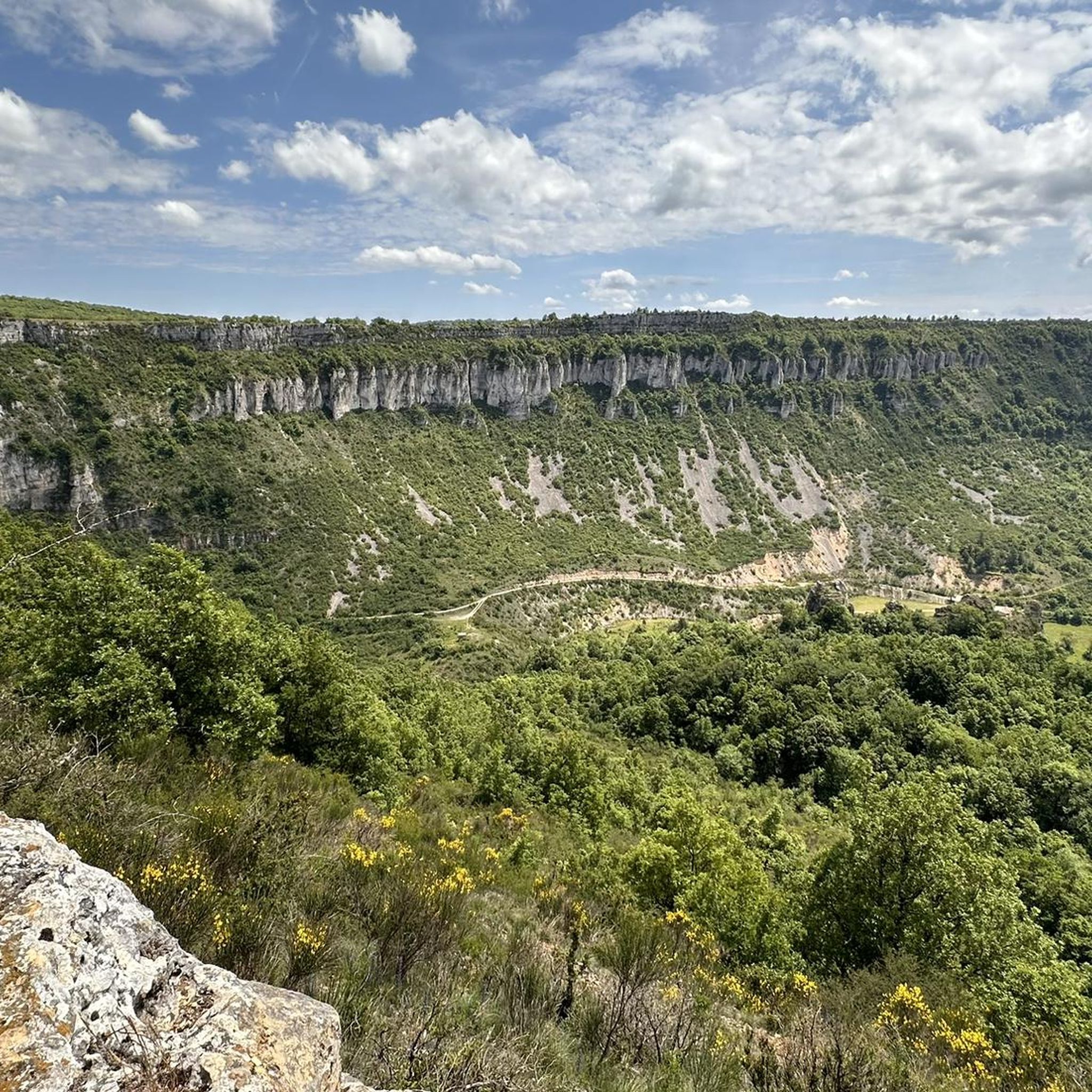
From this switchback on the road to Labro, the Larzac plateau suddenly opens up to reveal the spectacular cirque of Saint-Geniez-de-Bertrand. This has been progressively formed by the erosion of the limestone series that make up the Larzac. The water, by infiltrating the fractures in the limestone, gradually dissolves the rock and circulates at depth before emerging at the foot of the slopes. This underground action, associated with runoff and valley erosion, causes a progressive retreat of the cliffs and slopes: this is the phenomenon of regressive erosion. Over time, the limestone reliefs recede towards the interior of the plateau and a vast indentation forms, giving birth to the cirque.
3
0
This section of the greenway follows a narrow and shaded path, where dense vegetation forms a real green tunnel in places. The natural surface is particularly pleasant to ride on. These wooded sections alternate with a few openings, which allow you to reconnect with the Tarn river and, further on, the Millau viaduct.
3
0
Frequently Asked Questions
How many gravel bike trails are available around Saint-Rome-De-Cernon?
There are over 20 gravel bike routes around Saint-Rome-De-Cernon, offering a diverse range of experiences. Most of these routes are classified as difficult, with a few moderate options available for those seeking a less strenuous ride.
What kind of terrain can I expect on gravel bike trails in Saint-Rome-De-Cernon?
The region offers a highly varied terrain, ideal for gravel biking. You'll encounter everything from paths along the Cernon river valley to ascents onto the vast limestone plateaus of Larzac and the undulating heights of Lévézou. Expect a mix of garrigues, forest paths, and sometimes even former railway lines, providing a constantly engaging surface.
Are there any easy or beginner-friendly gravel routes in the area?
While many routes are classified as difficult, there are moderate options available. For example, the Millau Viaduct – Old bridge loop from Saint-Georges-de-Luzençon is a moderate 26.1 km route that takes less than 2 hours to complete, offering a good introduction to the region's gravel biking.
What are some scenic viewpoints or attractions I can visit while gravel biking?
The area is rich in natural beauty and historical sites. You can ride past impressive structures like the Millau Viaduct, or stop at viewpoints such as Pas Destrech Cross, Millau Viaduct Viewpoint, or Cap de Coste Viewpoint for panoramic vistas. The region also features ancient dolmens and the picturesque Cernon River Valley.
Are there any circular gravel bike trails around Saint-Rome-De-Cernon?
Yes, many of the gravel routes in the area are circular, allowing you to start and end in the same location. Examples include the challenging Tiergues Dolmen – Rocher de Caylus loop from Couat and the moderate Millau Viaduct – Old bridge loop from Saint-Georges-de-Luzençon.
What do other gravel bikers enjoy most about the trails in Saint-Rome-De-Cernon?
The gravel biking routes around Saint-Rome-De-Cernon are highly rated by the komoot community, with an average score of 4.4 stars from over 50 reviews. Riders often praise the diverse landscapes, from river valleys to expansive plateaus, and the engaging mix of surfaces that make for a varied and rewarding cycling experience.
What is the best time of year for gravel biking in Saint-Rome-De-Cernon?
The region's climate, typical of southern France, generally makes spring and autumn ideal for gravel biking, offering pleasant temperatures and vibrant scenery. Summer can be warm, especially on the exposed plateaus, while winter might bring cooler temperatures and potentially some wet conditions, though many trails remain accessible.
Are there any routes that pass by waterfalls?
Yes, for those interested in natural water features, the Cascade des Raspes du Tarn is a notable waterfall in the vicinity that can be incorporated into longer rides or visited as a highlight.
Can I find routes that offer views of the famous Millau Viaduct?
Absolutely. Several routes provide stunning views of the Millau Viaduct. For instance, the challenging Millau Viaduct – View of the Millau Viaduct loop from Saint-Georges-de-Luzençon offers excellent perspectives of this architectural marvel.
What are the typical distances and durations for gravel rides here?
Gravel rides in Saint-Rome-De-Cernon vary in length and duration. You can find routes ranging from moderate 26 km rides taking under 2 hours, like the Millau Viaduct – Old bridge loop from Saint-Georges-de-Luzençon, to more challenging 45-50 km routes that can take around 3.5 to 4 hours, such as the Saint-Affrique – Saint-Affrique loop from Saint-Affrique.
Are there historical sites to explore along the gravel routes?
Yes, the region is rich in history. You can discover ancient dolmens, explore the old village of Saint-Rome-De-Cernon with its castle and stone houses, and encounter other historical landmarks that add a cultural dimension to your gravel biking adventures.
Most popular routes around Saint-Rome-De-Cernon
Most popular attractions around Saint-Rome-De-Cernon

Get inspired with the komoot mobile app


Explore more
Browse the best Gravel rides in other regions.
