The best gravel rides around Les Villards-Sur-Thônes
4.3
(40)
297
riders
22
rides
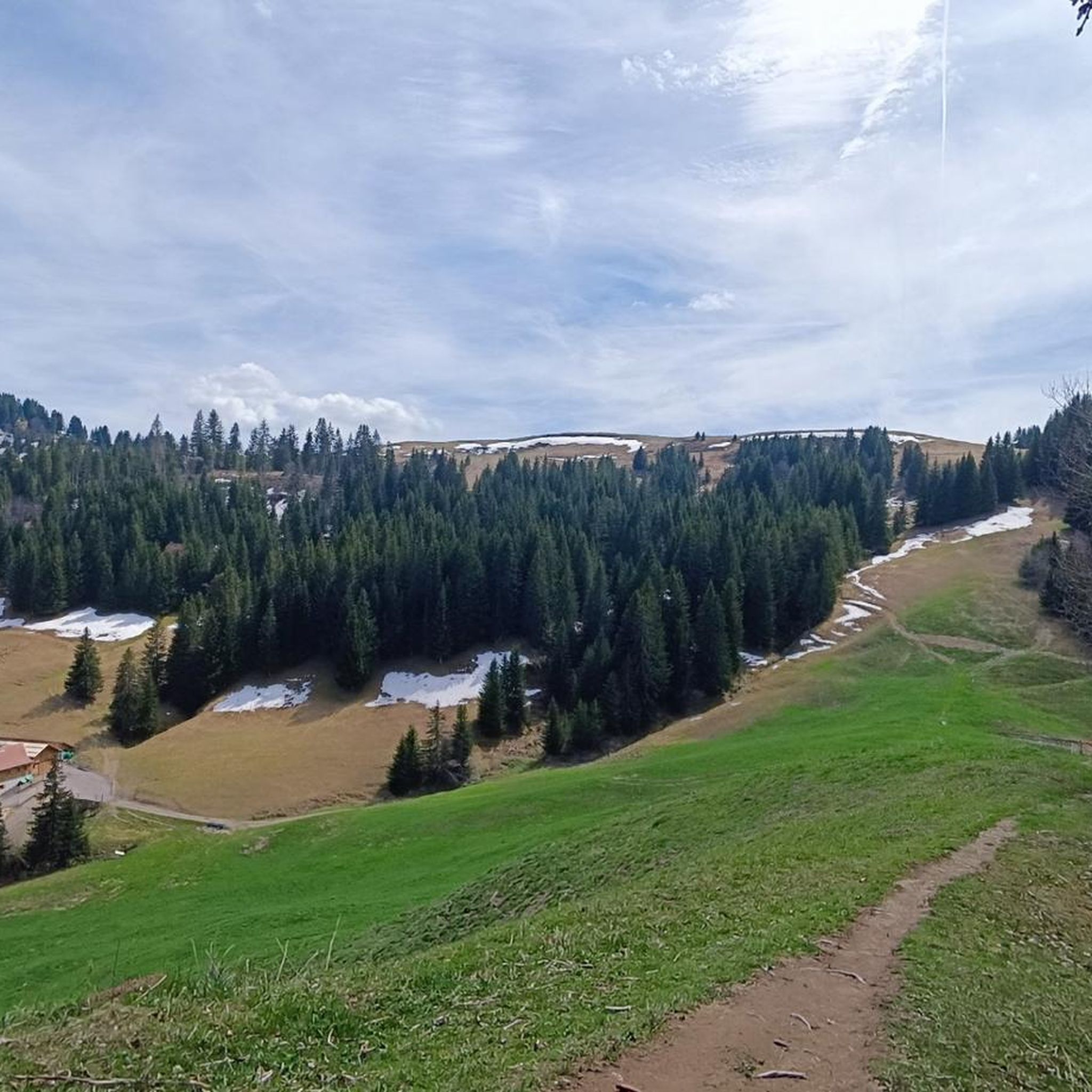
Gravel biking around Les Villards-Sur-Thônes offers diverse terrain within the Haute-Savoie region of France. The area is characterized by its position at the foot of the Beauregard Plateau and facing Mont Lachat, providing significant elevation changes through valleys and mountain pastures. Riders can expect a mix of paved and unpaved surfaces, including hard-packed gravel and forest tracks, suitable for an alpine gravel experience. The Nom River flows through the commune, and proximity to the Aravis mountain range defines the landscape.
…Last updated: October 6, 2026
4.3
(3)
42
riders
72.5km
05:20
1,970m
1,970m
Hard gravel ride. Very good fitness required. Mostly paved surfaces. Suitable for all skill levels.
4.2
(5)
47
riders
43.6km
03:28
1,260m
1,260m
Hard gravel ride. Very good fitness required. You may need to push your bike for some segments of this route.

4.0
(1)
18
riders
28.0km
02:50
920m
920m
Hard gravel ride. Very good fitness required. Mostly paved surfaces. Suitable for all skill levels.
5.0
(1)
15
riders
42.0km
03:20
1,380m
1,380m
Hard gravel ride. Very good fitness required. Mostly paved surfaces. Suitable for all skill levels.
3.7
(3)
14
riders
21.5km
01:39
570m
570m
Hard gravel ride. Very good fitness required. Mostly paved surfaces. Suitable for all skill levels.
Get access to more routes and recommendations from other explorers.
Already have an account?
Our route recommendations are based on thousands of hikes, rides, and runs completed by other people on komoot.
Start today with a free account
Your next adventure awaits.

Tips from the Community

It's beautiful but it's quite demanding on the gravel descent, there are still a lot of stones, it shakes a lot
0
0

small suspended lake perched in the middle of mountain pebble paths
0
0

Nice small pass, decent but steady climb. Great views and a nice restaurant at the pass, Refuge Auberge du Col de l'Arpettaz
3
0
Pleasant D12 as an ascent to the Marais.
1
0
Beautiful descent from the Aravis on the D909.
3
0
Shortly before the pass, there is also a beautiful view of Mont Blanc here.
2
0
In winter with biathlon, well visited in summer, many opportunities for a short break.
3
0
Frequently Asked Questions
What kind of terrain can I expect on gravel bike trails around Les Villards-Sur-Thônes?
The region offers a diverse mix of paved and unpaved surfaces, including hard-packed gravel and forest tracks. You'll encounter significant elevation changes as routes navigate through valleys and mountain pastures, providing a true alpine gravel experience. The area is defined by the Aravis mountain range and the Beauregard Plateau.
Are there gravel bike trails suitable for beginners or families in Les Villards-Sur-Thônes?
While most routes in the area are rated as difficult, there are a few moderate options. For a less challenging ride that still offers scenic views, consider the Roman road – Fier River banks loop from Les Villards-sur-Thônes. This 18.9-mile (30.4 km) trail is rated moderate and leads through river banks and historical paths, making it a good option for those seeking a more relaxed experience.
What are some of the most scenic viewpoints or landmarks I can see while gravel biking in the area?
Many routes offer breathtaking views of the Aravis mountain range and Mont Lachat. You can also find trails with expansive views of Lake Annecy. Specific highlights include the Tête du Danay — view of the Aravis (1,730 m) and the View of the Mont Blanc range. The region also features picturesque lakes like Lessy lake and Lac de la Cour.
What do other gravel bikers enjoy most about the trails in Les Villards-Sur-Thônes?
The gravel bike routes around Les Villards-Sur-Thônes are highly rated by the komoot community, with an average score of 4.4 stars from over 20 reviews. Riders frequently praise the diverse terrain, the stunning alpine scenery, and the challenging nature of the mountain and valley routes.
Are there any circular gravel bike routes available?
Yes, many of the gravel bike routes in Les Villards-Sur-Thônes are designed as loops. Examples include the challenging Col des Annes – Le Grand-Bornand loop from La Clusaz, the scenic Lake Annecy Tour – Lake Annecy cycle route loop from Thônes, and the moderate Roman road – Fier River banks loop from Les Villards-sur-Thônes.
What is the best time of year for gravel biking in Les Villards-Sur-Thônes?
The best time for gravel biking is generally from spring through autumn. During these seasons, the weather is more favorable, and mountain passes are typically clear of snow. Winter can bring snow and ice, making many higher-elevation gravel tracks impassable or requiring specialized equipment.
Are there any specific regulations or permits required for gravel biking in the Haute-Savoie region?
Generally, no specific permits are required for gravel biking on public trails in the Haute-Savoie region. However, always respect local signage, private property, and protected natural areas. Some areas might have restrictions on motorized vehicles or specific times for certain activities, so it's always good to check local regulations if you plan to venture off marked paths.
Can I bring my dog on the gravel bike trails around Les Villards-Sur-Thônes?
While many outdoor areas in the French Alps are dog-friendly, specific rules can vary. It's generally recommended to keep dogs on a leash, especially in mountain pastures where livestock may be present, and to clean up after them. Always check for local signage regarding dog access on specific trails or in nature reserves.
Are there options for advanced gravel bikers looking for a challenge?
Absolutely. The region is well-suited for experienced gravel bikers seeking significant challenges. Most of the 25 routes available are rated as difficult, featuring substantial elevation gains. Trails like the Mont Blanc view – Col des Aravis loop from La Clusaz, with over 1300 meters of ascent, offer a demanding mountain experience.
How many gravel bike trails are there in Les Villards-Sur-Thônes?
There are over 25 gravel bike routes available around Les Villards-Sur-Thônes, catering to various skill levels from moderate to very challenging. These routes allow you to explore the diverse landscapes of the Haute-Savoie region.
Are there any places to stop for refreshments or accommodation near the gravel bike trails?
Les Villards-Sur-Thônes and nearby villages offer various amenities. While specific cafes directly on every trail might be limited, you'll find options in the villages for refreshments and accommodation. The region also features welcoming mountain huts, such as the Refuge de la Bombardellaz, which provides an idyllic setting with panoramic views of the Aravis mountain range.
What are the typical distances and durations for gravel bike trails in this area?
The gravel bike trails around Les Villards-Sur-Thônes vary in length and duration. For example, the Col des Annes – Le Grand-Bornand loop from La Clusaz is 27.1 miles (43.6 km) and typically takes around 3 hours 28 minutes. Shorter, moderate options like the Roman road – Fier River banks loop from Les Villards-sur-Thônes cover 18.9 miles (30.4 km) in about 2 hours 30 minutes.
Most popular routes around Les Villards-Sur-Thônes
Most popular attractions around Les Villards-Sur-Thônes

Get inspired with the komoot mobile app


Explore more
Browse the best Gravel rides in other regions.
