The best gravel rides around Río Guadalmansa
4.0
(3)
37
riders
2
rides
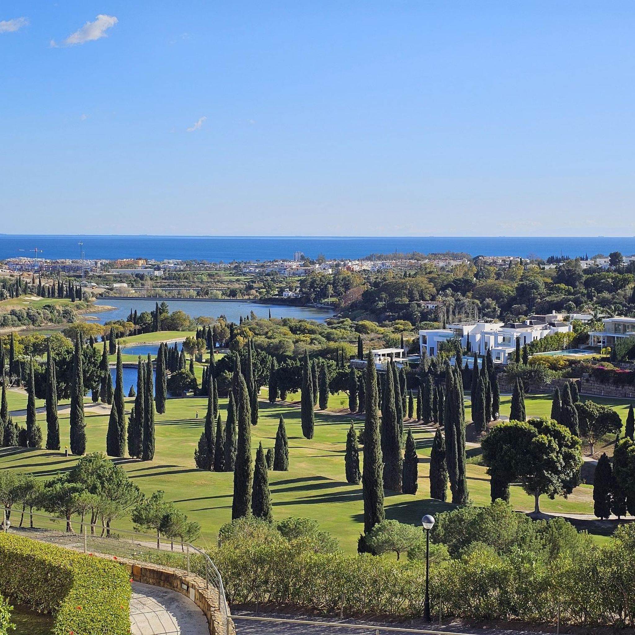
Gravel biking around Río Guadalmansa offers varied terrain, transitioning from coastal paths to the mountainous backdrop of Sierra Bermeja. The region, a Special Zone of Conservation, features diverse landscapes including riverine ecosystems and rolling hills. Riders encounter a mix of surfaces, from compacted earth to gravelly stretches, with undulating relief and occasional canyons. This area provides a blend of scenic coastal rides and routes venturing into the broader Andalusian landscape.
Best gravel bike trails around Río Guadalmansa
- The most popular…
Last updated: May 22, 2026
5.0
(2)
22
riders
68.4km
06:05
1,720m
1,720m
Hard gravel ride. Very good fitness required. Mostly paved surfaces. Suitable for all skill levels.
4.7
(3)
9
riders
43.2km
03:09
960m
960m
Hard gravel ride. Very good fitness required. Mostly paved surfaces. Suitable for all skill levels.

Sign up for free
10
riders
28.1km
02:13
560m
560m
Hard gravel ride. Very good fitness required. Mostly paved surfaces. Suitable for all skill levels.
3.0
(1)
5
riders
Hard gravel ride. Very good fitness required. Mostly paved surfaces. Suitable for all skill levels.
5
riders
Hard gravel ride. Very good fitness required. Mostly paved surfaces. Suitable for all skill levels.
4
riders
27.8km
02:08
680m
680m
Hard gravel ride. Very good fitness required. Mostly paved surfaces. Suitable for all skill levels.
1
riders
Hard gravel ride. Very good fitness required. Mostly paved surfaces. Suitable for all skill levels.
Our route recommendations are based on thousands of hikes, rides, and runs completed by other people on komoot.
Start today with a free account
Your next adventure awaits.
Login or Signup
Tips from the Community


The 21-meter-high dam does not have the task of storing water reserves for dry periods. It serves exclusively to intercept the water of the Río Guadalmina. The impounded water is diverted directly through a 9.5-kilometer-long tunnel. This diverts the water into the region's large main reservoir – the Embalse de la Concepción near Istán/Marbella.
0
0

Charming place at the start of the route
0
0

The statue represents the two traditional sources of wealth in Estepona. It connects directly to Estepona’s identity as a former fishing village with strong rural roots. t’s considered one of the most emblematic monuments of the town.
0
0

The mural "The Last Supper" in Estepona is a modern interpretation of Leonardo da Vinci's famous work and part of the Ruta de Murales Artísticos (Artistic Mural Route). Created by the artist Curro Leyton, it is located on a building facade near Calle Madrid. This large-scale mural contributes to Estepona's transformation into an open-air art museum, blending classical themes with contemporary street art.
1
0
The Acueducto del Ángel in Estepona is an impressive relic from the 18th century, reminiscent of the region's agricultural past. It is located in the area of Parque del Ángel, near Arroyo de Hornacinos and Calle Terral, not far from the modern residential complex Playa del Ángel. The historical structure once served to irrigate the surrounding fields and was part of an extensive water supply system that connected springs and water reservoirs. The aqueduct consists of multi-arched masonry viaducts that carried water over an elevated structure, likely to mills or agricultural facilities in the area. After years of decay, it was restored by the city of Estepona as part of a project to upgrade the coastal park and made accessible again. Today, it is surrounded by a small park with walking paths and information boards and can be visited freely. The Acueducto del Ángel is thus not only a technical monument but also a symbol of the connection between history, landscape, and water management in Andalusia. Between modern development and proximity to the sea, it tells of a time when water was a valuable commodity and the engineering skills of the Moors and their successors created the foundation for fertile fields and flourishing gardens.
2
0
The Parque del Ángel in Estepona is a spacious, modernly designed green area near the coast that combines nature, culture, and recreation. Amidst Mediterranean plantings, palm trees, and open meadows, there is a restored aqueduct that gives the park a historical element. A wooden bridge over the small Hornacinos stream connects the surrounding neighborhoods and blends harmoniously into the landscape. In addition, several sculptures by the artist Santiago de Santiago enrich the park like a small open-air museum, while a landscaped noria recalls old irrigation systems. The offering is complemented by a modern calisthenics zone and quiet paths, making the Parque del Ángel a beautiful place for relaxation, sports, and photo opportunities.
1
0

The upper section of the off-road route is currently being improved by the road service, making it easily accessible.
0
0
Frequently Asked Questions
What kind of terrain can I expect on gravel bike trails around Río Guadalmansa?
Gravel biking around Río Guadalmansa offers a diverse mix of terrain. You'll find coastal paths with stunning Mediterranean views, rolling hills, and more rugged inland areas. The broader Andalucía region, where Río Guadalmansa is located, is known for its varied surfaces, from mountain trails to sun-kissed beaches and olive groves, providing a rich and engaging experience for gravel cyclists.
Are there challenging gravel bike routes in the Río Guadalmansa area?
Yes, many of the gravel bike routes around Río Guadalmansa present significant challenges. For instance, the Source of the Molinos River – La Concepción Reservoir loop from San Pedro Alcántara is a difficult 42.6-mile (68.5 km) trail with over 1700 meters of elevation gain. Another demanding option is the Real de la Quinta Urbanisation loop from San Pedro Alcántara, which covers 17.4 miles (28.0 km) with substantial elevation through urban and natural landscapes.
Are there any easier or family-friendly gravel bike trails near Río Guadalmansa?
While many of the listed gravel routes are challenging, the region offers alternatives for easier rides. The Senda Litoral (Coastal Path) extends through the Estepona district and provides a flatter, more accessible route suitable for casual cycling, which can be a good option for families or those seeking a less strenuous ride. Sections of this path may be suitable for gravel bikes or provide access to other gentle routes.
What natural features or viewpoints can I see along the gravel bike routes?
The routes around Río Guadalmansa offer beautiful scenery. You can expect stunning views of the Mediterranean Sea, often extending towards Gibraltar and the African coastline. Inland routes, such as the La Concepción Reservoir – View over valley loop from San Pedro Alcántara, provide vistas over valleys and reservoir surroundings. The diverse landscapes of Andalucía also mean you might encounter rolling hills, olive groves, and varied natural areas.
Are there any historical landmarks to explore on these trails?
Yes, the area features historical elements that add a cultural dimension to your ride. Notably, structures like the Guadalmansa Watchtower are often situated in scenic coastal locations, offering a glimpse into the region's past. Exploring these watchtowers can be a rewarding stop along your gravel biking adventure.
What is the best time of year to go gravel biking in Río Guadalmansa?
Río Guadalmansa, located in Andalucía, benefits from year-round sunshine and mild winters, making it an excellent destination for gravel biking almost any time. Spring and autumn offer particularly pleasant temperatures, ideal for longer rides. Even winter provides comfortable conditions for cycling, though it's always wise to check local weather forecasts before heading out.
Is there parking available near the gravel bike trails in Río Guadalmansa?
While specific parking areas aren't detailed for each trail, many routes start from towns like San Pedro Alcántara or Monte Biarritz. These areas typically offer public parking options. It's advisable to check local parking availability in these starting locations before your ride.
Can I find circular gravel bike routes in Río Guadalmansa?
Yes, several routes are designed as loops, allowing you to start and finish in the same location. Examples include the Source of the Molinos River – La Concepción Reservoir loop from San Pedro Alcántara and the Guadiaro River Dam and Bridge – Taberna Fantástica, Benahavís loop from Monte Biarritz. These circular routes offer convenience and a varied experience without retracing your steps.
What do other gravel bikers enjoy most about gravel biking in Río Guadalmansa?
The gravel biking experience around Río Guadalmansa is highly rated by the komoot community, with an average score of 4.0 stars. Riders often praise the diverse terrain, from coastal paths to inland hills, and the stunning Mediterranean views. The variety of routes, offering both scenic coastal rides and challenging inland adventures, is also a significant draw for the more than 60 gravel bikers who have explored the area with komoot.
Are there any cafes or places to eat near the gravel bike trails?
The routes often start or pass near towns and urbanizations like San Pedro Alcántara, Monte Biarritz, and Marbella. These areas are well-equipped with cafes, restaurants, and pubs where you can refuel before or after your ride. For example, the Guadiaro River Dam and Bridge – Taberna Fantástica, Benahavís loop from Monte Biarritz passes near Taberna Fantástica in Benahavís, offering a potential stop.
Are the gravel bike trails around Río Guadalmansa suitable for dogs?
While specific regulations for dogs on these trails are not detailed, many natural areas in Andalucía are generally dog-friendly, especially if dogs are kept on a leash. However, given the challenging nature and length of some routes, consider your dog's fitness and the terrain. Always ensure you carry enough water for both yourself and your pet, and be mindful of local wildlife and other trail users.
How long are the gravel bike trails in Río Guadalmansa?
The gravel bike trails in the Río Guadalmansa area vary significantly in length. You can find routes ranging from shorter, more intense rides like the Real de la Quinta Urbanisation loop from San Pedro Alcántara at 17.4 miles (28.0 km), to much longer expeditions such as the Marbella Promenade – San Pedro de Alcántara loop from San Pedro Alcántara, which covers 37.2 miles (59.9 km).
Most popular routes around Río Guadalmansa

Get inspired with the komoot mobile app


Explore more
Browse the best Gravel rides in other regions.
