The best gravel rides around Thallwitz
4.4
(6)
29
riders
20
rides
Gravel biking around Thallwitz offers diverse landscapes in the Leipzig region, characterized by rolling hills, expansive meadows, cultivated fields, and dense forests. The area features a floodplain landscape bordered by the Mulde and Lossa rivers, and includes the Hohburg Mountains, providing varied terrain for gravel cyclists. Situated on the edge of the Leipziger Neuseenland, the region's geological diversity, part of the Porphyrland Geopark, creates a network of trails suitable for gravel exploration. This mix of natural features provides a dynamic…
Last updated: May 21, 2026
4
riders
Hard gravel ride. Good fitness required. You may need to push your bike for some segments of this route.
4.0
(2)
8
riders
58.7km
03:07
120m
120m
Moderate gravel ride. Good fitness required. Mostly paved surfaces. Suitable for all skill levels.

Sign up for free
2
riders
15.5km
01:00
90m
90m
Easy gravel ride. Great for any fitness level. Mostly paved surfaces. Suitable for all skill levels.
4.5
(2)
4
riders
20.3km
01:14
100m
100m
Easy gravel ride. Great for any fitness level. Mostly paved surfaces. Suitable for all skill levels.
4.0
(1)
3
riders
59.6km
03:40
370m
370m
Moderate gravel ride. Good fitness required. Mostly paved surfaces. Suitable for all skill levels.
Get access to more routes and recommendations from other explorers.
Sign up for free
Already have an account?
Our route recommendations are based on thousands of hikes, rides, and runs completed by other people on komoot.
Start today with a free account
Your next adventure awaits.
Login or Signup
Tips from the Community

Die Heideschänke is a recommendation for a restaurant with very good cuisine. A hikers' rest stop in the beer garden is also so beautiful in nature.
0
0

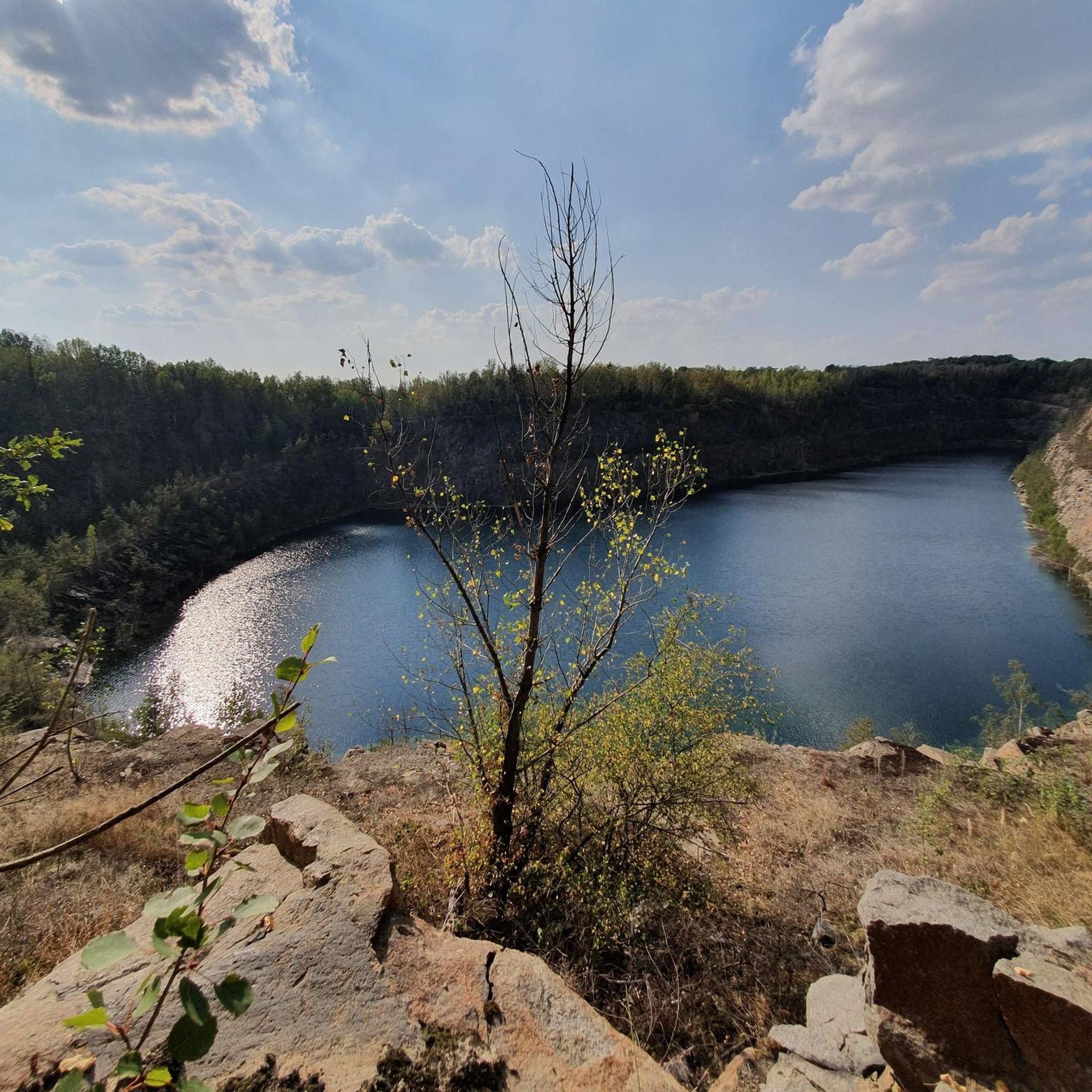
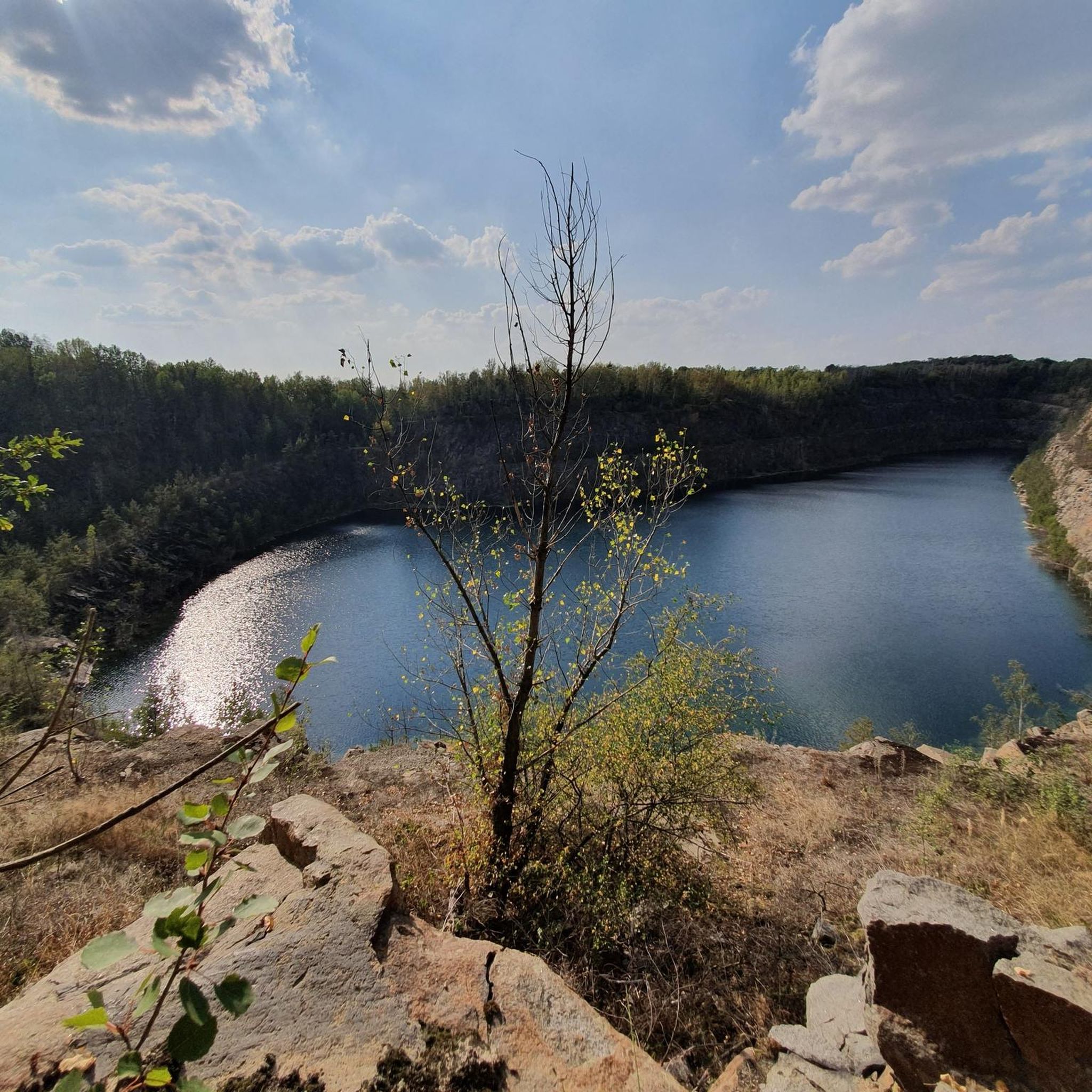
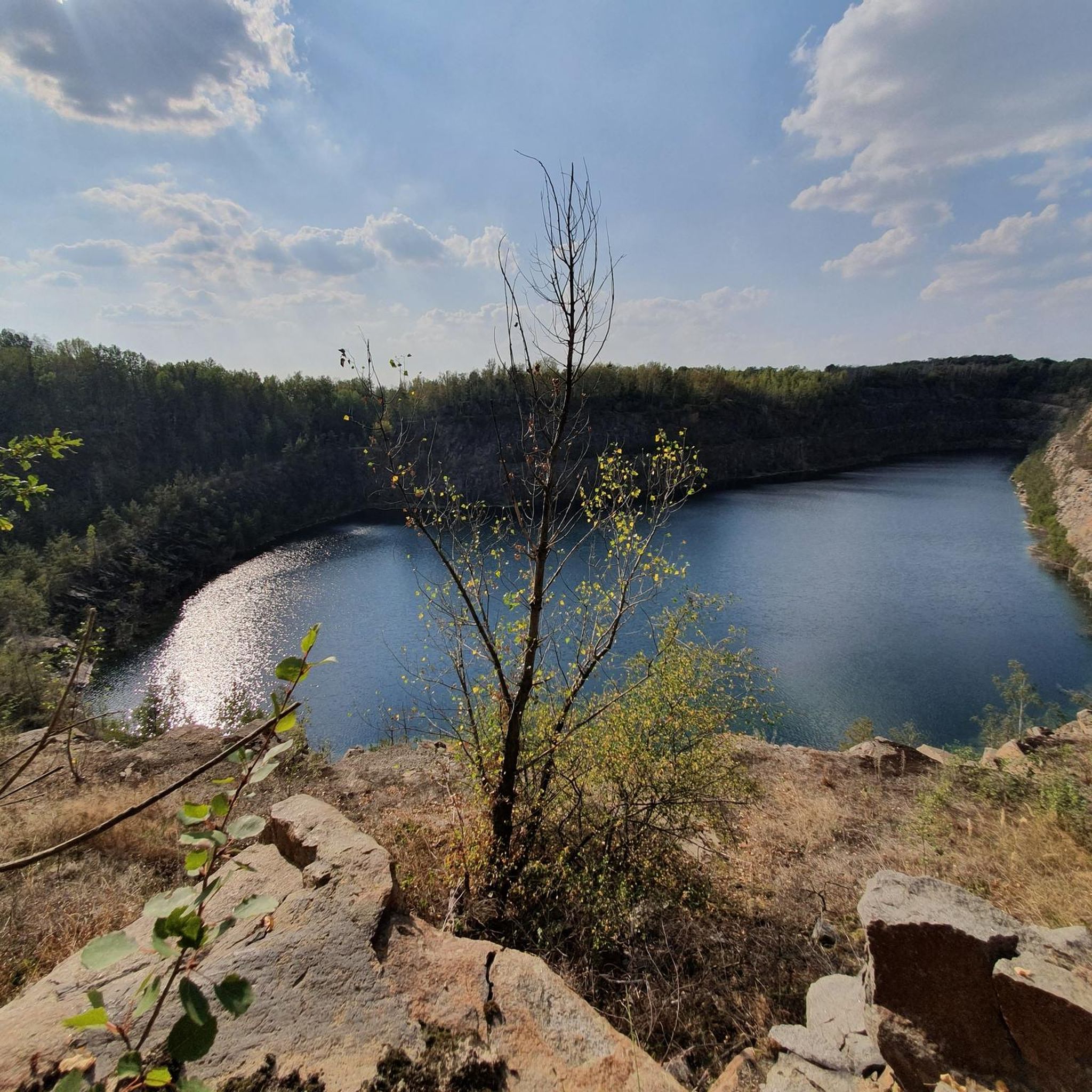
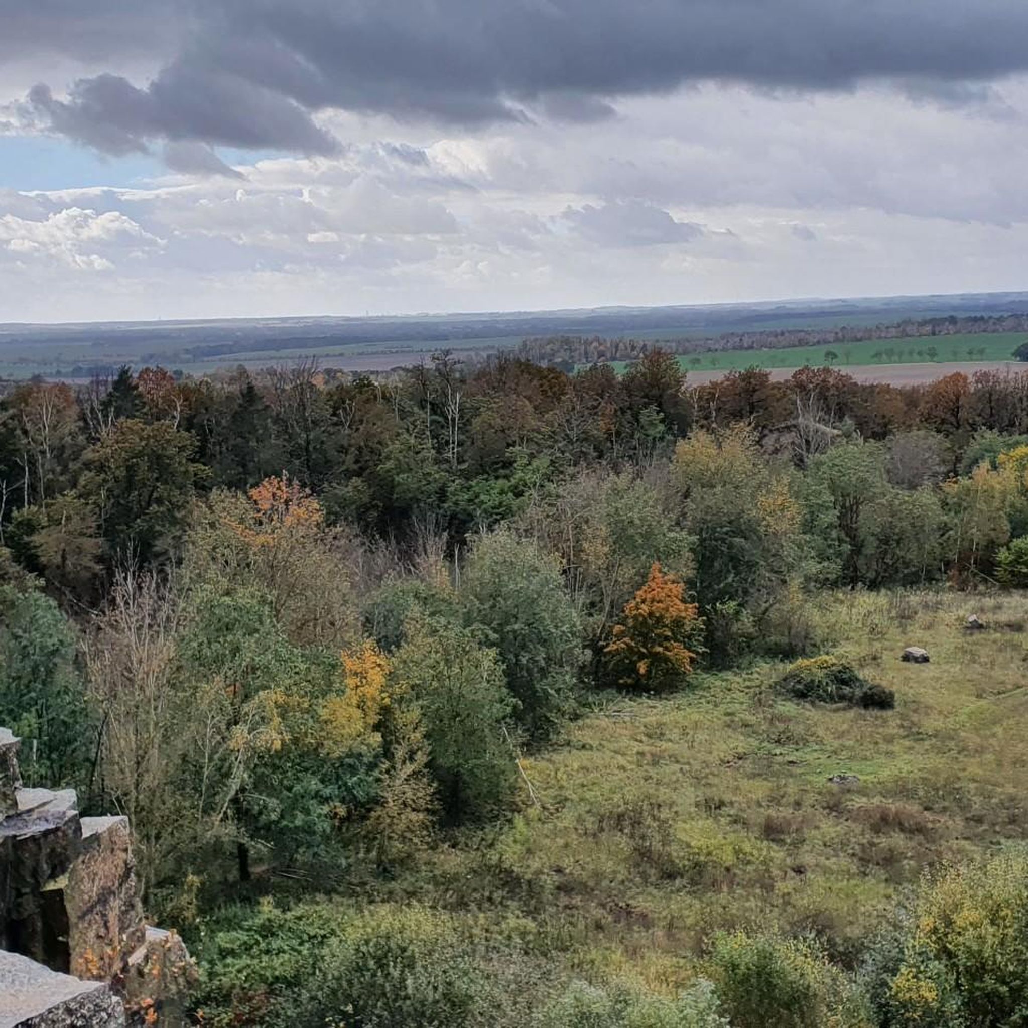
From the small bridge, you have a nice view over the water.
2
0
Invites you to take a short break
0
0
The centerpiece of the furnishings is a late Gothic carved altar from around 1500, which was restored in 1996/97. In the predella, it shows a painted depiction of the Veil of Veronica; in the shrine, a crescent Madonna with Saints Martin and Nicholas on either side. Each wing depicts four saints, whose attributes are partly no longer original, which is why the dating is unclear. On the left are a saint with an ax and Catherine, as well as Cyriacus and Ursula, on the right are Dorothea and Rochus, as well as Barbara and Peter. Of the tracery with five saints, only four pinnacles and a small crucifix above the shrine have been preserved. The octagonal baptismal font from the 17th century shows a pewter baptismal bowl with the year 1653. The small organ with a neo-Gothic prospect and free-standing console is a work from around 1840, probably by Ludwig Weineck or Nicolaus Schrickel. Source: https://de.wikipedia.org/wiki/Dorfkirche_Battaune
1
0
The simple Romanesque hall church is particularly noteworthy for its carefully executed painting, which was probably created around the year 1200. The hall was extended at the end of the 15th century, and the windows were enlarged at the beginning of the 19th century. The murals have been uncovered since 1997. The towerless building has an apse and a half-hipped roof. The Romanesque part consists of bog iron ore, the extensions to the west were made of rubble stone and brick. On the north and south sides there are (now walled-up) round-arched portals and round-arched windows, in the apse five Romanesque windows, three of which have been widened and two walled up. Inside, the building is covered with a flat roof; simple galleries are installed on three sides, with simple loges from around 1700 on the north and south sides. Under the late Gothic room version with consecration crosses, unusually well-preserved murals in a fine zigzag style have been found in the apse and on the southern wall of the hall. They show the Maiestas Domini with evangelist symbols and probably an extended Deesis in the apse, below prophets and curtain painting. There is an Atlas at each of the corner points of the apse. The Archangel Michael and the Crucifixion are depicted on the eastern wall of the hall. Source https://de.wikipedia.org/wiki/Dorfkirche_Battaune
1
0
Frequently Asked Questions
How many gravel bike trails are available around Thallwitz?
There are nearly 30 gravel bike trails around Thallwitz, offering a variety of options for different skill levels. This includes 7 easy routes, 14 moderate routes, and 8 more challenging trails.
What kind of terrain can I expect on gravel bike routes in Thallwitz?
Gravel biking in Thallwitz features diverse terrain, including picturesque rolling hills, expansive meadows, cultivated fields, and dense forests. The region is characterized by a charming floodplain landscape along the Mulde and Lossa rivers, and borders the Hohburg Mountains, providing varied surfaces for exploration.
Are there any easy gravel bike routes suitable for beginners or families?
Yes, Thallwitz offers 7 easy gravel bike routes. A good option for a more relaxed ride is the Schwemmteich Machern – Machern Castle loop from Brandis, which is about 20.3 km long and takes around 1 hour 30 minutes to complete.
What are some notable landmarks or attractions I can see along the gravel bike trails?
Many routes offer views of the region's historical and natural highlights. You might pass by impressive castles like Machern Castle or Thallwitz Castle. Natural features include the Schwarzer Bruch Quarry Lake and the unique Gruna Ferry across the Mulde River.
Are there any circular gravel bike routes in the Thallwitz area?
Yes, many of the gravel bike routes in Thallwitz are circular, allowing you to start and end at the same point. For example, the Muldentalbahn Cycle Path – View of the Mulde loop from Machern (Sachsen) is a popular moderate circular route offering scenic views of the Mulde valley.
What do other gravel bikers say about the routes in Thallwitz?
The gravel biking routes in Thallwitz are highly rated by the komoot community, with an average score of 4.1 stars from over 9 reviews. Riders often praise the diverse landscapes, from river floodplains to rolling hills and dense forests, and the variety of options for different ability levels.
What is the best time of year for gravel biking in Thallwitz?
Spring and summer are particularly vibrant for gravel biking in Thallwitz, with blooming fruit and rape fields adding to the scenic beauty. However, the diverse landscape and well-developed cycling infrastructure make it enjoyable throughout much of the year, with autumn offering beautiful foliage.
Are there any routes that follow the Mulde River?
Yes, the Mulde River is a prominent feature of the region, and several routes follow its course. A popular option is the Muldenaue near Eilenburg – Damm Cycle Path loop from Eilenburg Ost Bk Hp, which offers extensive views of the floodplain landscape along the river.
Are there any routes that explore the Porphyrland Geopark?
Thallwitz is situated within the Porphyrland Geopark, meaning many routes will naturally traverse this geologically significant area. While specific routes might not be named after the geopark, you'll experience its unique insights into volcanic eruptions and ancient landscapes throughout the region. For more specific geological insights, consider visiting the geoportal at Röcknitz Manor.
Are there any more challenging gravel routes for experienced riders?
Yes, for experienced riders seeking a challenge, there are 8 difficult routes available. One such route is the Muldenaue near Eilenburg – Wooden Bridge in Dübener Heide loop from Eilenburg Ost, which covers over 35 km with some elevation gain, leading through the Muldenaue and towards Dübener Heide.
What are the typical distances and elevation gains for gravel routes in Thallwitz?
Gravel routes in Thallwitz vary significantly. Easy routes can be around 20 km with moderate elevation, while moderate routes often range from 30-40 km with elevation gains up to 150 meters. More difficult trails can be longer and feature more significant climbs, though the region is generally characterized by rolling hills rather than steep mountains.
Can I find routes that pass through forests or natural reserves?
Absolutely. The region is known for its dense forests and natural areas. The Muldenaue near Eilenburg – Wooden Bridge in Dübener Heide loop from Eilenburg Ost, for instance, leads towards the Dübener Heide. The Naturschutzgebiet Wachtelberg-Mühlbachtal, Germany's oldest protected area for endangered plants, is also nearby, offering opportunities to experience the region's rich biodiversity.
Most popular attractions around Thallwitz

Get inspired with the komoot mobile app


Explore more
Browse the best Gravel rides in other regions.
