The best road cycling routes in Auburn State Recreation Area
4.4
(7)
376
riders
58
rides
Road cycling routes in Auburn State Recreation Area are situated within the Sierra Nevada foothills, offering diverse terrain for riders. The region is characterized by the North and Middle Forks of the American River, deep canyons, and a mix of pine and oak woodlands. Cyclists encounter varied surfaces, including paved sections and roads with significant climbs and descents. The landscape provides panoramic views of the American River Canyon and features like Lake Clementine.
Best road cycling routes in Auburn State…
Last updated: November 7, 2026
6
riders
Moderate road ride. Good fitness required. Mostly well-paved surfaces and easy to ride.
7
riders
49.7km
02:41
850m
850m
Moderate road ride. Good fitness required. Mostly well-paved surfaces and easy to ride.

23
riders
102km
05:40
2,180m
2,180m
18
riders
Hard road ride. Very good fitness required. Mostly well-paved surfaces and easy to ride.
3
riders
28.4km
01:26
450m
450m
Moderate road ride. Good fitness required. Mostly well-paved surfaces and easy to ride.
Get access to more routes and recommendations from other explorers.
Already have an account?
Our route recommendations are based on thousands of hikes, rides, and runs completed by other people on komoot.
Start today with a free account
Your next adventure awaits.
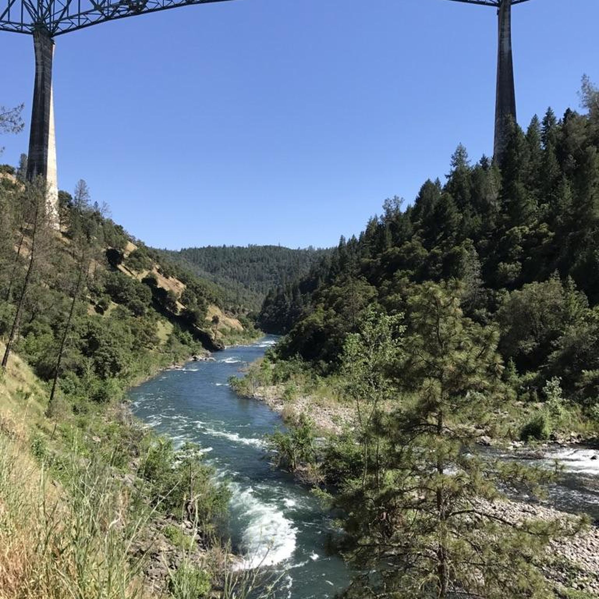
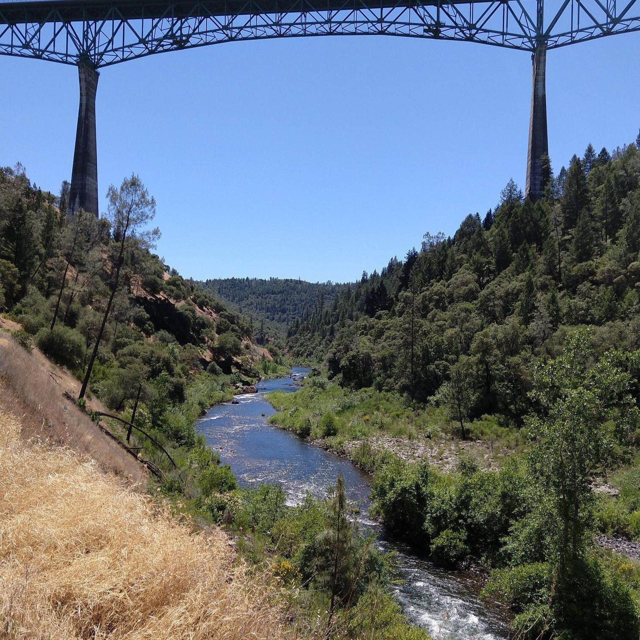
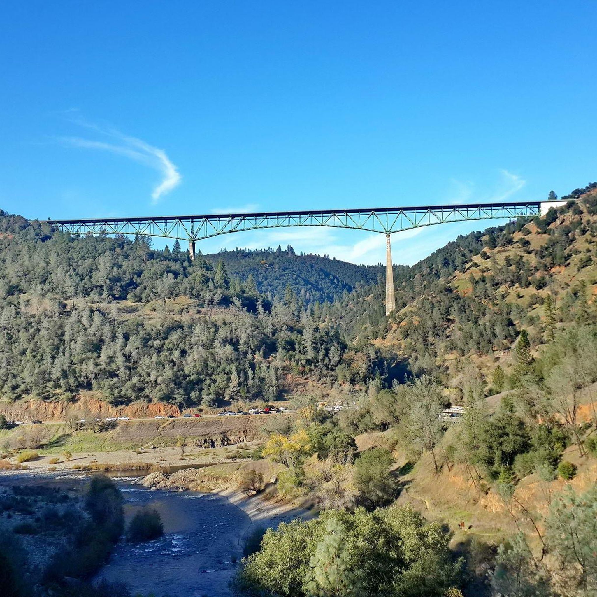
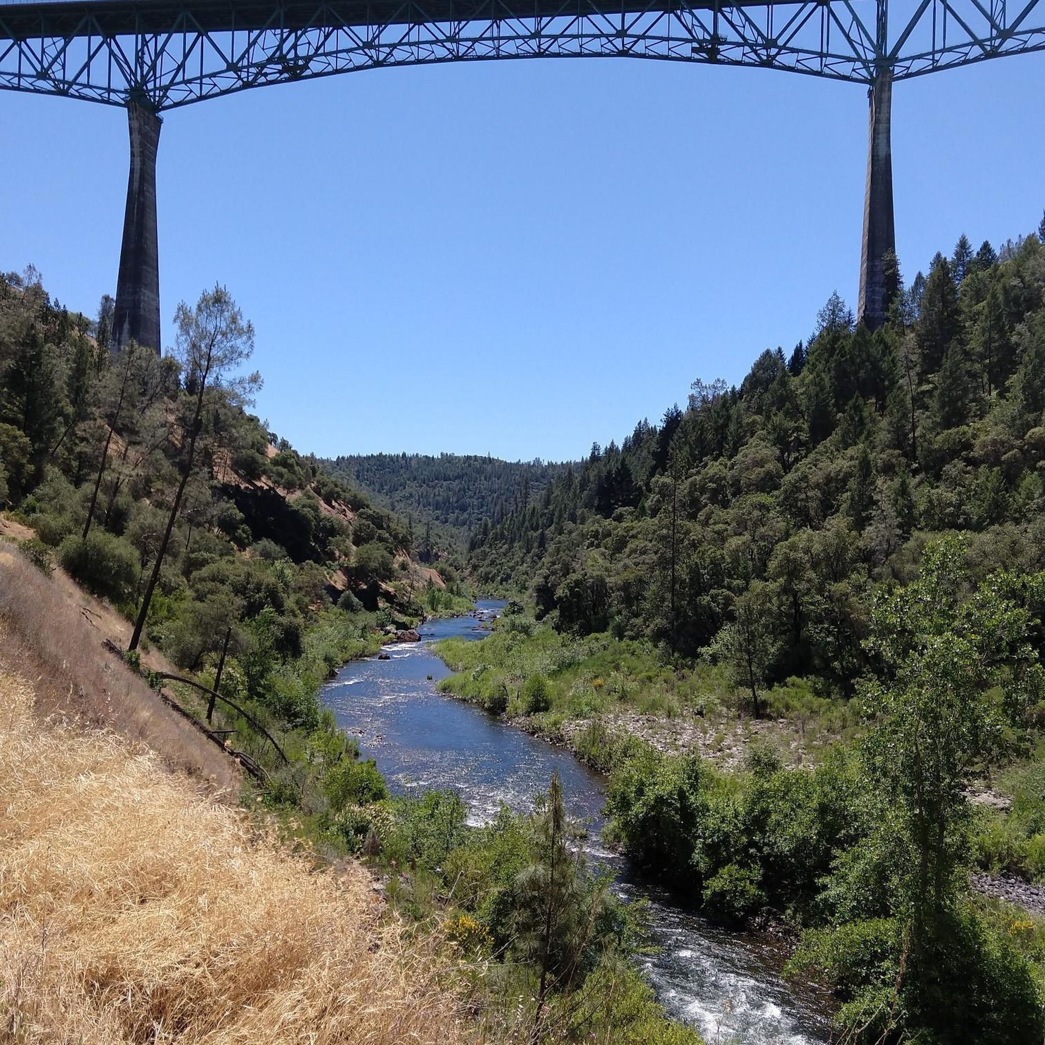

Tips from the Community

Great perspective for a long view south into the American River Canyon from the western ridge. Pioneer Express trail connects nearby to Shirland Canal Trail to stay on the contour, and also continues parallel to the south and north.
1
0
A little east parallel and between road and the the Shirland Canal Trail, Pioneer Express has excellent views into American River Canyon.
1
0
Auburn's downtown preserved some of its 19th century Western town architecture and flair. After its initial boom during the gold mining period it maintained its seat of courts and benefits from its location at the Sierra Nevada foothills as one of the gateways to a pass across the mountain range. Established in 1849, Auburn that has shops, monuments, museum, restaurants, and more all within walking distance, and hosts several well-known outdoor events.
1
0

Foresthill Road is a scenic highway going through the Auburn State Recreation Area. It's not great for running on, as it has no good shoulders and can be very trafficked, but it is a good turn-around spot.
0
0
Fire House No. 1 is on the National Register of Historic Places and was, at one point, completely relocated in the 1970s from another part of town. It was originally built in 1888. The inside is not open to the public, but the outside is open for photos and marveling.
0
0
Old Town Auburn, established in 1849, is a part of Auburn that has shops, monuments, restaurants, and more all within walking distance. It has some historical sites to check out, and the vibe still feels like that of an old gold mining town here.
0
0

The American River sits at the bottom of this dry, riparian canyon. The hills above the river offer sweeping vistas of the American as it snakes through the yellow and green grasses.
0
0
Sugar Pine Reservoir Dam serves as the water supply for the Foresthill community. Visitors can find a day-use and swimming area featuring restrooms, drinking water facilities, and a campground just 1.2 miles down Iowa Hills Road heading east. The reservoir is home to rainbow trout and bass.
0
0
Frequently Asked Questions
How many road cycling routes are available in Auburn State Recreation Area?
Auburn State Recreation Area offers over 50 road cycling routes, providing a wide range of options for various skill levels and preferences.
What kind of terrain can I expect on road cycling routes in Auburn State Recreation Area?
You can expect diverse terrain, from the Sierra Nevada foothills to deep canyons. Routes often feature significant climbs and descents on both paved and unpaved sections, winding through pine and oak woodlands with panoramic views of the American River Canyon.
Are there any challenging road cycling routes for experienced riders?
Yes, there are several challenging routes. For instance, the Sugar Pine Dam and Reservoir loop from Ruck-a-Chucky Campground is a difficult 61.4-mile path with significant climbs and descents. Another demanding option is the North Fork loop, covering over 63 miles with substantial elevation gain.
What are some scenic viewpoints or natural features to look out for?
The area is rich with natural beauty. You can enjoy stunning views of the American River Canyon and features like Lake Clementine. The Foresthill Bridge offers monumental views over the American River, and the North Fork Dam at Lake Clementine creates an impressive waterfall during peak runoff.
Are there any family-friendly road cycling options in the area?
While many routes feature significant climbs, some sections and multi-use trails incorporate smoother, paved surfaces that can be more suitable for families. It's best to check individual route details for specific difficulty and terrain information to find the most appropriate options.
Can I find loop routes for road cycling?
Yes, many road cycling routes in Auburn State Recreation Area are designed as loops. Examples include the popular Roadbike loop from Auburn Lake Trails and the more challenging Folsom Lake loop from Auburn Lake Trails.
What is the best time of year for road cycling in Auburn State Recreation Area?
The Sierra Nevada foothills generally offer pleasant cycling conditions during spring and fall, when temperatures are milder. Summers can be hot, especially in the canyons, while winters may bring cooler temperatures and occasional rain. Always check local weather forecasts before heading out.
Where can I park when road cycling in Auburn State Recreation Area?
Parking is available at various access points throughout the Auburn State Recreation Area. Specific parking locations often depend on the trailhead or starting point of your chosen route. It's advisable to check the details for your specific route or consult the official park website for designated parking areas.
Are there any historical sites or attractions along the routes?
The region has a rich Gold Rush heritage, with remnants from that era and old railroad routes. While cycling, you might encounter historical markers or sites that speak to the area's past. The Foresthill Bridge itself is a notable landmark from 1973.
What do other cyclists say about road cycling in Auburn State Recreation Area?
The routes in Auburn State Recreation Area are highly rated by the komoot community, with an average score of 4.4 stars from over 5 reviews. Cyclists often praise the varied terrain, stunning views of the American River Canyon, and the challenging yet rewarding climbs and descents.
Are dogs allowed on road cycling routes in Auburn State Recreation Area?
Auburn State Recreation Area is generally dog-friendly, but specific rules may apply to different trails or areas. It's always best to check the official park regulations regarding pets on trails to ensure compliance and a safe experience for everyone.
What are some nearby attractions I can explore besides cycling?
Beyond cycling, Auburn State Recreation Area offers numerous activities. You can enjoy hiking, mountain biking, water activities like boating, fishing, rafting, and swimming in the American River or Lake Clementine. The area also has opportunities for camping, gold panning, and horseback riding. For more details, you can visit the official California State Parks website for Auburn State Recreation Area.
Are there any easy road cycling routes for beginners?
While many routes feature significant elevation changes, there are some easier options available. The area has 2 routes classified as 'easy' out of a total of over 50. These routes typically have less elevation gain and shorter distances, making them more accessible for those new to road cycling or looking for a more relaxed ride.
Most popular routes in Auburn State Recreation Area
Most popular attractions in Auburn State Recreation Area

Get inspired with the komoot mobile app


Explore more
Browse the best Road cycling routes in other regions.
