The best walks and hikes in Upper Las Virgenes Open Space Preserve
4.4
(75)
1,094
hikers
15
hikes
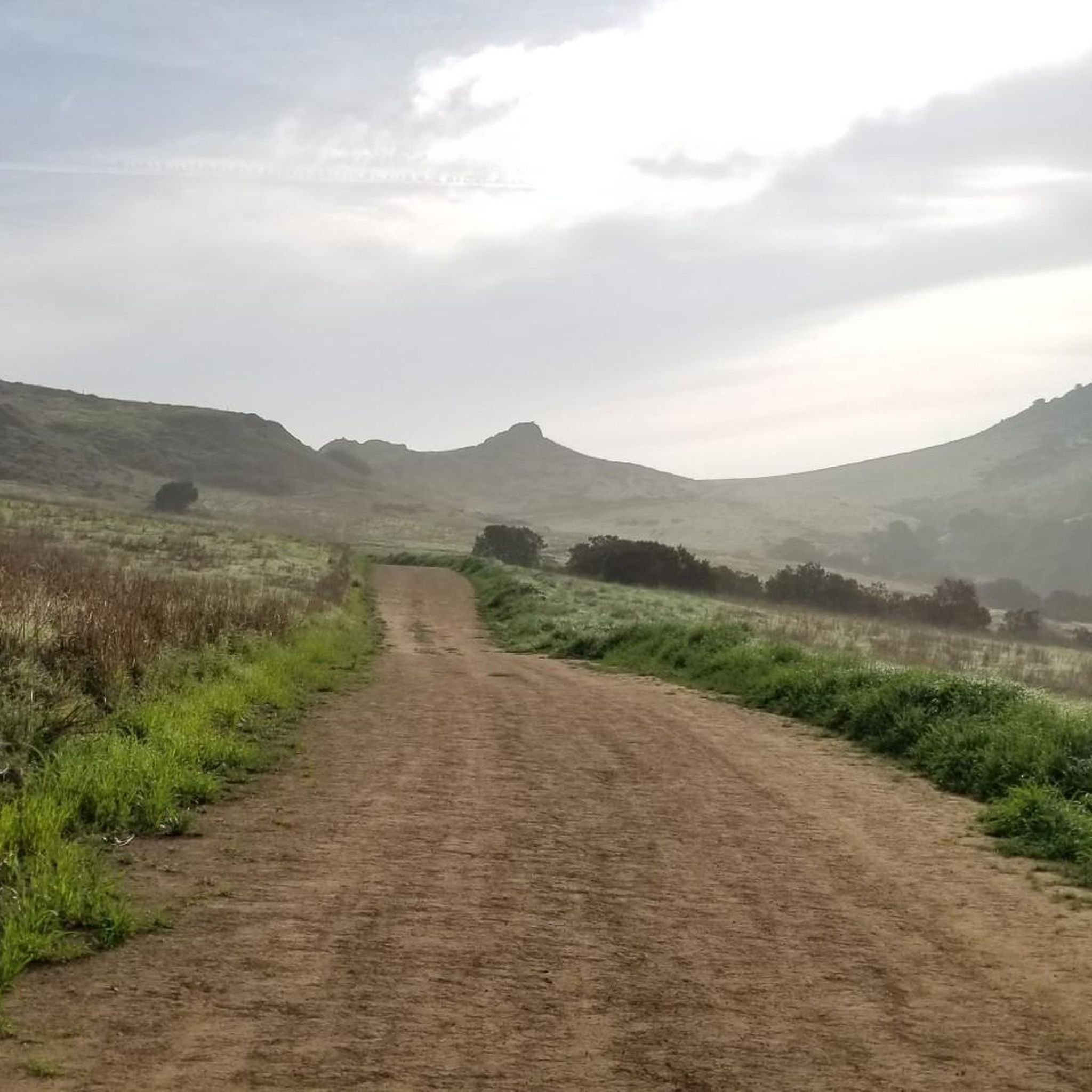
Hikes in Upper Las Virgenes Open Space Preserve explore a landscape of rolling hills, oak woodlands, and expansive grasslands in the Simi Hills. The preserve features a network of wide fire roads and singletrack trails that cross sycamore-lined canyons and open terrain. Formerly known as Ahmanson Ranch, this area serves as a critical wildlife corridor, with trails offering broad views of the surrounding landscape. The main access points are the Victory Trailhead and the Las Virgenes Canyon Road Trailhead.
Best hiking trails in Upper Las Virgenes Open Space Preserve
- The most popular hiking route is the Mary Weisbrock Loop Trail — Upper Las Virgenes Open Space Preserve, a 3.4 mile (5.4 km) trail that takes around 1 hour 30 minutes to complete. This easy route follows wide paths through the preserve's characteristic rolling grasslands.
- Another top favourite among local hiking enthusiasts is the East Las Virgenes Canyon Trail — Upper Las Virgenes Open Space Preserve, a moderate 6.0 mile (9.7 km) path. The trail provides a longer exploration of the canyon floor and surrounding hills.
- Local hiking enthusiasts also love the Victory Trailhead – Mary Weisbrock Loop Trail loop from Upper Las Virgenes Open Space Preserve, a 5.0 mile (8.1 km) trail leading through open hillsides, often completed in about 2 hours 15 minutes.
- Hiking in Upper Las Virgenes Open Space Preserve is defined by its rolling grasslands, oak-studded hills, and wide canyon trails. The trail network offers options for different ability levels, from gentle loops to more extended moderate hikes.
- The routes in Upper Las Virgenes Open Space Preserve are highly rated by the komoot community with an average score of 4.7 stars from more than 75 reviews. More than 1,000 hikers have used komoot to explore Upper Las Virgenes Open Space Preserve's varied terrain.
Last updated: October 11, 2026
20
hikers
6.12km
01:42
110m
110m
The East Las Virgenes Canyon Loop offers a delightful journey through the Upper Las Virgenes Canyon Open Space Preserve, showcasing rolling hills and diverse habitats. You'll traverse unpaved fire roads, winding past impressive valley oaks and through sycamore-lined canyon bottoms, with glimpses of the small Las Virgenes Creek. This easy 3.8-mile (6.1 km) hike involves a manageable 365 feet (111 metres) of elevation gain, typically taking about 1 hour and 42 minutes to complete, making it ideal for a refreshing outing.
To start your adventure, head to the Victory Trailhead, which is the main entrance to the preserve. There's a $3 parking fee, so have some cash or card ready. The trail is dog-friendly, but always confirm current leash regulations before you go. For the most scenic experience, consider visiting after winter rains when the landscape is at its greenest, offering excellent opportunities for wildlife spotting like lizards and hawks.
This loop provides a fantastic introduction to the natural beauty of the Upper Las Virgenes Canyon Open Space Preserve, known for its extensive riparian corridors and varied plant communities like Southern Coast Live Oaks Riparian Forest. You'll be treated to panoramic vistas of the surrounding area, including parts of the San Fernando Valley, making it a popular choice for those seeking accessible views and a taste of local wilderness.
13
hikers
6.20km
01:40
80m
80m
The Mary Wiesbrock Loop Trail offers a delightful and varied outdoor experience, winding through grassy canyons and hillsides dotted with valley oak trees. You'll enjoy panoramic views of the Santa Monica Mountains and the San Fernando Valley from spots like Lasky Mesa, especially vibrant in spring with colorful wildflowers. This easy 3.9 miles (6.2 km) route, with a gentle 267 feet (81 metres) of elevation gain, is perfect for a relaxed outing, typically taking about 1 hour and 40 minutes to complete, making it one of the more popular trails routes for a quick nature fix.
To plan your visit, head to the Victory Trailhead where parking is available for a $3 fee. Spring is the ideal time to go, when the landscape bursts with wildflowers, though be mindful that the trail can be muddy after rain. During warmer months, rattlesnakes may be present, so stay alert. This Mary Wiesbrock Loop Trail parking is generally easy to access, and the trail is dog-friendly, provided your furry friend stays on a leash.
Located within the Upper Las Virgenes Canyon Open Space Preserve, this trail is a haven for local wildlife; keep an eye out for red-winged blackbirds, hawks, lizards, squirrels, and rabbits. Beyond its natural beauty, the area is also known for being a frequent movie and television filming location. It's a multi-use path, so expect to share the route with runners, mountain bikers, and horseback riders, adding to the lively atmosphere of this accessible loop.

5
hikers
15.9km
04:21
240m
240m
The East Las Virgenes Canyon and Laskey Mesa Loop offers a diverse hiking experience through Southern California's rolling grasslands and oak woodlands. You'll find yourself on wide paths, often resembling fire roads, that lead through sycamore-lined canyon bottoms near Las Virgenes Creek, eventually opening up to expansive views of the Santa Monica Mountains. This moderate 9.9-mile (15.9 km) route, with its 801 feet (244 metres) of elevation gain, provides a good workout and a refreshing escape into nature.
To plan your visit, you can park at either the Las Virgenes Road Trailhead or the Victory Trailhead, both offering convenient access. The estimated time for this hike is around 4 hours and 20 minutes, so plan accordingly. For the most vibrant scenery, consider hiking after winter rains when the hills are lush and green, though spring and fall also offer comfortable temperatures for exploring the East Las Virgenes Canyon and Laskey Mesa Loop.
This trail is a gem within the Upper Las Virgenes Canyon Open Space Preserve, an ecologically significant area protecting vital habitats. The landscape transforms with the seasons, from dewy green in spring to golden brown in drier months, showcasing the natural beauty of the region. It's a less-traveled option on its western side, providing a sense of solitude compared to busier local trails, and connects to a larger network of paths for those seeking longer adventures.
4.0
(1)
6
hikers
4.85km
01:20
90m
80m
The Lower Las Virgenes Canyon Loop offers a delightful and diverse hiking experience within the Upper Las Virgenes Canyon Open Space Preserve. You'll traverse wide dirt paths through California sagebrush and mature valley oaks, then wind through grassy meadows alongside Las Virgenes Creek, eventually reaching groves of oaks and ceanothus bushes. The scenery shifts from open hillsides with expansive views of the Santa Monica Mountains to more sheltered riparian woodlands, providing a varied and engaging journey.
This easy 3.0-mile (4.8 km) loop involves a gentle 282 feet (86 metres) of elevation gain, taking approximately 1 hour and 20 minutes to complete. The trail is well-suited for most fitness levels, including beginners, and is popular with hikers, mountain bikers, and equestrians. Access is via the Las Virgenes Road Trailhead, and the western entrance to the preserve is often less crowded, offering a peaceful escape.
Part of a significant conservation area, this trail serves as a vital ecological linkage and wildlife corridor for the Santa Monica Mountains, supporting diverse wildlife like deer, hawks, and bobcats. In spring, the hillsides burst with colorful wildflowers, making it a particularly beautiful time to visit. Keep an eye out for distinct sandstone formations and enjoy the quiet solitude this less-traveled route provides.
4
hikers
6.13km
01:46
150m
150m
The East Las Virgenes Canyon and Laskey Mesa Loop offers a delightful escape into Southern California's natural beauty. This easy 3.8-mile (6.1 km) hike, with its 484 feet (148 metres) of elevation gain, guides you through rolling hills, grasslands, and the picturesque sycamore-lined East Las Virgenes Canyon. Expect wide, well-maintained paths and rewarding panoramic views of the Santa Monica Mountains and San Fernando Valley from Laskey Mesa, all achievable in about 1 hour and 45 minutes.
Parking is readily available at the Las Virgenes Road Trailhead, making access straightforward. The trail is dog-friendly, provided your furry friend stays on a leash. For the best experience, consider hiking in the cooler seasons or during the morning hours, especially if you're looking for a less crowded experience and to avoid the midday sun.
This route is nestled within the Upper Las Virgenes Canyon Open Space Preserve, an ecologically significant area known for its biodiversity. Laskey Mesa itself holds a fascinating past, having served as a popular filming location for Westerns and other movies from the 1920s to the 1950s, adding a touch of Hollywood history to your outdoor adventure.
Get access to more routes and recommendations from other explorers.
Already have an account?
Our route recommendations are based on thousands of hikes, rides, and runs completed by other people on komoot.
Start today with a free account
Your next adventure awaits.
Popular around Upper Las Virgenes Open Space Preserve
Tips from the Community

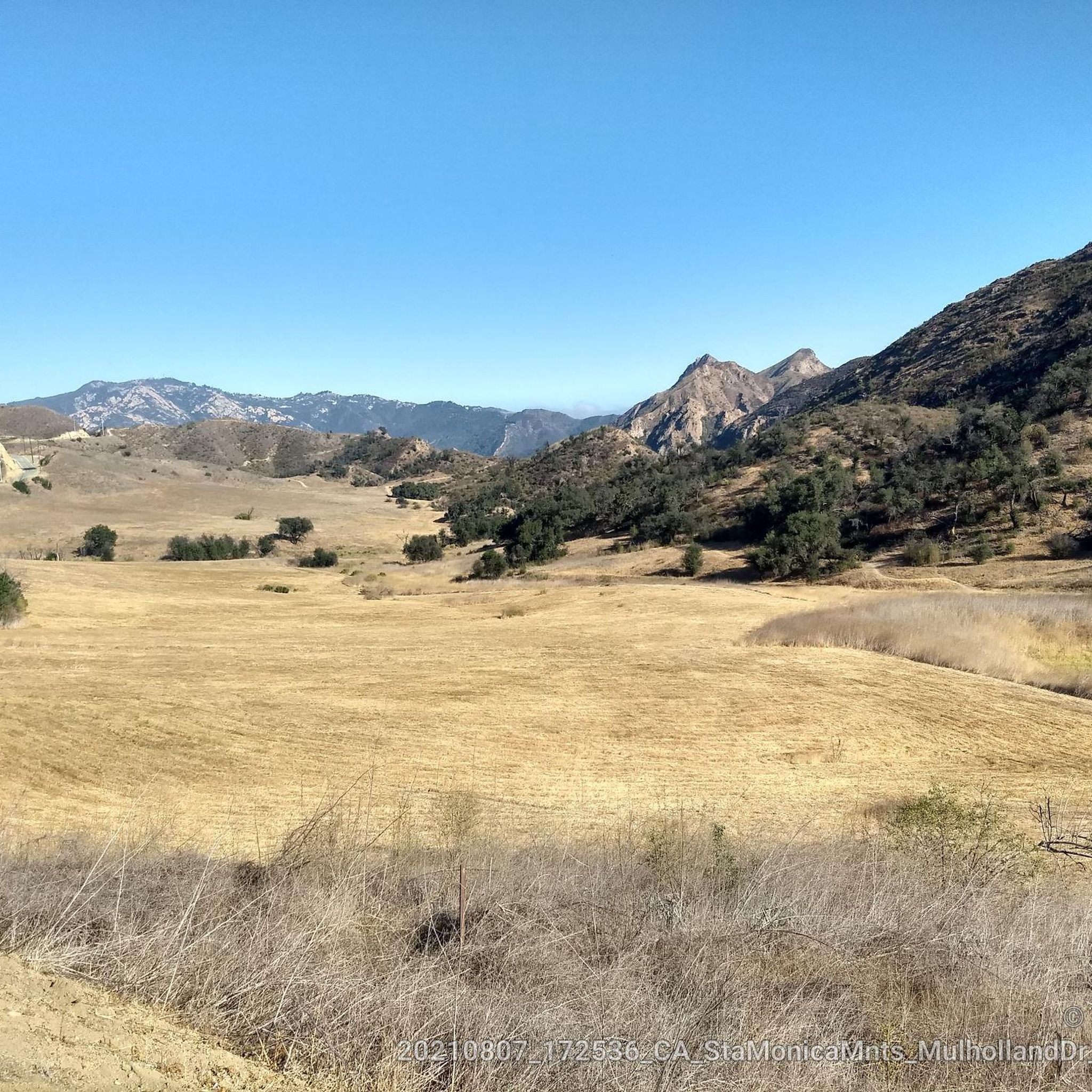
At the end of Victory Blvd is a parking spot (USD 3 per car). From here you can choose wide trails and small paths throughout a hilly landscape. From top of the hills you can enjoy the view.
0
0

This trailhead is an access point for the Upper Las Virgenes Open Space Preserve. The trail network here has some beautiful views of rolling hills and passes through diverse local habitats.
0
0
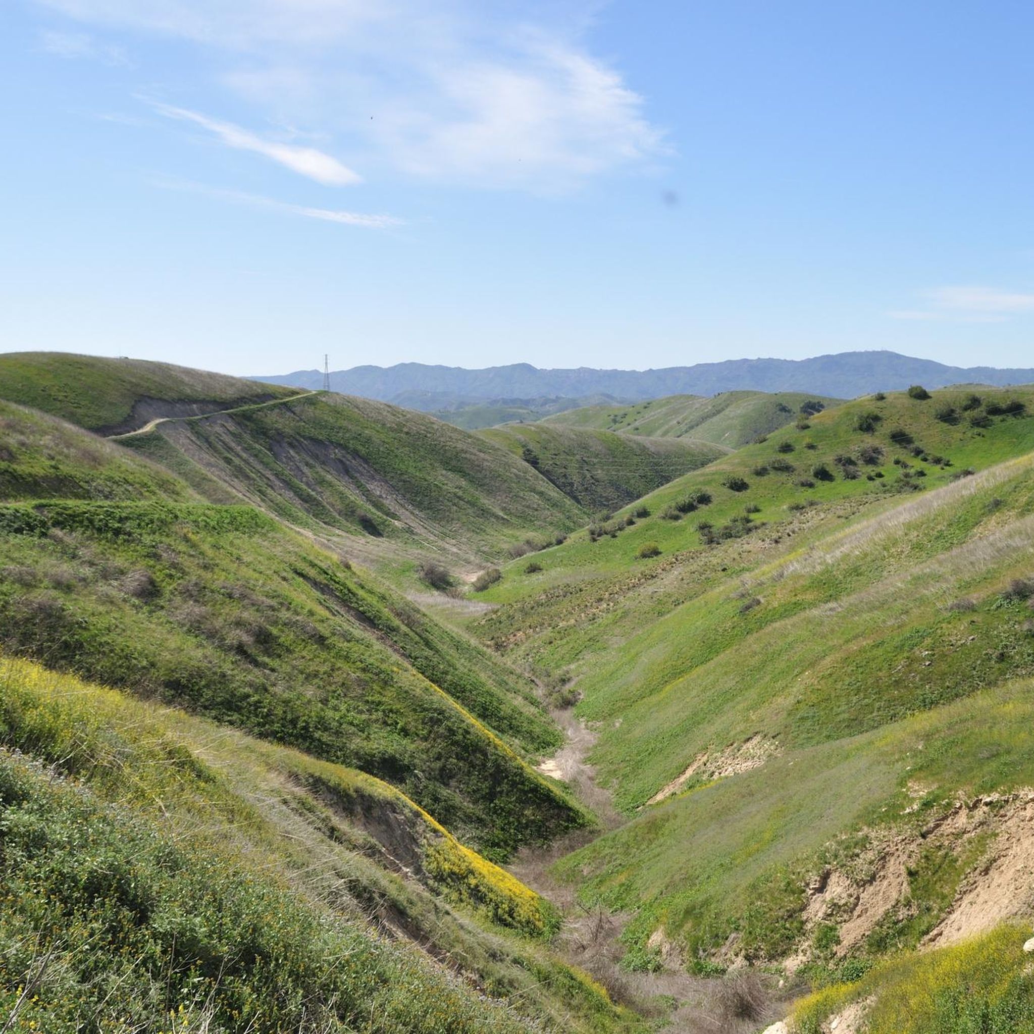
This trailhead offers access to the southern end of the Upper Las Virgenes Open Space Preserve. You can follow it to the East Las Virgenes Canyon or Upper Las Virgenes Canyon Trails for some beautiful views of the park.
0
0
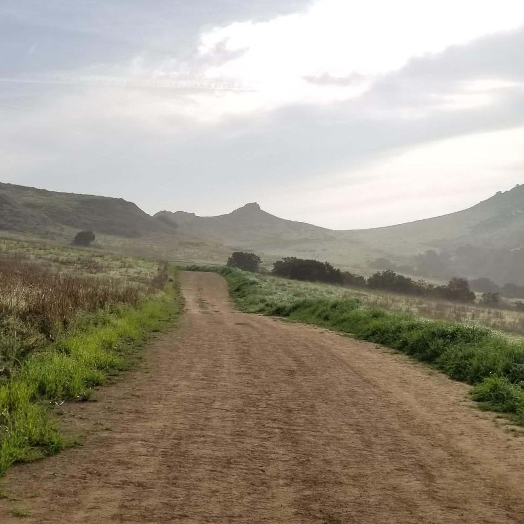
This trailhead is an access point for the Upper Las Virgenes Open Space Preserve. The trail network here has some beautiful views of rolling hills and passes through diverse local habitats. There is a $3 parking fee at the trailhead.
0
0
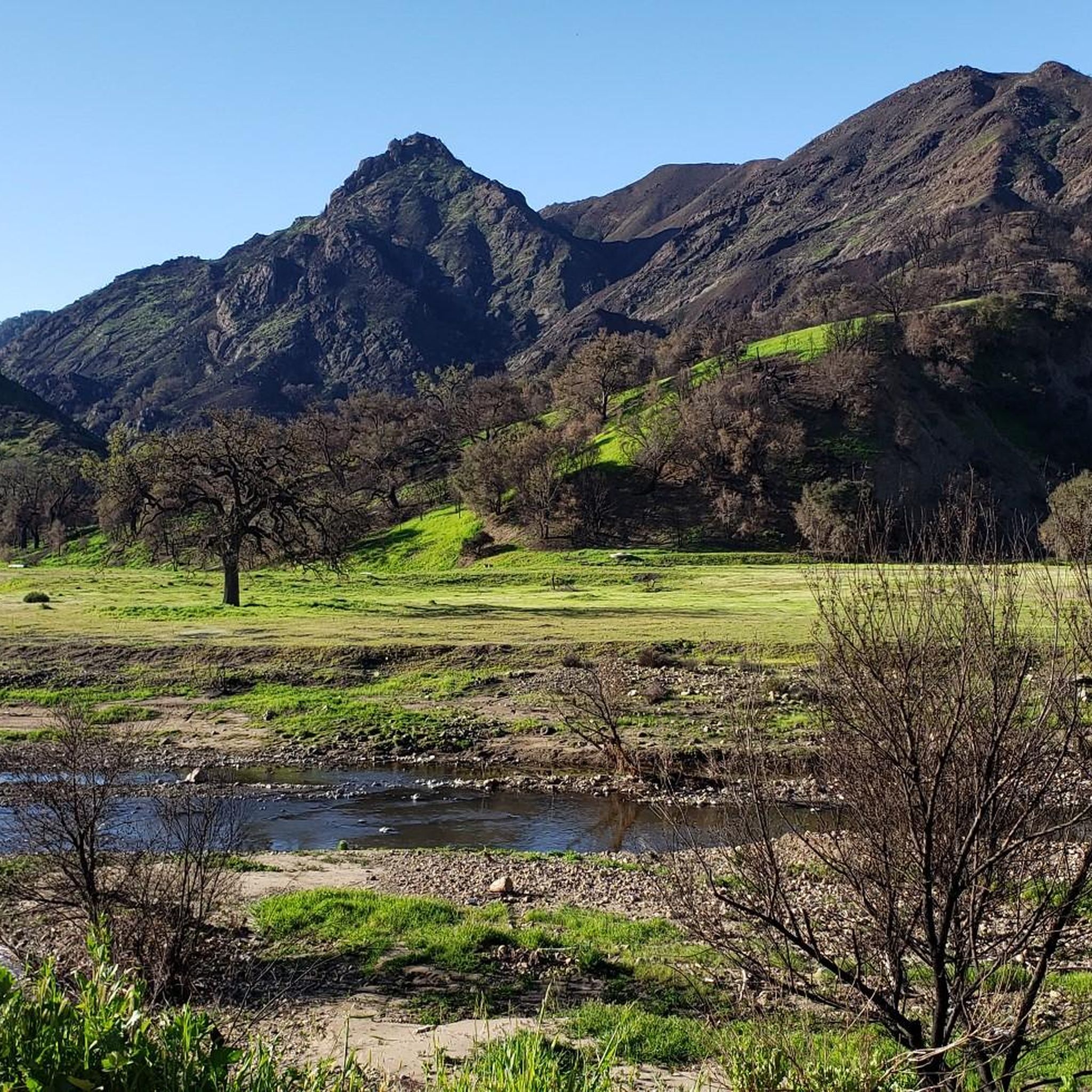
Right around the junction of the Upper Las Virgenes Canyon Trail and the East Las Virgenes Canyon Trail, you pass by this small creek with beautiful views of the canyon in the distance.
0
0
Frequently Asked Questions
Where are the main trailheads for Upper Las Virgenes Open Space Preserve?
There are two primary access points for the preserve. The Victory Trailhead is located at the western end of Victory Boulevard in West Hills. The other main entrance is the Las Virgenes Canyon Road Trailhead in Calabasas. Both offer access to the extensive trail network.
Are dogs allowed on the trails?
Yes, dogs are welcome in the preserve but must be kept on a leash at all times. Please be mindful of the local wildlife, including snakes, and be sure to bring enough water for both yourself and your pet, as the trails are very exposed.
What is the best time of year to hike here?
Spring is a spectacular time to visit, as the rolling hills are green and covered in wildflowers like poppies and lupine. Autumn and winter offer cooler, more pleasant hiking conditions. Summer can be extremely hot and dry with little shade, so if you hike during this season, it's best to go early in the morning and carry plenty of water.
Are there any easy, beginner-friendly hikes?
Yes, the preserve has several easier options. The Victory Trailhead loop from Canoga Park is a great choice for a gentler walk. It follows wide fire roads through the grasslands and is a good introduction to the area's landscape without significant elevation gain.
What kind of wildlife might I see?
The preserve is a vital wildlife corridor, so sightings are common. You may encounter deer, coyotes, rabbits, and various birds of prey. It's also home to a variety of reptiles, including rattlesnakes, so always be aware of your surroundings. The area's ecosystems support sensitive species like the California red-legged frog.
Can I go mountain biking or horseback riding?
Yes, the preserve's wide fire roads and multi-use trails are popular with both mountain bikers and equestrians. The rolling terrain offers a variety of options suitable for different skill levels. Always be courteous and yield to other trail users.
Are there any waterfalls in the preserve?
The preserve is characterized by its dry, chaparral landscape and does not feature any permanent waterfalls. The creeks and canyons, such as Bell Canyon Creek, may have flowing water after significant rainfall, but this is seasonal and temporary.
What is the historical significance of this area?
The land has a rich history. It was originally home to the Chumash, Tongva, and Tataviam peoples, and landmarks like the Cave of Munits and Castle Peak hold cultural importance. More recently, the area was known as Ahmanson Ranch before being saved from development and preserved as open space in 2003.
How many trails are there in the preserve?
There are over 100 different routes to explore within Upper Las Virgenes Open Space Preserve. The network consists of a mix of wide fire roads and singletrack trails, offering everything from short, easy loops to more strenuous, longer hikes.
Can I do a long-distance hike here?
Absolutely. For a longer and more challenging exploration of the preserve, consider the Victory Trailhead – Las Virgenes Canyon loop from Canoga Park. This route covers more ground and provides a comprehensive tour of the canyons and hillsides.
How do I get an official trail map?
While many trails are well-marked, it's always wise to carry a map. You can find official maps and information on the park's website. For the most current park status, trail conditions, and downloadable maps, visit the MRCA park page.
What do other hikers say about the trails?
The trails in Upper Las Virgenes Open Space Preserve are highly regarded by the komoot community. Hikers often praise the stunning, wide-open vistas, the beautiful wildflower displays in the spring, and the sense of solitude despite being close to the city.
Most popular routes in Upper Las Virgenes Open Space Preserve
Most popular attractions in Upper Las Virgenes Open Space Preserve

Get inspired with the komoot mobile app


Explore more
Browse the best Hikes in other regions.
