Routes

Planner

Features

Updates

App

Login or Signup

Get the App

Login or Signup

Routes
Hikes
United States
California
Santa Clara County

Sierra Azul Open Space Preserve

The best walks and hikes in Sierra Azul Open Space Preserve

4.6

(214)

3,404

hikers

17

hikes

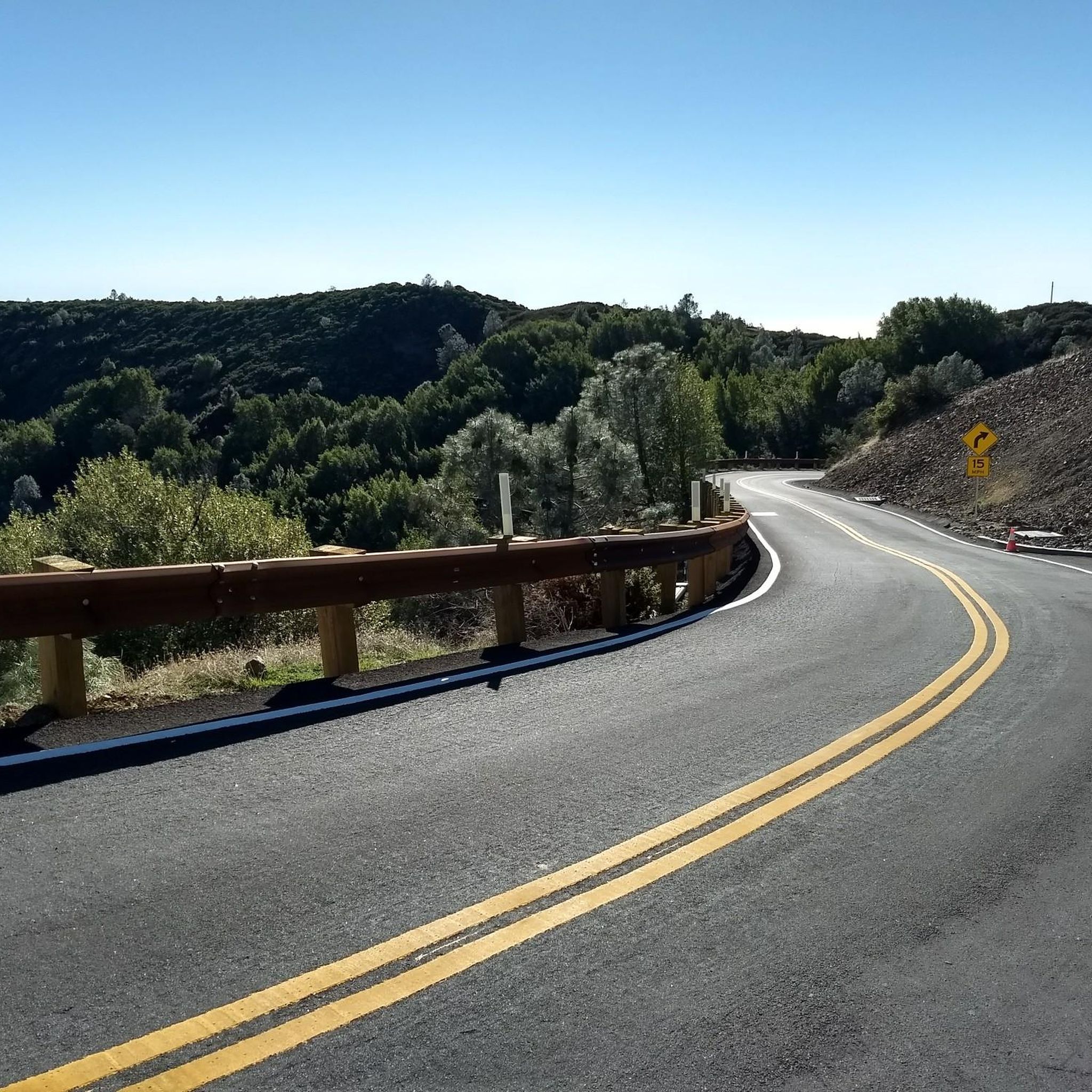
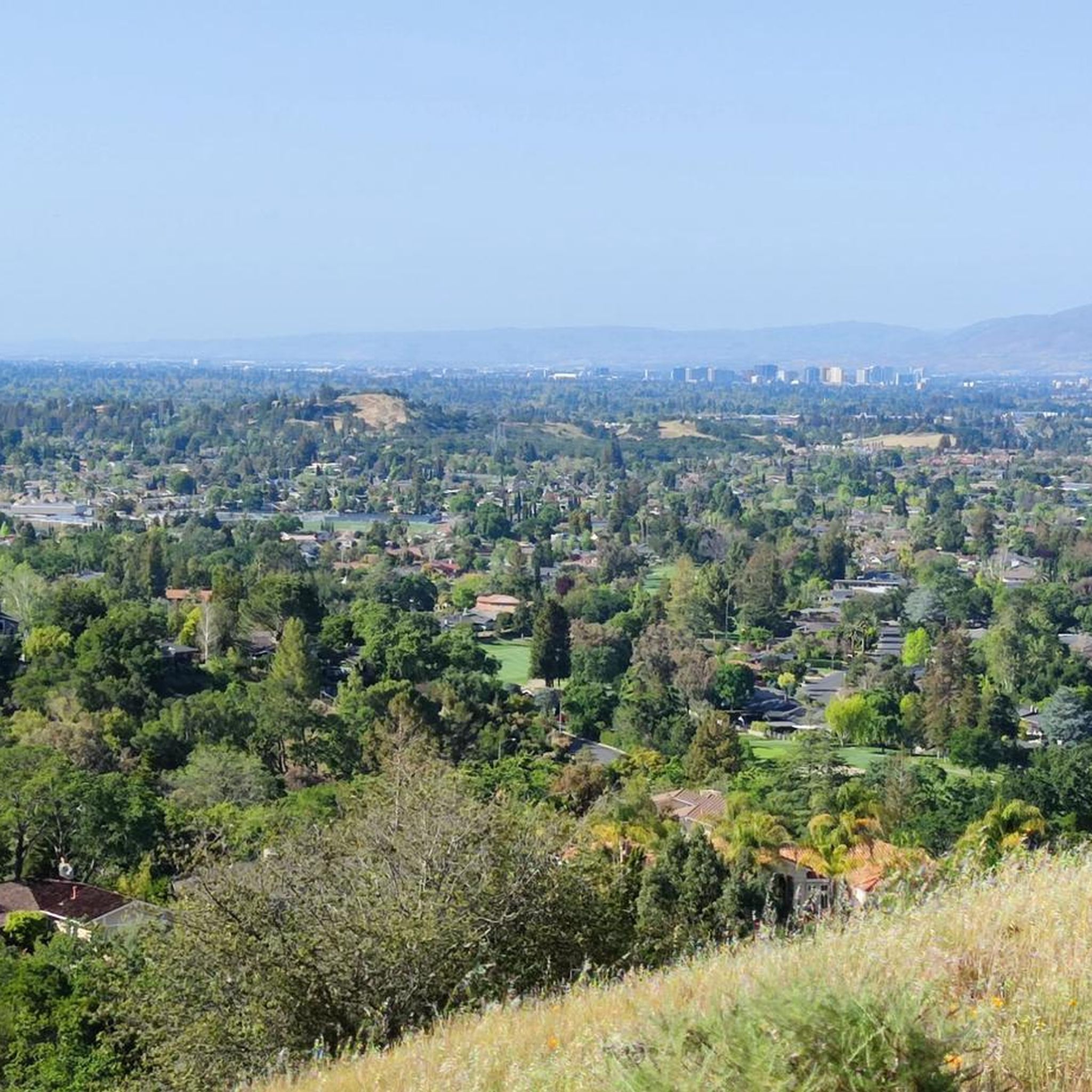
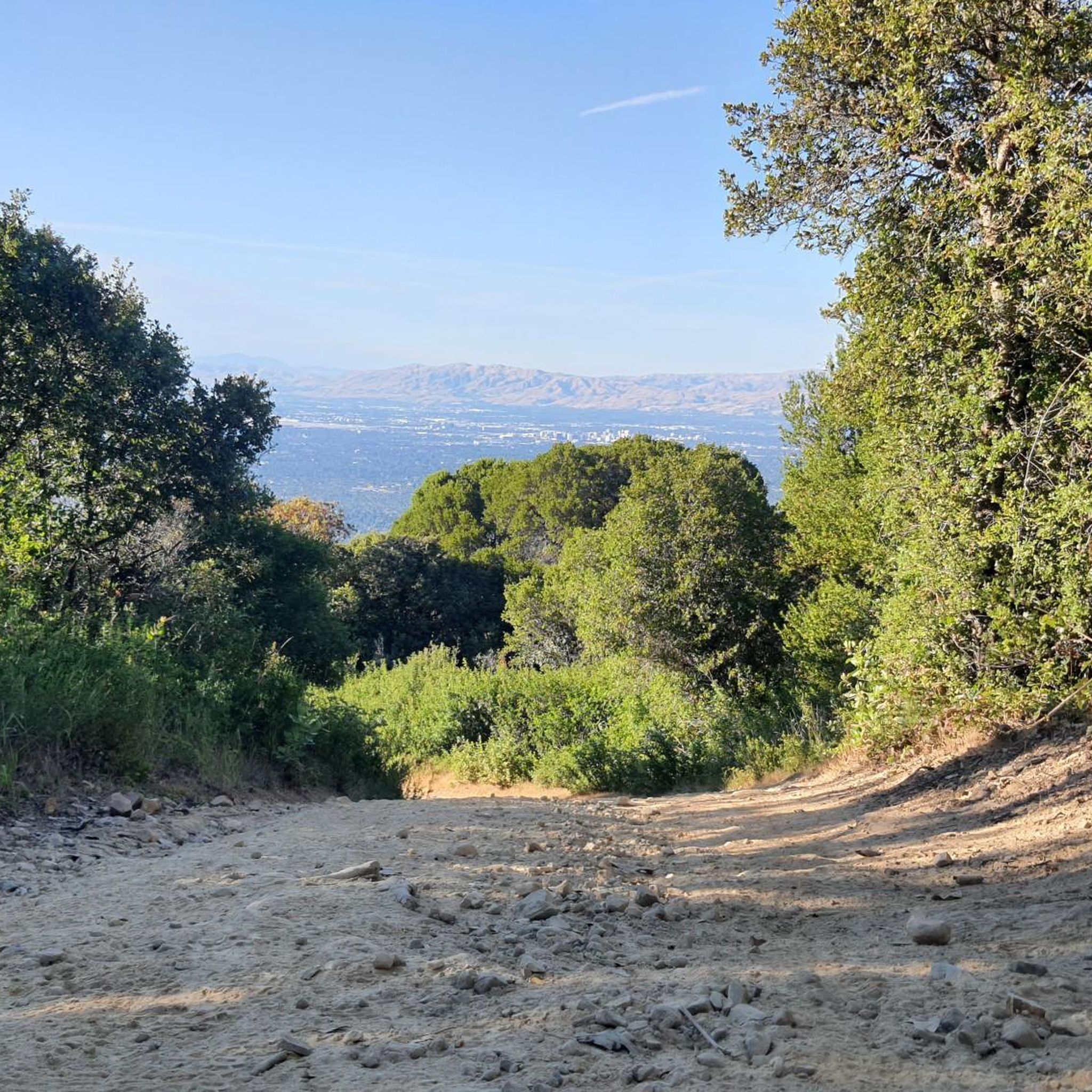
Hiking in Sierra Azul Open Space Preserve offers access to over 19,000 acres within the Santa Cruz Mountains in Santa Clara County. The preserve features diverse landscapes, including serpentine grasslands, chaparral, and shaded oak woodlands. Its terrain is characterized by significant peaks like Mount Umunhum and Mount El Sombroso, providing varied elevation gains and panoramic views. This area provides a range of hiking experiences across its extensive trail system.

Best hiking trails in Sierra Azul Open Space Preserve

  • The most popular hiking route is Mount Umunhum β€” Sierra Azul Open Space Preserve, an 8.0 miles (12.9 km) trail that takes 3 hours 45 minutes to complete. This moderate route leads to the 3,486-foot peak, offering extensive views of the surrounding valleys and Bay Area.
  • Another top favourite among local hikers is Mount El Sombroso via Kennedy Trail β€” Sierra Azul Open Space Preserve, a difficult 11.9 miles (19.1 km) path. This trail provides a challenging ascent to Mount El Sombroso, with rewarding views over the valley.
  • Local hikers also love the Guadalupe Creek Overlook via Mount Umunhum Trail β€” Sierra Azul Open Space Preserve, a 2.9 miles (4.7 km) trail leading through varied habitats, often completed in about 1 hour 22 minutes.
  • Hiking in Sierra Azul Open Space Preserve is defined by its peaks, diverse woodlands, and open grasslands. The network offers options for easy walks, moderate day hikes, and more challenging ascents.
  • The routes in Sierra Azul Open Space Preserve are highly rated by the komoot community with an average score of 4.6 stars from over 80 reviews. More than 1,600 hikers have used komoot to explore Sierra Azul Open Space Preserve's varied terrain.

Last updated: July 7, 2026

5.0

(1)

11

hikers

#1.

Mount Umunhum Trail

6.56km

01:51

20m

370m

Embark on an easy hike along the Mount Umunhum Trail, a route that guides you through diverse scenery within the Sierra Azul Open Space Preserve. You will transition from chaparral scrub into woodlands of oak and pine, offering a gentle introduction to the natural beauty of the Santa Cruz Mountains. This 4.1-mile (6.6 km) path involves a modest 54 feet (16 metres) of elevation gain, making it suitable for a relaxed outing. Expect to complete the hike in about 1 hour and 51 minutes, with plenty of opportunities for wildlife spotting as you go.

Planning your visit to the Mount Umunhum Trail is straightforward. The trailhead is generally accessible, and you will typically find parking available on site. The area has undergone extensive restoration, ensuring a well-maintained path for all visitors. Before heading out, always remember to check local conditions, especially concerning the weather, to ensure a pleasant experience.

This trail is part of a larger area known for its spectacular and expansive views across the landscape. The reopening of this region to the public after restoration efforts highlights a commitment to preserving its natural features. As you explore, you are walking through a significant part of the Santa Cruz Mountains, an ecosystem rich in diverse flora and fauna.

Navigate with device

Send to Phone

Save

Easy

2

hikers

This difficult 12.3-mile hike in Sierra Azul Open Space Preserve offers 3343 feet of climbing and panoramic views from Mount El Sombroso.

Hard
guide_signup
Let us show you the way with the komoot mobile app
With aΒ free komoot account, you can easily find, customize, and navigate endless outdoor adventures.

Sign up for free

1

hikers

55.0km

16:32

1,670m

1,930m

Hike the challenging 34.2-mile Quicksilver 50K in Almaden Quicksilver County Park, featuring 5493 feet of elevation gain and diverse scenery

Hard

2.37km

00:43

120m

10m

The Mount Umunhum Trail offers a fantastic opportunity to experience the diverse landscapes of the Santa Cruz Mountains, from chaparral to shaded oak woodlands, all leading to truly expansive views. You'll traverse well-maintained paths, passing through varied terrain that includes knobcone pine and mixed evergreen forests, before reaching the summit. The highlight is undoubtedly the 360-degree panorama from the top, encompassing Silicon Valley, Monterey Bay, and even the distant Sierra Nevada on clear days.

This easy hiking route covers 1.5 miles (2.4 km) with 405 feet (124 metres) of elevation gain, typically taking around 43 minutes to complete. The trail is well-engineered, making it a great option for a quick, rewarding outing. Parking is available at the trailhead, but as a popular destination, it's wise to arrive early, especially on weekends, to ensure a spot and enjoy a more serene experience.

Mount Umunhum holds deep historical and cultural significance, with its name meaning "resting place of the hummingbird" in the Ohlone language. At the summit, you'll encounter "the Cube," a distinctive six-story concrete radar tower from the Cold War era, which serves as a unique landmark. Interpretive panels along the way provide insights into the mountain's natural, cultural, and military past, adding an educational layer to your hike.

Easy

4.8

(13)

172

hikers

The Bay Area Ridge Trail: Mount Umunhum offers a diverse hiking experience, transitioning from shaded mixed evergreen woodlands and chaparral near the headwaters of Guadalupe Creek to more open, rocky terrain as you approach the summit. You'll find yourself surrounded by knobcone pine and coastal woodlands, with the final push to the top involving steps that make the 3,486-foot summit feel like a true mountain ascent. The payoff is incredible 360-degree views of Silicon Valley, the Santa Cruz Mountains, and even the Pacific Ocean on clear days.

This moderate 8.0-mile (12.9 km) out-and-back route involves a continuous climb of 1157 feet (353 metres) and typically takes about 3 hours and 45 minutes to complete. There are no fees for parking or trail access, and facilities like accessible restrooms and picnic tables are available at the Summit parking area. The trail is well-maintained, but the final section to the summit is for hikers only; plan to arrive early on weekends to secure parking.

Mount Umunhum is not just about the views; it's steeped in history, serving as a sacred site for local Native American people and featuring the iconic Cold War-era radar tower at its peak. As the highest point on the Bay Area Ridge Trail, it offers a unique blend of natural beauty, cultural significance, and a chance to spot diverse wildlife like hummingbirds and golden eagles across varied ecosystems.

Moderate
Sign up for free to see 13 more hikes in Sierra Azul Open Space Preserve.

Get access to more routes and recommendations from other explorers.

Sign up for free

Already have an account?

Our route recommendations are based on thousands of hikes, rides, and runs completed by other people on komoot.

Start today with a free account

Your next adventure awaits.

Login or Signup
Popular around Sierra Azul Open Space Preserve

Running Trails in Sierra Azul Open Space Preserve

MTB Trails in Sierra Azul Open Space Preserve

Cycling in Sierra Azul Open Space Preserve

Road Cycling Routes in Sierra Azul Open Space Preserve

Gravel biking in Sierra Azul Open Space Preserve

Tips from the Community

Martin Stein
March 9, 2026, Bench With a View of Almaden Quicksilver County Park

Mount Umunhum in the background

0

0

If you make the summit a fantastic view awaits. Be aware the road goes down then up to the road about then up again to the summit!…

0

0

Lisa
June 29, 2025, Mount Umunhum

Still one of the highest points in the Santa Cruz Mountains, even though the military graded and flattened the actual summit to create an Air Force base. The summit was cleaned of hazardous material in 2009, then carefully restored after a lot of community input. It's a lovely place to visit now!

0

0

You'll want to have your maps downloaded and your route planned once you reach this point. Two trails diverge here and short distance down the Castillero Trail you'll have the option to take up the English Camp Trail.

1

0

Sue
December 7, 2024, Randol Trail Junction

Randol Trail runs parallel to Mine Hill Trail but is situated at a lower elevation on the San Francisco Bay Area side. Originally built as a mining road to access the historic Day Tunnel, the trail is a lovely wide, well-maintained path winding through grassy fields, brush, and beautiful wooded landscapes with nice San Francisco South Bay Area views.

0

0

This junction offers many options for continuing to explore the park. From here, you can stay to the left on Mine Hill Trail to extend your hike and connect with other trails to the west. Explore the small April Trail loop northwest or east onto the Great Eastern Trail to connect with Randol and several trails on the east side of the grounds.

1

0

Alex
February 22, 2024, Guadalupe Reservoir

At this point along the track you'll gain lovely views of the reservoir. Guadalupe Reservoir, lies approximately 5 miles south of San Jose. Situated at an elevation of 614 feet, it covers a surface area of 74 acres and boasts a capacity of 4,212,000 mΒ³.

0

0

Quicksilver is a term used to refer to mercury. These lands, now transformed into an outdoor activity park, were once places where mercury mines were found.

0

0

Frequently Asked Questions

How many hiking trails are available in Sierra Azul Open Space Preserve?

Sierra Azul Open Space Preserve offers over a dozen distinct hiking routes. These trails vary in difficulty, ranging from easy walks to challenging ascents, providing diverse experiences across its extensive trail system.

What kind of terrain can I expect when hiking in Sierra Azul Open Space Preserve?

The preserve features a rich diversity of environments. You'll encounter serpentine grasslands, rocky chaparral, dense stands of bay trees, shaded oak woodland forests, deep ravines, and riparian corridors. This varied terrain provides a dynamic backdrop for hikes, from wooded creek canyons to open meadows.

Are there any easy hiking trails suitable for beginners or families?

Yes, there are several easier options. For instance, the Guadalupe Creek Overlook via Mount Umunhum Trail is an easy 2.9-mile route that takes about 1 hour 22 minutes to complete, leading through varied habitats.

What are the most prominent landmarks or viewpoints in the preserve?

The most prominent landmark is Mount Umunhum, one of the highest peaks in the Santa Cruz Mountains, offering incredible panoramic views. Other significant points include Mount El Sombroso and Mount Thayer. Specific viewpoints like the Guadalupe Creek Overlook provide scenic vistas over the valley, Lexington Reservoir, and the Santa Clara Valley.

Are there any loop trails for hikers who prefer circular routes?

Yes, the preserve offers loop trails. An example is the challenging Lime Klin & Priest Rock Trail loop, a difficult 13.8-mile route with significant elevation gain. Another option is the moderate Bald Mountain via Woods Trail & Barlow Road loop.

What do other hikers enjoy most about Sierra Azul Open Space Preserve?

The area is highly rated by the komoot community, with an average score of 4.6 stars from over 80 reviews. Hikers frequently praise the challenging climbs, diverse natural features, and breathtaking panoramic views from peaks like Mount Umunhum.

Is Sierra Azul Open Space Preserve suitable for dog walking?

Many trails within Sierra Azul Open Space Preserve are dog-friendly, but regulations can vary by specific trail or section. It's always best to check local signage or the official preserve website for the most current rules regarding dogs on trails.

What wildlife might I encounter while hiking?

Sierra Azul is prime habitat for abundant wildlife. Hikers might spot mountain lions, deer, bobcats, and coyotes, adding an element of wildness to the experience. Always maintain a respectful distance and do not feed wild animals.

Are there any historical or cultural points of interest in the preserve?

Yes, Mount Umunhum holds cultural significance for the Amah Mutsun people, featuring prominently in their creation story. The peak also houses a distinctive blocky radar tower, a relic from the Cold War era when it was an Air Force station. The area also has historical ties to 19th-century German and Austrian refugees who settled near the New Almaden Quicksilver mining operations.

What are the parking options at Sierra Azul Open Space Preserve trailheads?

Parking is available at various trailheads throughout the preserve, such as the Bald Mountain parking area for Mount Umunhum access, and near the Kennedy Trail. Specific parking availability can vary, so it's advisable to check the preserve's official resources for detailed information on trailhead parking.

What is the best time of year to hike in Sierra Azul Open Space Preserve?

The preserve can be enjoyed year-round, but spring offers vibrant wildflowers and lush greenery, while fall provides cooler temperatures and clear views. Summers can be hot, especially on exposed trails, so early morning hikes are recommended. Winters are generally mild but can bring rain, making some trails muddy.

Most popular routes in Sierra Azul Open Space Preserve

Dog-friendly hikes in Sierra Azul Open Space Preserve

Most popular attractions in Sierra Azul Open Space Preserve

Places to see

Store rating

Get inspired with the komoot mobile app

With aΒ free komoot account, you can easily find, customize, and navigate endless outdoor adventures.

or

Join komoot Now

Store rating

Explore more

Browse the best Hikes in other regions.

Santa Cruz MountainsSan JosePalo AltoSanborn County ParkSaratoga Gap Open Space Preserve (Closed Areas)Almaden Quicksilver County ParkGilroyMΓ‘yyan 'OoyΓ‘kma – Coyote Ridge Open Space PreserveMount Chual Open Space Preserve (Closed Area)Los AltosLoyolaMonte Bello Open Space Preserve (Closed Area)Uvas Canyon County ParkCupertinoFremont Older Open Space PreserveUpper Uvas Creek Open Space Preserve (Closed Area)Ed R. Levin County ParkRancho San Antonio County ParkSierra Azul Open Space Preserve (Closed Areas)Henry Coe State ParkRancho Canada Del Oro Open Space Preserve - Restricted AreaLos Altos HillsCoyote Ridge Open Space PreservePicchetti Ranch Open Space PreserveMorgan HillMilpitasUpper Stevens Creek County ParkLos GatosLittle Uvas Open Space Preserve (Restricted Area)El Toro Open Space PreserveBear Creek Redwoods Open Space PreserveFoothills Open Space PreserveSanta ClaraRancho Canada Del Oro Open Space PreserveRanch Canada Del Oro Open Space Preserve (Closed Areas)Mountain ViewJoseph D. Grant County ParkChesbro Reservoir County ParkCoyote Lake - Harvey Bear Ranch County ParkSan MartinLexington Reservoir County Park (Closed Area)El Sereno Open Space Preserve (Closed Areas)Felton Station Open Space Preserve (Closed)St. Joseph'S Hill Open Space PreserveMount Madonna County ParkUvas Reservoir County ParkSaratoga Gap Open Space PreserveCalero County ParkRancho San Antonio Open Space PreserveCoyote Valley Open Space PreserveSierra Vista Open Space PreserveAnderson Lake County ParkBear Creek Redwoods Open Space Preserve (Closed Area)Lexington HillsStevens Creek County ParkEl Sereno Open Space PreserveMonte Bello Open Space PreserveSanta Teresa County ParkSaratogaSunnyvaleAlum RockLexington Reservoir County ParkMonte SerenoLos Trancos Open Space PreserveEast FoothillsCampbellStevens Creek Shoreline Nature Study Area Open Space PreserveBurbankCambrian ParkStanfordFruitdale

Nearby adventure guides

Things to Do in Sierra Azul Open Space Preserve (Closed Areas)

background

Get ready to conquer new peaks

Sign up for Free

Explore
RoutesRoute plannerFeaturesHikesMTB TrailsRoad cycling routesBikepackingSitemap
Download the app
Follow Us on Socials

Β© komoot GmbH

Privacy Policy