Routes

Planner

Features

Updates

App

Login or Signup

Get the App

Login or Signup

Routes
Road cycling routes
United States
California
San Mateo County

Ravenswood Open Space Preserve

The best road cycling routes in Ravenswood Open Space Preserve

4.6

(259)

9,623

riders

132

rides

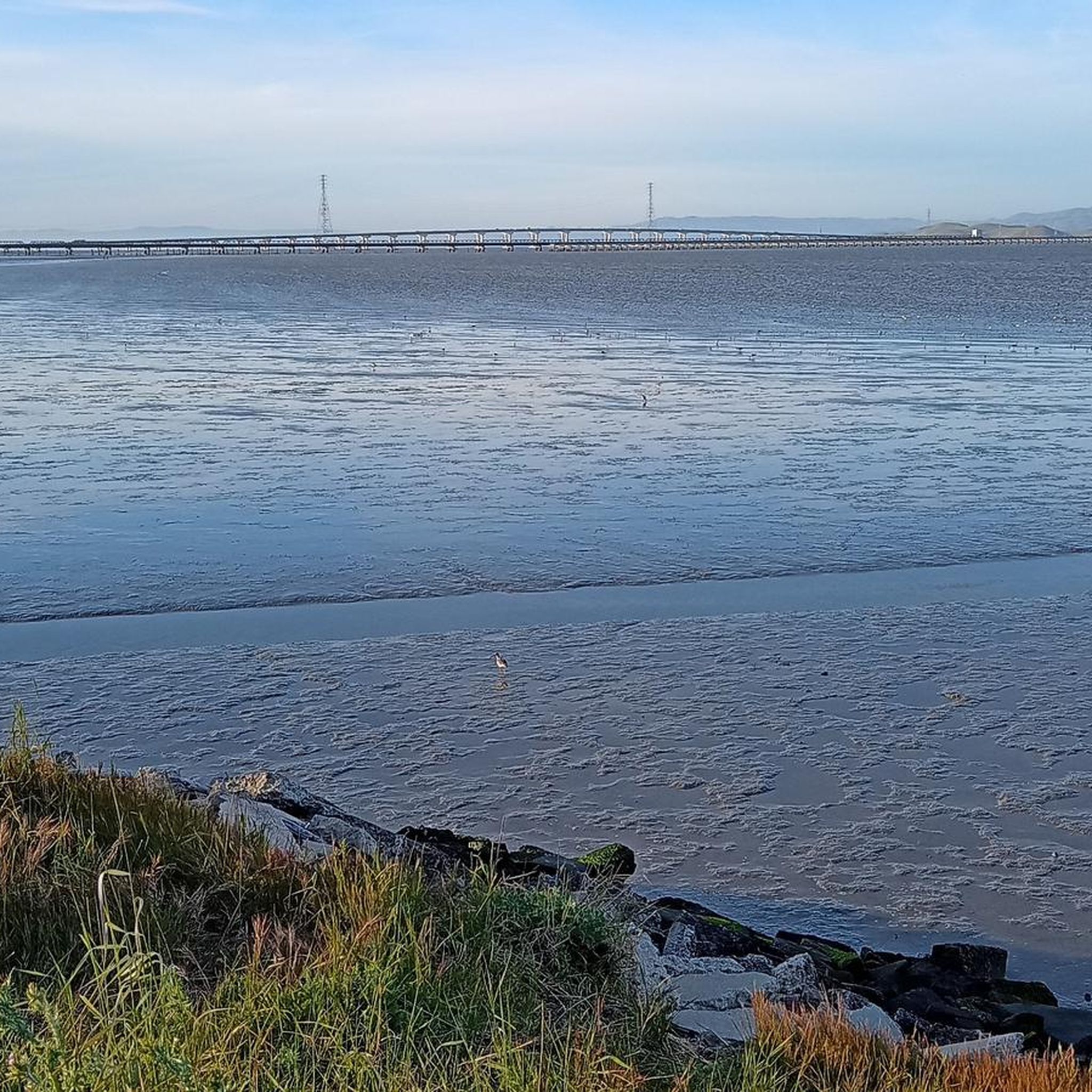
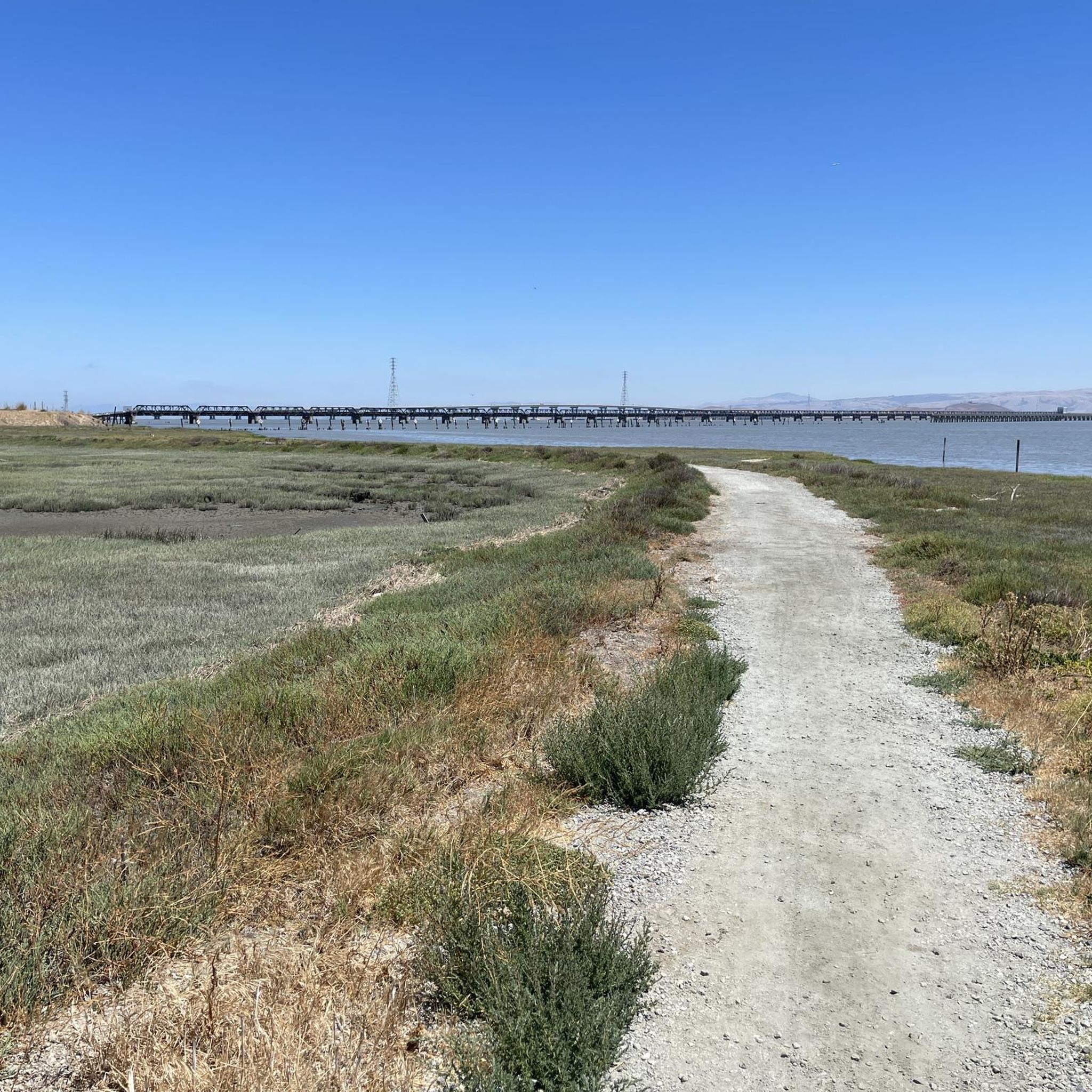
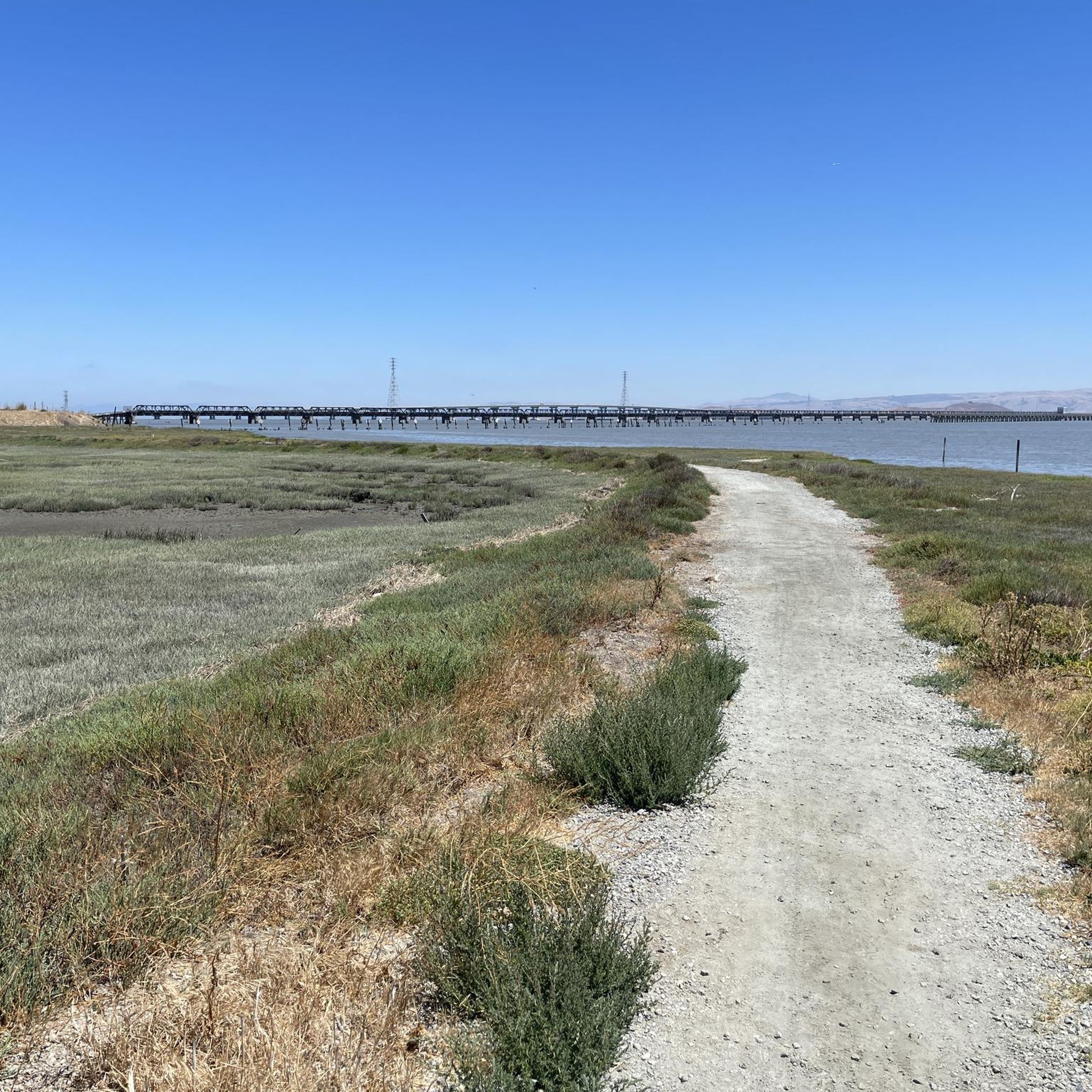
Road cycling in Ravenswood Open Space Preserve offers extensive flat trails along the San Francisco Bay. The preserve features a dynamic landscape of tidal marsh and wetlands, providing scenic views of the bay and the Dumbarton Bridge. It is an integral part of the San Francisco Bay Trail, offering miles of accessible routes along marsh levees. This area provides a unique blend of recreational opportunities within a critical habitat.

Best road cycling routes in Ravenswood Open Space Preserve

  • The most popular road cycling route is Old La Honda & Kings Mountain loop from Palo Alto, a 74.7 miles (120.2 km) trail that takes 6 hours 10 minutes to complete. This route features significant elevation gain, making it a challenging ride.
  • Another top favourite among local road cyclists is Stevens Creek Reservoir Loop, a difficult 40.6 miles (65.4 km) path. This route offers varied terrain and views around the reservoir.
  • Local road cyclists also love the Old La Honda & Woodside loop from Palo Alto, a 27.5 miles (44.3 km) trail leading through scenic areas, often completed in about 2 hours 19 minutes.
  • Road cycling in Ravenswood Open Space Preserve is defined by flat trails, tidal marshlands, and expansive San Francisco Bay views. The network offers options for different ability levels, from easy rides along the Bay Trail to more challenging loops.
  • The routes in Ravenswood Open Space Preserve are highly rated by the komoot community with an average score of 4.7 stars from over 260 reviews. More than 9,000 road cyclists have used komoot to explore Ravenswood Open Space Preserve's varied terrain.

Last updated: July 9, 2026

5.0

(2)

334

riders

#1.

Old La Honda & Kings Mountain loop from Palo Alto

120km

06:10

2,100m

2,100m

The Old La Honda & Kings Mountain loop offers a quintessential Northern California road cycling experience, plunging you into the heart of the Santa Cruz Mountains. You'll climb through a stunning progression of landscapes, from sun-drenched oak woodlands to the cool, misty embrace of ancient redwood groves, especially along the famed Old La Honda Road. The route is a continuous journey of ascents and descents, with narrow, winding roads that feel far removed from urban life, occasionally revealing expansive viewpoints of the San Francisco Bay.

This difficult 74.7-mile (120.2 km) loop demands good fitness, featuring 6887 feet (2099 metres) of elevation gain and an estimated duration of 6 hours and 9 minutes. While there are no specific parking instructions, starting from Palo Alto provides convenient access to this challenging ride. It's advisable to carry sufficient water and snacks, as amenities are sparse along much of the route, though the "Bike Hut" on Tunitas Creek Road can be a welcome stop if your route includes it.

Old La Honda Road is particularly notable as a benchmark climb, attracting national-caliber riders and serving as a local proving ground. Both Old La Honda and Kings Mountain roads are celebrated for their consistent grades and excellent pavement, making them a favorite among advanced road cycling climbs near Palo Alto. The combination of a rigorous workout with serene, beautiful surroundings makes this loop a standout among Palo Alto road cycling popular routes.

Navigate with device

Send to Phone

Save

Hard

4.4

(7)

262

riders

65.4km

03:19

1,060m

1,060m

The Stevens Creek Reservoir Loop offers a diverse road cycling adventure through the Santa Cruz Mountains foothills. You'll wind past the tranquil waters of Stevens Creek Reservoir, climb through varied woodlands, and enjoy views of wineries from higher elevations. Expect a mix of well-paved roads and significant elevation changes, including the notable Mt. Eden Road climb, making for a rewarding and scenic ride.

Planning your Stevens Creek Reservoir Loop road cycling trip is straightforward, though a few points are worth noting. Parking is typically available at the Chestnut Parking Lot, but be prepared for potential fees. If you're riding on a weekday, be mindful of quarry trucks on Stevens Canyon Road, which can increase traffic in that area. An early start is recommended to fully appreciate the tranquil atmosphere.

This difficult 40.6-mile (65.4 km) road cycling route features a substantial 3468 feet (1057 metres) of elevation gain, taking approximately 3 hours and 18 minutes. It's an excellent choice for advanced cyclists seeking a challenging workout and varied terrain. The route transitions from lush creekside paths along Stevens Creek to open vistas, showcasing the natural beauty of Santa Clara County.

Hard
guide_signup
Let us show you the way with the komoot mobile app
With a free komoot account, you can easily find, customize, and navigate endless outdoor adventures.

Sign up for free

4.5

(11)

217

riders

The Old La Honda & Woodside loop from Palo Alto offers a quintessential Bay Area road cycling experience, winding through serene redwood groves and past suburban oak woodlands. The highlight is the consistent, challenging climb up Old La Honda Road, a peaceful ascent that rewards you with a sense of accomplishment and a fast descent. You'll find yourself immersed in natural beauty, far from the city bustle, making it a favorite among local riders.

This moderate 27.5-mile (44.3 km) route features a significant 2578 feet (786 metres) of elevation gain, typically taking around 2 hours and 19 minutes to complete. The road surface is generally well-maintained, and traffic is light, ensuring a smooth and enjoyable ride. It's a fantastic option for cyclists looking to push their limits on a benchmark climb without an overly punishing gradient.

Old La Honda Road is famously known as a

Moderate

The Old La Honda Road – Lower Kings Mountain Road loop from Palo Alto is a classic road cycling route that immerses you in the diverse beauty of the Bay Area. You'll climb through the serene redwood groves of Old La Honda Road, where a consistent grade tests your legs under a dense tree canopy, then traverse Skyline Boulevard with its expansive views, and finally ascend through the redwoods of Huddart Park on Kings Mountain Road, often considered even more scenic with glimpses of the San Francisco Bay. This difficult 49.0-mile (78.9 km) ride with 4842 feet (1476 metres) of elevation gain is a true benchmark for experienced cyclists, taking about 4 hours and 10 minutes.

To make the most of this challenging loop, plan an early start, especially if you're riding on a weekend, as Kings Mountain Road can experience higher traffic volumes. While there's no specific parking mentioned for the Palo Alto start, you'll find ample street parking in residential areas. Be sure to carry plenty of water and nutrition for the sustained effort, as this route is designed to push your limits.

This loop is widely regarded as an iconic ride in the region, with Old La Honda Road serving as a benchmark climb for many Bay Area cyclists to measure their fitness. The route's popularity stems from its combination of significant physical challenge, consistent grades, and the stunning, varied scenery that transitions from oak woodlands to dense redwood forests and panoramic viewpoints.

Hard

The Manzanita Way – Kings Mountain Road loop from Palo Alto is a quintessential Bay Area road cycling experience, known for its significant climbs and diverse scenery. You'll push through shaded redwood forests on Kings Mountain Road, where the consistent 7.5% average gradient demands focus, before enjoying the quieter, canopied stretch of Manzanita Way. This difficult 30.2-mile (48.6 km) route, with its 3027 feet (923 metres) of elevation gain, offers stunning views of the Bay and South Bay, making the 3 hours and 4 minutes of effort well worth it for experienced riders.

Planning your ride from Palo Alto, you'll find Kings Mountain Road to be well-maintained and signed, with turnouts for cyclists, while Manzanita Way offers a peaceful, low-traffic alternative. The best season for road cycling in the Santa Cruz Mountains generally spans spring through fall, but always check local weather forecasts before heading out. Parking is typically available in Palo Alto for those looking to tackle this popular route.

This loop is a celebrated part of the Santa Cruz Mountains cycling network, often combined with other routes for longer adventures. Kings Mountain Road is a classic climb, frequently highlighted for its challenging profile and the rewarding vistas it provides over Silicon Valley. Manzanita Way stands out for its serene, bucolic atmosphere, offering a pleasant contrast to the more strenuous sections of the ride.

Hard
Sign up for free to see 128 more rides in Ravenswood Open Space Preserve.

Get access to more routes and recommendations from other explorers.

Sign up for free

Already have an account?

Our route recommendations are based on thousands of hikes, rides, and runs completed by other people on komoot.

Start today with a free account

Your next adventure awaits.

Login or Signup
Popular around Ravenswood Open Space Preserve

Hiking in Ravenswood Open Space Preserve

Running Trails in Ravenswood Open Space Preserve

Cycling in Ravenswood Open Space Preserve

Gravel biking in Ravenswood Open Space Preserve

MTB Trails in Ravenswood Open Space Preserve

Tips from the Community

maniboyflex
June 20, 2025, Alice's Restaurant at La Honda and Skyline Junction

Alise’s Restaurant is a popular spot for both cyclists and motorcyclists. The food is good, the staff is known for being friendly, and the place has a laid-back, welcoming vibe—perfect for a post-ride meal or coffee break.

1

0

Didn’t OLR used to turn into Dirt before reaching Skyline? Is it all pavement now?? Scott

0

0

Alex
January 25, 2025, Stevens Creek Reservoir

Stevens Creek Reservoir spans 87 acres and is surrounded by a 1,063-acre park. Visitors can enjoy hiking, horseback riding, picnicking, and limited fishing. Seasonal boating for low-power boats is available from mid-April to mid-October. The park is open daily from 8 a.m. to sunset, with vehicle entry fees collected year-round at the Chestnut Parking Lot. Visitors can explore natural beauty and historic remnants like the Villa Maria orchard.

1

0

Woodside Store was built back in the 1850s by two pioneers who came to California for the gold rush. At the time it was the only stagecoach stop between San Francisco and Santa Clara, and it carried all the essential items that travelers riding between cities might need. The store has been restored, inside and out, to look exactly as it did centuries ago. You can call the museum ahead of your trip to book tours.

0

0

Great place for a break in a beautiful, peaceful spot among the redwoods. The restaurant is popular with locals, motorcyclists, hikers, and cyclists, and is the perfect place for a cold drink after finishing the climb up.

1

0

A lovely little cut through from the quiet MP part of Alma to the busy PA side (or the turn across the tracks and El Camino to Sand Hill). If you're not in a hurry, pause on the bridge to enjoy the view of the creek which might be dry in the summer or a raging torrent in the winter. The rail bridge to the west is the original Southern Pacific bridge from a century ago, still in use by Caltrain. And if you look closely, you will find El Palo Alto (from which the city gets its name) in this grove of redwoods. It is not obvious in 2024 but it is signed.

0

0

The San Francisquito Creek Bridge provides a smooth ride over the San Francisquito Creek, which eventually ends in southwest San Francisco Bay. Enjoy the beauty here and stop on the bridge to peer down into the creek.

0

0

Scott
September 5, 2024, La Honda Road

Old La Honda Road is considered one of the most challenging climbs in the Bay Area. The road winds through Redwood forests, offering stunning views of the surrounding mountains and valleys, as well as a peaceful and enjoyable ride.

1

0

Frequently Asked Questions

What is the typical terrain and elevation gain for road cycling in Ravenswood Open Space Preserve?

Ravenswood Open Space Preserve is characterized by extensive flat trails, making it ideal for road cycling. The routes primarily follow marsh levees along the San Francisco Bay, offering minimal elevation gain. While the preserve itself is flat, some longer routes that start from the area, such as the Old La Honda & Kings Mountain loop from Palo Alto, can feature significant climbs as they extend into the surrounding hills.

Are there road cycling routes suitable for beginners or advanced riders in Ravenswood Open Space Preserve?

Yes, the preserve offers a range of options. The flat, accessible trails along the San Francisco Bay Trail within the preserve are excellent for beginners and casual riders. For more advanced cyclists seeking a challenge, routes like the Stevens Creek Reservoir Loop or the Old La Honda Road – Lower Kings Mountain Road loop from Palo Alto, which start nearby and venture into hillier terrain, provide substantial elevation gain and varied conditions.

What natural features or landmarks can I expect to see while road cycling in Ravenswood Open Space Preserve?

Cyclists can enjoy picturesque views of the San Francisco Bay and the iconic Dumbarton Bridge. The preserve is known for its expansive tidal marsh and wetlands, which are critical habitats for diverse wildlife. You'll observe unique marshland plants like cordgrass and pickleweed, and the dynamic landscape changes with the tides. Key points of interest include the Ravenswood Open Space Preserve itself, the Ravenswood Boardwalk, and Cooley Landing, which offers additional amenities and educational signage.

What is the best time of year for road cycling in Ravenswood Open Space Preserve?

Road cycling in Ravenswood Open Space Preserve is enjoyable year-round due to the mild Bay Area climate. However, the trails are largely exposed to the sun, so it's advisable to be prepared for varying weather conditions, especially during warmer months. Spring and fall often offer the most comfortable temperatures for riding.

Is parking available for road cyclists at Ravenswood Open Space Preserve?

Yes, parking is available at Ravenswood Open Space Preserve. The preserve is designed to be accessible, and facilities are provided for visitors, including those arriving by car for cycling activities.

How can I reach Ravenswood Open Space Preserve using public transport?

Ravenswood Open Space Preserve is accessible via public transportation, particularly through connections to the nearby communities of East Palo Alto and Menlo Park. Specific bus routes or transit options can be researched based on your starting location, often involving services that connect to the Dumbarton Bridge area.

Are the road cycling trails in Ravenswood Open Space Preserve family-friendly?

Yes, the preserve's flat, easy-access trails along the marsh levees are very suitable for families. The smooth surfaces and scenic views make it a pleasant environment for cyclists of all ages, including children. The 1.2-mile easy-access trail on a raised levee is a particular highlight for family outings.

Are dogs allowed on the road cycling trails in Ravenswood Open Space Preserve?

The preserve is a critical habitat for diverse wildlife, including endangered species. While specific regulations regarding dogs on cycling trails should always be verified with official park signage, generally, dogs are permitted on leash in designated areas to protect the sensitive marshland ecosystem.

Are there any cafes or restaurants near Ravenswood Open Space Preserve for a post-ride stop?

Yes, Ravenswood Open Space Preserve is conveniently located near East Palo Alto and Menlo Park, both of which offer a variety of cafes, restaurants, and other amenities. You'll find options for refreshments and meals just a short ride away from the preserve.

What do other road cyclists enjoy the most about road cycling in Ravenswood Open Space Preserve?

The area is highly rated by the komoot community, with an average score of 4.7 stars from over 260 reviews. Reviewers often praise the extensive flat trails, the scenic bay views, and the unique experience of cycling through a vibrant tidal marshland. The connection to the broader San Francisco Bay Trail is also a significant draw for many.

Are there any loop trails for road cycling in Ravenswood Open Space Preserve?

While the core trails within the preserve are primarily out-and-back sections of the Bay Trail, the connection to the wider Bay Trail network allows for creating longer loop routes by combining different sections. For example, the Old La Honda & Woodside loop from Palo Alto is a popular option that starts nearby and offers a scenic loop experience.

How many road cycling routes are available in Ravenswood Open Space Preserve?

There are over 120 road cycling routes available in and around Ravenswood Open Space Preserve on komoot. These routes cater to various difficulty levels, with a significant number of easy and moderate options, alongside some more challenging rides that extend into the surrounding areas.

Most popular routes in Ravenswood Open Space Preserve

Hiking in Ravenswood Open Space Preserve

Most popular attractions in Ravenswood Open Space Preserve

Places to see

Store rating

Get inspired with the komoot mobile app

With a free komoot account, you can easily find, customize, and navigate endless outdoor adventures.

or

Join komoot Now

Store rating

Explore more

Browse the best Road cycling routes in other regions.

West Menlo ParkEast Palo AltoNorth Fair OaksRedwood CityAthertonMenlo ParkSan Bruno Mountain State ParkDaly CityEmerald Lake HillsMoss BeachWunderlich County ParkMillbraeWoodsideSkyline Ridge Open Space PreserveEl GranadaTeague Hill Open Space PreserveBaywood ParkLa Honda Creek Open Space PreserveSan MateoSkyline Ridge Open Space Preserve (Closed Area)HillsboroughBrisbaneBroadmoorCoal Creek Open Space PreserveWindy Hill Open Space PreservePulgas Ridge Open Space PreserveFoster CityHalf Moon BayLoma MarHuddart County ParkMemorial County ParkPescadero Creek County ParkAño Nuevo State ParkLa Honda Creek Open Space Preserve (Closed Areas)Purisima Creek Redwoods Open Space Preserve (Closed Area)La Honda Creek Open Space Preserve (Permit Area)Miramontes Ridge Open Space Preserve (Closed)Purisima Creek Redwoods Open Space PreserveBurlingamePigeon Point County ParkTunitas Creek Open Space Preserve (Closed)Butano State ParkPortola ValleyMontaraWindy Hill Open Space Preserve (Closed Areas)South San FranciscoPescaderoRussian Ridge Open Space PreserveRussian Ridge Open Space Preserve (Closed Area)La HondaBurleigh H. Murray Ranch State ParkEl Corte De Madera Creek Open Space PreserveSan CarlosHighlandsThornewood Open Space Preserve (Closed Area)LaderaBelmontSan Pedro Valley County ParkColmaPortola Redwoods State ParkSan BrunoThornewood Open Space PreservePacificaEl Corte De Madera Creek Open Space Preserve (Closed Area)

Nearby adventure guides

Things to Do around East Palo Alto

background

Get ready to conquer new peaks

Sign up for Free

Explore
RoutesRoute plannerFeaturesHikesMTB TrailsRoad cycling routesBikepackingSitemap
Download the app
Follow Us on Socials

© komoot GmbH

Privacy Policy