Routes

Planner

Features

Updates

App

Login or Signup

Get the App

Login or Signup

Routes
Hikes
United States
California
Santa Clara County

Ranch Canada Del Oro Open Space Preserve (Closed Areas)

Routes
Hikes
United States
California
Santa Clara County

Ranch Canada Del Oro Open Space Preserve (Closed Areas)

The best walks and hikes in Ranch Canada Del Oro Open Space Preserve (Closed Areas)

4.7

(120)

1,588

hikers

93

hikes

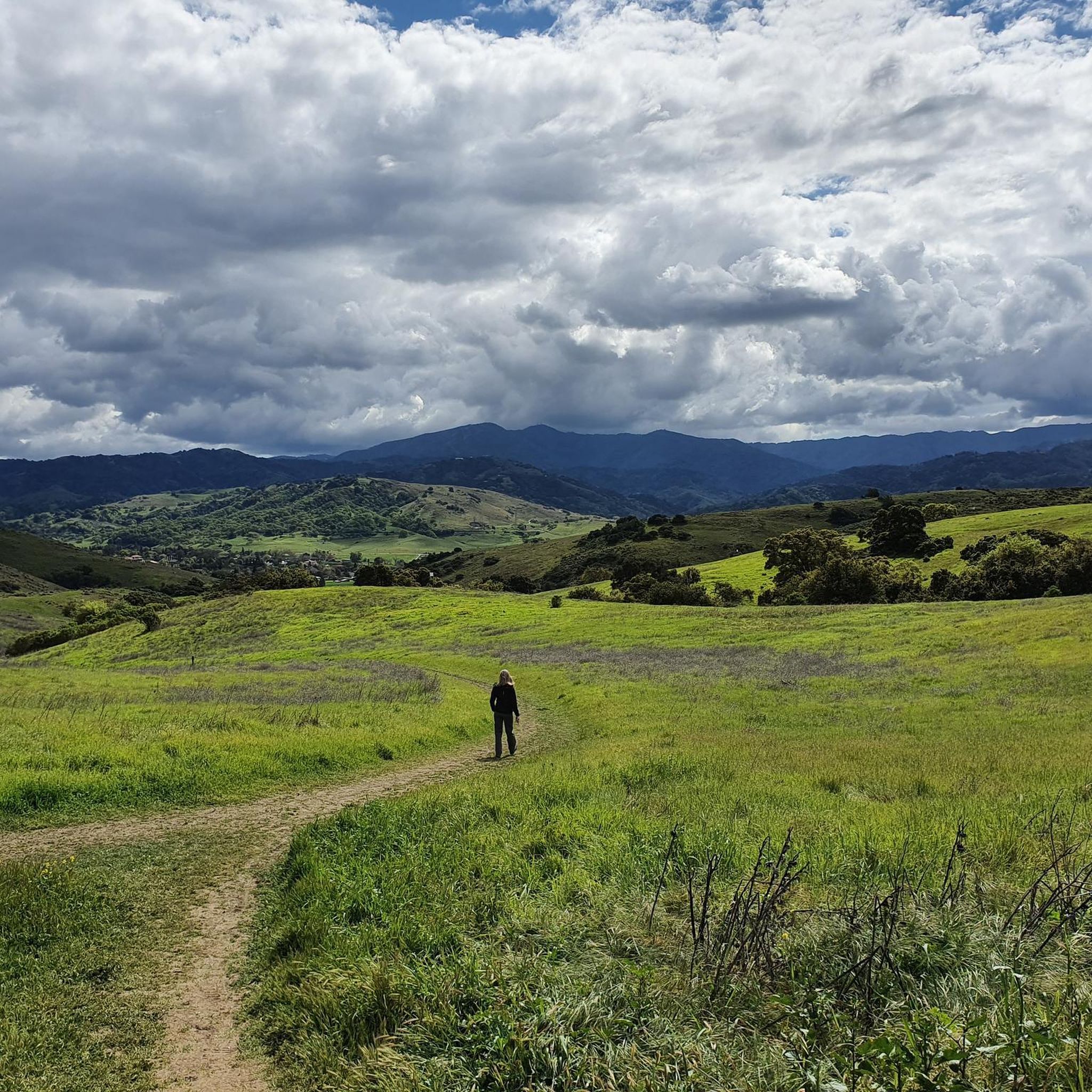
Hikes in Rancho Cañada del Oro Open Space Preserve are located in the foothills of the Santa Cruz Mountains in Santa Clara County. The landscape is characterized by mixed oak woodlands, open grasslands, and creekside paths. The preserve's trail system includes a section of the Bay Area Ridge Trail and offers routes with significant elevation gain leading to views of the surrounding area.

Best hiking trails in Ranch Canada Del Oro Open Space Preserve (Closed Areas)

  • The most popular hiking route is Bald Peaks loop — Rancho Canada del Oro Open Space Preserve, a 8.1 mile (13.1 km) trail that takes about 3 hours 58 minutes to complete. This moderate hike follows well-graded paths through the preserve's varied terrain.
  • Another top favourite among local hiking enthusiasts is Bald Peaks loop — Calero County Park, a moderate 6.8 mile (10.9 km) path. The route traverses grassy meadows and offers views from the ridgelines.
  • Local hiking enthusiasts also love the Hiking loop from Almaden Valley, a 4.4 mile (7.1 km) trail leading through oak woodlands, often completed in about 2 hours 5 minutes.
  • Hiking in Ranch Canada Del Oro Open Space Preserve (Closed Areas) is defined by rolling hills, oak forests, and open grasslands. The trail network provides options for different ability levels, from shorter loops to more strenuous climbs.
  • The routes in Ranch Canada Del Oro Open Space Preserve (Closed Areas) are highly rated by the komoot community with an average score of 4.6 stars from over 100 reviews. More than 1,500 hikers have used komoot to explore Ranch Canada Del Oro Open Space Preserve (Closed Areas)'s varied terrain.

Last updated: July 8, 2026

2

hikers

#1.

Rancho Canada del Oro and Calero Park Loop

26.5km

07:58

830m

840m

The Rancho Canada del Oro and Calero Park Loop offers a truly diverse hiking experience, winding through beautiful green rolling hills, grassy meadows, and mixed oak woodlands. You'll encounter varied terrain, from unpaved paths to gravel, with seasonal creeks and wildflowers adding to the natural beauty, especially in early spring. The highlight is undoubtedly the Bald Peaks Viewpoint, providing expansive panoramic views across the Diablo Range and Santa Cruz Mountains.

Planning your visit requires a bit of foresight for this long trek. Parking is available at the trailheads, but remember that dogs are not permitted within Rancho Cañada del Oro Open Space Preserve. Given the trail's length and significant exposed sections, starting early and carrying ample water is essential, particularly during warmer seasons. This difficult route demands preparation.

This popular loop trail is notable for connecting two significant natural areas, Rancho Cañada del Oro Open Space Preserve and Calero County Park, forming a segment of the larger Bay Area Ridge Trail. The area is home to diverse wildlife, including deer, bobcats, and even mountain lions, making it a rich natural environment. The substantial Rancho Canada del Oro trail difficulty and elevation gain make it a rewarding challenge for experienced hikers.

Navigate with device

Send to Phone

Save

Hard

5.0

(4)

32

hikers

13.1km

03:58

450m

450m

The Bald Peaks Loop Trail offers a dynamic hiking experience, transitioning between open grasslands, shaded oak woodlands, and even creek sections. You'll be treated to panoramic 270-degree vistas from various points, including the Bald Peaks Viewpoint, showcasing the Santa Clara Valley, Santa Cruz Mountains, and Diablo Range. Keep an eye out for deer grazing in the open areas, especially in spring when wildflowers carpet the hills.

This moderate 8.1-mile (13.1 km) loop involves a significant 1469 feet (448 metres) of elevation gain, taking approximately 3 hours and 58 minutes to complete. The trail can be quite muddy after rain, so planning your visit for drier conditions is recommended. It's a challenging route with steep sections, so come prepared for a good workout.

What truly sets this trail apart is the combination of a rigorous physical challenge with incredibly rewarding scenery. The ever-changing landscape keeps the hike engaging, and the expansive views make every climb worthwhile. It's a fantastic option for hikers in Santa Clara County looking for a substantial day out with diverse natural features.

Moderate
guide_signup
Let us show you the way with the komoot mobile app
With a free komoot account, you can easily find, customize, and navigate endless outdoor adventures.

Sign up for free

5.0

(1)

16

hikers

10.9km

03:15

330m

330m

The Bald Peaks Loop offers a rewarding hiking experience through varied terrain, from open grasslands to shady oak woodlands, all while delivering continuous, sweeping views. You'll traverse dirt single tracks and service roads, with the landscape shifting to reveal panoramic vistas of the Santa Cruz Mountains, Santa Clara Valley, and even the San Francisco Bay Area from viewpoints like Bald Peaks Viewpoint. Keep an eye out for local wildlife, including deer, as you navigate the route's diverse ecosystems.

Planning your visit to the Bald Peaks Loop is key to a great experience; this moderate 6.8-mile (10.9 km) trail with 1091 feet (333 metres) of elevation gain typically takes about 3 hours and 15 minutes. It's best to tackle this route in drier conditions, as it can get quite muddy after rain, and the exposed sections can make summer hikes uncomfortably hot. Spring and winter offer lush green hills and potential wildflower blooms, making them ideal times to visit Rancho Cañada del Oro Open Space Preserve.

What makes the Bald Peaks Loop particularly notable is its combination of significant elevation changes and the sheer breadth of its views across California's landscape. From certain points, you can spot landmarks like Calero Reservoir, Almaden Valley, and even distant peaks like Loma Prieta and Mt. Umunhum. This trail provides a fantastic opportunity to experience the diverse natural beauty of the region, offering a challenging yet highly scenic outing for those seeking expansive vistas.

Moderate

The Longwall Canyon Trail loop at Rancho Cañada del Oro Open Space Preserve offers a delightful journey through varied terrain, from wide grassy paths to narrow singletrack. You'll traverse areas shaded by oaks and California bay trees, follow Little Llagas Creek, and climb through grassy hills. The highlight for many is the stunning ridgeline views of the Santa Cruz Mountains and the Diablo Range, especially from the picnic bench at the Bald Peaks Trail junction.

This moderate hike covers 4.4 miles (7.1 km) with 680 feet (207 metres) of elevation gain, typically taking about 2 hours and 6 minutes. You'll start from the Rancho Cañada del Oro Open Space Preserve Entrance. Spring is the ideal season to experience the trail, as the serpentine soils along the route come alive with a spectacular array of native wildflowers, making it one of the popular trails in the area.

Rancho Cañada del Oro Open Space Preserve is celebrated for its rich biodiversity and remote feel, despite its proximity to urban areas. Beyond the beautiful scenery, the Longwall Canyon Trail loop offers opportunities for wildlife spotting, with deer, wild turkeys, and hawks frequently seen. The preserve's commitment to protecting natural habitats ensures a truly immersive outdoor experience.

Moderate

The Bald Peaks Viewpoint – Bald Peaks Trail Viewpoint loop offers a challenging yet incredibly rewarding hiking experience, traversing diverse terrain from shaded oak woodlands to open grasslands. As you climb, you'll be treated to expansive, panoramic views that sweep across the Santa Cruz Mountains, Santa Clara Valley, and the San Francisco Bay Area, culminating in a spectacular 270-degree vista from the Bald Peaks Viewpoint itself. Keep an eye out for wildlife like deer and bobcats as you navigate the varied landscape, which includes both fire roads and narrower single-track paths.

This moderate 8.8-mile (14.2 km) loop involves a significant 1548 feet (472 metres) of elevation gain, typically taking around 4 hours and 17 minutes to complete. It's best to visit during winter and spring when the hills are green and wildflowers bloom, but be aware that sections can be muddy after rain. The preserve is managed by the Santa Clara Valley Open Space Authority and offers a thoughtful trail network, making it a great destination for a substantial day hike.

What truly sets this trail apart are its "top of the world" views from Bald Peaks, providing clear perspectives towards Morgan Hill and Mount Hamilton. The 5,432-acre Rancho Cañada del Oro Open Space Preserve, opened in 2004, is considered a hidden gem for both hikers and mountain bikers. Its dynamic landscape, from dense bay trees near creek beds to bare hilltops, creates a visually appealing experience with the striking layered look of the Coastal Range.

Moderate
Sign up for free to see 89 more hikes in Ranch Canada Del Oro Open Space Preserve (Closed Areas).

Get access to more routes and recommendations from other explorers.

Sign up for free

Already have an account?

Our route recommendations are based on thousands of hikes, rides, and runs completed by other people on komoot.

Start today with a free account

Your next adventure awaits.

Login or Signup

Popular around Ranch Canada Del Oro Open Space Preserve (Closed Areas)
Running Trails in Ranch Canada Del Oro Open Space Preserve (Closed Areas)
MTB Trails in Ranch Canada Del Oro Open Space Preserve (Closed Areas)
Cycling in Ranch Canada Del Oro Open Space Preserve (Closed Areas)
Road Cycling Routes in Ranch Canada Del Oro Open Space Preserve (Closed Areas)

Gravel biking in Ranch Canada Del Oro Open Space Preserve (Closed Areas)

Tips from the Community

Alex
January 9, 2025, Bald Peaks Viewpoint

Bald Peak provides great views of Santa Clara Valley, the Diablo Range, and the Santa Cruz Mountains. Hikers and mountain bikers can access the peak via trails like Hidden Springs and Coyote Peak, which offer moderate to steep climbs. Early mornings or late afternoons are best for enjoying cooler temperatures in hot summer months. The trails are well-maintained and scenic.

0

0

Alex
February 21, 2024, Longwall Canyon Trail

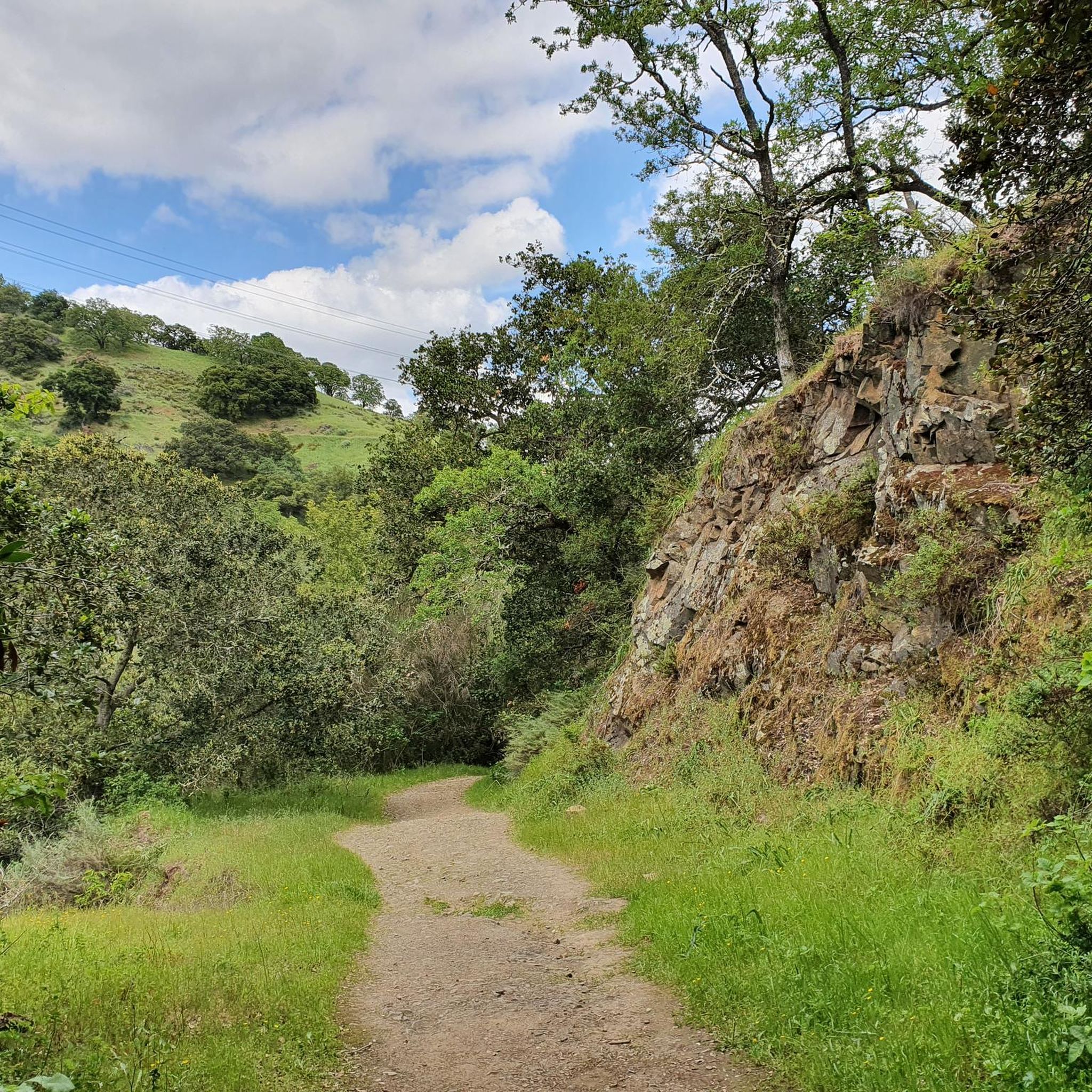
This length of singletrack is absolutely stunning. Running through a mixture of small trees and open scrubland, and on a good quality surface, it can't get much better than this.

1

0

Alex
February 21, 2024, Bald Peak Trail

The views from the Bald Peak Trail are fantastic, with arid scrubland mixed in with lush trees and vegetation. The elevated position of this trail gives it a really special feeling.

0

0

Longwall Canyon Trail is a nicely marked trail that navigates through trees, fields, and has stunning views of the South Bay at points. The trail has a nice mix of terrain and scenery to keep things interesting.

0

0

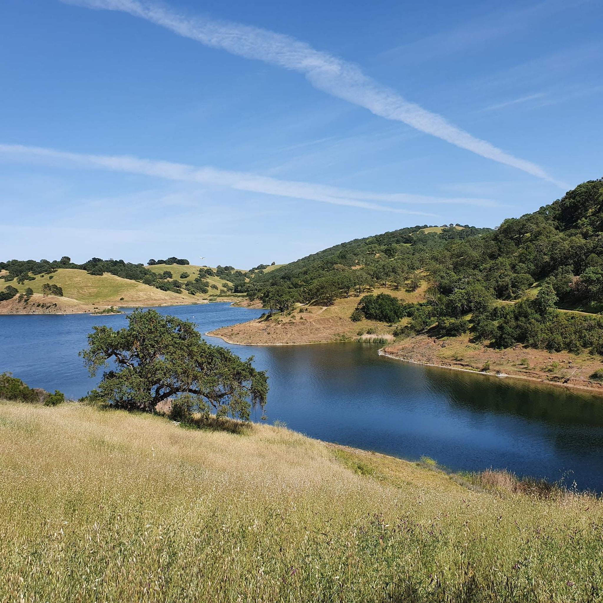
Calero County Park is a huge park covering over 4,400 acres and featuring a huge lake. Calero Reservoir is definitely the pinnacle of the park, but there are a number of trails and paths that offer different views and pass through different natural ecosystems. Being such a big park, there are a bunch of different trailheads and park entrances that you can utilize.

0

0

Matthew
January 25, 2024, Calero County Park

Calero County Park is a huge park covering over 4,400 acres and featuring a huge lake. Calero Reservoir is definitely the pinnacle of the park, but there are a number of trails and paths that offer different views and pass through different natural ecosystems. Being such a big park, there are a bunch of different trailheads and park entrances that you can utilize.

1

0

Scott
January 25, 2024, Bald Peaks

Fossils of marine creatures like clams and oysters can be found in the sandstone of the peaks, hinting at a time when the area was submerged beneath the ocean. The hills around Bald Peaks are home to unique rock formations like chert and rhyolite, attracting hobbyists searching for colorful and interesting specimens.

1

0

From the high knoll you get a 360 degree view of all the South Bay. Wildflowers are abundant in the spring.

0

0

Frequently Asked Questions

Why is this guide named for 'Closed Areas'? Are the trails at Rancho Cañada del Oro not accessible?

The 'closed areas' designation refers to undeveloped parts of the preserve where the Santa Clara Valley Open Space Authority is planning future trail expansions. The established trails within the preserve, like those featured in this guide, are open to the public. Always check the official park website for the most current trail status before your visit.

Are there any easy, accessible trails in the preserve?

Yes, the preserve is designed to be welcoming for various abilities. The Llagas Creek Loop Trail is a notable accessible trail, offering a full nature experience for visitors with limited mobility. The preserve also features accessible restrooms and picnic areas near the main entrance.

What kind of scenery can I expect on the trails?

The landscape is a classic California foothill environment. You'll hike through a mix of mixed oak woodlands, open grasslands perfect for sunny days, and shaded paths alongside creeks. From the higher ridgeline trails, you can get panoramic views of the surrounding Santa Clara Valley and peaks like Loma Prieta.

How many hiking trails are available in the preserve?

There are over 70 different hiking routes to explore within Rancho Cañada del Oro Open Space Preserve. These range from short, gentle loops to more challenging climbs with significant elevation gain, offering plenty of options for all fitness levels.

Are there any long-distance hiking options available?

Yes, the preserve is great for a longer day out. A significant 5.5-mile portion of the Bay Area Ridge Trail runs through the park. For a challenging loop with rewarding views, consider the Bald Peaks loop, which covers about 8.1 miles and involves a good amount of climbing.

What do other hikers say about the trails at Rancho Cañada del Oro?

The preserve is highly regarded by the komoot community, with hikers giving the trails an average rating of 4.6 stars. Reviewers frequently praise the well-maintained paths, the beautiful views from the ridges, and the peaceful atmosphere of the oak woodlands.

When is the best time to see wildflowers?

Spring is the most spectacular time for wildflowers. The preserve's grasslands and hillsides, particularly areas with serpentine soil, come alive with a vibrant display of native flowers like calochortus and gilia.

Can I see wildlife in the preserve?

Absolutely. The area is a sanctuary for a variety of wildlife. It's common for hikers to spot deer, and if you're quiet and observant, you might also see bobcats, foxes, and a wide array of bird species.

How do the trails connect to Calero County Park?

The trail systems of Rancho Cañada del Oro and the adjacent Calero County Park are connected, allowing for extended hikes between the two. Routes like the Bald Peaks loop from Calero County Park showcase how you can start in one park and traverse the ridgelines into the other.

Are there any good trails for a shorter, moderate hike?

Yes, there are several great options. The Hiking loop from Almaden Valley is a popular choice, offering a 4.4-mile journey through oak woodlands that typically takes about 2 hours to complete.

Where can I find the best viewpoints?

For some of the best panoramic views, you'll want to gain some elevation on the ridgeline trails. The Bald Peaks Trail Viewpoint loop from Almaden Valley is specifically routed to lead you to excellent vistas overlooking the valley.

Is there parking available at the preserve?

Yes, there is a parking lot at the main entrance located at 4289 Casa Loma Rd, Morgan Hill. The preserve also offers free parking for horse trailers, making it accessible for equestrians.

Most popular routes in Ranch Canada Del Oro Open Space Preserve (Closed Areas)

Running Trails in Ranch Canada Del Oro Open Space Preserve (Closed Areas)

Store rating

Get inspired with the komoot mobile app

With a free komoot account, you can easily find, customize, and navigate endless outdoor adventures.

or

Join komoot Now

Store rating

Explore more

Browse the best Hikes in other regions.

Santa Cruz MountainsSan JosePalo AltoSanborn County ParkSaratoga Gap Open Space Preserve (Closed Areas)Almaden Quicksilver County ParkGilroyMáyyan 'Ooyákma – Coyote Ridge Open Space PreserveMount Chual Open Space Preserve (Closed Area)Los AltosLoyolaMonte Bello Open Space Preserve (Closed Area)Uvas Canyon County ParkCupertinoFremont Older Open Space PreserveUpper Uvas Creek Open Space Preserve (Closed Area)Ed R. Levin County ParkRancho San Antonio County ParkSierra Azul Open Space Preserve (Closed Areas)Henry Coe State ParkRancho Canada Del Oro Open Space Preserve - Restricted AreaSierra Azul Open Space PreserveLos Altos HillsCoyote Ridge Open Space PreservePicchetti Ranch Open Space PreserveMorgan HillMilpitasUpper Stevens Creek County ParkLos GatosLittle Uvas Open Space Preserve (Restricted Area)El Toro Open Space PreserveBear Creek Redwoods Open Space PreserveFoothills Open Space PreserveSanta ClaraRancho Canada Del Oro Open Space PreserveMountain ViewJoseph D. Grant County ParkChesbro Reservoir County ParkCoyote Lake - Harvey Bear Ranch County ParkSan MartinEl Sereno Open Space Preserve (Closed Areas)Lexington Reservoir County Park (Closed Area)Felton Station Open Space Preserve (Closed)St. Joseph'S Hill Open Space PreserveMount Madonna County ParkUvas Reservoir County ParkSaratoga Gap Open Space PreserveCalero County ParkRancho San Antonio Open Space PreserveCoyote Valley Open Space PreserveSierra Vista Open Space PreserveAnderson Lake County ParkBear Creek Redwoods Open Space Preserve (Closed Area)Lexington HillsStevens Creek County ParkEl Sereno Open Space PreserveMonte Bello Open Space PreserveSanta Teresa County ParkSaratogaSunnyvaleAlum RockLexington Reservoir County ParkMonte SerenoLos Trancos Open Space PreserveEast FoothillsCampbellStevens Creek Shoreline Nature Study Area Open Space PreserveBurbankCambrian ParkStanfordFruitdale

Nearby adventure guides

Things to Do in Rancho Canada Del Oro Open Space Preserve

background

Get ready to conquer new peaks

Sign up for Free

Explore
RoutesRoute plannerFeaturesHikesMTB TrailsRoad cycling routesBikepackingSitemap
Download the app
Follow Us on Socials

© komoot GmbH

Privacy Policy

