The best walks and hikes in Fort Ord Dunes State Park
4.7
(93)
1,067
hikers
90
hikes
Hiking in Fort Ord Dunes State Park offers routes through diverse coastal landscapes along Monterey Bay. The park is characterized by rolling coastal dunes, many of which have been restored, providing unique habitats. Trails often feature expansive ocean vistas and direct access to four miles of ocean beachfront. The terrain primarily consists of sandy paths and a notable paved recreation trail, with options for easy to difficult ability levels.
Best hiking trails in Fort Ord Dunes State Park
- The most popular hiking route is Fort Ord Dunes Trail, a 5.2 miles (8.4 km) trail that takes 2 hours 11 minutes to complete. This moderate route offers coastal views and ocean access.
- Another top favourite among local hikers is Fort Ord Dunes State Park – Fort Ord Dunes State Park loop from Fort Ord Dunes State Park, an easy 3.4 miles (5.6 km) path. This trail provides continuous views of the coastal dunes.
- Local hikers also love the Leary and Elliot Hill Loop via Watkins Gate Road, a 15.6 miles (25.0 km) trail leading through varied terrain with hills, often completed in about 6 hours 39 minutes.
- Hiking in Fort Ord Dunes State Park is defined by coastal dunes, ocean vistas, and paved recreation trails. The network offers options for easy, moderate, and difficult ability levels.
- The routes in Fort Ord Dunes State Park are highly rated by the komoot community with an average score of 4.9 stars from over 80 reviews. More than 900 hikers have used komoot to explore Fort Ord Dunes State Park's varied terrain.
Last updated: July 8, 2026
5.0
(1)
2
hikers
8.36km
02:11
60m
50m
The Fort Ord Dunes Trail offers a captivating coastal experience, blending the serene beauty of Monterey Bay with a fascinating historical backdrop. This moderate 5.2-mile (8.4 km) hiking route features a gentle 199 feet (61 metres) of elevation gain, making it a pleasant journey that typically takes about 2 hours and 10 minutes. You'll traverse a mix of wide paved paths and natural trails winding through rolling sand dunes, all while enjoying stunning ocean vistas and unique coastal vegetation.
Planning your visit is straightforward, with ample parking available at Fort Ord Dunes State Park. The trail is generally accessible, though some natural dune sections have uneven terrain. Dogs are permitted on the paved trails, but for the protection of sensitive wildlife, they are not allowed on the beach or the spur trails leading to it. It's a great option for a refreshing walk with a view, especially during the cooler parts of the day.
What truly sets this trail apart is its rich history as a former U.S. Army training facility, with interpretive signs detailing its past and transformation into a state park. Beyond its historical significance, the park is a vital sanctuary for endangered species, including the western snowy plover, making it crucial to remain on designated paths. The trail also connects to the broader Monterey Bay Coastal Recreation Trail, offering further exploration opportunities.
5.0
(6)
9
hikers
5.92km
01:33
40m
40m
The Fort Ord Dunes State Park loop offers a refreshing coastal experience, guiding you through vast sandy dunes and along blufftop viewing platforms that provide panoramic vistas of the Monterey Bay National Marine Sanctuary. You'll encounter unique coastal vegetation and may even spot local wildlife, all while enjoying the sound of the ocean. The trail combines paved sections with natural sandy paths, making for a varied and engaging journey.
Planning your visit is simple, though be aware there's a day use parking fee at Fort Ord Dunes State Park. It's important to stick to designated trails to protect the sensitive habitats within the park. If you're bringing your canine companion, dogs are welcome on paved trails, but they are not allowed on the beach or on the spur trails leading to it. This easy 3.7-mile (5.9 km) route, with only 133 feet (41 metres) of elevation gain, takes about 1 hour and 32 minutes, making it a great option for a quick, accessible outing.
What makes this park particularly interesting is its rich history; it was once part of Fort Ord, a U.S. Army training facility. Educational panels along the route provide insight into its past, including its former use as rifle ranges, and its transformation into a protected habitat for endangered species like the Smith's blue butterfly. The park, which opened to the public in 2009, offers nearly 1,000 acres of public land, blending natural beauty with a compelling historical narrative.

Sign up for free
1
hikers
25.0km
06:39
250m
250m
Hike the difficult 15.6-mile Leary and Elliot Hill Loop via Watkins Gate Road in Fort Ord National Monument, gaining 829 feet.
34.7km
08:56
170m
170m
Embark on the Monterey Bay Coastal Trail for an expansive journey along the Pacific, where the path continuously delivers stunning ocean vistas. You'll wander through diverse scenery, from the dramatic tall sand dunes near Sand City to the lively waterfronts of Fisherman's Wharf and Cannery Row, all while keeping an eye out for sea otters and seals playing in the bay. This 21.6-mile (34.7 km) hiking route, though mostly flat, is rated difficult due to its considerable length, requiring about 8 hours and 56 minutes to complete its 552 feet (168 metres) of elevation gain.
Accessing the trail is straightforward, with multiple entry points and parking options available, particularly around the more urban sections like the Monterey Bay Aquarium. Since this is a full-day commitment, plan to start early to make the most of the daylight and avoid rushing. The trail is generally open and enjoyable throughout the year, but spring and autumn provide comfortable temperatures for such a long excursion.
This historic route, built on a former Southern Pacific Railroad corridor, seamlessly blends natural beauty with cultural landmarks. It connects you directly to some of Monterey's most popular attractions, offering interpretive signs that delve into the region's rich history and abundant marine life. The trail's unique combination of coastal wilderness and urban connectivity makes it a vibrant hub for both locals and visitors.
890m
00:14
0m
10m
The Marina Dunes Preserve Trail offers a truly unique coastal experience, guiding you through a landscape of wind-sculpted dunes and native vegetation. You'll find yourself on soft, sandy paths, occasionally interspersed with paved sections, all while enjoying expansive ocean views of Monterey Bay. It's a serene journey where the sound of the waves and the sight of the distinctive dunes create a peaceful atmosphere, leading you to a secluded stretch of beach north of Marina State Beach.
This easy 0.6-mile (0.9 km) hike, with just 13 feet (4 metres) of elevation gain, can be completed in about 13 minutes, making it ideal for a quick, refreshing outing. While the overall difficulty is low, walking on sand can add a surprising amount of effort, so keep that in mind. The trail is generally accessible, and it's a great spot for a casual walk with your dog, provided they are on a leash.
Beyond its scenic beauty, the preserve is a critical habitat for indigenous plants and animals, including the rare Smith's blue butterfly, found only in this specific dune environment. The area has undergone significant restoration since its past as a sand mine, making it a testament to conservation efforts. It's a fantastic place for wildlife spotting and nature photography, offering a quiet alternative to more crowded coastal areas.
Get access to more routes and recommendations from other explorers.
Sign up for free
Already have an account?
Our route recommendations are based on thousands of hikes, rides, and runs completed by other people on komoot.
Start today with a free account
Your next adventure awaits.
Login or Signup


Tips from the Community

A lovely wharf you should see
0
0

Nice flat run on footpath to aquarium.
0
0

Fishwife, adjacent to the Beachcomber Motel, is steps away from Asilomar Beach. The restaurant serves fresh seafood with a Caribbean twist in a relaxed, beachside setting. It is a great place to stop for lunch, and while you're here, don't miss a chance to try a slice of their legendary homemade key lime pie!
0
0

Fort Ord Dunes State Park, opened to the public in 2009, reveals itself as a haven across nearly 1,000 acres of public land. Discover 4 miles of coastal beauty with awe-inspiring views along the ocean beach, showcasing the splendor of the Monterey Bay National Marine Sanctuary. This sanctuary for endangered species urges responsible exploration, staying on designated trails, and following CA State Park rules to preserve these delicate habitats.
0
0

Cannery Row, the waterfront district that boomed in the 1850s - For thousands of years it was home to the Ohlone, Esselen and Salinas tribes, and in the 19th century immigrants from Europe and Asia settled here to fish the waters, especially for sardines. Thanks to the canneries that resulted, Monterey became known as the "Sardine Capital of the World." John Steinbeck, born and raised in nearby Salinas, immortalized this era in his 1945 novel Cannery Row, and the name stuck.
3
0

Nice, small (and free!) museum just before Fisherman's Wharf in Monterey. Nice exhibition.
1
0
Beautiful little wharf, touristy but still OK. Starting point for a (wonderful) whale watching tour. There is a sea lion colony on the edge - just watching these animals is worth a visit.
1
0

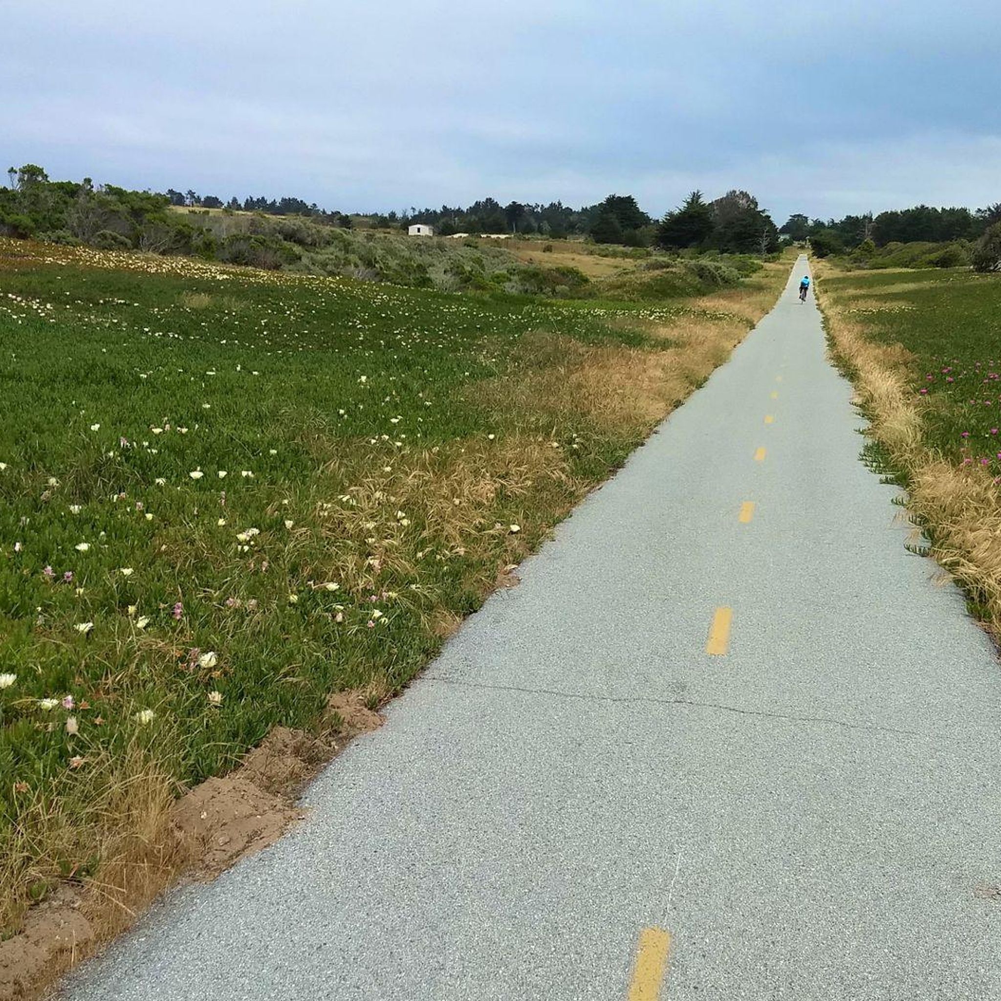
There is a simple gate that allows cyclists to pass with ease but bars the road from vehicular traffic. From here you can access the sprawling Fort Ord trail system.
0
0
Frequently Asked Questions
How many hiking trails are available in Fort Ord Dunes State Park?
Fort Ord Dunes State Park offers a wide selection of hiking routes, with over 60 trails available for exploration. These range from easy strolls along the coast to more moderate paths.
Are there family-friendly hiking options in Fort Ord Dunes State Park?
Yes, the park is very family-friendly. Many trails are easily accessible and suitable for various fitness levels, including over 50 easy hikes. The 4-mile paved recreation trail is particularly good for families, offering a smooth surface and scenic views.
Are dogs allowed on the hiking trails in Fort Ord Dunes State Park?
Yes, leashed dogs are permitted on the 4-mile paved recreation trail that runs north-south through the park. This allows visitors to enjoy the coastal scenery with their canine companions.
What kind of terrain can I expect on the trails in Fort Ord Dunes State Park?
The park's terrain is characterized by rolling coastal dunes, sandy paths, and a notable paved recreation trail. While most routes are relatively flat, some areas in the wider Fort Ord region might offer routes with greater elevation gain. The park's unique dune habitats have been largely restored, providing a distinct natural landscape.
What are the best times of year to hike in Fort Ord Dunes State Park?
The park is enjoyable year-round, but spring is particularly beautiful when vibrant wildflowers bloom across the grasslands. The coastal location means bracing ocean air and expansive views are consistent, though caution is advised near the water due to strong undertows.
Are there any circular or loop trails in the park?
Yes, many of the trails in and around Fort Ord Dunes State Park are designed as loops, allowing you to experience diverse scenery without retracing your steps. An example is the Monterey Canning Company – View of Monterey Harbor loop from Monterey State Beach, which offers coastal paths and takes about 2 hours.
What natural features or wildlife can I expect to see while hiking?
Hikers can enjoy expansive ocean vistas and the unique coastal dune ecosystem. The park is a haven for bird watchers, with species like California brown pelicans, red-tailed hawks, and western snowy plovers. You might also spot seals, sea lions, and other sea and shore birds. During spring, wildflowers add splashes of color to the landscape.
Is parking available at Fort Ord Dunes State Park?
Yes, parking is available at the main parking area within Fort Ord Dunes State Park. Interpretive panels at this location provide insights into the park's history and natural features.
What do other hikers enjoy most about hiking in Fort Ord Dunes State Park?
The area is highly rated by the komoot community, with an average score of 4.9 stars from over 90 reviews. Reviewers often praise the stunning ocean views, the peaceful coastal atmosphere, and the well-maintained trails that offer a refreshing escape along the Monterey Bay.
Are there any unpaved hiking trails in Fort Ord Dunes State Park?
Beyond the paved recreation trail, Fort Ord Dunes State Park features numerous unpaved paths that wind through the coastal dunes and offer a more natural hiking experience. These trails allow for closer interaction with the unique dune habitats and their diverse plant and wildlife communities.
How long do hikes typically take in Fort Ord Dunes State Park?
Hikes in the park can vary in duration. Many easy routes, such as the Hiking loop from Marina, can be completed in under 1.5 hours. Longer routes, like the Monterey Beach – Old Fisherman's Wharf loop from Del Monte, might take closer to 2 hours, offering continuous ocean views along the coastline.
Are there any historical points of interest in Fort Ord Dunes State Park?
Yes, the park has a significant history as a former U.S. Army post. Interpretive panels at the main parking area and a mobile phone audio tour provide insights into this military past, alongside information about the park's natural features. The restoration of the coastal dunes is also a testament to its evolving history.
Most popular routes in Fort Ord Dunes State Park

Get inspired with the komoot mobile app


Explore more
Browse the best Hikes in other regions.
