The best running trails in Sand To Snow National Monument
82
runners
13
runs
Jogging in Sand To Snow National Monument offers diverse landscapes ranging from low desert floors to high alpine peaks. This region is characterized by its unique convergence of three distinct ecosystems, providing a variety of terrains for running. Runners can experience everything from riparian forests and wetlands along the Whitewater River to challenging ascents in the San Bernardino Mountains. The dramatic elevation changes create a wide array of running experiences for all fitness levels.
Best jogging routes in Sand To…
Last updated: June 29, 2026
4
runners
7.18km
00:54
120m
120m
Moderate run. Good fitness required. Mostly paved surfaces. Suitable for all skill levels.
10
runners
18.2km
02:48
990m
990m
Hard run. Very good fitness required. Mostly paved surfaces. Suitable for all skill levels.

Sign up for free
13
runners
33.3km
04:48
1,420m
1,420m
Hard run. Very good fitness required. Mostly paved surfaces. Suitable for all skill levels.
8
runners
9.39km
01:10
140m
140m
Moderate run. Good fitness required. Mostly paved surfaces. Suitable for all skill levels.
3
runners
13.3km
01:44
290m
290m
Moderate run. Good fitness required. Mostly paved surfaces. Suitable for all skill levels.
Get access to more routes and recommendations from other explorers.
Sign up for free
Already have an account?
Our route recommendations are based on thousands of hikes, rides, and runs completed by other people on komoot.
Start today with a free account
Your next adventure awaits.
Login or Signup
Popular around Sand To Snow National Monument
Tips from the Community

The Vivian Creek Trail is a short but steep trail that takes you to the peak of Mt. San Gorgonio. There are several great viewpoints along the way as you make you way up the mountain.
0
0

Only 2+ miles from the trailhead, this hike makes for a perfect introduction to snowshoeing with great views of the surrounding mountains.
0
0

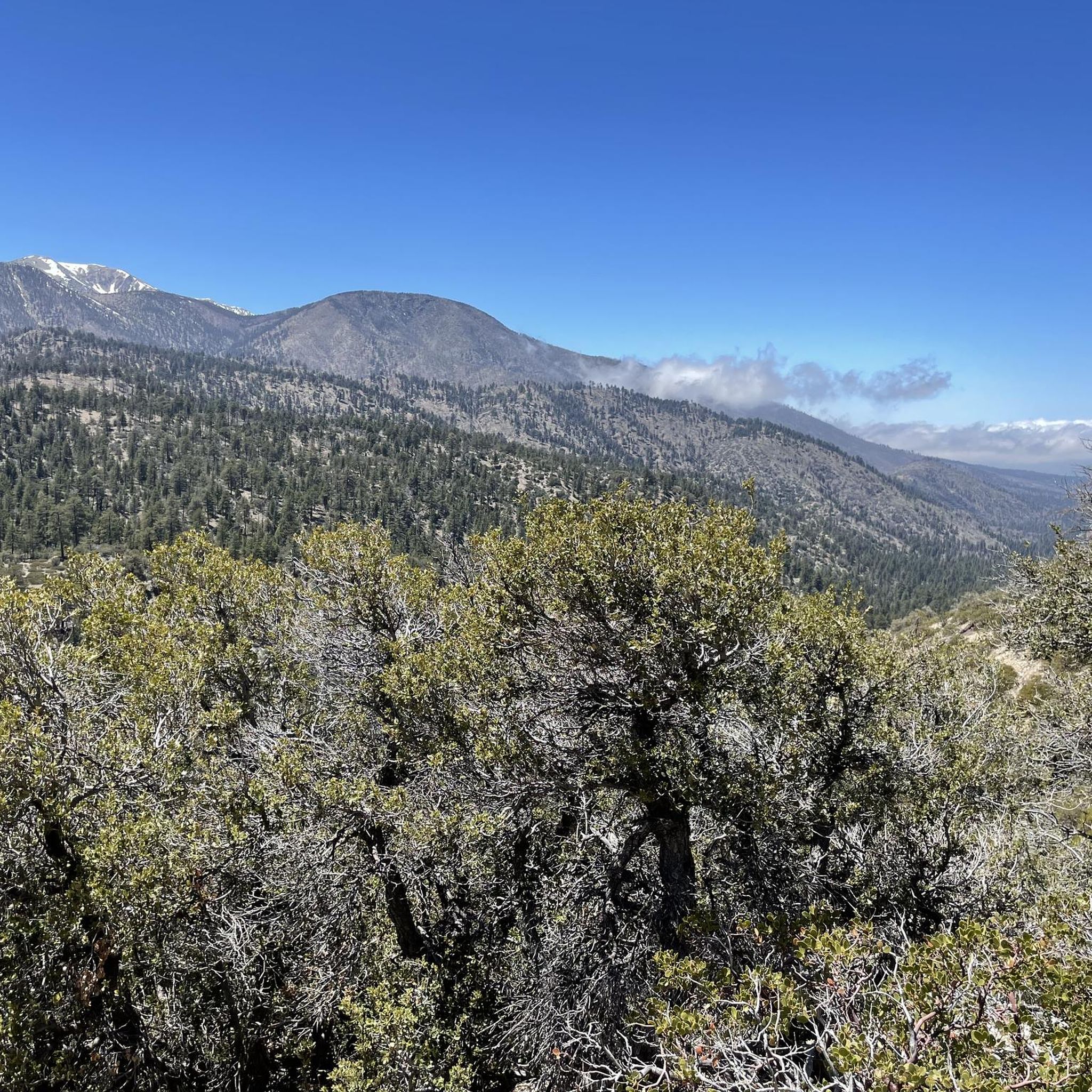
San Gorgonio Mountain, also called Mount San Gorgonio or Old Greyback, is the highest peak in Southern California, standing at 11,503 feet. The mountain has a pyramid-like shape, with a steep north face and a gentler south face. On clear days, hikers can enjoy expansive 360-degree views of San Gorgonio Wilderness and even the Pacific Ocean.
0
0
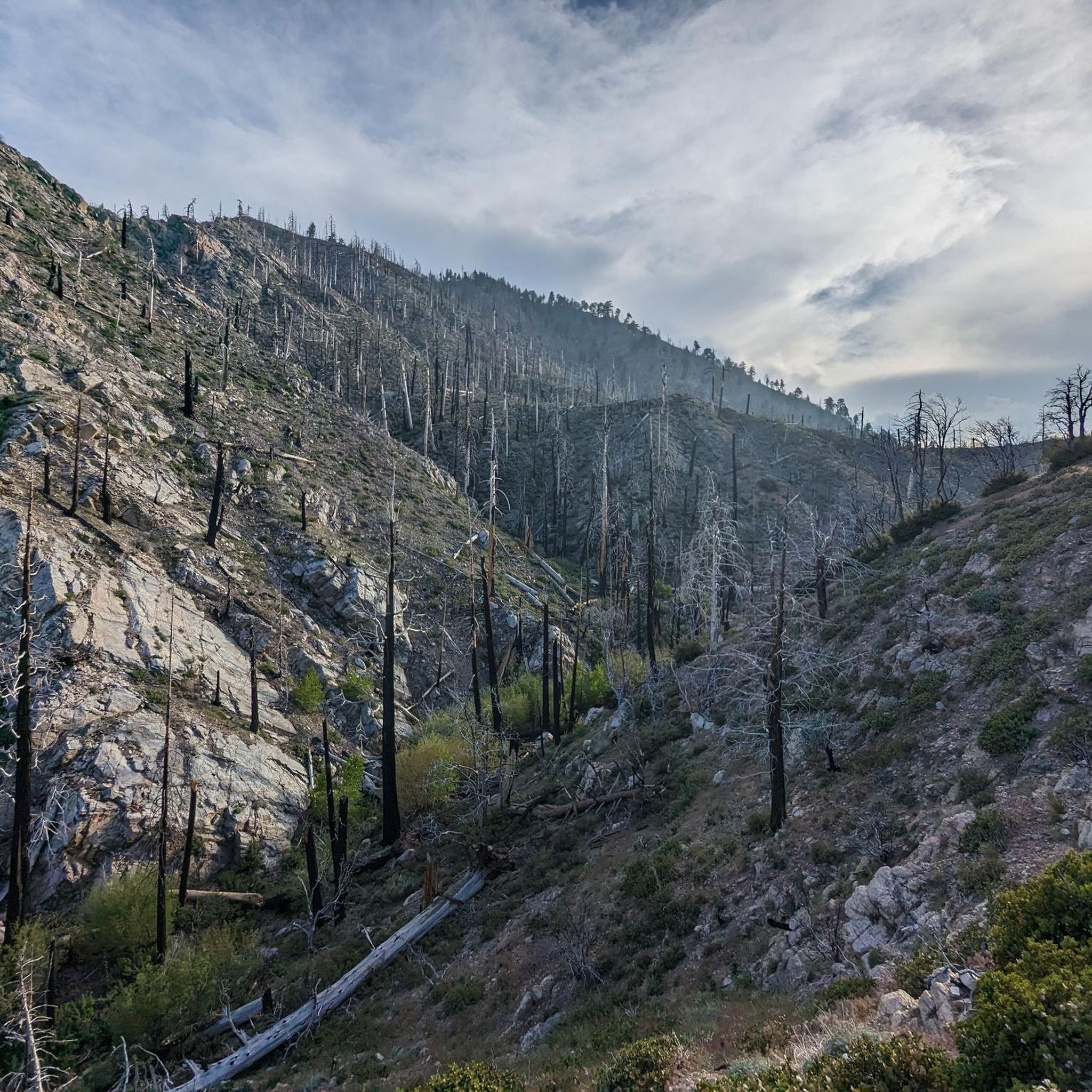
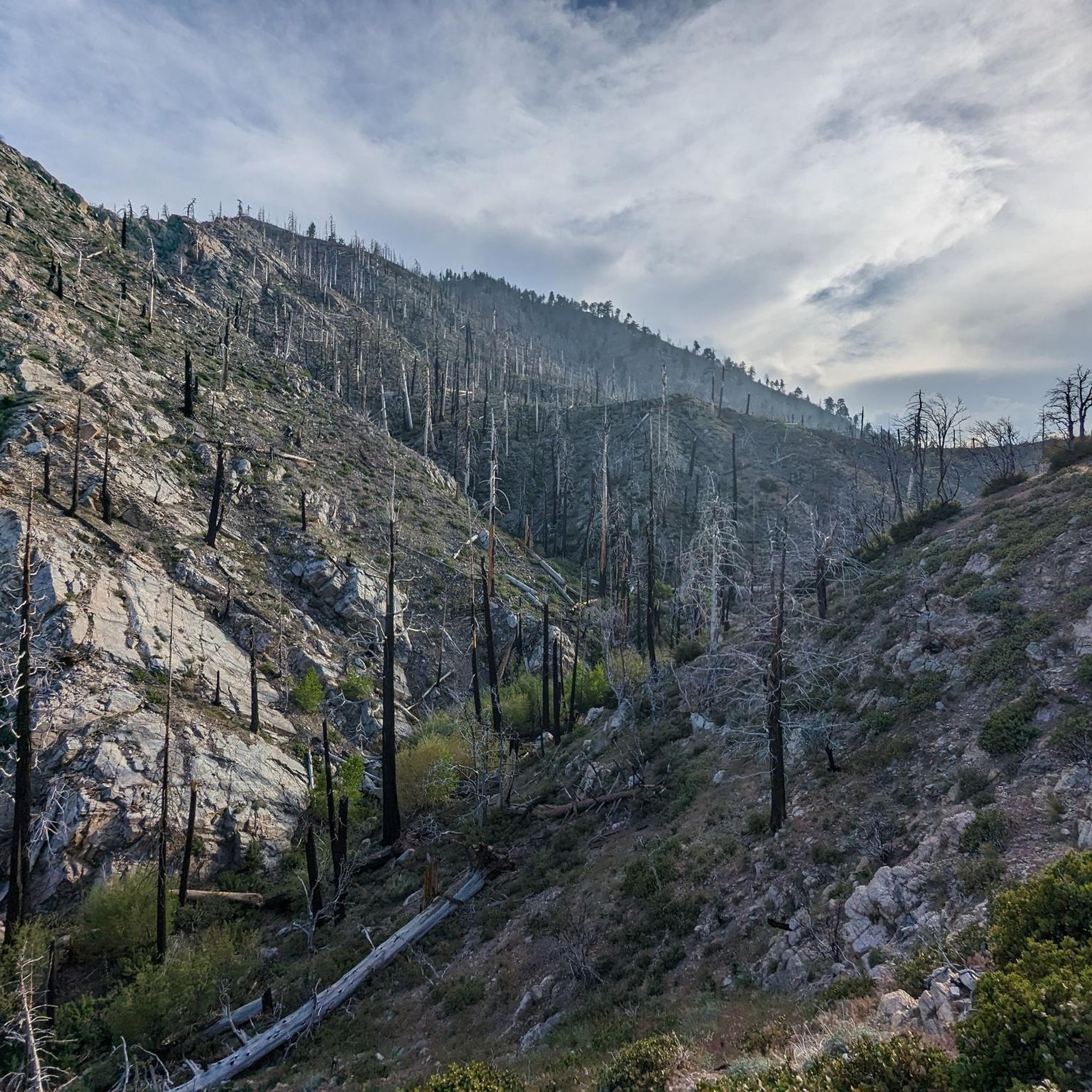
The San Bernardino Peak Divide Trail offers stunning views of the San Gorgonio Wilderness, but hikers must obtain a permit for day and overnight use. Although beautiful, the trail shows the effects of past wildfires, and hikers should prepare for a 13+ mile stretch with no water, depending on snowmelt. The trail can be dangerous in snowy conditions, so bring any necessary equipment or wait for the summer months when the snow melts.
0
0

Easy ride up Whitewater Canyon Road to the Preserve. There you will find a nicely kept picnic area where you can day camp, hike or soak in the nice swimming hole. The canyon has a robust population of bighorn sheep, deer, and bear!
0
0

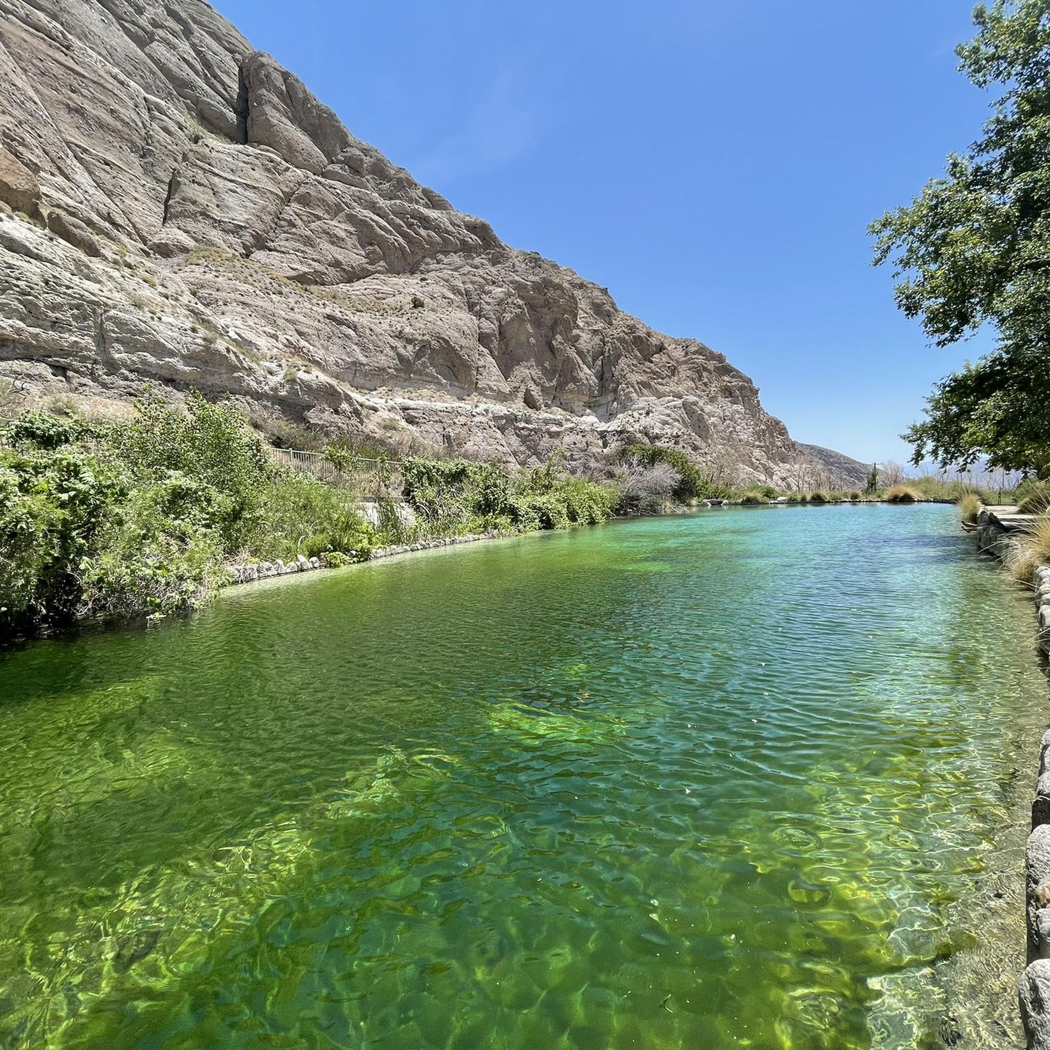
The Whitewater Preserve is a true oasis in a desert canyon. You can relax in the shade of huge trees near beautiful turquois and green pools. Enjoy the lovely hummingbirds that buzz around the ranger station and cool your feet in the wading pool. There are a lot of picnic benches, restrooms and potable water. Using the area is free of charge, but consider a donation for this unique place that once was a trout hatchery.
5
0
A beautiful oasis in the desert with a bubbling White River for a refreshing splash next to you. The Red Dome rises above the desert floor. There might be some mosquitos in spring and summer though.
2
1
Vivian Creek Trail is the steepest trail to summit San Gorgonio Mountain, but the scenery will compensate your effort and sweat. You hike along the burbling Vivian Creek and the treeline opens up for stunning vistas of Mount San Jacinto. There are two campsites along the trail: Halfway Camp and High Creek Camp if you want to split your hike into more than a day. Since this is a quite popular trail up to San Gorgonio Mountain, you will need to obtain a free permit as soon as you plan your hike. Quotas fill up early!
4
0
Frequently Asked Questions
What types of running trails can I find in Sand To Snow National Monument?
Sand To Snow National Monument offers a wide variety of running trails, ranging from low desert floors to high alpine peaks. You can find everything from easy loops through riparian forests and wetlands, such as those near the Whitewater River, to challenging ascents in the San Bernardino Mountains. The monument's unique convergence of three distinct ecosystems provides diverse terrains suitable for all fitness levels.
Are there any easy or beginner-friendly running routes in the monument?
Yes, there are routes suitable for beginners and those looking for an easier run. For instance, the Whitewater River & Red Dome via PCT – San Bernardino National Forest is a moderate 4.5-mile trail that follows the Whitewater River, offering a less strenuous experience with scenic views. The region also features trails through desert oasis habitats like Big Morongo Canyon Preserve, which are generally easier and shorter.
Where can I find challenging or advanced running trails?
For experienced runners seeking a challenge, the monument offers several difficult routes with significant elevation gain. The Vivian Creek Trail loop from Restrooms is a difficult 11.3-mile path that provides challenging ascents towards the highest peak in Southern California. Another demanding option is the Jepson Peak – Mount San Gorgonio Summit loop from South Fork trailhead parking lot, a 20.7-mile trail leading through alpine conifer forests.
Are there any circular running routes in Sand To Snow National Monument?
Yes, several routes offer a circular experience. For example, the Pioneertown loop from Pioneertown is a moderate 5.8-mile circular route. Many of the more challenging mountain trails, like the Vivian Creek Trail loop, are also designed as loops, allowing you to start and finish at the same point.
What natural features or landmarks can I see while running in the monument?
The monument is rich in natural attractions. Along your runs, you might encounter the unique basalt formation of Whitewater River Crossing, or explore the lush Big Morongo Canyon Preserve, a vital desert oasis. For those tackling higher elevations, you can reach prominent summits like Mount San Gorgonio Summit, the highest peak in Southern California, offering incredible views.
Is Sand To Snow National Monument suitable for family-friendly running or walks?
While many trails offer challenging terrain, there are sections and preserves within the monument that are more family-friendly. Areas like Big Morongo Canyon Preserve feature boardwalks and easier paths, making them suitable for families looking for a gentle jog or walk amidst diverse wildlife. Always check the specific trail details for distance and elevation to ensure it matches your family's capabilities.
Are dogs allowed on the running trails in Sand To Snow National Monument?
Regulations regarding dogs can vary within national monuments and preserves. While some areas may permit leashed dogs, others, particularly sensitive wildlife habitats or designated wilderness areas, may have restrictions. It's always best to check the specific rules for the trail or preserve you plan to visit before bringing your dog. For general information, you can consult the official BLM website for the monument: blm.gov/visit/sand-snow-national-monument.
What is the best time of year to go running in Sand To Snow National Monument?
The best time to run depends on the elevation you plan to explore. Lower desert areas are ideal during the cooler months, from fall through spring (October to April), to avoid extreme summer heat. For higher alpine trails, late spring through early fall (May to October) is preferable, as winter brings snow and challenging conditions to the peaks. Always check weather forecasts and trail conditions before heading out.
Are there any permits required for running on trails in the monument?
Some areas within Sand To Snow National Monument, particularly those leading into designated wilderness or high-elevation zones like the San Gorgonio Wilderness, may require permits for day use or overnight stays. It's crucial to research the specific requirements for your chosen route in advance. Information on permits can often be found on the U.S. Forest Service or BLM websites for the area.
Where can I find parking for the running trails?
Parking availability varies by trailhead. Many popular trailheads, especially those for longer or more challenging routes, have designated parking lots. For example, routes leading to Mount San Gorgonio often start from areas like the South Fork trailhead parking lot. For specific routes, it's advisable to check the route details on komoot or consult official park maps for parking information.
What kind of wildlife might I encounter on the running paths?
Sand To Snow National Monument is a biodiversity hotspot. Depending on the elevation and habitat, you might spot a variety of wildlife. In desert areas and riparian zones like Big Morongo Canyon Preserve, look for bighorn sheep, mule deer, and numerous bird species (over 240 species recorded). In higher elevations, you might encounter black bears or California spotted owls. Always maintain a safe distance and never feed wildlife.
How many running routes are available in Sand To Snow National Monument?
Komoot features over 10 running routes within Sand To Snow National Monument, offering a diverse range of experiences. These include a mix of easy, moderate, and difficult trails, ensuring options for runners of all skill levels.
Most popular routes in Sand To Snow National Monument
Most popular attractions in Sand To Snow National Monument

Get inspired with the komoot mobile app


Explore more
Browse the best Running Trails & Routes in other regions.
