The best walks and hikes in Sand To Snow National Monument
4.6
(258)
2,575
hikers
17
hikes
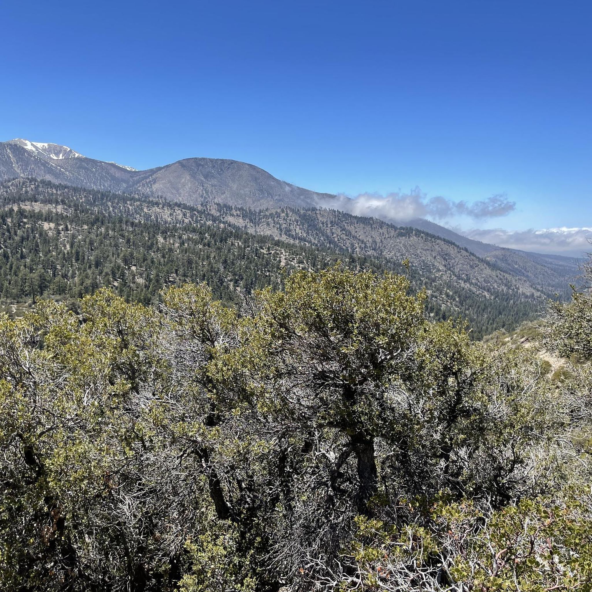
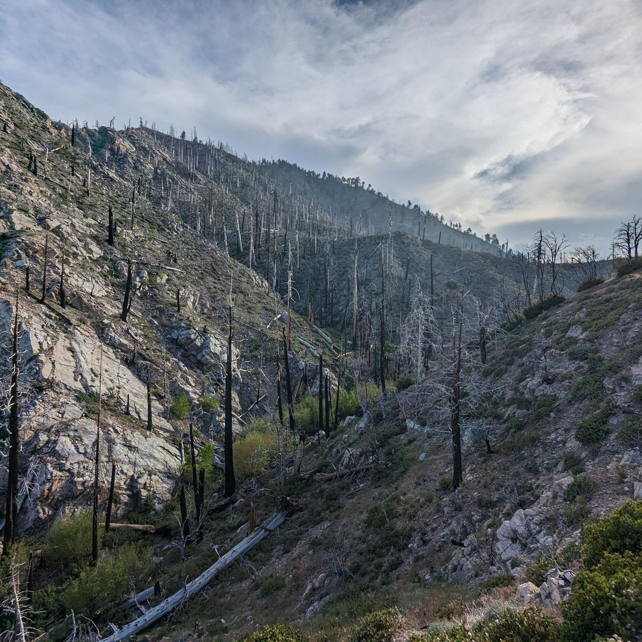
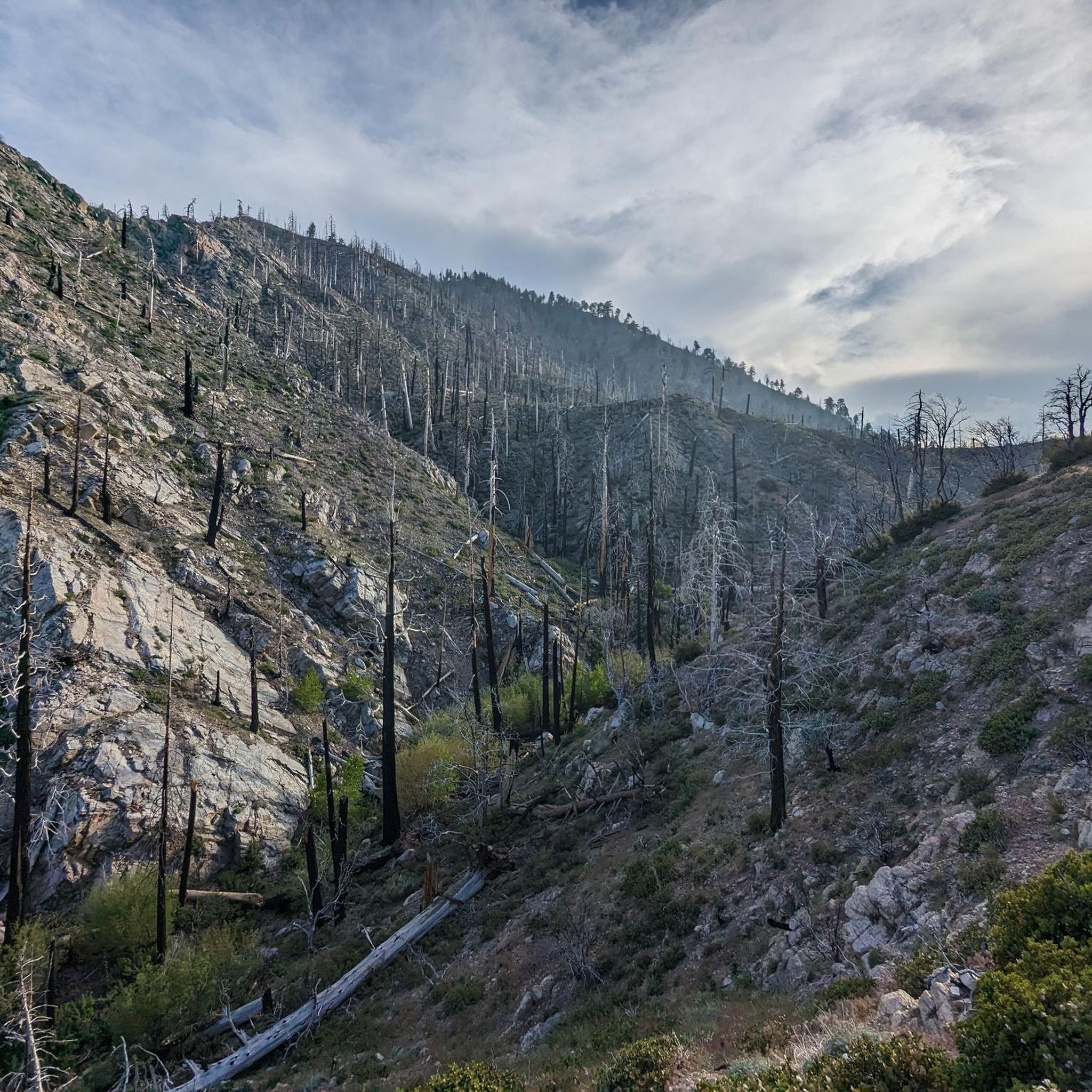
Hiking in Sand To Snow National Monument covers a landscape with significant elevation change, transitioning from Sonoran and Mojave Desert floors to alpine coniferous forests. This gradient encompasses a vast range of ecosystems, providing varied and scenic hiking experiences. The region is characterized by arid desert scrub, riparian woodlands, and the high-altitude terrain of the San Gorgonio Mountains. A 30-mile section of the Pacific Crest Trail also bisects the monument.
Best hiking trails in Sand To Snow National Monument
- The most popular hiking route is San Gorgonio Mountain via Fish Creek Trail, a 10.0 miles (16.1 km) trail that takes 5 hours 9 minutes to complete. This challenging hike ascends toward the highest peak in Southern California.
- Another top favourite among local hikers is Red Dome via Pacific Crest Trail, an easy 2.3 miles (3.7 km) path. This route follows a section of the Pacific Crest Trail to a distinctive basalt rock formation.
- Local hikers also love the Big Morongo Canyon Trail, a 12.3 miles (19.7 km) trail leading through a rare desert oasis habitat, often completed in about 5 hours 30 minutes.
- Hiking in Sand To Snow National Monument is defined by diverse ecosystems, desert canyons, alpine forests, and high mountain peaks. The trail network offers options for different ability levels, from short walks to difficult summit ascents.
- The routes in Sand To Snow National Monument are highly rated by the komoot community with an average score of 4.6 stars from over 170 reviews. More than 1,900 hikers have used komoot to explore Sand To Snow National Monument's varied terrain.
Last updated: July 8, 2026
4.0
(1)
48
hikers
6.83km
02:04
230m
210m
Embark on the Whitewater Canyon View Loop Trail for a moderate hike that showcases the desert's diverse beauty. You will traverse the wash of the Whitewater River, crossing via wooden footbridges, before climbing up cactus-dotted hills. From these higher points, you can enjoy panoramic vistas of the western Coachella Valley and the majestic San Jacinto Mountains. This loop covers 4.2 miles (6.8 km) with an elevation gain of 749 feet (228 metres), typically taking about 2 hours and 3 minutes to complete.
To plan your visit, head to the Whitewater Preserve where you will find free parking and restrooms conveniently located near the ranger station, which is also the trailhead. Since the trail offers minimal shade, it is best to start your hike early in the morning, especially during warmer months, and always carry plenty of water. Dogs are welcome to join you on the trail, provided they remain on a leash throughout your adventure.
This trail offers a unique opportunity to experience a blend of riverine oasis and expansive canyon views within the preserve. As you hike, keep an eye out for diverse wildlife, including bighorn sheep, which frequent this vital corridor. The route provides an excellent overview of the natural environment, making it a notable choice for understanding the local ecosystem and its inhabitants.
3
hikers
16.1km
05:09
1,080m
60m
Hike the challenging San Gorgonio Mountain via Fish Creek Trail, a 10-mile route to Southern California's highest peak with 3,553 feet of ga

Sign up for free
3
hikers
19.7km
05:30
380m
370m
Embark on a challenging hike through the Big Morongo Canyon Preserve, a remarkable desert oasis where the Mojave and Colorado Deserts meet. This difficult 12.3-mile (19.7 km) route will take you about 5 hours and 30 minutes to complete, with a significant elevation gain of 1255 feet (382 metres). You will traverse diverse landscapes, from lush cottonwood-willow riparian areas featuring boardwalks to expansive, exposed desert washes. Keep an eye out for ancient gneiss rock outcroppings, which mark the Morongo Valley Fault, adding a geological highlight to your journey. The preserve is also known for its rich biodiversity, especially its many bird species, making it a rewarding experience for nature lovers.
Before you set out, remember that much of the route is exposed to the sun, so preparing for desert conditions is essential. You should bring plenty of water, as there are no resupply points along the 12.3-mile (19.7 km) trek. Starting early in the morning is advisable to avoid the midday heat, especially during warmer months. The preserve is conveniently located about 20 minutes north of Palm Springs, making it an accessible day trip. Plan your visit carefully to ensure a safe and enjoyable experience on this demanding trail.
This trail offers a unique opportunity to explore a critical transition zone between the Mojave and Colorado Deserts. The Big Morongo Canyon Preserve is recognized for its unique ecosystem, supporting a wide array of plant and animal life that thrives in this desert environment. Its designation as a globally important bird area highlights its significance for migratory and resident bird species. The presence of ancient gneiss rock formations also provides a fascinating glimpse into the region's geological history, making the route more than just a physical challenge.
1
hikers
3.72km
01:03
130m
0m
Embark on an easy hiking adventure along the Red Dome via Pacific Crest Trail, a 2.3-mile (3.7 km) route that offers a unique desert experience. You will gain 411 feet (125 metres) in elevation, making it a gentle climb that takes approximately 1 hour and 3 minutes to complete. The trail guides you through a distinctive desert environment, following a dirt path alongside a rocky riverbed, with the prominent Red Dome serving as a striking visual landmark against the vast landscape.
To begin your hike, head to the Whitewater Preserve, which provides a visitor center and shaded picnic areas for your convenience. It is important to note that cell phone reception often becomes unreliable shortly after you leave Interstate 10, so plan accordingly. This route is also dog-friendly, but please ensure your canine companion remains on a leash throughout your visit.
This trail offers a glimpse into the Whitewater Preserve, often described as an oasis nestled among giant mountains, featuring crystalline pools. You will encounter the Whitewater River, recognized as a Wild and Scenic River, and enjoy expansive views of the surrounding peaks. The Red Dome itself is an obvious red outcropping that truly stands out, highlighting the unique geology of this desert region.
3.21km
01:00
190m
20m
Hike the easy 2.0-mile Aspen Grove Trail in San Gorgonio Wilderness to see rare Quaking Aspen trees and enjoy a serene woodland setting.
Get access to more routes and recommendations from other explorers.
Sign up for free
Already have an account?
Our route recommendations are based on thousands of hikes, rides, and runs completed by other people on komoot.
Start today with a free account
Your next adventure awaits.
Login or Signup
Tips from the Community

Go through the longer southern loop, beautiful open areas with lots of vegetation and you might see the Roadrunner crossing your path 🤗
0
0

San Gorgonio Mountain, also called Mount San Gorgonio or Old Greyback, is the highest peak in Southern California, standing at 11,503 feet. The mountain has a pyramid-like shape, with a steep north face and a gentler south face. On clear days, hikers can enjoy expansive 360-degree views of San Gorgonio Wilderness and even the Pacific Ocean.
0
0

Easy ride up Whitewater Canyon Road to the Preserve. There you will find a nicely kept picnic area where you can day camp, hike or soak in the nice swimming hole. The canyon has a robust population of bighorn sheep, deer, and bear!
0
0

The Whitewater Preserve is a true oasis in a desert canyon. You can relax in the shade of huge trees near beautiful turquois and green pools. Enjoy the lovely hummingbirds that buzz around the ranger station and cool your feet in the wading pool. There are a lot of picnic benches, restrooms and potable water. Using the area is free of charge, but consider a donation for this unique place that once was a trout hatchery.
5
0
A beautiful oasis in the desert with a bubbling White River for a refreshing splash next to you. The Red Dome rises above the desert floor. There might be some mosquitos in spring and summer though.
2
1
Right between the Sonora Desert and the higher elevated Mojave Desert you will find this little oasis nestled in among the Little San Bernardino Mountains in the Sand to Snow National Monument. Hike on nice boardwalks and enjoy the nature preserve with its wildlife like big horn sheep, mule deer, and mountain lions as well as amphibians and reptiles and a unique flora thanks to perennial water within the area.
4
0
A beautiful oasis in the desert with a bubbling White River next to you. The Red Dome rises above the desert floor. For hikers of the Pacific Crest Trail, this is a very much appreciated refreshment, so take your time and enjoy the cool water. There might be some mosquitos in spring and summer though.
5
0

This is a tough hike, but a nice one to check off your bucket list. Incredible views from this point.
1
0
Frequently Asked Questions
Are dogs allowed on trails in Sand to Snow National Monument?
Yes, dogs are generally permitted on many trails within the Sand to Snow National Monument, but they must be kept on a leash. However, please be aware that dogs are not allowed in certain protected areas like the Big Morongo Canyon Preserve or the Whitewater Preserve to protect wildlife. Always check specific trail regulations before you go.
What are some good options for an easy hike?
For a relatively easy and scenic walk, consider the Big Morongo Canyon Preserve trail. It's a short 2.6-mile (4.2 km) route through a rare desert oasis habitat, perfect for bird-watching and enjoying unique scenery without a major physical challenge.
Do I need a permit to hike in the monument?
For most trails in the monument, no permit is required for day hiking. However, a permit is required for both day hikes and overnight trips into the San Gorgonio Wilderness, which includes the popular San Gorgonio Peak. You can obtain a free, self-issued permit at the Mill Creek Ranger Station.
When is the best time of year to hike in Sand to Snow?
The best time to hike depends on the elevation. The lower desert areas are most pleasant from fall through spring (October to May). Summer can be extremely hot at low elevations. The higher alpine trails, like those in the San Gorgonio Mountains, are best from late spring to fall (June to October) when they are generally free of snow.
Are there reliable water sources on the trails?
Water sources are scarce and can be unreliable, especially in the desert sections. The Whitewater River and Mission Creek are potential sources, but all water should be treated before drinking. For longer or more strenuous hikes, it is critical to carry all the water you will need, typically at least one gallon (about 4 liters) per person, per day.
Can I go camping in the monument?
Yes, dispersed camping is allowed in many parts of the monument, but you must follow Leave No Trace principles. For backpacking trips into the San Gorgonio Wilderness, an overnight permit is required. There are also designated campgrounds in the surrounding San Bernardino National Forest. Always check for fire restrictions, which are common.
What kind of wildlife might I see?
The monument's diverse ecosystems support a wide range of wildlife. In the lower elevations and canyon areas, you might spot bighorn sheep, various lizards, and many bird species, especially in the Big Morongo Canyon Preserve. In the higher, forested areas, it's possible to see black bears, deer, and mountain lions. Always observe wildlife from a safe distance.
How difficult are the hikes in this region?
The difficulty varies dramatically with the terrain. You'll find everything from easy, flat walks in the preserve areas to extremely strenuous mountain ascents. For a challenging, high-elevation trek, the San Gorgonio Peak via Vivian Creek Trail involves over 5,300 feet (1,600 m) of elevation gain. For a much gentler option, the Whitewater River & Red Dome via PCT trail is a mostly flat walk along the river.
How many hiking trails are available in the monument?
There are over 50 designated hiking trails within Sand to Snow National Monument. These routes cover the full spectrum of environments, from desert floor canyons and oases to high alpine peaks, offering options for all skill levels.
What do other hikers say about the trails in Sand to Snow National Monument?
The trails are highly regarded by the komoot community, with an average rating of 4.7 out of 5 stars. Hikers often praise the incredible diversity of the landscape, from the stark beauty of the desert to the serene forests of the high country. The dramatic elevation changes and stunning views are frequently mentioned as major highlights.
Can I hike a section of the Pacific Crest Trail here?
Yes, approximately 30 miles of the iconic Pacific Crest Trail (PCT) run through the heart of the monument. You can experience a part of it on routes like the hike to Mission Creek Shelter, which follows the PCT through a beautiful canyon environment.
Are there any challenging multi-peak hikes?
Yes, the monument is famous for the "Nine Peaks Challenge," a grueling 27-mile trek that summits nine different peaks in the San Gorgonio Wilderness. For a still-demanding but more focused ascent, the hike to San Bernardino East Peak offers a significant challenge with substantial elevation gain and rewarding views.
Most popular routes in Sand To Snow National Monument
Most popular attractions in Sand To Snow National Monument

Get inspired with the komoot mobile app


Explore more
Browse the best Hikes in other regions.
