Routes

Planner

Features

Updates

App

Login or Signup

Get the App

Login or Signup

Routes
Hikes
United States
California
San Diego County

Mission Trails Regional Park

The best walks and hikes in Mission Trails Regional Park

4.9

(384)

4,094

hikers

82

hikes

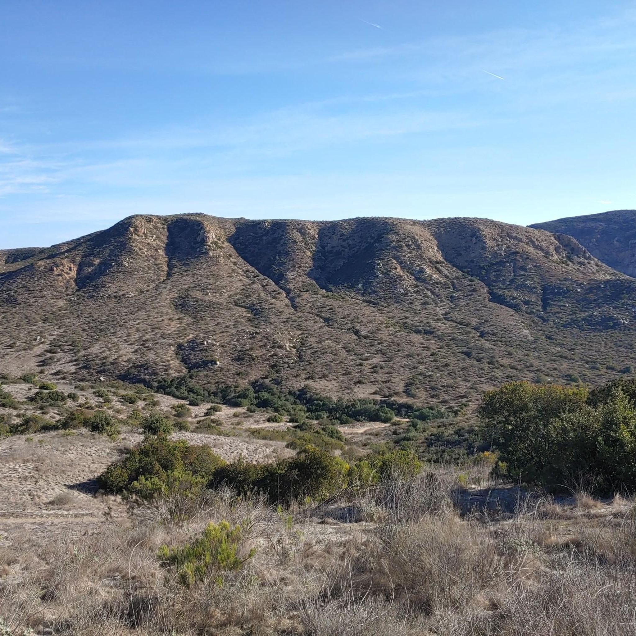
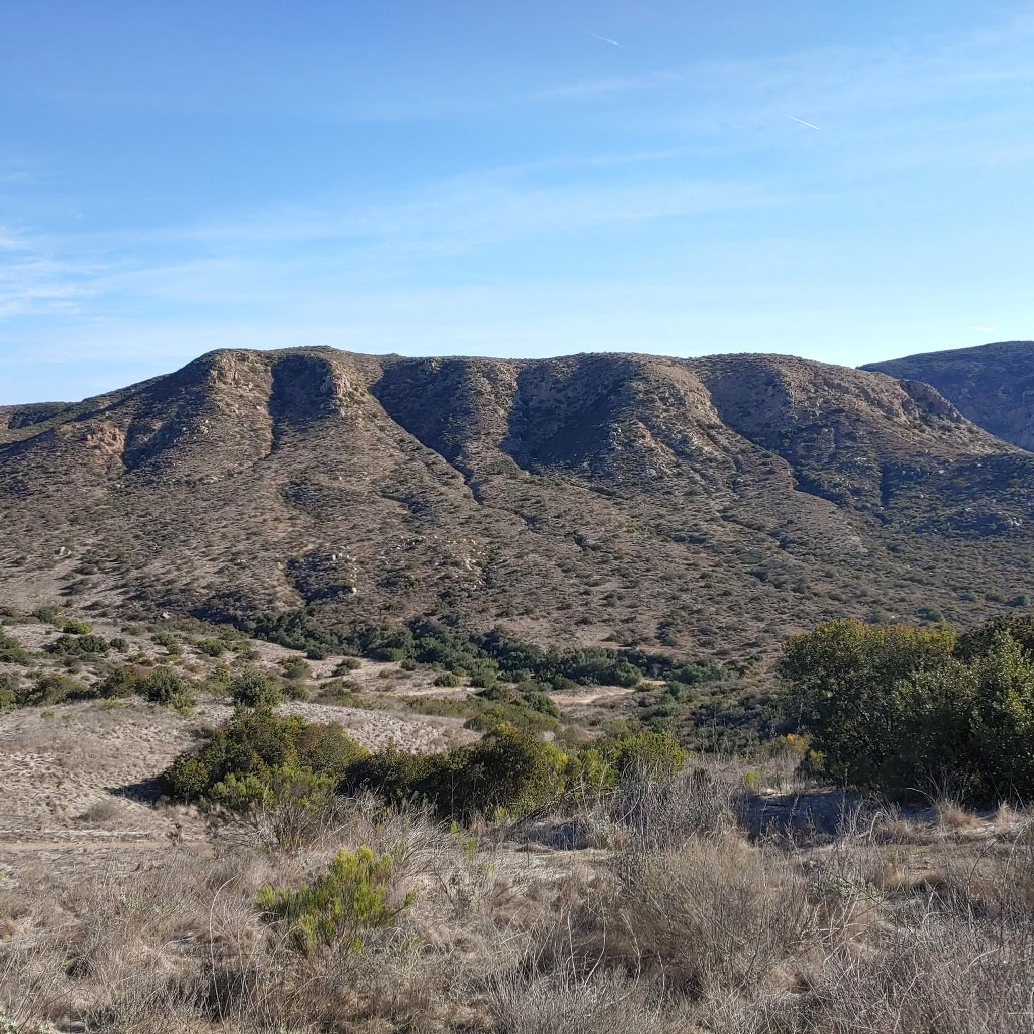
Hiking in Mission Trails Regional Park offers diverse landscapes across over 8,000 acres, featuring rugged hills, vast valleys, and open areas. The park encompasses chaparral, sage scrub, oak woodland, and grassland habitats. Elevations vary, with prominent peaks like Cowles Mountain and Pyles Peak providing expansive views. The San Diego River flows through sections of the park, contributing to varied trail environments.

Best hiking trails in Mission Trails Regional Park

  • The most popular hiking route is Cowles Mountain Trail, a 1.5 miles (2.4 km) trail that takes 52 minutes to complete. This route ascends to the highest point in the City of San Diego, offering 360-degree views.
  • Another top favourite among local hikers is South Fortuna and North Fortuna Loop, a moderate 8.2 miles (13.1 km) path. This trail combines two prominent peaks, providing a more strenuous hike with varied terrain.
  • Local hikers also love the Oak Canyon Loop Trail, a 3.8 miles (6.1 km) trail leading through diverse scenery including oak trees and rocky gorges, often completed in about 1 hour 40 minutes.
  • Hiking in Mission Trails Regional Park is defined by rugged hills, diverse chaparral, and oak woodland, with trails following the San Diego River. The extensive network offers options for all ability levels, from easy walks to challenging peak ascents.
  • The routes in Mission Trails Regional Park are highly rated by the komoot community with an average score of 4.8 stars from over 230 reviews. More than 2000 hikers have used komoot to explore Mission Trails Regional Park's varied terrain.

Last updated: July 7, 2026

5.0

(1)

67

hikers

#1.

Cowles Mountain Trail

2.41km

00:52

250m

0m

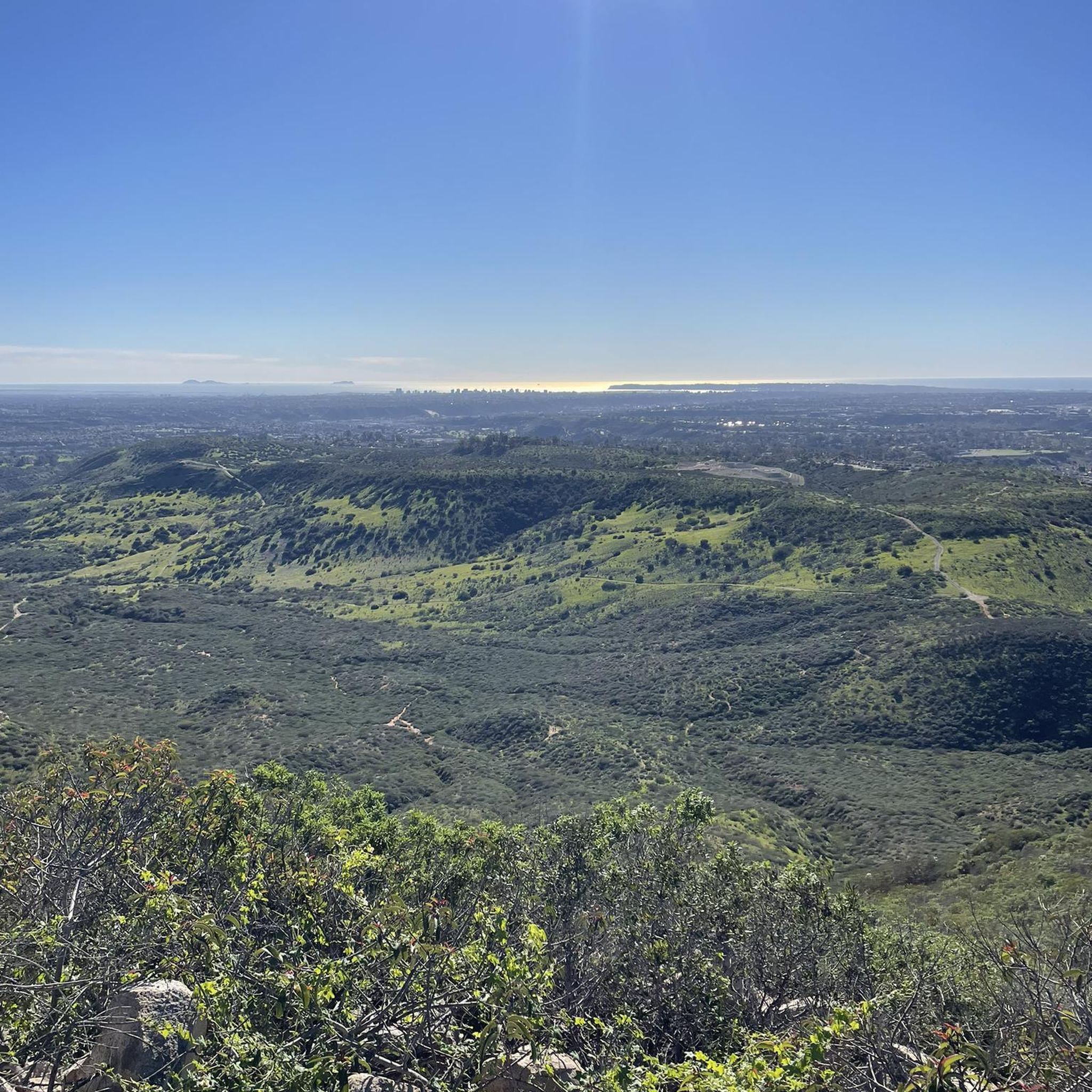
The Cowles Mountain Trail offers a classic San Diego hiking experience, leading you up to the highest point within the city. You'll start on stone steps, then transition to a dirt single track that winds through coastal chaparral, ascending continuously via numerous switchbacks. The terrain is rocky and uneven in places, but the effort is well worth it for the stunning 360-degree panoramic views from the 1,591-foot summit, where you can spot downtown San Diego, the Pacific Ocean, and Lake Murray.

This 1.5-mile (2.4 km) hike involves a steady 833 feet (254 metres) of elevation gain, typically taking around 52 minutes to complete, and is rated easy. Given its popularity, especially on weekends, plan to arrive early or hike during off-peak hours to secure parking at the Cottonwood Mountain Staging Area. The trail is largely exposed with no shade, so bring ample water and sun protection, particularly if you're hiking during warmer months.

Cowles Mountain is an urban treasure, known for being the most frequented hiking destination in San Diego County. It's a key part of the Mission Trails Regional Park 5-Peak Challenge and offers breathtaking sunrise and sunset views. The mountain also holds historical significance, named after an early San Diego rancher and once home to a Kumeyaay Winter Solstice observatory site.

Navigate with device

Send to Phone

Save

Easy

4.5

(2)

46

hikers

6.11km

01:41

100m

100m

The Oak Canyon Loop Trail in Mission Trails Regional Park offers a delightful escape into nature, winding through a varied landscape that feels much more remote than its urban setting. You'll hike along a seasonal stream, crossing it on wooden bridges, and pass through sections shaded by towering oak trees that create natural tunnels. After winter rains, you might even spot small waterfalls, and spring brings a burst of wildflowers, making the scenery particularly vibrant. Keep an eye out for local wildlife like birds and rabbits as you navigate the path, which includes some rocky sections and opportunities for creek bed scrambling.

Planning your visit to this easy 3.8-mile (6.1 km) loop, which takes about 1 hour and 40 minutes to complete with 331 feet (101 metres) of elevation gain, is straightforward. The trailhead is conveniently located near the historic Old Mission Dam in San Diego, California. Parking is available, but arriving early is recommended, especially on busy days. This trail is suitable for most ages and is considered a great family-friendly option, offering a rewarding experience without being overly strenuous.

What makes this trail stand out is its flexibility and diverse features within a relatively short distance. Beyond the scenic oak groves and seasonal creek, you'll encounter dramatic rocky gorges. The Oak Canyon Loop Trail can also be combined with other routes in Mission Trails Regional Park, like the Grasslands Loop, to create longer, more challenging hikes if you're looking to extend your adventure. It's a fantastic way to experience the natural beauty of San Diego.

Easy
guide_signup
Let us show you the way with the komoot mobile app
With a free komoot account, you can easily find, customize, and navigate endless outdoor adventures.

Sign up for free

4.5

(2)

23

hikers

4.59km

01:16

100m

40m

The Oak Canyon Trail offers an easy hiking experience through a diverse landscape. You will follow a creek, crossing it multiple times via wood plank platforms and bridges, winding through wooded areas filled with impressive oak and sycamore trees. Expect sections requiring some scrambling over large boulders, adding an adventurous twist to this 2.9 miles (4.6 km) route. With an elevation gain of 318 feet (97 metres), you can complete this hike in about 1 hour and 15 minutes.

The trailhead for the Oak Canyon Trail is conveniently located near the historic Old Mission Dam within Mission Trails Regional Park. Parking is generally available in the designated areas of the park. While the trail is considered family-friendly, be aware that some sections involve boulder scrambling and drop-offs near waterfalls. If you are hiking with small children, exercise caution in these areas.

This route provides a refreshing escape into nature, showcasing lush creek views and verdant vegetation. The path's proximity to the historic Old Mission Dam near the trailhead offers a glimpse into the region's past and adds a cultural dimension to your hike. It is a perfect choice for a quick outdoor adventure, allowing you to immerse yourself in the natural beauty of the park.

Easy

4.0

(2)

11

hikers

Embark on the South Fortuna and Oak Canyon Loop, a moderate hike that spans 6.9 miles (11.1 km) with an elevation gain of 1139 feet (347 metres). This route typically takes around 3 hours and 20 minutes to complete. You will experience a dynamic landscape, from the challenging ascent up South Fortuna Mountain, known for its distinctive wooden steps, to the tranquil, riparian environment of Oak Canyon. Expect varied terrain, including wide gravel paths and rugged sections with loose rocks, offering a true taste of Mission Trails Regional Park's diverse beauty.

When planning your visit, remember that the trail is considered moderate, but its significant elevation changes mean you should wear sturdy hiking shoes. The Old Mission Dam is a popular starting point for many routes in the park, providing good access to the trailhead. Consider starting your hike early in the morning to enjoy cooler temperatures and avoid the midday sun, especially during warmer months. Always carry enough water, as sections of the trail are exposed.

This loop offers more than just a workout; it provides expansive views from the summits, allowing you to gaze across Mission Gorge and the golden hillsides. The contrast between the open, elevated sections and the shaded, potentially lush Oak Canyon, especially after rainfall, makes this trail particularly notable. It's a fantastic way to explore the natural and historical richness of Mission Trails Regional Park, blending scenic vistas with a rewarding physical challenge.

Moderate

12

hikers

The South Fortuna and North Fortuna Loop offers a rewarding hiking experience, rated as moderate, that covers 8.2 miles (13.1 km) with a substantial elevation gain of 1452 feet (443 metres). You can expect to complete this journey in about 4 hours. As you hike, you will encounter varied terrain, from smooth paths to rocky sections and steep climbs, all while enjoying impressive 360-degree panoramic views of the greater San Diego area, including the ocean, especially from the North Fortuna Summit. The trail winds through fragrant coastal sage and towering chaparral, with wildflowers adding splashes of color during the wetter seasons.

Planning your visit requires some foresight, as much of the route is exposed to the sun; remember to carry plenty of water, particularly on warmer days. Many hikers find it beneficial to tackle the loop counter-clockwise, which allows you to ascend the steepest parts, like the famous "Stairway to Heaven," rather than descending them. The trail is well-maintained and clearly marked, and you will generally have good cell phone reception throughout your adventure.

This loop is a highlight within Mission Trails Regional Park, known for its diverse ecosystems and challenging yet accessible trails. The varied landscape provides a home for a range of local flora and fauna, making it a great spot for nature observation. Its unique combination of physical challenge and expansive views makes it a popular choice for those looking to explore the natural beauty surrounding San Diego.

Moderate
Sign up for free to see 78 more hikes in Mission Trails Regional Park.

Get access to more routes and recommendations from other explorers.

Sign up for free

Already have an account?

Our route recommendations are based on thousands of hikes, rides, and runs completed by other people on komoot.

Start today with a free account

Your next adventure awaits.
Login or Signup

Popular around Mission Trails Regional Park

Cycling in Mission Trails Regional Park

Running Trails in Mission Trails Regional Park

MTB Trails in Mission Trails Regional Park

Road Cycling Routes in Mission Trails Regional Park

Gravel biking in Mission Trails Regional Park

Tips from the Community

Luis Alcantara
August 3, 2025, View from Cowles Mountain

Being plenty of water! Nice hike

0

0

Cowles Mountain, sitting at 1,593 feet, is the highest point within the City of San Diego. The summit gives you panoramic views of downtown San Diego, making it a popular destination for hikers seeking both a moderate challenge and scenic vistas.

1

0

oliviakellis
December 17, 2024, Shepherd Pond

Shepherd Pond is a lovely spot to have a rest during your ride in Mission Trails Regional Park.

0

0

1519 feet, this is the highest point in Mission Trails Regional Park in San Diego.

0

0

start of cowled Mountain trail

0

0

River crossing near the Visitor's Center. Can be nearly dry or full of storm runoff, depending on the season. It's a nice bit of water in an otherwise dry area.

0

0

At 1,293 feet, North Fortuna Mountain is one of the tallest mountains and one of the best viewpoints in Mission Trails Regional Park. The views from the top are of the surrounding peaks in the park and even out to the ocean on a clear day.

0

0

Matthew
January 8, 2024, Old Mission Dam

This overlook on the trail offers a cool bird's eye view of the Old Mission Dam. You can tell just how wide the structure spans when you get this higher perspective.

0

0

Frequently Asked Questions

How many hiking trails are available in Mission Trails Regional Park?

Mission Trails Regional Park offers an extensive network of over 70 hiking trails, catering to various skill levels. You'll find a good mix of easy, moderate, and challenging routes to explore the park's diverse landscapes.

What are the difficulty levels of hikes in Mission Trails Regional Park?

The park features a wide range of difficulties. There are over 30 easy trails, more than 35 moderate routes, and a few challenging options for experienced hikers. This variety ensures there's something for everyone, from leisurely strolls to strenuous peak ascents.

Are there any family-friendly hiking options in Mission Trails Regional Park?

Yes, Mission Trails Regional Park has several family-friendly trails. Many of the easier routes are suitable for families, including some paved paths that can accommodate strollers. The park's diverse scenery, including oak woodlands and views of the San Diego River, makes for an engaging outing for all ages.

Can I bring my dog on the trails in Mission Trails Regional Park?

Yes, dogs are generally welcome on the trails in Mission Trails Regional Park, but they must be kept on a leash. Always remember to clean up after your pet to help keep the park enjoyable for everyone.

Are there any circular hiking routes in Mission Trails Regional Park?

Many trails in Mission Trails Regional Park are designed as loops, offering varied scenery without retracing your steps. For example, the Rim Trail & North & South Fortuna loop provides a comprehensive experience of the park's rugged hills and valleys.

Where can I find the best viewpoints in Mission Trails Regional Park?

For panoramic views, head to the summits of the park's prominent peaks. The View from Cowles Mountain offers 360-degree vistas of San Diego, Mexico, and beyond. Pyles Peak also provides excellent perspectives, especially when combined with Cowles Mountain.

Are there any historical landmarks or natural attractions to see while hiking?

Absolutely. The park is rich in both natural beauty and historical significance. You can visit the Old Mission Dam, a significant historical landmark, or explore the scenic Lake Murray Reservoir. Mission Gorge also offers stunning natural views, particularly from the Visitor Center.

Can I see waterfalls in Mission Trails Regional Park?

Yes, you can find seasonal waterfalls in Mission Trails Regional Park, particularly along the Oak Canyon Trail. These are most impressive during the spring months or after significant rainfall, when the creeks are flowing strongly.

What kind of wildlife can I expect to see in Mission Trails Regional Park?

Mission Trails Regional Park is home to diverse wildlife. Hikers often spot various bird species, insects, deer, and coyotes. Keep an eye out for foxes and different snake species, especially during warmer months. The park's varied habitats support a rich ecosystem.

Is there parking available at Mission Trails Regional Park trailheads?

Yes, Mission Trails Regional Park provides several parking areas at various trailheads and key access points, including near the Visitor Center and popular peaks like Cowles Mountain. It's advisable to arrive early on weekends or holidays as parking lots can fill up quickly.

What facilities are available at Mission Trails Regional Park?

The park features an award-winning Visitor and Interpretive Center, which offers educational exhibits, restrooms, and a gift shop. There are also picnic areas, and Kumeyaay Lake provides camping facilities. Restrooms are available at key locations throughout the park.

What do other hikers enjoy the most about hiking in Mission Trails Regional Park?

The area is highly rated by the komoot community, with an average score of 4.8 stars from over 230 reviews. Reviewers often praise the park's diverse terrain, the rewarding views from the peaks, and the extensive network of well-maintained trails that offer a quick escape into nature within an urban setting.

Most popular routes in Mission Trails Regional Park

Family-friendly hikes in Mission Trails Regional Park

Most popular attractions in Mission Trails Regional Park

Places to see

Store rating

Get inspired with the komoot mobile app

With a free komoot account, you can easily find, customize, and navigate endless outdoor adventures.

or

Join komoot Now

Store rating

Explore more

Browse the best Hikes in other regions.

San DiegoCleveland National ForestLaguna MountainsAnza-Borrego Desert State ParkLake San MarcosAnza-Borrego Desert State WildernessSan MarcosCarlsbadCuyamaca Rancho State ParkFairbanks RanchSan Diego National Wildlife RefugeGranite HillsChula VistaHarbison CanyonEscondidoNational CitySanteeAlpinePowayEncinitasWinter GardensSan Diego Country EstatesValley CenterCuyamaca Mountain State WildernessBostoniaLakesideElfin ForestLemon GroveDel DiosRamonaBonitaVallecito MountainsLa PresaCrestPine Creek WildernessHidden MeadowsEucalyptus HillsRainbowSanta Rosa MountainsOtay Mountain WildernessFallbrookJamulRancho San DiegoMount LagunaSan Diego Bay National Wildlife RefugeBorrego SpringsRancho Santa FeDescansoJulianPine ValleyCampoHauser WildernessBlack Mountain Open Space ParkLa MesaOceansideSanta Rosa Mountains State WildernessImperial BeachSawtooth Mountains WildernessCamp Pendleton MainsideEl CajonVistaSawtooth Mountains A Wilderness Study AreaSan Ysidro Mountain Wilderness Study AreaSan Felipe Hills Wilderness Study AreaBorder Field State ParkTijuana Slough National Wildlife RefugeSpring ValleyHarmony GroveAgua Tibia WildernessCabrillo National MonumentCasa De Oro-Mount HelixBonsallHauser Mountain Wilderness Study AreaBeauty Mountain Wilderness Study AreaCoronadoAgua Caliente County ParkSolana BeachPalaDel MarCarrizo Gorge WildernessCamp Pendleton SouthSawtooth Mountains C Wilderness Study AreaCarrizo Gorge Wilderness Study Area

Nearby adventure guides

Things to Do around Santee

background

Get ready to conquer new peaks

Sign up for Free

Explore
RoutesRoute plannerFeaturesHikesMTB TrailsRoad cycling routesBikepackingSitemap
Download the app
Follow Us on Socials

© komoot GmbH

Privacy Policy