The best walks and hikes in Usery Mountain Regional Park
4.7
(62)
686
hikers
35
hikes
Hikes in Usery Mountain Regional Park explore the Sonoran Desert landscape at the western end of the Goldfield Mountains. The park contains more than 29 miles (46 km) of multi-use trails that navigate through a terrain of sandy paths and rocky sections. The area is characterized by desert flora, including saguaro and cholla cacti, with views of the surrounding mountains.
Best hiking trails in Usery Mountain Regional Park
- The most popular hiking route is Wind Cave via Wind Cave Trailhead — Apache Junction, a 3.1 mile (5.0 km) trail that takes around 1 hour 45 minutes to complete. The path leads to a wind-eroded alcove on Pass Mountain.
- Another top favourite among local hiking enthusiasts is Pass Mountain Trail loop via Wind Cave Trailhead — Apache Junction, a moderate 7.7 mile (12.5 km) path. This route circles Pass Mountain, offering varied desert scenery.
- Local hiking enthusiasts also love the North & South Cat Peak loop — Usery Mountain Regional Park, a 3.0 mile (4.8 km) trail leading through the desert landscape, often completed in about 1 hour 15 minutes.
- Hiking in Usery Mountain Regional Park is defined by desert paths, rocky ascents, and views across the Sonoran landscape. The trail network provides options for both easy and moderate ability levels.
- The routes in Usery Mountain Regional Park are highly rated by the komoot community with an average score of 4.9 stars from more than 25 reviews. More than 300 hikers have used komoot to explore Usery Mountain Regional Park's varied terrain.
Last updated: September 27, 2026
6
hikers
6.50km
01:43
60m
50m
Embark on an easy hike along the Noso, Channel, Spillway, Cat Peaks Pass, and Blevins Trails, a 4.0-mile (6.5 km) route that takes about 1 hour and 42 minutes to complete. You'll experience the unique Colorado desert landscape, gaining a gentle 187 feet (57 metres) in elevation. As you traverse the Cat Peaks Pass, look out for panoramic views from the saddle, with the Superstition Mountains clearly visible to the east. From South Cat Peak, you can even spot the distant skyline of Phoenix. The trail immerses you in a world of iconic saguaro, cholla, and hedgehog cacti, offering a true desert experience.
The Noso, Channel, Spillway, Cat Peaks Pass, and Blevins Trails are generally well-marked, making navigation straightforward for hikers. Before you head out, it's always a good idea to check the current conditions at Usery Mountain Regional Park. This is especially important after any significant rainfall, as the Channel Trail section can become quite muddy or even impassable due to its function as a natural drainage channel. Planning your visit during cooler parts of the day or year will enhance your enjoyment of this desert environment. Ensure you bring enough water, as shade is limited along the route.
This route offers a fantastic opportunity to explore the rich biodiversity of the Sonoran Desert. In spring, the Channel Trail section comes alive with vibrant wildflowers, adding a splash of color to the arid scenery. The trail's design allows you to appreciate the natural drainage patterns of the area, particularly along the Channel Trail. It's a perfect choice for a relaxed outdoor adventure within Usery Mountain Regional Park, providing accessible desert views without strenuous effort.
4
hikers
7.43km
02:35
190m
250m
Hike the moderate 4.6 miles (7.4 km) Pass Mountain Trail in Usery Mountain Regional Park for panoramic desert views and Saguaro cactus field

2
hikers
6.82km
01:46
40m
40m
The Ruidoso, County Line, and Meridian Trail Loop offers a quintessential Sonoran Desert experience, winding through varied terrain with clear views of the iconic Superstition Mountain. This easy 4.2-mile (6.8 km) hike, with a modest 141 feet (43 metres) of elevation gain, provides a serene atmosphere for about 1 hour and 46 minutes. You'll encounter diverse desert flora and fauna, making it a perfect route for a relaxing outdoor outing.
Located in Usery Mountain Regional Park, the trailhead is easily accessible with ample parking. For the most comfortable experience, especially in warmer seasons, aim to start your hike in the early morning or late afternoon to avoid the midday heat. The trail is multi-use, welcoming hikers, mountain bikers, and horseback riders, and it's also a great option if you're looking for dog-friendly trails in the area.
This loop is an excellent choice for families and beginner hikers, offering a gentle introduction to the beauty of the Arizona desert without significant physical challenge. The striking backdrop of Superstition Mountain makes for memorable scenery, distinguishing it from other local trails. It's a fantastic way to immerse yourself in the unique ecosystem of the region.
1
hikers
4.84km
01:17
50m
50m
The Cat's Peaks Loop via Meridian Trail offers a quintessential Sonoran Desert experience, showcasing a vibrant landscape filled with saguaro cacti and a unique "cholla forest." As you hike this easy 3.0-mile (4.8 km) loop, you'll be treated to expansive panoramic views, including the iconic Superstition Mountains, particularly from the saddle between the peaks. The path is mostly singletrack with some rocky sections, providing a gentle journey through this arid beauty.
This accessible route is conveniently located at the north end of Meridian Road in East Mesa, offering direct entry into Tonto National Forest without any park fees. With an estimated duration of 1 hour and 17 minutes and only 159 feet (49 metres) of elevation gain, it's an ideal choice for a quick escape or a leisurely family hike. Consider an evening visit to witness the desert's colors intensify as the sun sets.
Beyond its scenic appeal, the Cat's Peaks Loop is a multi-use trail, so you might encounter mountain bikers or horseback riders sharing the path. Its easy difficulty and relatively short distance make it a great option for those new to desert hiking or anyone looking for a rewarding outdoor experience without a strenuous climb. It's a fantastic way to immerse yourself in the Arizona desert landscape.
5.77km
01:29
30m
30m
If you're seeking a quintessential Sonoran Desert experience with rewarding vistas, the South Cats Peak via Channel Trail Loop is a fantastic choice. This 3.6-mile (5.8 km) hike guides you through a landscape dotted with saguaro, cholla, and yucca, offering impressive long-range views of the Superstition Mountains from the Channel Trail. The highlight is undoubtedly the 360-degree panorama from South Cat Peak, where you can spot Phoenix in the distance, making it one of the best hikes near Mesa for scenic viewpoints.
Planning your visit is straightforward; the trail is located in Usery Mountain Regional Park. While the overall difficulty is easy, the ascent to South Cat Peak involves a moderate climb over rocky sections, so wear appropriate footwear. The best time to hike this loop is during the cooler seasons to avoid extreme desert heat; always bring ample water. Parking is typically available at the trailhead, but arriving early can help secure a spot on busy days.
This loop is a great introduction to the desert ecosystem, showcasing a rich variety of plant life. The South Cat Peak summit even features benches, inviting you to linger and soak in the expansive views. It's a multi-use trail in parts, accommodating hikers, gravel bikers, and adaptive bikers, which speaks to its accessibility and popularity among different outdoor enthusiasts.
Get access to more routes and recommendations from other explorers.
Already have an account?
Our route recommendations are based on thousands of hikes, rides, and runs completed by other people on komoot.
Start today with a free account
Your next adventure awaits.

Tips from the Community

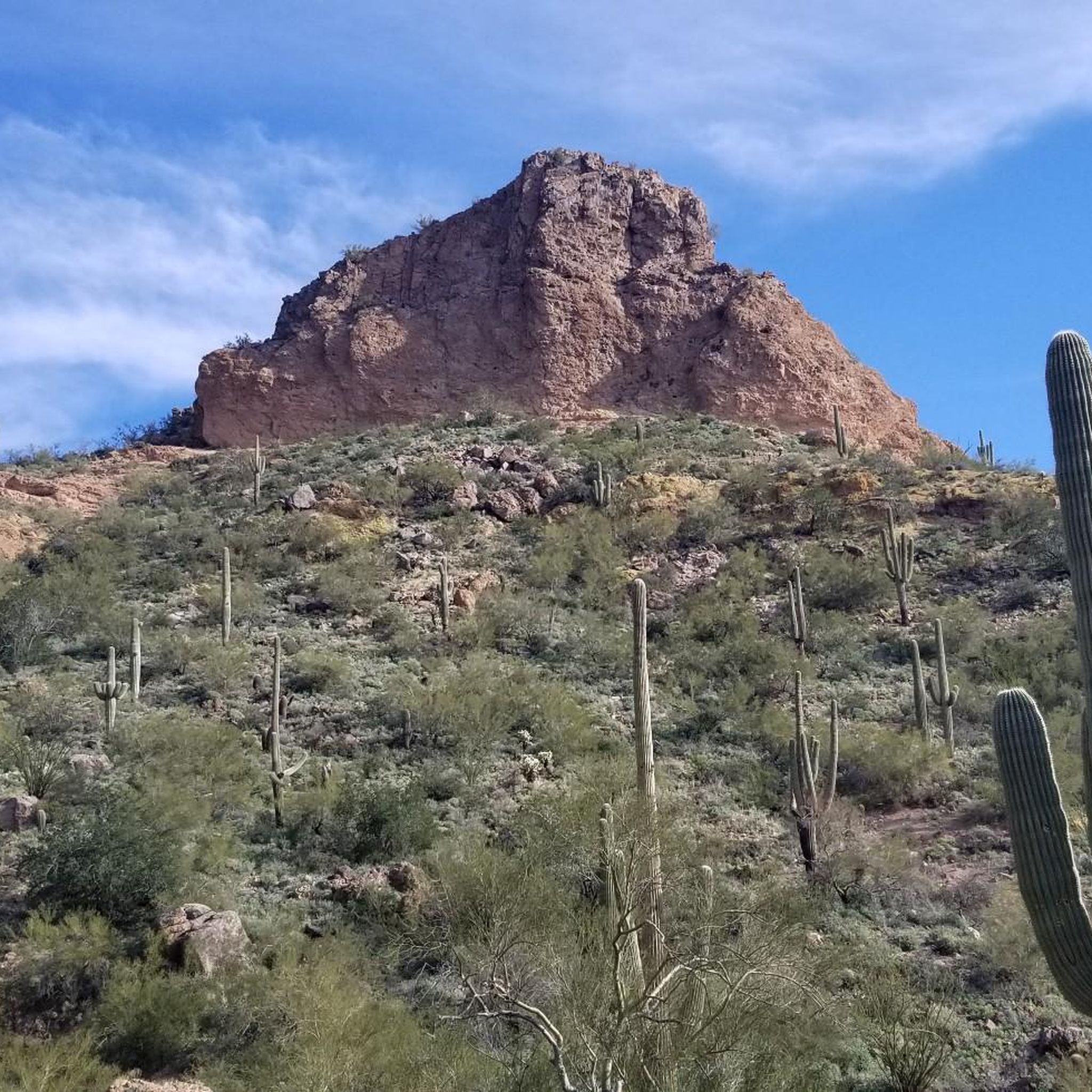
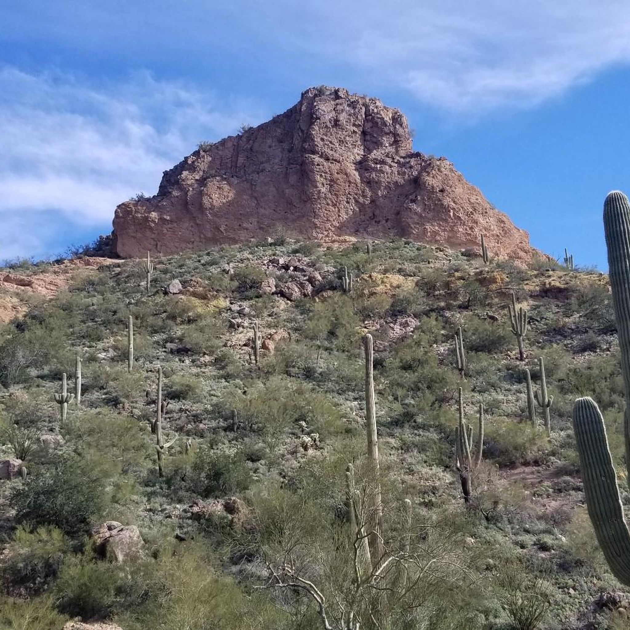
Blevins Trail in Usery Mountain Regional Park near Mesa, Arizona, is a popular spot for gravel cycling thanks to its well-groomed, mostly flat terrain and scenic desert views. The 3.1-mile loop features crushed gravel and sand surfaces, making it ideal for beginner to intermediate riders. Cyclists can enjoy wide-open views of Pass Mountain and the Superstitions while weaving through classic Sonoran Desert landscape. The trail connects to others like Moon Rock and Cat Peaks, offering options to extend your ride. Accessible year-round, it’s best ridden in cooler months.
0
0

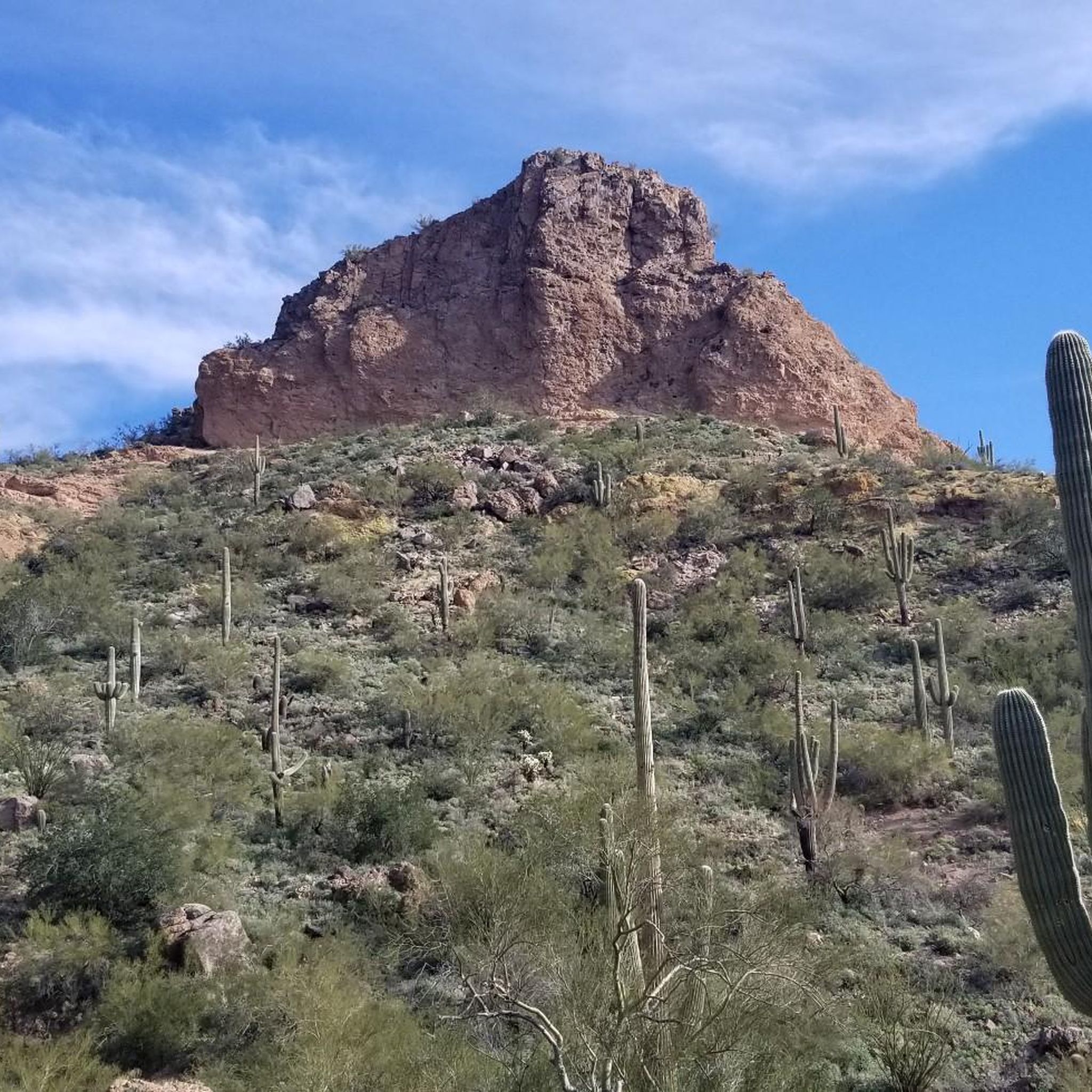
Reaching the top of South Cat Peak above Apache Junction treats mountain bikers to serene desert panoramas after a moderate ride up the trail. Challenge yourself pedaling over rocky inclines before stopping at a peaceful summit bench to soak in 360 degree views. It's an easy trail most of the way with rewarding vistas at the top.
0
0

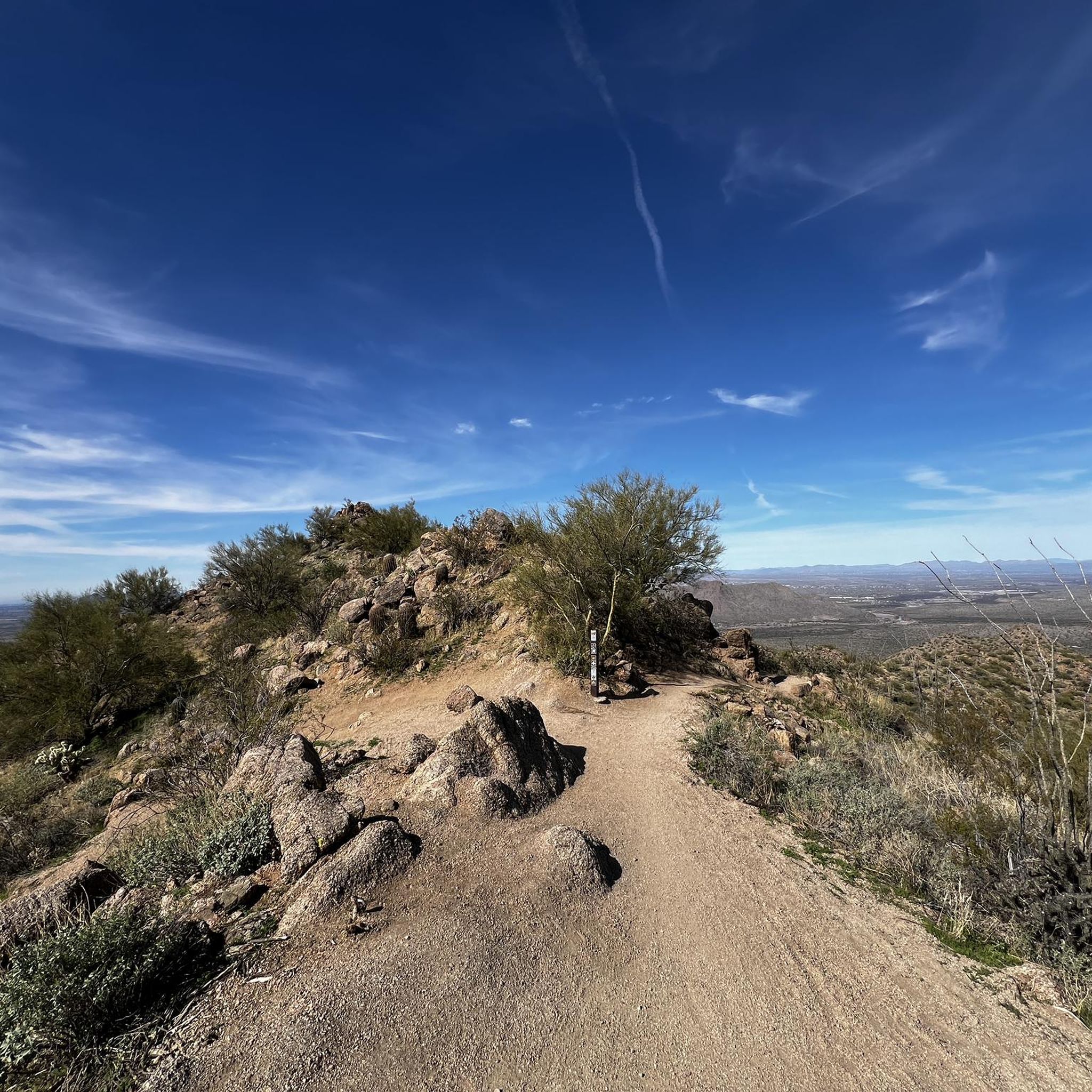
Here is a great view of Superstition Mountain. Look for the mountain's two major peaks: Superstition Peak or "Peak 5057" at an elevation of 5,059 feet (1,542 m) Flatiron Peak or "Peak 5024" at an elevation of 5,024 feet (1,531 m)
0
0


Frequently Asked Questions
What are the entrance fees for Usery Mountain Regional Park?
Yes, there is an entrance fee to access the park. The fee is typically charged per vehicle. Rates can change, so it's always a good idea to check the official Maricopa County Parks website for the most current fee information before your visit.
Are dogs allowed on the hiking trails?
Yes, dogs are generally welcome in Usery Mountain Regional Park, but they must be kept on a leash at all times. It's also important to bring plenty of water for your pet, especially during warmer months, and to clean up after them to help preserve the park's natural environment.
Are there any easy, family-friendly hikes in the park?
Absolutely. The park is very accommodating for families and beginners. The Merkle Trail is a 1-mile, barrier-free loop perfect for strollers and wheelchairs, featuring educational signs about the desert. For a slightly longer but still gentle walk, the Blevins Trail loop is a great option that explores the flat desert landscape.
How long does it take to hike to the Wind Cave?
The hike to the Wind Cave is one of the most popular in the park. The round trip is approximately 3 miles (5 km) and generally takes about 1 hour and 45 minutes to complete. The trail involves a steady climb with some rocky steps, leading to a large alcove with rewarding views.
What is the best time of year to hike in Usery Mountain Regional Park?
The best time to hike is from late fall through spring, typically from October to April. During these months, the temperatures are cooler and more pleasant for hiking. The spring, in particular, can be spectacular when the desert wildflowers are in bloom.
Are there any circular walks available?
Yes, the park has several excellent loop trails. A great choice for a relatively flat and scenic walk is the Lost Sheep Trail & Chain Fruit Trail loop. This 3.3-mile (5.4 km) circuit offers a wonderful immersion into the Sonoran Desert flora with minimal elevation change.
What kind of wildlife might I see in the park?
The park is a vibrant habitat for Sonoran Desert wildlife. Keep an eye out for Gila woodpeckers, cactus wrens, and Gambel's quail. You might also spot mule deer, javelinas, coyotes, and various lizards. For your safety and the animals' well-being, always observe wildlife from a distance and never feed them.
Is there a good trail for watching the sunrise?
The Wind Cave Trail is a fantastic choice for a sunrise hike. The trail faces west, so as you ascend, you can watch the early morning light illuminate the Phoenix valley below. Reaching the cave as the sun comes up provides a memorable experience and beautiful photo opportunities.
Are there trails suitable for horseback riding?
Yes, most of the trails in Usery Mountain Regional Park are multi-use and open to equestrians. The park's extensive network of over 29 miles of trails provides plenty of options for riders to explore the desert landscape. Always check trail signage for any specific restrictions.
What do other hikers enjoy most about Usery Mountain Regional Park?
The park is highly rated by the komoot community. Hikers frequently praise the well-maintained and clearly marked trails that cater to all skill levels. The stunning Sonoran Desert scenery, with its iconic saguaro cacti and panoramic mountain views, is another consistently highlighted feature.
How many hiking trails are in the park?
Usery Mountain Regional Park features an extensive network of over 25 designated trails. These range from short, accessible nature walks to more strenuous mountain loops, offering a wide variety of experiences for hikers of all abilities.
What should I bring for a hike in the park?
It is essential to bring more water than you think you'll need, especially in the warmer months. Also, wear sturdy hiking shoes, sun protection such as a hat and sunscreen, and carry a map of the trails. Snacks are also a good idea for longer hikes.
Most popular routes in Usery Mountain Regional Park
Most popular attractions in Usery Mountain Regional Park

Get inspired with the komoot mobile app


Explore more
Browse the best Hikes in other regions.
