The best running trails in American Flats Wilderness Study Area
104
runners
15
runs
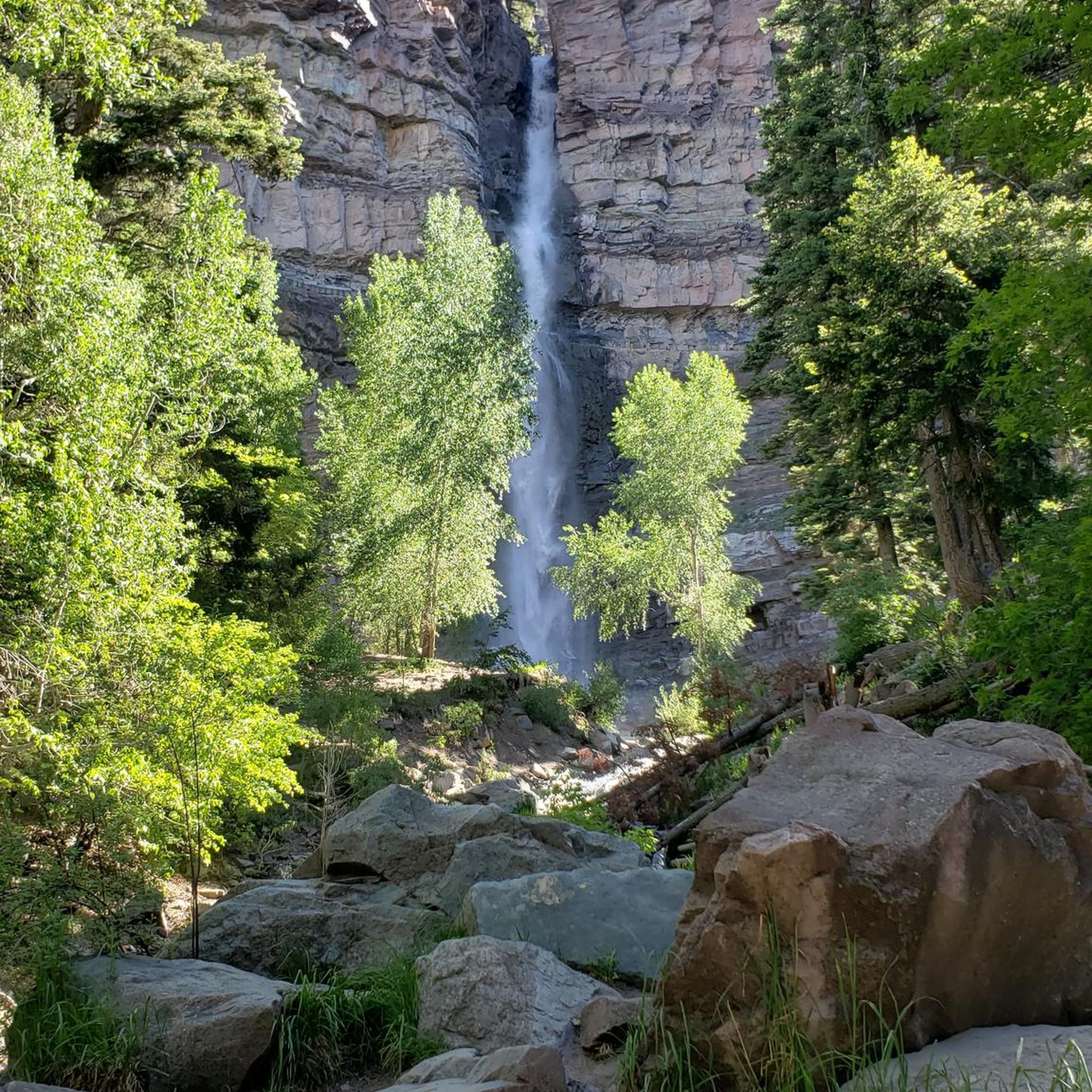
Jogging in American Flats Wilderness Study Area offers challenging routes through a high-altitude, mountainous environment. The region is characterized by prominent peaks and deep basins, with significant elevation changes across its trails. Runners can expect to navigate rugged terrain and experience the vastness of this protected wilderness.
Best jogging routes in American Flats Wilderness Study Area
- The most popular jogging route is Wetterhorn Peak and Uncompahgre Peak, a 15.1 miles (24.3 km) trail that takes 3 hours 54 minutes to complete, offering a demanding ascent to two prominent peaks.
- Another top favourite among local runners is Redcloud & Sunshine Peaks, a difficult 12.1 miles (19.5 km) path. This route traverses high alpine ridges, providing expansive views of the surrounding wilderness.
- Local runners also love the Handies Peak from Silver Creek/Grizzly Gulch, a 7.9 miles (12.7 km) trail leading through high mountain passes, often completed in about 2 hours 23 minutes.
- Jogging in American Flats Wilderness Study Area is defined by high peaks, challenging ascents, and remote wilderness. The network offers primarily difficult routes, with a few moderate options for experienced runners.
- The guide includes highly-rated routes that showcase the best of the region's landscape. More than 80 runners have used komoot to explore American Flats Wilderness Study Area's varied terrain.
Last updated: July 6, 2026
2
runners
24.3km
03:55
1,450m
1,450m
Hard run. Very good fitness required. Mostly paved surfaces. Suitable for all skill levels.
10
runners
19.5km
03:16
1,330m
1,330m
Hard run. Very good fitness required. Mostly paved surfaces. Suitable for all skill levels.

Sign up for free
5
runners
12.7km
02:24
1,080m
1,080m
Hard run. Very good fitness required. Mostly paved surfaces. Suitable for all skill levels.
3
runners
8.73km
01:33
670m
670m
Hard run. Very good fitness required. Mostly paved surfaces. Suitable for all skill levels.
5.77km
00:57
370m
370m
Hard run. Very good fitness required. Mostly paved surfaces. Suitable for all skill levels.
Get access to more routes and recommendations from other explorers.
Sign up for free
Already have an account?
Our route recommendations are based on thousands of hikes, rides, and runs completed by other people on komoot.
Start today with a free account
Your next adventure awaits.
Login or Signup
Popular around American Flats Wilderness Study Area
Tips from the Community


Two information boards and a medium sized parking lot are located at the American Basin Trailhead. This is a great starting point to summit Handies Peak since you are already pretty high up in elevation. To get here though, you should have a car with high-clearance and 4x4.
3
0
The American Basin is a popular spot along the Alpine Loop. There are some dispersed campsites, a reliable stream and the trailhead to summit Handies Peak that towers over the basin.
3
0
With an elevation of 14,058 feet, Handies Peak is one of the Colorado 14,000ers. You can access the summit either from the American Basin, passing beautiful Sloan Lake or via Grizzly Gulch from Cinnamon Pass Road on the other side of the mountain. The view from the top is spectacular! Keep in mind, that the weather can change quickly and expect thunderstorms especially during the summer months. So start your hike early and descent in the early afternoon at the latest.
3
0
The climb out of the American Basin up to American Pass is steep and strenuous. Your reward is a great view over Turkey Thief Lake and the surrounding San Juan Mountains including Handies Peak, one of the 14,000ers.
2
0

The final climb up to the peak has a class 2 section, but overall this is a fairly easy 14'er. The views of Matterhorn, Wetterhorn, and the surrounding peaks from here are phenomenal.
0
0
The view of Wetterhorn from the valley here is incredible. Up until this point the trail is easy class 1, but the climb up the peak is class 3. It is a very solid class 3, but if you are not prepared to summit this is a good place to turn around.
0
0
There is parking on both sides of the road near the old mining ruins. Public restrooms are available and dispersed camping is allowed near the trailhead. From here you can run up Redcloud to the east, or Handies to the west; both are long nontechnical creek trails of comparable difficulty. It is best to get here super early in the summer or camp overnight to summit before afternoon storms.
0
0
Frequently Asked Questions
How many running routes are available in American Flats Wilderness Study Area?
There are 14 dedicated running routes mapped on komoot within the American Flats Wilderness Study Area. These routes primarily traverse high-altitude, mountainous terrain.
What is the general difficulty level of jogging trails in American Flats Wilderness Study Area?
The majority of running routes in this area are classified as difficult, with 12 out of 14 routes falling into this category. There are also a few moderate options for experienced runners, but no easy trails.
Are there any beginner-friendly running trails in American Flats Wilderness Study Area?
No, there are no routes specifically classified as easy in the American Flats Wilderness Study Area. The terrain is generally rugged, high-altitude, and features significant elevation changes, making most trails suitable for experienced runners.
What are some of the longer running routes in the American Flats Wilderness Study Area?
For those seeking a longer challenge, the Wetterhorn Peak and Uncompahgre Peak route spans 24.3 km (15.1 miles). Another substantial option is Redcloud & Sunshine Peaks, which is 19.5 km (12.1 miles) long.
Are dogs allowed on the running trails in American Flats Wilderness Study Area?
As a Wilderness Study Area, dogs are generally permitted on trails, but they must be kept on a leash to protect wildlife and ensure the safety of other users. Always practice Leave No Trace principles, including packing out all pet waste.
Are there any family-friendly running options in American Flats Wilderness Study Area?
Given the high-altitude, rugged terrain, and difficult classification of most routes, the American Flats Wilderness Study Area is not typically considered family-friendly for jogging, especially with young children. The trails are better suited for experienced runners.
What is the best time of year to go jogging in American Flats Wilderness Study Area?
The best time for jogging is typically late spring through early fall (June to September) when trails are generally free of snow and weather conditions are more stable. However, be prepared for rapidly changing mountain weather, even in summer.
What should I wear for jogging in American Flats Wilderness Study Area, especially in colder months?
Due to the high-altitude and mountainous environment, layering is crucial. Even in summer, temperatures can drop significantly. In colder months, wear moisture-wicking base layers, insulating mid-layers, and a waterproof/windproof outer shell. Always carry gloves, a hat, and extra warm clothing.
Are there any loop trails for running in American Flats Wilderness Study Area?
Yes, many of the prominent routes in the area are designed as loops or out-and-back trails that can be completed as loops. For example, the Handies Peak from Silver Creek/Grizzly Gulch offers a challenging loop experience.
Are permits required for running in American Flats Wilderness Study Area?
Generally, permits are not required for day-use activities like jogging in Wilderness Study Areas. However, it's always advisable to check with the local Bureau of Land Management (BLM) office for any specific regulations or updates before your visit, especially if planning an overnight trip.
What kind of scenery can I expect on the running trails?
Runners can expect breathtaking high-alpine scenery, including prominent peaks, deep basins, and vast stretches of protected wilderness. The trails offer expansive views of the surrounding San Juan Mountains, often above the tree line.
Are there any less crowded jogging trails in American Flats Wilderness Study Area?
While specific crowd levels can vary, trails leading to less prominent peaks or those that are longer and more challenging, such as the Handies Peak via American Basin Trail, might offer more solitude compared to the most popular routes.
What are the typical elevation gains on these running routes?
Given the mountainous terrain, significant elevation gains are common. For instance, the Wetterhorn Peak and Uncompahgre Peak route involves an ascent of over 1,400 meters (4,600 feet), while the Handies Peak from Silver Creek/Grizzly Gulch route has an elevation gain of nearly 1,100 meters (3,600 feet).
Most popular routes in American Flats Wilderness Study Area

Get inspired with the komoot mobile app


Explore more
Browse the best Running Trails & Routes in other regions.
