The best road cycling routes in Beggars-Tick Wildlife Refuge
4.6
(90)
3,763
riders
128
rides
Road cycling in Beggars-Tick Wildlife Refuge offers routes through urban and suburban landscapes within Multnomah County, featuring a mix of paved roads, green spaces, and riverfront paths. The terrain includes wetlands, forests, and meadows, with gentle elevation changes. The refuge connects to the Springwater Corridor Trail, a multi-use paved path extending over 21 miles, providing car-free cycling through wetlands, buttes, and agricultural fields. This area provides accessible road cycling options for various skill levels.
Best road cycling routes in Beggars-Tick…
Last updated: July 2, 2026
4
riders
66.5km
02:36
520m
520m
Moderate road ride. Good fitness required. Mostly well-paved surfaces and easy to ride.
4.5
(8)
166
riders
Moderate road ride. Good fitness required. Mostly well-paved surfaces and easy to ride.

Sign up for free
7
riders
17.1km
00:48
70m
70m
Easy road ride. Great for any fitness level. Mostly well-paved surfaces and easy to ride.
7
riders
26.5km
01:24
190m
190m
Moderate road ride. Great for any fitness level. Some segments of this route may be unpaved and difficult to ride.
5
riders
37.5km
01:58
160m
160m
Moderate road ride. Great for any fitness level. Some segments of this route may be unpaved and difficult to ride.
Get access to more routes and recommendations from other explorers.
Sign up for free
Already have an account?
Our route recommendations are based on thousands of hikes, rides, and runs completed by other people on komoot.
Start today with a free account
Your next adventure awaits.
Login or Signup
Popular around Beggars-Tick Wildlife Refuge


Tips from the Community

Tilikum Crossing, Bridge of the People, is a cable-stayed bridge designed by TriMet for MAX Orange Line trains, buses, streetcars, cyclists, pedestrians, and emergency vehicles. Opened on September 12, 2015, it prohibits private cars and trucks, making it the first major U.S. bridge built for transit and non-motorized traffic only. Named after the Chinook word for "people," it was the first new bridge over the Willamette River in Portland since the Fremont Bridge in 1973. Construction began in 2011.
0
0

The Clackamas River gets its name from the Clackamas people who have lived in the area for hundreds of generations. Though much of the river's course has been developed 47 of its 83 miles are designated as NWSRS (National Wild and Scenic River System)
0
0

The Eastbank Esplanade is the longest floating pedestrian and bike path in the United States, stretching 1,200 feet along the Willamette River. It offers great views of the river and the city of Portland.
0
0

Great diversion spot just off the road that that takes you to some closer views of the river along the Cross Park Trail.
0
0

The 82nd Drive Pedestrian Bridge, a crucial link between Gladstone and Oregon City in Oregon, has been entrusted to the vigilant care of the Clackamas Water Environment Services since 1998, ensuring its continued role in uniting these communities.
0
0

Great loop to take from any part of PDX. I cruise from NE take the east bank esplanade to the Springwater on the Willamette path to Oaks Park and the Sellwood bridge. Some near dirt trails off the path along the waterfront. You’ll see the occasional camper off the less travelled path but everyone seems to keep to themselves. Sellwood bridge has some nice views of the Portland skyline you cross the river and you can take the South Waterfront Greenway back to Downtown or the Tilikum Crossing Bridge. It’s a pretty nice and simple convenient way to see different parts of town and be off in your own world if you’re looking for a ride to clear your head at 7AM, 2PM or 3AM it’s always pretty quiet
0
0
Marvel at the Sellwood Bridge, a majestic arch spanning the mighty Willamette River. Its latest iteration, completed in 2016, succeeded the 1925 original. The inaugural bridge, Portland's pioneering fixed-span crossing, reigned as Oregon's busiest two-lane bridge, serving as the lone river crossing for miles in every direction.
0
0

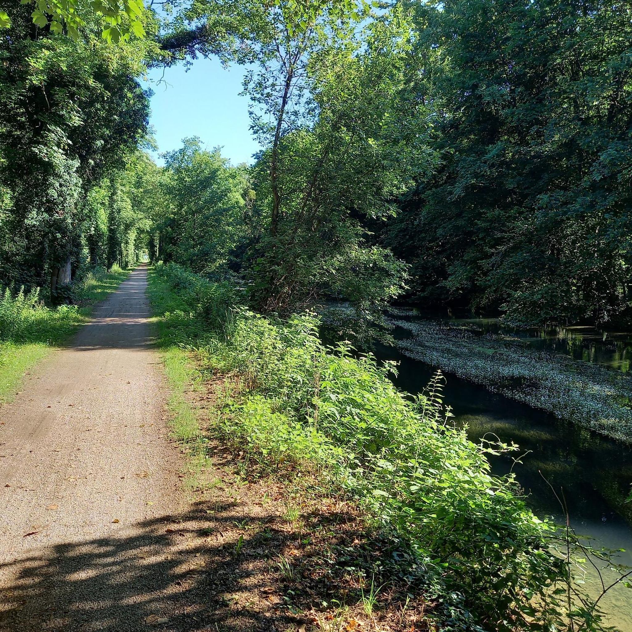
Just off the Springwater Corridor Trail, this area of lowland is, as its name suggests, a floodplain. The area includes woodland and bushy marshland. It is popular with wildlife, notably with birds and insects.
0
0
Frequently Asked Questions
What types of road cycling routes can I find in Beggars-Tick Wildlife Refuge?
Beggars-Tick Wildlife Refuge offers a diverse network of road cycling routes, primarily through urban and suburban landscapes within Multnomah County. You'll find a mix of paved roads, green spaces, and riverfront paths, often with views of the Willamette River. The terrain generally features gentle elevation changes, making it accessible for various skill levels.
Are there easy road cycling routes suitable for beginners or families?
Yes, Beggars-Tick Wildlife Refuge has numerous easy routes perfect for beginners or family outings. For example, the West Lents Floodplain – Gateway Green loop from Southeast Flavel Street is an easy 26.4 km (16.4 miles) path that takes approximately 1 hour 21 minutes to complete, offering a pleasant ride through green spaces.
How many road cycling routes are available in Beggars-Tick Wildlife Refuge?
There are over 120 road cycling routes available in Beggars-Tick Wildlife Refuge, catering to various preferences and skill levels. This includes approximately 48 easy routes, 69 moderate routes, and 11 more challenging options.
What are the typical lengths and durations of road cycling routes in the refuge?
Route lengths and durations vary widely. You can find shorter, easy rides like the West Lents Floodplain – Gateway Green loop at 26.4 km (16.4 miles) taking about 1 hour 21 minutes. Longer, moderate routes, such as the Happy Valley Loop, span around 66.5 km (41.3 miles) and can take approximately 2 hours 35 minutes.
Are there any challenging or advanced road cycling routes in Beggars-Tick Wildlife Refuge?
While many routes feature gentle elevation changes, there are more challenging options available. The refuge offers 11 routes classified as difficult, providing more significant climbs and longer distances for experienced road cyclists seeking a greater challenge.
What do other road cyclists say about the routes in Beggars-Tick Wildlife Refuge?
The road cycling routes in Beggars-Tick Wildlife Refuge are highly rated by the komoot community, with an average score of 4.6 stars from over 60 reviews. Cyclists often praise the varied terrain, scenic river views, and the accessibility of routes connecting different neighborhoods.
Are there circular road cycling routes available?
Yes, many of the road cycling routes in Beggars-Tick Wildlife Refuge are designed as loops, allowing you to start and end at the same point. Examples include the Old 82nd Drive Bridge loop from Southeast Flavel Street and the Happy Valley Loop, providing convenient round trips.
What is the best time of year for road biking in Beggars-Tick Wildlife Refuge?
The mild climate of the Pacific Northwest generally makes road cycling enjoyable for much of the year. Spring and fall offer pleasant temperatures and vibrant scenery. Summer is also excellent, though some routes might be more exposed to sun. Winter cycling is possible, but be prepared for cooler temperatures and potential rain.
Are there any specific routes that offer scenic river views?
Absolutely. Routes that incorporate the Willamette River are known for their scenic views. The Willamette River view – Tilikum Crossing loop from Southeast Holgate Boulevard is a prime example, offering beautiful vistas of the river and crossing the iconic Tilikum Bridge.
Can I access road cycling routes in Beggars-Tick Wildlife Refuge using public transport?
Given the urban and suburban nature of many routes within Multnomah County, public transport access is generally good. Many starting points for routes are located near public transit hubs, particularly in areas connecting to Portland's extensive bus and light rail system, making it convenient to reach the trails without a car.
Are there cafes or places to stop for refreshments along the road cycling routes?
Yes, as many routes traverse urban and suburban areas, you'll find numerous opportunities for cafes, restaurants, and convenience stores, especially in neighborhoods like Happy Valley or along the riverfront paths in Portland. It's advisable to check your specific route for amenities beforehand.
Where can I find parking for road cycling in Beggars-Tick Wildlife Refuge?
Parking availability varies by route starting point. Many urban and suburban areas offer street parking or public parking lots. For routes starting near parks or specific attractions, dedicated parking facilities are often available. It's recommended to check the specific komoot Tour page for parking suggestions related to your chosen route.
Most popular routes in Beggars-Tick Wildlife Refuge

Get inspired with the komoot mobile app


Explore more
Browse the best Road cycling routes in other regions.
