The best running trails in Brushy Peak Regional Park
141
runners
23
runs
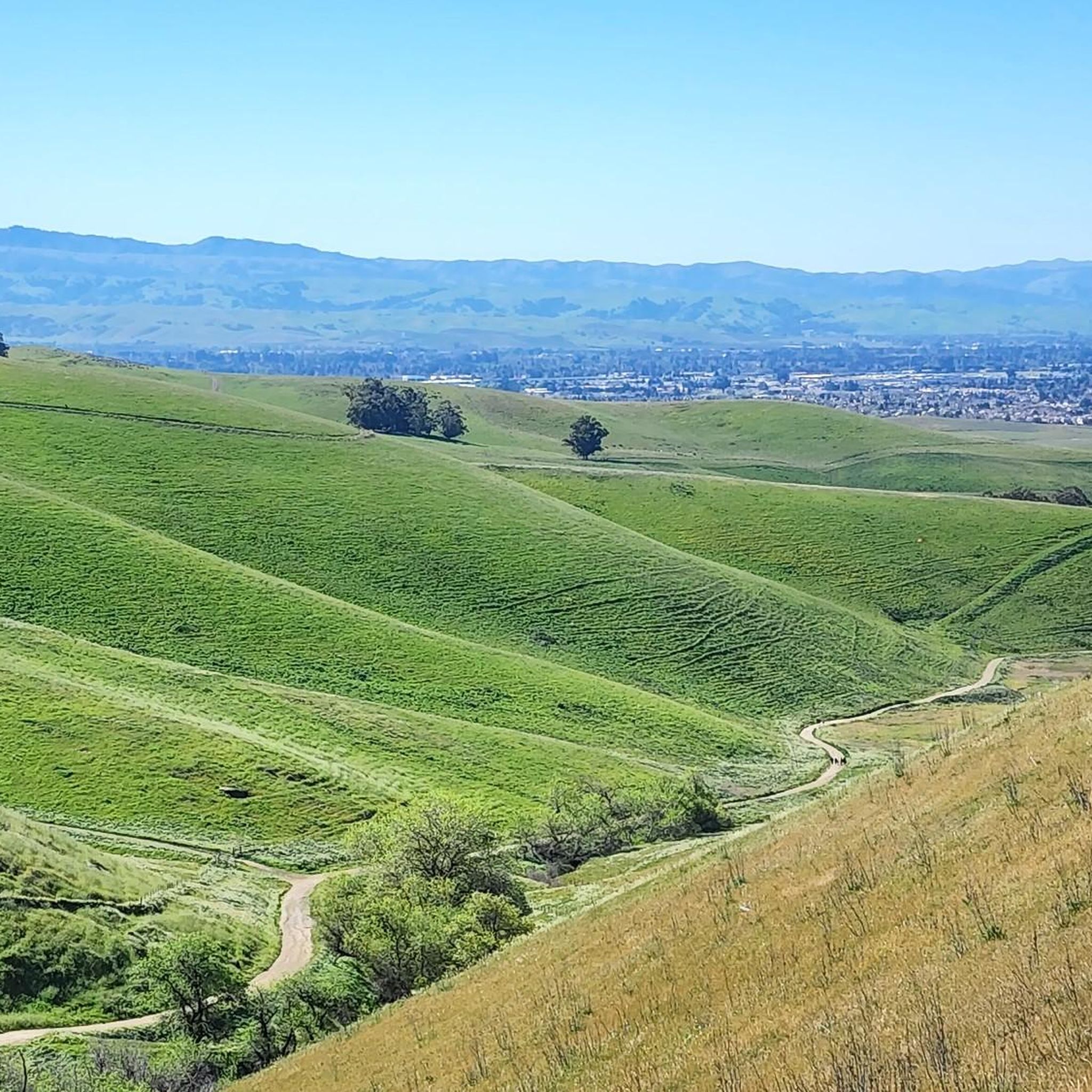
Jogging in Brushy Peak Regional Park offers routes through rolling hills and expansive views of the Livermore Valley. The landscape features pastureland, seasonal streams, and ponds, with distinctive oak groves on Brushy Peak itself. Trails provide a mix of flat sections, small hills, and steep inclines, catering to various running preferences. The park's diverse terrain includes exposed areas and sections with intermittent shade.
Best jogging routes in Brushy Peak Regional Park
- The most popular jogging route is Brushy Peak, Tamcan, and Laughlin Loop Trail, a 6.2 miles (9.9 km) trail that takes 1 hour 21 minutes to complete. This difficult route features significant elevation gain and panoramic views of the Livermore Valley.
- Another top favourite among local runners is Brushy Peak Loop Trail loop from Brushy Peak Regional Park, a difficult 4.5 miles (7.3 km) path. This trail winds around Brushy Peak, offering an elevation gain of 260 meters and intermittent shade from trees.
- Local runners also love the Running loop from Vasco Road, a 5.2 miles (8.4 km) trail leading through pastureland, often completed in about 52 minutes.
- Jogging in Brushy Peak Regional Park is defined by rolling hills, pastureland, and oak groves. The network offers options for different ability levels, from moderate paths to more challenging routes.
- The guide includes highly-rated routes that showcase the best of the region's landscape. More than 130 runners have used komoot to explore Brushy Peak Regional Park's varied terrain.
Last updated: July 7, 2026
6
runners
9.94km
01:21
320m
330m
Prepare for a challenging jogging experience on the Brushy Peak, Tamcan, and Laughlin Loop Trail. This difficult route covers 6.2 miles (9.9 km) and involves a significant climb of 1061 feet (323 metres), typically taking about 1 hour and 21 minutes to complete. As you jog, you'll navigate varied terrain, moving through rolling grasslands and up prominent hills with steep sections. From the higher points, you can enjoy expansive views stretching across the Livermore Valley and the Central Valley, often spotting windmills in the distance. Keep an eye out for grazing cattle and seasonal wildflowers along the way.
When planning your jogging trip, be aware that Brushy Peak Regional Park offers very limited shade along the trail. There is also no drinking water available on the route, so it is essential to bring enough water with you. Consider the sun exposure, especially if you plan to visit during warmer months, and start early to avoid the midday heat.
This route combines several trails within Brushy Peak Regional Park, providing a robust workout. The park itself is known for its prominent hills and open grasslands, offering a distinct natural environment. While jogging, you might encounter local wildlife and appreciate the seasonal changes in the landscape.
10
runners
7.34km
01:06
260m
260m
Hard run. Good fitness required. Sure-footedness, sturdy shoes and alpine experience required.

Sign up for free
6
runners
8.42km
00:53
20m
20m
This running loop near Vasco Road offers a distinctive East Bay jogging experience, winding through open grasslands dotted with iconic windmills. You'll enjoy expansive views over the Livermore Valley and the unique, almost minimalist landscape of the Diablo Range. The trail provides a refreshing change of scenery for your regular run, especially appealing when the hills are green.
Expect a moderate 5.2-mile (8.4 km) route with a gentle 81 feet (25 metres) of elevation gain, typically taking around 52 minutes to complete. While the main Vasco Road can be busy, this loop utilizes quieter surrounding trails. It's a great option for a quick, scenic workout, but remember to bring water as the area is exposed.
The Vasco Road area is known for its diverse wildlife, including golden eagles and bobcats, adding an element of nature observation to your run. The presence of numerous wind turbines creates a unique backdrop, making this one of the more visually interesting running routes near Vasco Road California. It's a notable spot for those seeking a moderate, engaging jog.
40
runners
19.8km
02:05
110m
110m
Hard run. Very good fitness required. Mostly paved surfaces. Suitable for all skill levels.
13
runners
12.2km
01:19
90m
90m
Moderate run. Good fitness required. Mostly paved surfaces. Suitable for all skill levels.
Get access to more routes and recommendations from other explorers.
Sign up for free
Already have an account?
Our route recommendations are based on thousands of hikes, rides, and runs completed by other people on komoot.
Start today with a free account
Your next adventure awaits.
Login or Signup
Popular around Brushy Peak Regional Park

Tips from the Community

There is a paved foot & bike path that runs straight through the park to Arroyo Road, though I am not sure if it actually has an exit onto the road. It continues further into Veterans Park. Of the gravel trails some are closed to bikes for nature preservation reasons. Others allow for a (mostly) easy gravel ride.
0
0

This multi-use trail runs through several neighborhoods in south Livermore sunning parallel to the Arroyo Mocho creek. There are paved and dirt sections to the trail and in this section crosses a bridge over Arroyo Mocho.
0
0

Livermore is California's oldest wine region and lies as the easternmost city in the San Francisco Bay Area. This city boasts a historic downtown with shopping, dining, and entertainment.
0
0

An 847 acre open space park with many native animals that can be spotted from the hiking trails, such as deer, turkey, rabbits, gopher snakes, occasional coyotes, and plenty of bird life. There are many hiking and biking trails in the park, that can be combined to make loops and to access viewpoints. The Sycamore Grove charges a parking fee of $5. For more information, please visit larpd.org/sycamore-grove-park.
0
0
The Tamcan Trail runs through pastureland and windmills. It can be combined with Laughlin and Brushy Peak Loop Trail to create a loop of the preserved area. The Brushy Peak Regional Preserve is a 1979 acre preserve with a large variety of native and non-native plants, including wildflowers blooming along the trails depending on the season. You can see many cows in the area, and if you’re lucky can also see ground squirrels, amphibians, reptiles, badgers, burrowing owls, and the San Joaquin kit fox. Dogs are allowed, but only on a leash.
0
0
The Brushy Peak Loop Trail passes to the north area of the preserved area, forming a loop with the West Side Loop Trail. The trail winds around the side of Brushy Peak with a 300 ft elevation gain, meandering in between trees which offer some shade. From the trail you can see the peak fully covered by trees, contrasting with the grassy hills around.
0
0
Laughlin Loop Trail is a short trail of no more than 2 miles, and runs through the south area of Brushy Peak Regional Preserve. The trail is a well-marked and easy walk going up small hills, with not much shade or elevation gain. It crosses a small stream before meeting Tamcan Trail, which makes this section a little muddy. The park has no drinking water available, so be sure to bring your own water.
0
0

The Olivina Gate is a point of local historical interest and was constructed as a tribute to the late Mr Julius Paul Smith who ran the Olivina winery. The gate marks the entrance to the old winery, and a tree-lined driveway leads to the old ruins. This winery was at one point the region's largest wine producer. As well as grapes, Olivina also grew olives and walnuts.
2
0
Frequently Asked Questions
How many running routes are available in Brushy Peak Regional Park?
Brushy Peak Regional Park offers a diverse selection of over 20 running routes, catering to various fitness levels and preferences. You'll find everything from moderate paths to more challenging trails with significant elevation changes.
What are the best times of year for jogging in Brushy Peak Regional Park?
The most enjoyable seasons for jogging in Brushy Peak Regional Park are spring, fall, and winter. Summer can be very hot due to exposed areas, so it's advisable to plan your runs during cooler parts of the day and carry plenty of water.
Are there any easy or beginner-friendly running routes in Brushy Peak Regional Park?
Yes, while many routes are moderate to difficult, there are options suitable for beginners. The park features trails with minimal elevation gain, such as sections of the Laughlin Loop Trail, which is well-marked and offers smaller hills, making it ideal for an easier jog.
Can I bring my dog on the running trails in Brushy Peak Regional Park?
Yes, Brushy Peak Regional Park is dog-friendly. Dogs are welcome on the trails, but for the safety and enjoyment of all park visitors and wildlife, they must be kept on a leash at all times.
What kind of terrain and trail conditions can I expect while running here?
The trails in Brushy Peak Regional Park primarily feature dirt surfaces. You'll encounter a mix of flat sections, rolling hills, and steep inclines. While some areas offer intermittent shade, many parts of the park are exposed, providing expansive views but also requiring sun protection and hydration.
Are there any circular running routes in the park?
Yes, many of the routes in Brushy Peak Regional Park are designed as loops, allowing you to start and finish at the same point. For example, the Olivina Gate loop from Livermore offers a moderate 7.6-mile circular path through the landscape.
What natural features or landmarks can I see along the running routes?
As you run, you'll experience rolling hills, pastureland, and seasonal streams. A distinctive feature is the oak grove capping Brushy Peak itself. You might also spot the numerous windmills of the Altamont Pass wind farm on nearby ridgetops. The historic Olivina Gate, marking the entrance to an old winery, is another point of interest you can encounter on longer routes.
Are there any running routes that offer panoramic views?
Absolutely. Many trails in Brushy Peak Regional Park provide stunning panoramic views of the Livermore Valley and beyond. The park's rolling hills ensure that you'll frequently be treated to expansive vistas, especially from higher points like those found on the Brushy Peak Loop Trail.
Is there parking available at Brushy Peak Regional Park?
Yes, parking is available at Brushy Peak Regional Park. It's recommended to check the park's official website for specific parking lot locations and any potential fees or restrictions before your visit.
What should I bring with me for a run in Brushy Peak Regional Park?
Given the exposed nature of many trails and the lack of drinking water facilities, it's crucial to bring plenty of water, especially during warmer months. Sunscreen, a hat, and appropriate running attire are also recommended. For dog owners, remember to bring a leash and waste bags.
Are there any less crowded running options in the park?
While popular routes can see more visitors, exploring some of the longer or slightly more challenging trails, such as the Olivina Gate – Sycamore Grove Park loop from Livermore, might offer a more secluded running experience, especially during off-peak hours or weekdays.
What is the elevation gain like on the running trails?
The elevation gain varies significantly across the park's trails. You can find routes with minimal changes, like the Running loop from Vasco Road which has only about 25 meters of elevation gain. However, more challenging routes can feature over 300 meters of ascent, providing a good workout and rewarding views.
Most popular routes in Brushy Peak Regional Park
Most popular attractions in Brushy Peak Regional Park

Get inspired with the komoot mobile app


Explore more
Browse the best Running Trails & Routes in other regions.
