The best walks and hikes in Bishop Ranch Regional Open Space Preserve
4.7
(37)
508
hikers
53
hikes
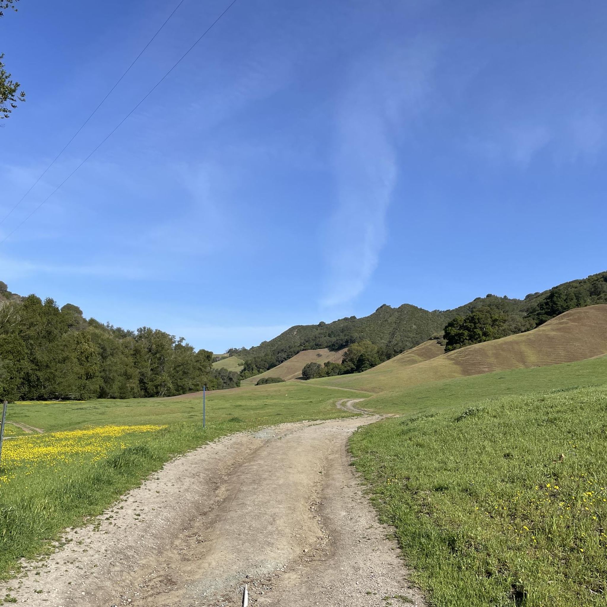
Hiking in Bishop Ranch Regional Open Space Preserve offers diverse outdoor experiences on a ridgetop at the edge of San Ramon, California. The preserve features attractive blue oak groves, rolling treeless hills, and scenic hilltop views of the surrounding oak-wooded hills and the San Ramon Valley. Hikers can experience grasslands that are particularly vibrant with wildflowers in spring, along with seasonal creeks and glimpses of Mount Diablo. The terrain includes steep and rough sections, typical for the East Bay, but…
Last updated: August 26, 2026
4.5
(2)
19
hikers
3.67km
01:12
170m
170m
Easy hike. Great for any fitness level. Easily-accessible paths. Suitable for all skill levels.
15.8km
04:00
10m
80m
The Iron Horse Regional Trail: San Ramon to Alamo offers a delightful and accessible hiking experience, perfect for a relaxed day out. This 9.8-mile (15.8 km) route, rated moderate, features…

Sign up for free
4
hikers
1.29km
00:20
0m
0m
The Osage Station Park Path offers a delightful and easy 0.8-mile (1.3 km) paved loop, perfect for a quick, relaxing walk. With only 9 feet (3 metres) of elevation gain,…
3.34km
00:56
100m
10m
Hike the easy 2.1-mile Dougherty Valley Ridge Trail for expansive views of Mount Diablo and the Dougherty Valley in San Ramon.
1.31km
00:24
60m
0m
Hike the easy 0.8-mile Donlan Point via Calaveras Ridge Regional Trail for panoramic views across Dublin Canyon and Livermore Valley.
Get access to more routes and recommendations from other explorers.
Sign up for free
Already have an account?
Our route recommendations are based on thousands of hikes, rides, and runs completed by other people on komoot.
Start today with a free account
Your next adventure awaits.
Login or Signup



Tips from the Community

What is Bishop Ranch Regional Open Space? This natural area covers approximately 806 acres and offers a peaceful escape from the hustle and bustle of the city. It's located near residential areas in San Ramon and is part of the East Bay Regional Park District. There are several hiking trails, including a popular 5-mile loop trail with an average hiking time of about 2 hours and 45 minutes.
1
0
What is the Iron Horse Trail? The Iron Horse Regional Trail is a more than 25-mile route that runs from Pleasanton to Concord, following the old Southern Pacific Railroad line. In San Ramon, the trail covers approximately 2.6 miles. The trail offers views of the valleys and hills of Mount Diablo and winds through residential neighborhoods, parks, and commercial areas.
1
0

The Museum of the San Ramon Valley was established in 1985 and sits in a restored 1891 Southern Pacific Railroad Depot with the Victorian-era “Combination Station No. 22” listed on the National Register of Historic Places. The Official Visitor Information Center offers maps, guides, and knowledgeable staff, along with free parking and restrooms located in the caboose.
1
0

Bishop Ranch Regional Open Space Preserve encompasses 806 acres of grasslands, forests, and meadows in San Ramon, California. The trails on the property offer a natural wilderness experience without having to drive far outside the city.
0
0

This museum collects, stores, and preserves artifacts from the San Ramon Valley while providing a permanent exhibit of the valley's past. Additionally, the museum offers local maps, guides, and a public restroom.
0
0
Bishop Ranch Regional Open Space Preserve encompasses 806 acres of grasslands, forests, and meadows in San Ramon, California. The trails on the property offer a natural wilderness experience without having to drive far outside the city.
0
0
Donlan Point is the main overlook in Dublin Hills Regional Park. This viewpoint features a bench and unobstructed views towards Pleasanton Ridge Regional Park.
0
0

The regional Trail passes Danville, with water fountains and rest options along the excellent partly shaded trail on a former rail line.
0
0
Frequently Asked Questions
How many hiking trails are available in Bishop Ranch Regional Open Space Preserve?
There are over 30 hiking routes in Bishop Ranch Regional Open Space Preserve, offering a variety of experiences from easy loops to more challenging ascents. These trails are highly rated by the komoot community, with an average score of 4.8 stars.
What do other hikers appreciate most about Bishop Ranch Regional Open Space Preserve?
Hikers frequently praise the preserve for its attractive blue oak groves, rolling grasslands, and the scenic hilltop views of the surrounding oak-wooded hills and the San Ramon Valley. Many enjoy the surprising amount of scenery that can block out signs of civilization, offering a sense of quiet and solitude.
When is the best time of year to hike in Bishop Ranch Regional Open Space Preserve?
The preserve is particularly vibrant in spring, when the grasslands burst with a variety of wildflowers such as owl's clover, poppies, and lupines. Clear days also offer excellent views of Mount Diablo. While pleasant year-round, spring offers a unique visual spectacle.
Are there any family-friendly hiking options in Bishop Ranch Regional Open Space Preserve?
Yes, there are several easier routes suitable for families. For instance, the Hiking loop from San Ramon is an easy 2.3-mile trail that takes about an hour to complete, offering pleasant views without significant difficulty.
Are dogs allowed on the trails in Bishop Ranch Regional Open Space Preserve?
Yes, dogs are welcome in Bishop Ranch Regional Open Space Preserve. They are allowed on leash in designated areas and under verbal control elsewhere, making it a popular spot for dog walks.
What kind of terrain can I expect on the hiking trails?
The preserve features diverse terrain, including sharp climbs through valley oaks and grassland, as well as open ridges. While some sections can be steep and rough, typical for the East Bay, the trails are generally well-maintained. You'll encounter attractive blue oak groves, rolling treeless hills, and seasonal creeks.
Are there any loop trails for hikers who prefer not to retrace their steps?
Yes, many trails in Bishop Ranch Regional Open Space Preserve can be combined to form loop configurations. For example, the Donlan Point Viewpoint loop from Dublin Hills Regional Park is a 4.2-mile trail that leads through open hillsides to a scenic viewpoint, offering a complete loop experience.
What kind of wildlife might I see while hiking?
Hikers often spot deer, red-tailed hawks, and turkey vultures. The preserve also features diverse plant life that changes with the seasons, and you might encounter cattle in some grazing areas.
Are there any notable viewpoints or scenic spots in the preserve?
Absolutely. The preserve is known for its scenic hilltop views of the surrounding oak-wooded hills and the San Ramon Valley. On clear days, trails like the Grey Fox Trail offer glimpses of Mount Diablo. The Donlan Point Viewpoint also provides expansive vistas.
Is there parking available at Bishop Ranch Regional Open Space Preserve trailheads?
Yes, parking is available at various trailheads around the preserve, providing convenient access for hikers. Specific parking details can often be found on individual route pages or park district maps.
Can I reach Bishop Ranch Regional Open Space Preserve using public transport?
While the preserve is located at the edge of San Ramon, public transport options directly to the trailheads may be limited. It's advisable to check local transit schedules for the San Ramon area and plan for potential connections or a short ride-share to reach specific access points.
Are there any longer, more challenging hikes for experienced trekkers?
Yes, for those seeking a greater challenge, routes like the Las Trampas/Calaveras Ridge and Madrone Trails loop offer a difficult 14.9-mile hike with significant elevation gain, providing a strenuous and rewarding experience.
What are some of the key natural features of the preserve?
Beyond its attractive blue oak groves and seasonal wildflowers, the preserve features rolling, treeless hills, seasonal creeks often lined with willow, and diverse plant life. The landscape also includes grasslands that were historically used for cattle grazing.
Most popular routes in Bishop Ranch Regional Open Space Preserve

Get inspired with the komoot mobile app


Explore more
Browse the best Hikes in other regions.
