The best walks and hikes in Lafayette Reservoir Recreation Area
4.7
(258)
4,418
hikers
12
hikes
Hiking in Lafayette Reservoir Recreation Area offers diverse trails nestled within the East Bay hills, centered around the Lafayette Reservoir. The terrain features serene lakeside paths, open grasslands, and areas of oak woodlands, providing a mix of environments for outdoor activities. Trails range from gentle, paved loops along the water's edge to more challenging unpaved routes with significant elevation changes. The area provides panoramic views of the reservoir, surrounding foothills, and distant landmarks.
Best hiking trails in Lafayette Reservoir Recreation Area
- The most popular hiking route is Lafayette Reservoir loop — Lafayette Reservoir Recreation Area, a 3.0 miles (4.9 km) trail that takes 1 hour 17 minutes to complete. This easy, paved loop offers pleasant views along the reservoir's edge.
- Another top favourite among local hikers is Rim Trail loop — Lafayette Reservoir Recreation Area, a moderate 5.0 miles (8.0 km) path. This unpaved fire road presents a more challenging hike with significant elevation changes and commanding views of the reservoir and surrounding hills.
- Local hikers also love the Lafayette Reservoir & Rim Trail loop — Lafayette Reservoir Recreation Area, a 4.4 miles (7.1 km) trail leading through varied terrain including lakeside paths and elevated ridges, often completed in about 2 hours 2 minutes.
- Hiking in Lafayette Reservoir Recreation Area is defined by picturesque water views, open grasslands, and oak woodlands. The network offers options for different ability levels, from easy strolls to more strenuous climbs.
- The routes in Lafayette Reservoir Recreation Area are highly rated by the komoot community with an average score of 4.7 stars from over 200 reviews. More than 3,600 hikers have used komoot to explore Lafayette Reservoir Recreation Area's varied terrain.
Last updated: August 30, 2026
7
hikers
4.08km
01:11
110m
100m
The Lafayette Reservoir Rim, Big Oak, and Lakeside Nature Trail Loop offers a delightful blend of paved and unpaved paths, guiding you through serene lakeside scenery and up to elevated viewpoints. You'll trace the edge of the Lafayette Reservoir, enjoying continuous water views, before ascending through oak woodlands on the Big Oak Trail. From higher ground, the route provides expansive panoramic vistas of the reservoir and the distant Mount Diablo, making for a varied and engaging experience.
This easy 2.5-mile (4.1 km) hike, with its gentle 347 feet (106 metres) of elevation gain, is perfect for a quick outing, typically taking around 1 hour and 10 minutes. The Lafayette Reservoir Recreation Area is easily accessible, and the Lakeside Nature Trail sections are particularly family-friendly and stroller-friendly, with amenities like restrooms and picnic areas. While popular, it's a great option for a relaxed stroll or a light jog, especially on a clear day.
What makes this loop stand out is its versatility; it combines elements of the reservoir's distinct trail systems, allowing you to experience both the tranquil waterside and the higher ridges without committing to the more strenuous full Rim Trail. It's a fantastic way to enjoy the natural beauty of Contra Costa County, offering consistent scenic views and a refreshing escape that feels much further from the city than it actually is.
4.0
(1)
4
hikers
6.70km
01:52
120m
120m
The Rim Trail and Lakeside Nature Loop offers a delightful escape into nature, tracing the serene shores of Lafayette Reservoir. You'll enjoy continuous, picturesque views of the water and surrounding hills, with the path underfoot being generally gentle and accessible. This easy route is a fantastic option for a leisurely walk, providing a refreshing experience without demanding strenuous effort.
This 4.2-mile (6.7 km) hike with a modest 408 feet (124 metres) of elevation gain typically takes around 1 hour and 51 minutes to complete. Parking is conveniently located at the Lafayette Reservoir Visitor Center, making access simple. The trail is enjoyable throughout the year, but consider visiting in spring for wildflowers or fall for vibrant foliage.
Lafayette Reservoir is a unique natural feature in Contra Costa County, offering more than just hiking. You can also enjoy fishing, picnicking, or even pedal boating on the reservoir itself. This makes the Rim Trail and Lakeside Nature Loop a versatile destination for a full day out with family or friends.

Sign up for free
2.88km
00:52
100m
70m
The Rim Trail to Lafayette Viewpoint offers a surprisingly vigorous hike for its length, delivering continuous elevation changes and sweeping vistas. You'll traverse a wide dirt road that rolls over hills, providing a challenging workout with views of the Lafayette Reservoir, Briones Hills, and Mount Diablo. Look for the "Reservoir View - Rim-Trail summit" for a particularly rewarding panorama, making this a great choice for those who enjoy a quick, intense climb.
This 1.8-mile (2.9 km) hiking route, despite its easy rating, features 344 feet (105 metres) of elevation gain, taking about 52 minutes to complete. It's easily accessed from the main Lafayette Reservoir parking lot. Be mindful that dry summer conditions can make parts dusty and sandy, while winter can lead to slippery sections, so choose your footwear wisely. Sun protection is a must on sunny days, as much of the trail is exposed.
What makes this trail stand out is its ability to provide a significant workout and humbling experience in a short timeframe, contrasting with the flatter Lakeside Nature Trail. At its highest point, you'll find a bench and a marker from 1954, indicating a County map triangulation site. This trail is a popular local option for a quick, challenging hike with rewarding views, perfect for fitting into a busy schedule.
4.5
(6)
282
hikers
4.85km
01:17
40m
40m
The Lakeside Nature Trail is a fantastic choice for a relaxed outing, offering continuous, peaceful views of the Lafayette Reservoir. This easy hiking route is primarily paved and incredibly well-maintained, making it ideal for families, strollers, and anyone seeking a gentle stroll. You'll cover 3.0 miles (4.9 km) with a modest 135 feet (41 metres) of elevation gain, typically finishing in about 1 hour and 16 minutes.
When planning your visit, note that there's a parking fee at the park entrance, but the amenities are excellent, with restrooms and picnic areas conveniently spaced along the trail. The wide path accommodates many users comfortably, and while swimming isn't allowed, you can rent boats to enjoy the water. It's a popular location, so consider visiting during off-peak hours for a quieter experience.
What makes this trail stand out is its exceptional accessibility and community focus; it's a truly family-friendly hike. Beyond the main loop, you can also find 'spoke' trails that connect to the more challenging Rim Trail if you're looking to extend your workout. The presence of a playground and boat rentals near the reservoir adds to its appeal as a versatile recreational spot.
4.8
(4)
90
hikers
8.00km
02:18
200m
200m
Hike the moderate 5.0-mile Lafayette Reservoir Rim Trail Loop, gaining 653 feet with panoramic views of the reservoir and Mount Diablo.
Get access to more routes and recommendations from other explorers.
Sign up for free
Already have an account?
Our route recommendations are based on thousands of hikes, rides, and runs completed by other people on komoot.
Start today with a free account
Your next adventure awaits.
Login or Signup
Popular around Lafayette Reservoir Recreation Area

Tips from the Community

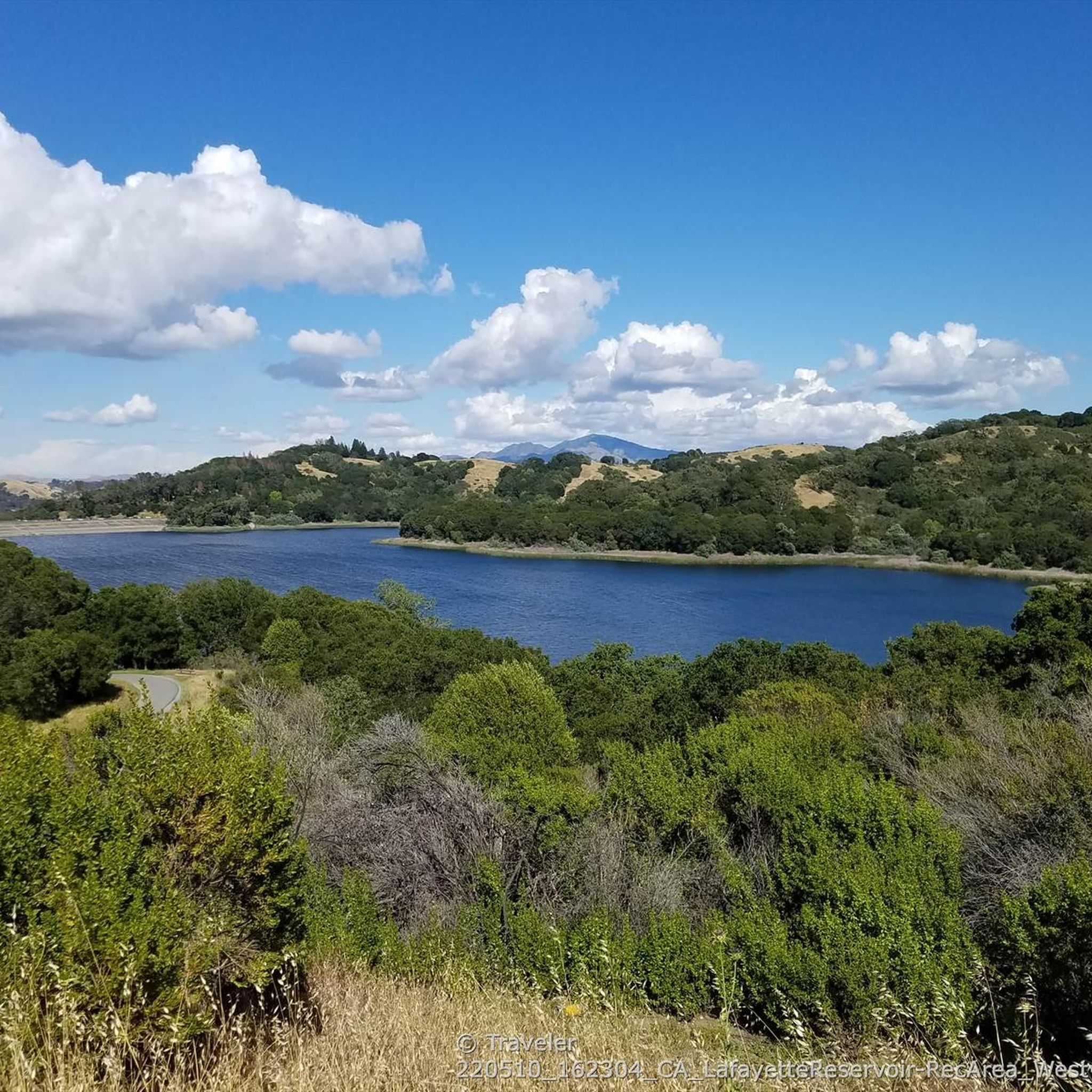
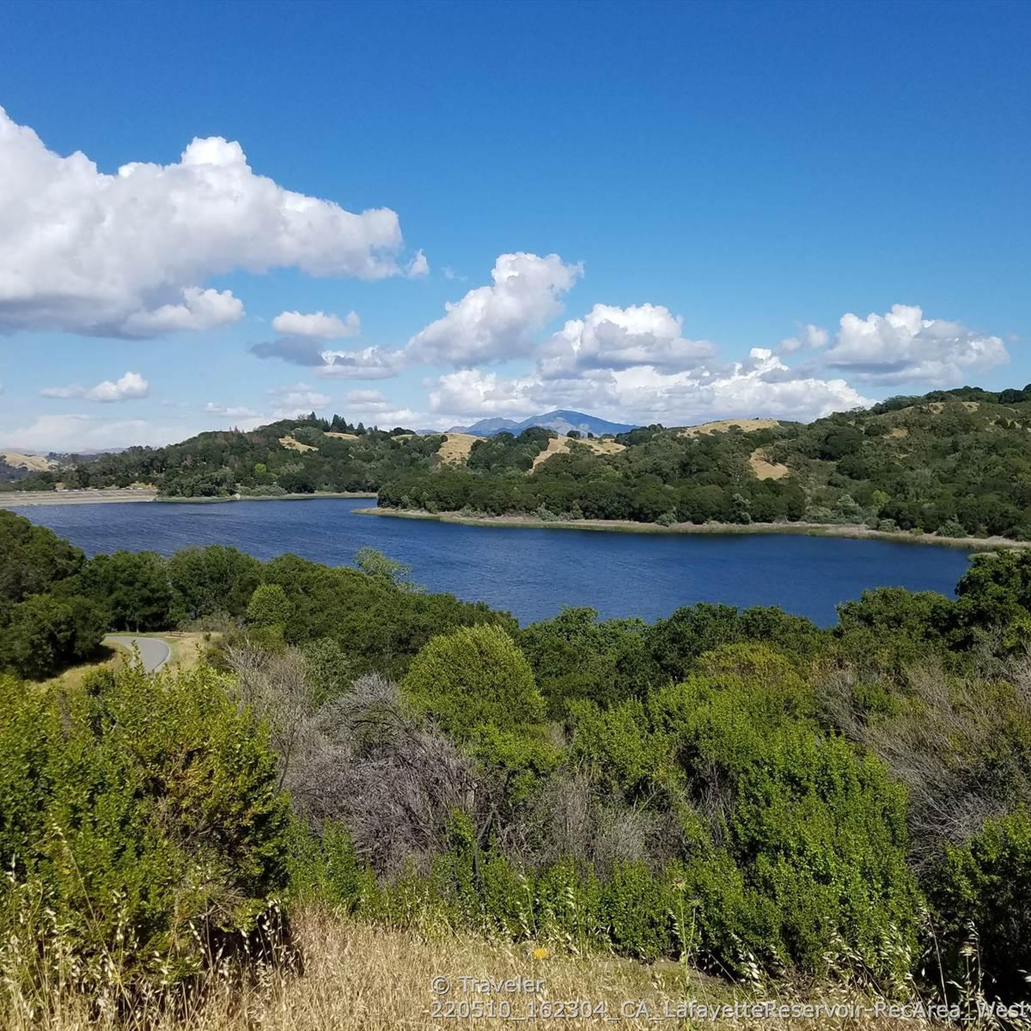
From this point, you can enjoy an almost unobstructed view of the entire Lafayette Reservoir, with the city visible in the background.
1
0
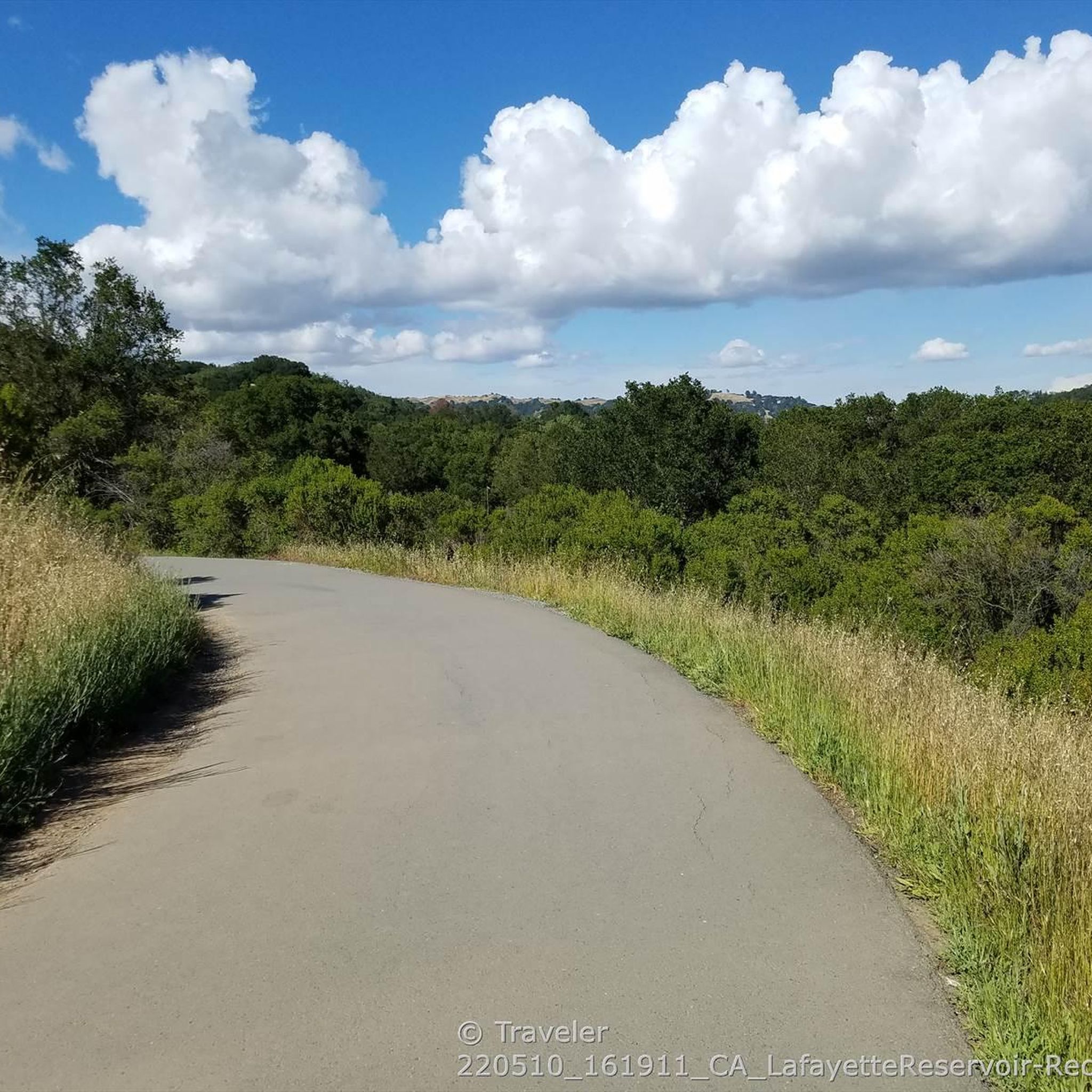
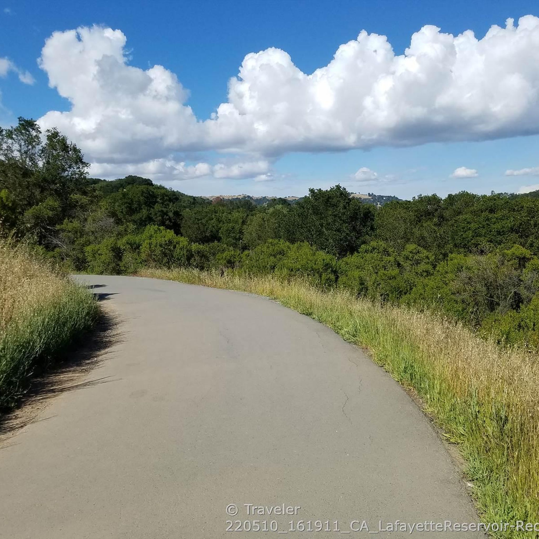
Throughout the hike, you'll encounter amazing views of the Lafayette Reservoir and the city. The trail features plenty of up and down hills, providing a nice challenge. Since most of the trail is uncovered, it offers unobstructed views, but be sure to bring a hat and sunscreen on a hot day to stay protected.
0
0
Here you can relish the beauty of the water while hiking, or take a break to partake in various other activities the reservoir has to offer. These include fishing, picnicking, and even the option to rent a pedal boat, providing a different perspective of the area.
0
0

Dam that creates the large reservoir. The paved along the top of the dam is a good connection between the trails on either side of the lake
0
0
Good information on trails, fishing, boat rental, restrooms, drinking water fountains
0
0
After weaving around the natural contours of the manmade reservoir, the Nature Trail crosses the crest of the dam on the north side of the lake.
0
0
Along the upper part of the Rim Trail the views open up down and across the Lafayette Reservoir lake to the East.
0
0

Frequently Asked Questions
How many hiking trails are available in Lafayette Reservoir Recreation Area?
The Lafayette Reservoir Recreation Area offers a wide variety of hiking experiences, with over 195 routes available for exploration. These range from easy strolls to more challenging climbs, catering to different fitness levels.
What kind of terrain can I expect on the trails in Lafayette Reservoir Recreation Area?
You can expect diverse terrain, including serene lakeside paths, open grasslands, and areas with oak woodlands. The trails traverse a mix of landscapes, from paved, gentle loops along the water's edge to unpaved fire roads with significant elevation changes.
What are the difficulty levels of hikes in Lafayette Reservoir Recreation Area?
The trails in Lafayette Reservoir Recreation Area offer a range of difficulty levels. There are 105 easy routes, perfect for a leisurely walk, 84 moderate paths for those seeking a bit more challenge, and 6 difficult trails for experienced hikers looking for a strenuous workout.
What do other hikers enjoy most about the trails here?
The trails in Lafayette Reservoir Recreation Area are highly rated by the komoot community, with an average score of 4.7 stars from over 200 reviews. Hikers often praise the picturesque water views, the varied terrain, and the well-maintained paths that offer options for all ability levels.
Are there family-friendly hiking options at Lafayette Reservoir?
Yes, the area is very family-friendly. The Lafayette Reservoir loop is a paved, easy 3.0-mile trail that is perfect for families with strollers or those seeking a gentle walk. There are also numerous picnic areas with tables and BBQ grills for a day out.
Are dogs allowed on the trails in Lafayette Reservoir Recreation Area?
Yes, dogs are generally welcome on the trails, but they must be kept on a leash. The paved Lakeside Nature Trail is a popular choice for dog owners due to its easy terrain.
What kind of views or natural features can I expect to see while hiking?
You can expect stunning panoramic views, especially from the higher points of the Rim Trail, which offer vistas of the entire Lafayette Reservoir, surrounding hills, the city, and even Mount Diablo in the distance. The trails also feature varied vegetation, including black and valley oaks, coast live oaks, eucalyptus, and pines.
Are there any accessible trails for strollers or wheelchairs?
Yes, the Lafayette Reservoir Lakeside Nature Trail is a paved, 2.7-mile loop that is ideal for strollers and wheelchairs, offering an easy and gentle experience along the reservoir's edge.
Is there parking available at Lafayette Reservoir Recreation Area?
Yes, there is ample parking available at the Lafayette Reservoir Recreation Area. It is a year-round day-use park, and parking information is typically well-marked upon arrival.
How can I get to Lafayette Reservoir Recreation Area using public transport?
The Lafayette Reservoir Recreation Area is conveniently located and easily accessible by public transport. It is just one mile from the Lafayette BART station, making it a great option for those traveling without a car.
What is the best time of year to hike in Lafayette Reservoir Recreation Area?
The Lafayette Reservoir Recreation Area is a year-round destination. Spring and fall offer pleasant temperatures and lush scenery, while summer can be warm but still enjoyable, especially in the mornings or evenings. Winter hikes are also possible, often with cooler, crisp air.
Are there any longer, more challenging loop trails for experienced hikers?
For a more challenging experience, consider the Rim Trail loop. This unpaved, 5.0-mile fire road features significant elevation changes and provides a good workout with rewarding panoramic views.
What should I be aware of regarding wildlife or natural elements?
While hiking, be aware of natural elements such as poison oak, which can be present along some trails. Although rare, there is a possibility of encountering mountain lions, especially during dawn and dusk hours. It's always wise to stay on marked trails and be observant of your surroundings.
Most popular routes in Lafayette Reservoir Recreation Area
Most popular attractions in Lafayette Reservoir Recreation Area

Get inspired with the komoot mobile app


Explore more
Browse the best Hikes in other regions.
