The best walks and hikes in Ing'S Mine Provincial Recreation Area
4.8
(28)
745
hikers
11
hikes
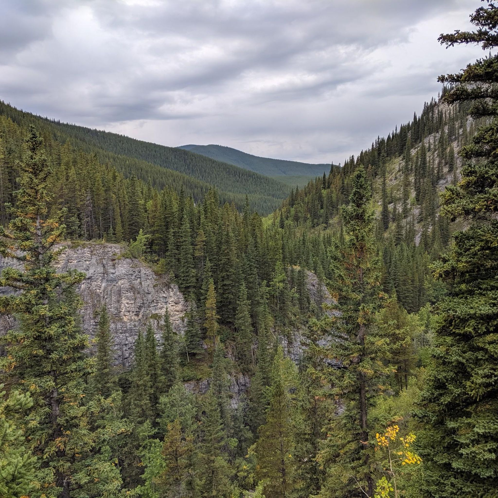
Hiking in Ing'S Mine Provincial Recreation Area, situated within Kananaskis Country, provides access to the Rocky Mountain - Alpine and Sub-alpine natural region. The terrain is characterized by rugged landscapes, including the northern base of Prairie Mountain and the southeastern flank of Moose Mountain. Hikers can expect varied ground underfoot, from gravel service roads to scree slopes and areas with loose boulders. The region features limestone formations and challenging ascents.
Best hiking trails in Ing'S Mine Provincial Recreation Area
- The…
Last updated: June 26, 2026
4.3
(4)
58
hikers
Moderate hike. Good fitness required. Easily-accessible paths. Suitable for all skill levels.
5.0
(2)
243
hikers
8.15km
03:21
680m
680m
Moderate hike. Good fitness required. Easily-accessible paths. Suitable for all skill levels.

Sign up for free
65
hikers
Moderate hike. Good fitness required. Easily-accessible paths. Suitable for all skill levels.
4.9
(7)
49
hikers
Moderate hike. Good fitness required. Easily-accessible paths. Suitable for all skill levels.
21
hikers
14.7km
04:31
530m
530m
Moderate hike. Good fitness required. Easily-accessible paths. Suitable for all skill levels.
Get access to more routes and recommendations from other explorers.
Sign up for free
Already have an account?
Our route recommendations are based on thousands of hikes, rides, and runs completed by other people on komoot.
Start today with a free account
Your next adventure awaits.
Login or Signup
Popular around Ing'S Mine Provincial Recreation Area

Tips from the Community

This Raven flew in as soon as I opened my lunch container. It walked around my position, making various sounds, going for a treat. I had to say no several times but it eventually got the hint and flew off!
0
0

The path climbs quite steeply. Beautiful meadow landscapes along the way. Deer sighting!
0
0
The view, flowers and air are amazing! The hike (at the beginning of May) included snow, ice, and mud but the trail, for the most part, was in good condition and easy to follow. Our "view score" included 4 red squirrels, 2 mule deer, a woodpecker, and an owl (smaller but similar colouring to a snowy owl). We only met 8 people on the trail.
0
0

Beautiful and very varied nature and views.
0
0

Views are somewhat limited by the fire ranger house at the summit (locked private property). Currently the family rest area is below Fire Ranger House closed, duration unknown. Very nice out and far views already on the way there. The first part of the route is still shaded by trees. The rest (above tree line) very sunny. No way to fill up with water!
0
0

Trail linking Powderface Creek and Prairie Creek trails.
0
0
Wide mutil-use trail heading out from the powderface trailhead.
0
0
Frequently Asked Questions
What kind of terrain can I expect on hikes in Ing's Mine Provincial Recreation Area?
Hikes in Ing's Mine Provincial Recreation Area, part of the Rocky Mountain - Alpine and Sub-alpine natural region, feature rugged and varied terrain. You'll encounter everything from gravel service roads to challenging scree slopes and areas with loose boulders. The region is also known for its distinctive limestone formations and often includes significant ascents.
Are there any unique natural attractions to see in Ing's Mine Provincial Recreation Area?
Yes, a primary natural attraction is the unofficial route leading to the **Canyon Creek Ice Cave**, also known as the Moose Mountain Ice Cave. These remarkable caves are formed by water eroding limestone and can be explored, though they require a strong light source as they are pitch black inside and may contain ice year-round. Some sections may even require crawling.
Are the hiking trails in Ing's Mine Provincial Recreation Area dog-friendly?
Yes, the popular unofficial route to the Canyon Creek Ice Cave is known to be dog-friendly. However, always ensure your dog is on a leash and that you pack out all waste to preserve the natural environment.
Do I need a permit or pass to hike in Ing's Mine Provincial Recreation Area?
Yes, for all visitors arriving by vehicle, a Kananaskis Conservation Pass is required to access Ing's Mine Provincial Recreation Area.
Are there many circular hiking routes available in the area?
Yes, several popular routes in Ing's Mine Provincial Recreation Area are circular. For example, you can explore the Moose Mountain Northeast – Buggeration Hill loop or the Prairie Mountain loop, both offering varied mountain experiences.
What safety precautions should I take when exploring the Canyon Creek Ice Cave?
When exploring the Canyon Creek Ice Cave, it's crucial to bring a strong light source as the interior is pitch black. Be prepared for potentially icy conditions year-round and sections that may require crawling. The terrain leading to the caves includes scree slopes and loose boulders, so sturdy footwear is essential.
What do other hikers say about Ing's Mine Provincial Recreation Area?
The area is highly rated by the komoot community, with an average score of 4.8 stars from over 25 reviews. Hikers often praise the challenging ascents, the rugged Rocky Mountain scenery, and the unique natural features like the ice caves.
Are there any particularly challenging hikes for experienced trekkers?
Beyond the ice caves, an unofficial route extends west along Canyon Creek towards Powderface Road. This route is known for being very challenging, featuring numerous water crossings that can become impassable during periods of high runoff. It's recommended for experienced hikers prepared for strenuous conditions.
How many hiking trails are there in Ing's Mine Provincial Recreation Area?
There are over 10 hiking trails available in Ing's Mine Provincial Recreation Area, ranging from moderate to difficult, offering a variety of experiences for different skill levels.
Are there any facilities or amenities available in Ing's Mine Provincial Recreation Area?
Ing's Mine Provincial Recreation Area is a natural area with limited facilities. Activities like camping and fires are generally not permitted within the Provincial Recreation Area itself.
What are the seasonal considerations for hiking in this area?
While the ice caves can have ice year-round, the unofficial route along Canyon Creek can become impassable during runoff periods due to numerous water crossings. It's advisable to check local conditions, especially in spring or after heavy rains, and be prepared for varied weather in the Rocky Mountain environment.
Are there good viewpoints along the trails?
Yes, many trails in Ing's Mine Provincial Recreation Area offer excellent viewpoints. For example, the View of Kananaskis Country – Prairie Creek Trail loop leads through mountain valleys with scenic vistas. Adventurous hikers exploring beyond the ice caves can also climb to ledges for expansive views of the surrounding landscape.
Most popular routes in Ing'S Mine Provincial Recreation Area

Get inspired with the komoot mobile app


Explore more
Browse the best Hikes in other regions.
