The best running trails in Katahdin Woods And Waters National Monument
14
runners
23
runs
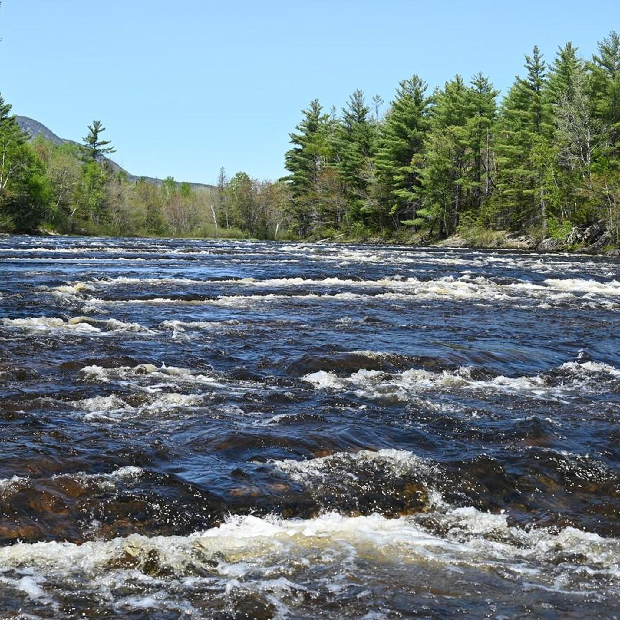
Jogging in Katahdin Woods And Waters National Monument offers access to a vast wilderness area characterized by diverse landscapes. The region features the East Branch Penobscot River system, carving river valleys through the terrain, and extensive forests composed of maple, oak, spruce, and hemlock. Visible from various points, Mount Katahdin stands as a prominent natural feature. The monument's topography also includes unique geological formations and former logging roads, providing varied surfaces for running.
Best jogging routes in Katahdin Woods And Waters National Monument
- The most popular jogging route is Grand Pitch Trail, a 3.5 miles (5.7 km) trail that takes about 41 minutes to complete. This moderate route follows the Penobscot River.
- Another top favourite among local runners is Barnard Mountain Trail, a moderate 4.4 miles (7.1 km) path. This route offers views of Mount Katahdin.
- Local runners also love the Katahdin Loop Road run, a 19.7 miles (31.6 km) trail leading through varied terrain with significant elevation gain, often completed in about 3 hours 39 minutes.
- Jogging in Katahdin Woods And Waters National Monument is defined by river systems, dense woodlands, and unpaved roads. The network offers options for various ability levels, from easier paths to more challenging long-distance routes.
- The routes in Katahdin Woods And Waters National Monument are highly rated by the komoot community. More than 15 runners have used komoot to explore Katahdin Woods And Waters National Monument's varied terrain.
Last updated: July 7, 2026
5.66km
00:41
40m
40m
Embark on the Grand Pitch Trail for a moderate jogging experience through classic Maine woods, tracing the East Branch Penobscot River. This route spans 3.5 miles (5.7 km) and involves a gentle elevation gain of 125 feet (38 metres), typically taking about 41 minutes to complete. As you go, you will encounter diverse terrain, from dirt and forest floor to gravel and rock, leading to varied footing. A highlight along the way is Stair Falls on the Penobscot River, one of the impressive waterfalls you will see.
To begin your adventure, you will find parking conveniently located at the trailhead, which provides direct access to the route. The trail starts on a double-track road before narrowing as it follows the river's edge. While no specific permits or fees are mentioned for the trail itself, it is always a good idea to check the Katahdin Woods and Waters National Monument website for any updates before your visit. This ensures you have the latest information for a smooth trip.
The Grand Pitch Trail is situated within the Katahdin Woods and Waters National Monument, offering a glimpse into the region's natural beauty. It forms part of a section of the International Appalachian Trail, showcasing impressive
7.10km
00:53
220m
220m
Embark on a moderate jogging route along the Barnard Mountain Trail, an out-and-back journey covering 4.4 miles (7.1 km). You will ascend 729 feet (222 metres) in elevation, with most people completing the route in about 53 minutes. The trail begins on a gravel logging road, then transitions to a traditional footpath winding through a boreal forest, where you will encounter exposed roots and rocky sections. The highlight is reaching the summit, an open granite ledge with a picnic table offering clear views of Mount Katahdin, Katahdin Lake, and Baxter State Park.
When planning your visit, be aware that while the trail is generally well-maintained, the footpath section has uneven surfaces, exposed roots, and rocks. It is typically easy to follow during summer months, but the path can become less obvious in autumn once the leaves have fallen. No specific permits are mentioned as being required for this route.
This trail is located within the Katahdin Woods and Waters National Monument, a region known for its natural beauty. As you jog through the deciduous forest sections, keep an eye out for local wildlife; you might spot moose and deer. The views from the summit provide a great sense of the surrounding wilderness, connecting you to the broader landscape of the national monument.

Sign up for free
31.6km
03:39
420m
420m
Embark on the Katahdin Loop Road run, a difficult jogging route that immerses you in the wilderness of Katahdin Woods & Waters National Monument. This challenging 19.7 miles (31.6 km) journey features 1381 feet (421 metres) of elevation gain, taking approximately 3 hours and 39 minutes to complete. You will jog through deep woods and alongside serene ponds, with the terrain mostly unpaved dirt and gravel. Keep an eye out for ledges that open up to sweeping views of the surrounding lakes and mountains, including the iconic Mount Katahdin View, offering panoramic vistas of Mount Katahdin and Baxter State Park.
Planning your visit requires some preparation for this remote area. Accessing the monument often means you will need a high-clearance vehicle due to rough feeder roads. Be aware that cell service and GPS coverage can be unreliable, and you will not find services like water, food, or fuel inside the monument. The loop road itself may have one-way sections for vehicles, a 15 mph speed limit, and you should always yield to logging trucks.
This route offers a truly immersive wilderness experience, allowing you to connect with the natural environment of Maine. The Katahdin Loop Road winds through a landscape shaped by ancient glaciers and rich in diverse ecosystems. It provides a unique opportunity to explore the monument's interior, showcasing its rugged beauty and remote character. This trail is ideal if you are seeking a significant workout combined with profound solitude in a wild setting.
17.6km
02:06
250m
250m
Prepare for a challenging jogging experience on the Sugarloaf Mountain loop, a difficult route spanning 10.9 miles (17.6 km). You'll gain 815 feet (249 metres) in elevation over an estimated 2 hours and 6 minutes, pushing through varied forest terrain. Expect steep sections with rock ledges and boulders, even some scrambling, as you ascend towards the summit. Your effort is rewarded with expansive 360-degree views from the top, offering a spectacular panorama of the surrounding landscape.
Before you head out, be aware that the road to the trailhead, Grondin Road, can be quite rough. You might need a high-clearance vehicle to reach the starting point directly, or you may have to park further away and walk in. This route is best suited for those who are prepared for a strenuous workout and comfortable with significant elevation changes and uneven ground. Plan your visit accordingly to ensure a smooth start to your adventure.
This trail stands out for its unique blend of forest exploration and a demanding climb, culminating in one of the region's most impressive viewpoints. From the open summit, you can clearly see prominent landmarks like Katahdin and Mount Chase, making it a memorable destination for experienced joggers. It offers a distinct challenge and a different perspective compared to other trails in the area, perfect if you're seeking a rigorous outdoor activity.
9.90km
01:22
270m
270m
Lace up your shoes for the Sugarloaf Mountain Trail, a moderate jogging route that takes you through changing forest landscapes. You will ascend through beautiful hardwood forests, gradually transitioning to softwood as you climb. This 6.1-mile (9.9 km) route involves a steady climb of 872 feet (266 metres) in elevation, typically completed in about 1 hour and 22 minutes. The highlight of your effort is reaching the Sugarloaf Mountain Summit, where you are rewarded with expansive panoramic views.
Before you head out, remember that accessing the trailhead is generally straightforward, with parking usually available nearby. However, it is always a good idea to check local conditions, especially if you are planning your visit during the shoulder seasons, as weather can significantly impact the trail. This route is a popular choice for jogging in the area, so planning your start time can help you enjoy a more peaceful experience.
This trail offers a fantastic opportunity to experience the natural beauty of Penobscot County, Maine. From the summit, you can clearly see iconic landmarks like Baxter Park and Katahdin, along with the vast surrounding valleys. The journey itself provides a good workout while immersing you in the serene environment, making it a notable option for anyone looking to combine exercise with scenic exploration in the region.
Get access to more routes and recommendations from other explorers.
Sign up for free
Already have an account?
Our route recommendations are based on thousands of hikes, rides, and runs completed by other people on komoot.
Start today with a free account
Your next adventure awaits.
Login or Signup
Popular around Katahdin Woods And Waters National Monument
Tips from the Community

Katahdin Loop Road circles around the Katahdin Woods and Waters National Monument property and offers views of the surrounding mountains. The road is pretty well-kept dirt the entire time and is popular for running, hiking, biking, and scenic driving.
0
0
There are a number of viewpoints along the Katahdin Woods and Waters Loop. This is the most well-known viewpoint of Mount Katahdin along the loop, and you can also find restrooms at this parking area.
0
0
At 1,558 feet, Barnard Mountain is a rocky summit with awesome views of the surrounding summits and lakes. There is actually a picnic table at the top of the 2-mile trail, which is a mixture of double-track and singletrack through a pretty thick forest.
0
0
Some ridges of rocks in lines across the Penobscot River cause the impression of a staircase. This wide section of river can only be viewed if you run into the area on the Portage Trail. There is a large primitive campground near the river where some backpackers stay overnight.
0
0
Sugarloaf Mountain reaches up to 1,868 feet and offers panoramic views of the valley and surrounding mountains of Maine. There is another Sugarloaf Mountain in the state that is along the Appalachian Trail that is quite a bit more popular. This is a short (but steep) trail that promises some solitude on its way up to the rocky summit.
0
0
Sugarloaf Mountain is surrounded by dirt forest roads that are great for running. The roads are smooth enough to run with road shoes, but there are enough hills to keep trail runners happy, too. This spot offers a pretty great view of the peak that dominates the area.
0
0
At 1,558 feet, Barnard Mountain is a rocky summit with awesome views of the surrounding summits and lakes. There is actually a picnic table at the top of the 2-mile trail, which is a mixture of double-track and singletrack through a pretty thick forest.
0
0
Some ridges of rocks in lines across the Penobscot River cause the impression of a staircase. This wide section of river can only be viewed if you hike into the area on the Portage Trail. There is a large primitive campground near the river if you want to stay in the area overnight.
0
0
Frequently Asked Questions
How many running routes are available in Katahdin Woods and Waters National Monument?
There are over 20 running routes available in Katahdin Woods and Waters National Monument, catering to various skill levels. You'll find a mix of easy, moderate, and challenging paths to explore.
What kind of terrain can I expect on the running trails in the monument?
The running trails in Katahdin Woods and Waters National Monument primarily feature unpaved roads and former logging roads. The landscape is characterized by dense woodlands, river systems like the East Branch Penobscot River, and unique geological formations, offering varied surfaces and scenic views.
Are there any easy running routes suitable for beginners or families?
Yes, the monument offers some easier paths. While specific 'easy' routes aren't highlighted in detail, the overall network includes options for various ability levels. For a moderate option that follows the Penobscot River, consider the Grand Pitch Trail.
What natural features or landmarks can I see while running in the monument?
Runners can enjoy spectacular natural features. You'll often catch views of the majestic Mount Katahdin. The Barnard Mountain Trail, for instance, offers stunning vistas of Mount Katahdin. Other attractions include the Penobscot River system, vast forests, and unique geological formations. The Lynx Pond Nature Walk, accessible from the Katahdin Loop Road, also leads to a boardwalk over the pond.
Are there any circular running routes in Katahdin Woods and Waters National Monument?
Yes, there are circular running options. The Sugarloaf Mountain loop is a notable long-distance circular route, offering a comprehensive experience of the area's terrain.
When is the best time of year for running in Katahdin Woods and Waters National Monument?
The monument is open year-round, but conditions vary. Spring can bring muddy conditions, leading to road closures. For optimal running, late spring through fall generally offers the most pleasant weather and accessible trails. Always check local conditions before heading out.
What kind of wildlife might I encounter on the running trails?
Katahdin Woods and Waters National Monument is rich in wildlife. You have a good chance of encountering a large moose population, as well as diverse flora and fauna throughout the monument. Keep an eye out for various bird species and other forest animals.
Is parking available for runners at the trailheads?
While the monument features mostly unpaved roads, parking is generally available. However, it's important to note that a high-clearance vehicle is recommended for navigating some of the unpaved roads within the monument.
Are dogs allowed on the running trails in Katahdin Woods and Waters National Monument?
The monument generally welcomes pets, but it's always best to check specific trail regulations before your visit. Ensure your dog is on a leash and you follow Leave No Trace principles to protect the wildlife and natural environment.
Are there any challenging long-distance running routes?
Absolutely. For those seeking a significant challenge, the Katahdin Loop Road run is a demanding 19.7-mile route with considerable elevation gain. Another challenging option is the Sugarloaf Mountain Trail, which offers a steeper climb and panoramic views.
What do other runners enjoy most about running in Katahdin Woods and Waters National Monument?
Runners frequently praise the monument's vast wilderness and diverse landscapes. The komoot community highlights the varied terrain, from river-following paths to routes with stunning mountain views. The remote nature and opportunities for wildlife viewing are also highly valued.
Are there any facilities or potable water sources within the monument?
Currently, there are no public facilities or potable water available within Katahdin Woods and Waters National Monument itself. Visitors should plan to bring all necessary supplies, including water, and be prepared for a self-sufficient experience.
Most popular routes in Katahdin Woods And Waters National Monument

Get inspired with the komoot mobile app


Explore more
Browse the best Running Trails & Routes in other regions.
